INDIANAPOLIS — As dry as it's been in Indiana, as forecasters we try and sniff any hint of a pattern change to bring much needed rain. The modeling over the past couple of days is trending toward that direction going from Sunday into next week. At this time, specifics on amounts to timing and coverage can be pinpointed. But for the first time in a while...there's hope that at least some areas will get some rain between Sunday and the middle of next week.
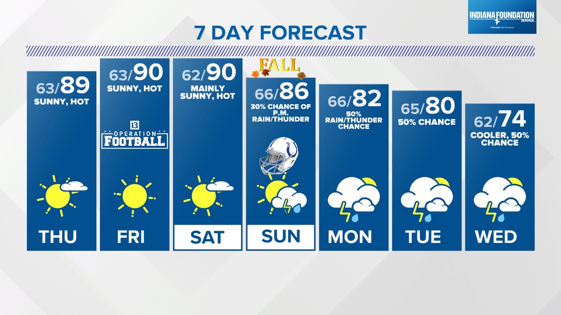
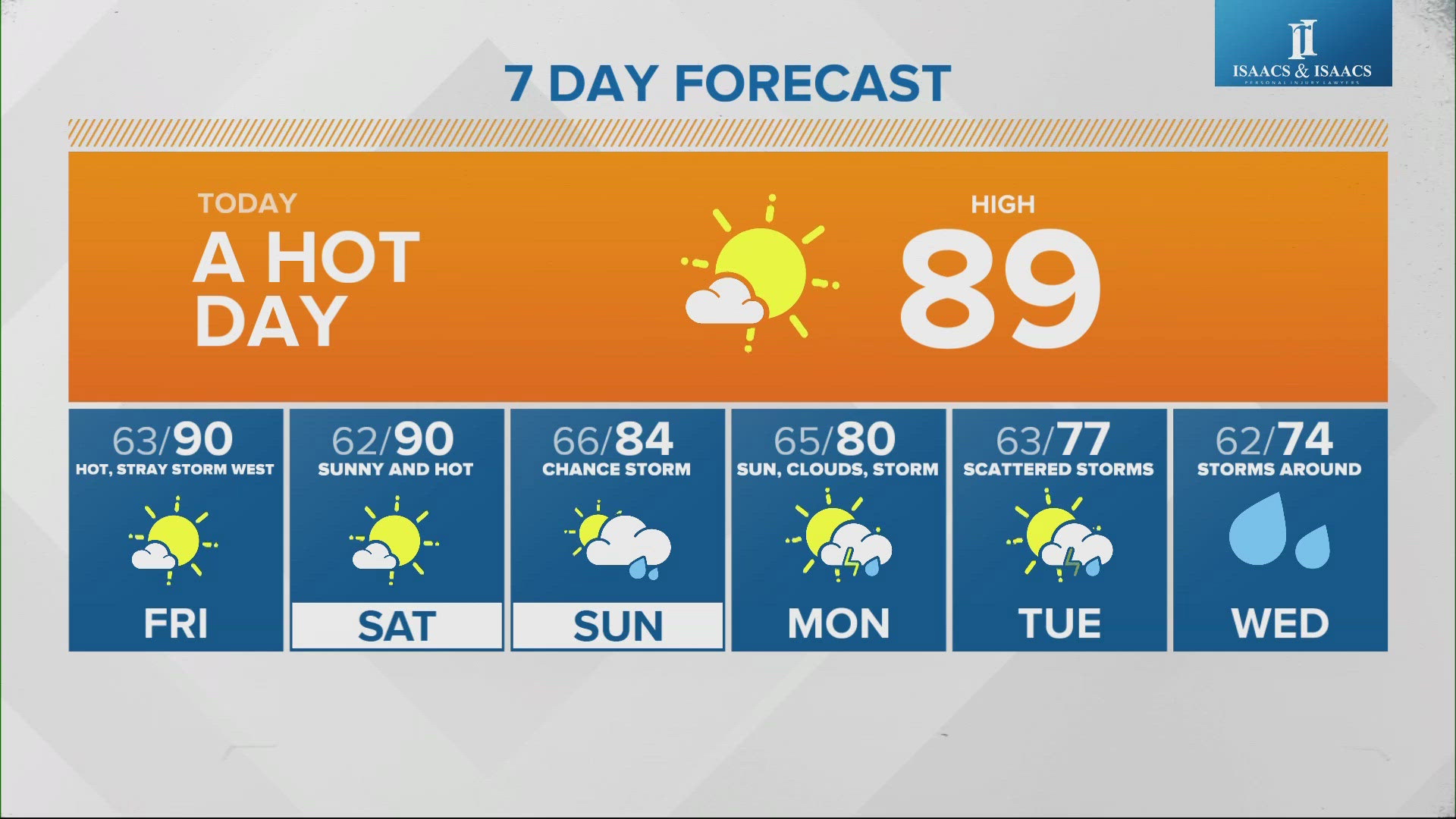
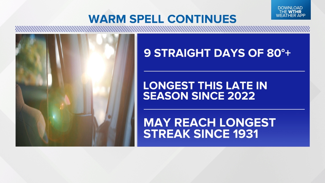
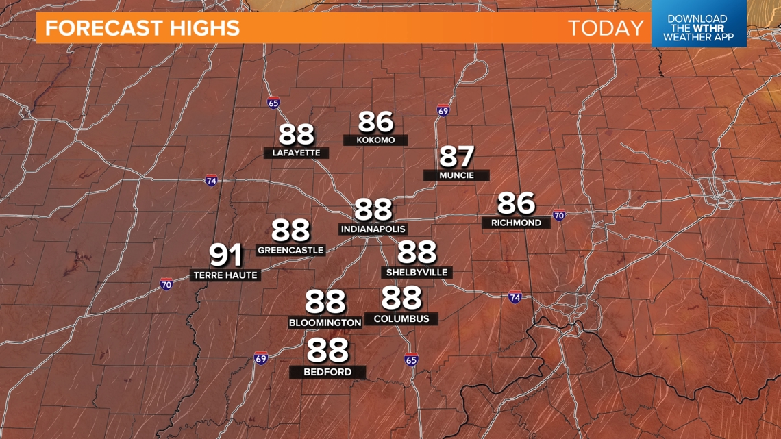
However, in between now and then plan on the same stagnant weather we've had for much of the month...cool mornings, sunny days, unseasonably warm afternoons, and dry conditions. Highs today into Saturday afternoon will be in the upper 80s to near 90°. While not breaking daily high temperatures records, these values are a good 10°+ above average.


Dry September:

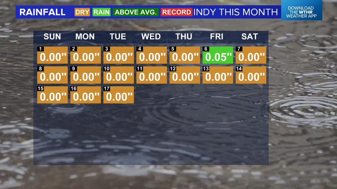

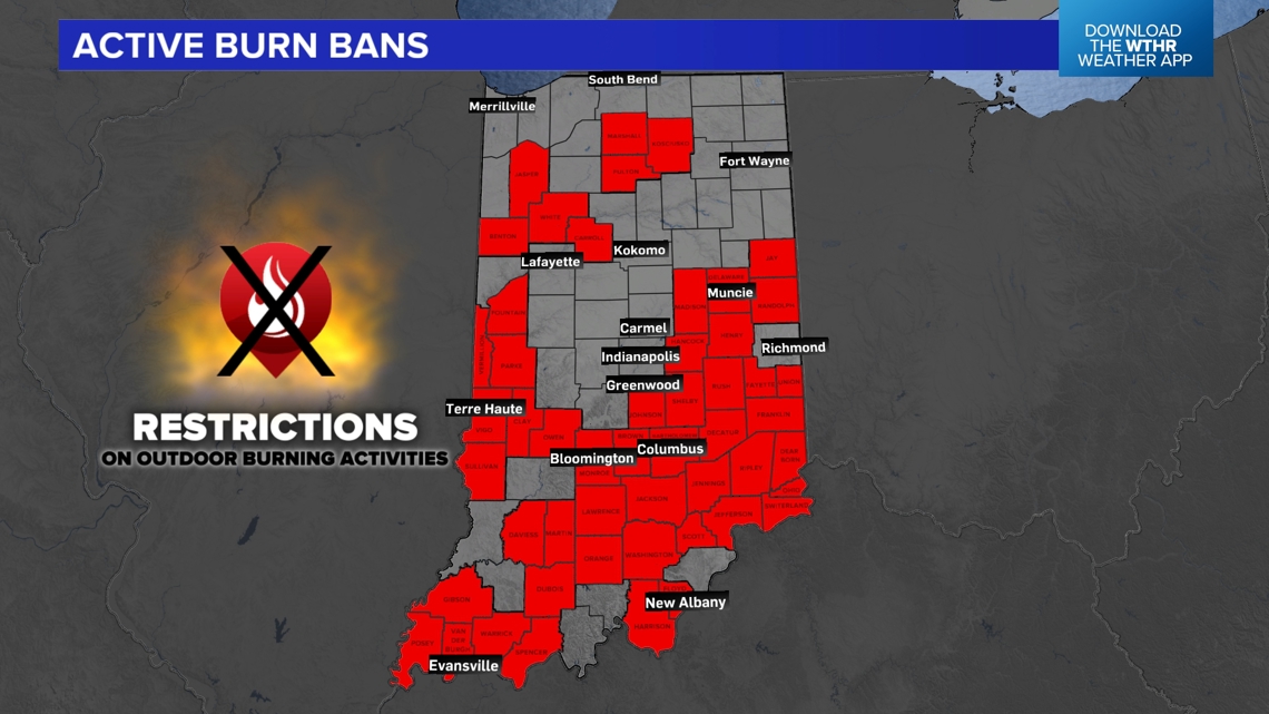
To date there's only been one day of measurable rain in Indianapolis and that was back on the 6th of the month. Rain deficits for the month are approaching 2" and since the middle of August many areas are in the 3"-4" range of rain needed. Additional counties were added to the Burn Ban map and it's likely many more will come before the rain chances arrive.
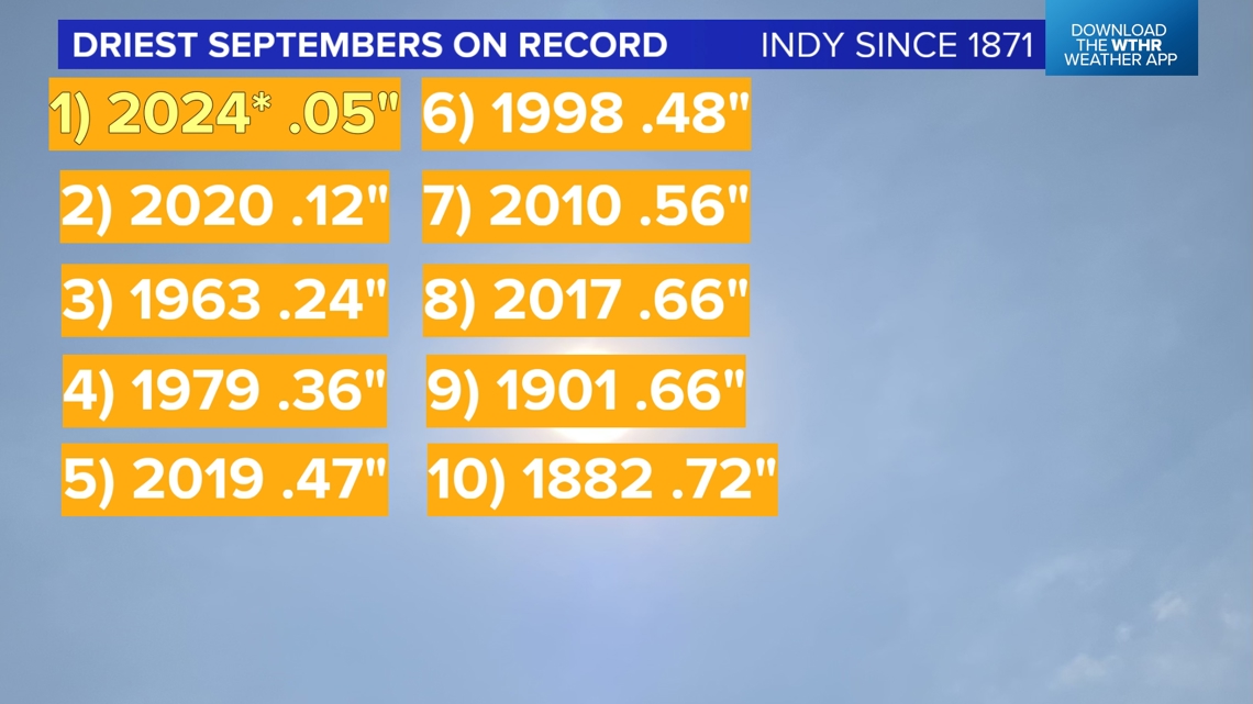
There's still time to put a dent in the rain deficit next week, but most of Indiana has had less than .10" of rain so. That would top the list for driest Septembers on record in Indianapolis and join four other years in the past 14 to make up the Top 8 driest Septembers here.
This lack of rainfall, if it continues, could play a role in fall foliage in central Indiana.

Pattern Shift Next Week:
With all that said, the transition from the "Omega" Block pattern that's driven our weather most of the month to a trough pattern locally next week will provide rain chances. As the positioning of the "Omega" ridge shifts to the western United States, a potential cut-off upper low may spin over the Ohio Valley for several days next week...bringing clouds, shower chances, and much cooler afternoon highs.

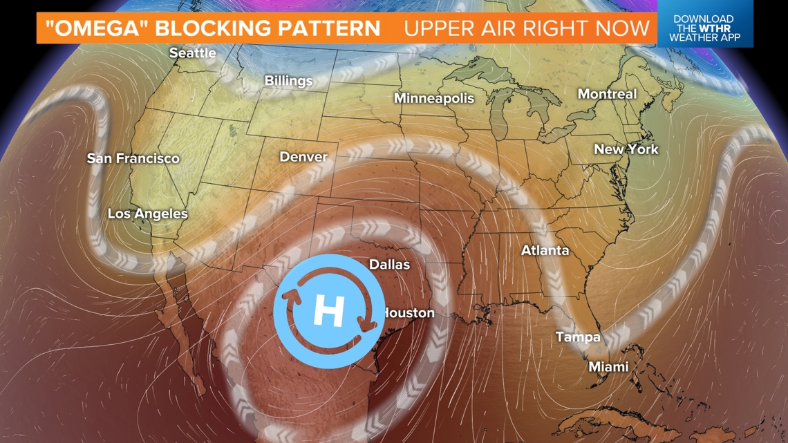

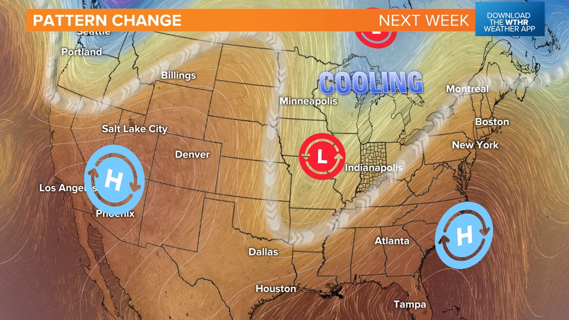
Preceding the upper-level low may be a period were a nose of increased low-level moisture teams-up with a cool front to bringing organized precipitation and possibly thunderstorms. We're still several days out from that scenario which could be some time Sunday into Monday. For now we're taking a lower confidence approach and we'll adjust in the coming days as if confidence grows.
We encourage you to follow our forecast for updates and potential impacts to second-half weekend plans.