INDIANA, USA — Don't let the sunshine fool you this afternoon. We're still on target for the first snow and coldest air of the season arriving tonight and snow rates peaking Thursday afternoon. Here's what you need to know about the Weather Impact Alert Day.
What's changed in the forecast?
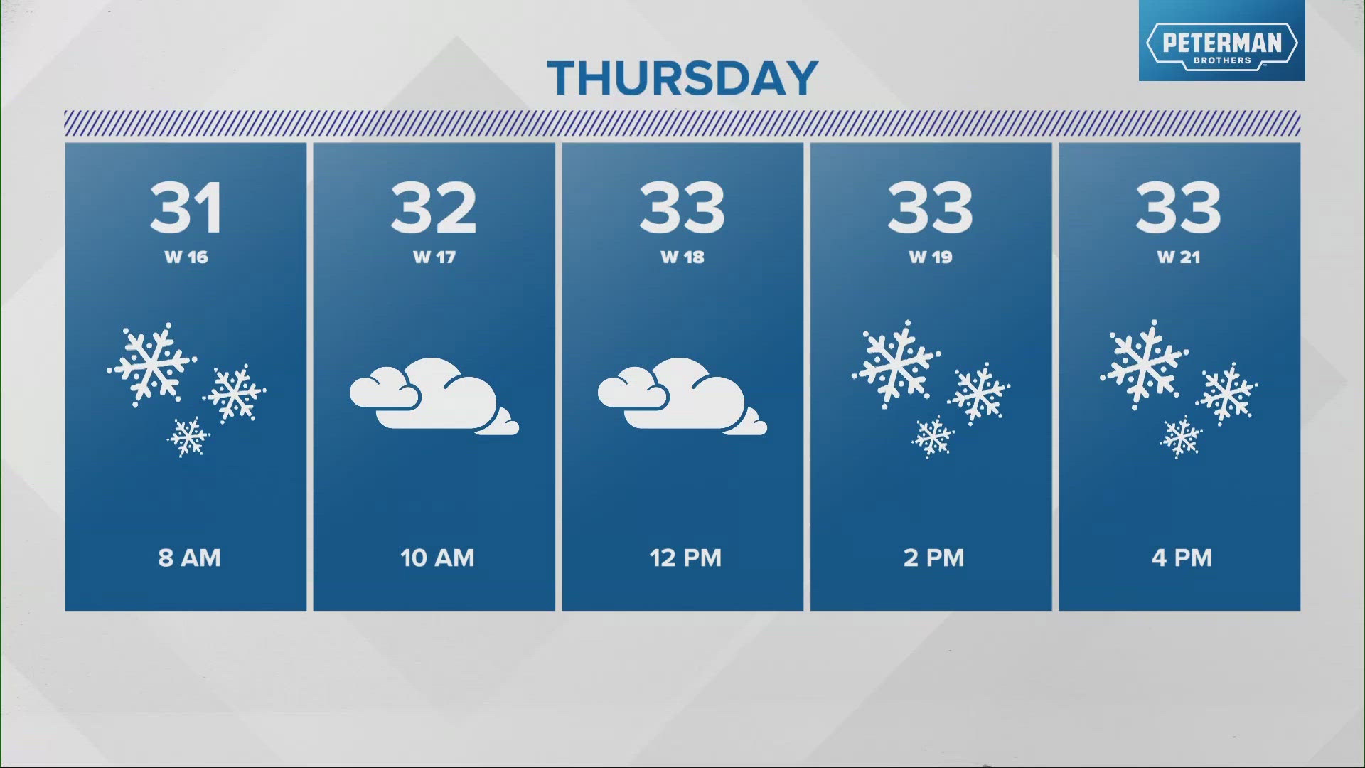
Latest guidance continues to speed up the secondary burst of steadier, heavier snow rates arriving as early as noon in north-central Indiana and 1-2 p.m. around the Indy metro area. The earlier arrival time also means a quicker departure time too, with the heavier rates diminishing by 8 p.m. as the system quickly departs to the south-southeast.
When do the first snowflakes arrive?
You may have some spotty sprinkles pass by this evening as the initial upper level energy approaches the state. We expect quick-moving bursts of flurries and snow showers to develop after midnight but before 5 a.m., with coverage of this first round of snow peaking during the 4-8 a.m. timeframe.
Some bridges, overpasses, and/or elevated surfaces could be a bit slick as temperatures drop to near/below freezing by sunrise. Use caution traveling in the morning, and check in with Chuck Lofton and Matt Standridge during 13Sunrise for updates.
Will it snow heavy enough to stick?
Absolutely. At times, snow rates will be heavy enough to overcome relatively warm ground, and this will be especially true in the noon-7 p.m. time window on Thursday. That's when a combination of factors come together to produce a steadier, heavier burst of snow that blankets much of central Indiana and impacts the afternoon/evening commute.
Much of the expected 1-2" accumulation occurs on grassy/elevated surfaces, and roads will be mainly wet. However, during heavier bursts of snowfall, it's possible – if not likely – that roads within those zones get slushy until the snow rates ease and it quickly melts again on the roads.
But road conditions improve rapidly once snow eases and/or ends, with temperatures hovering around freezing much of this event and into Friday morning.
Could snowfall be heavier than expected?
Also absolutely. There remains a high level of uncertainty of how much melting will occur and just how high snow rates will be. So it's also true that snowfall could be minimal (less than a coating) in some areas as well. Bottom line: Plan for wet to, at times, slushy roads and slower travel times.
What are the other impacts from this system?
The coldest air of the season, which equates to "highs" in the low/mid 30s and windchills hovering near 20° much of the day. Strong wind gusts exceeding 40 mph at times may cause some sporadic power outages and definitely reduces visibility by making "snow globe" conditions during snowfall.