INDIANAPOLIS — Chalk Monday up as another warm, dry, sunny day in central Indiana.
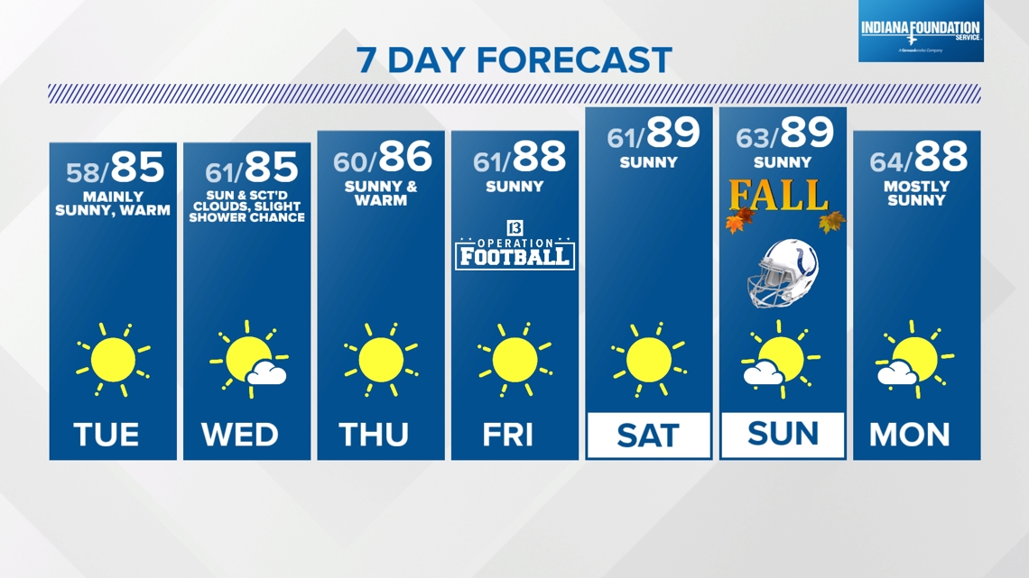
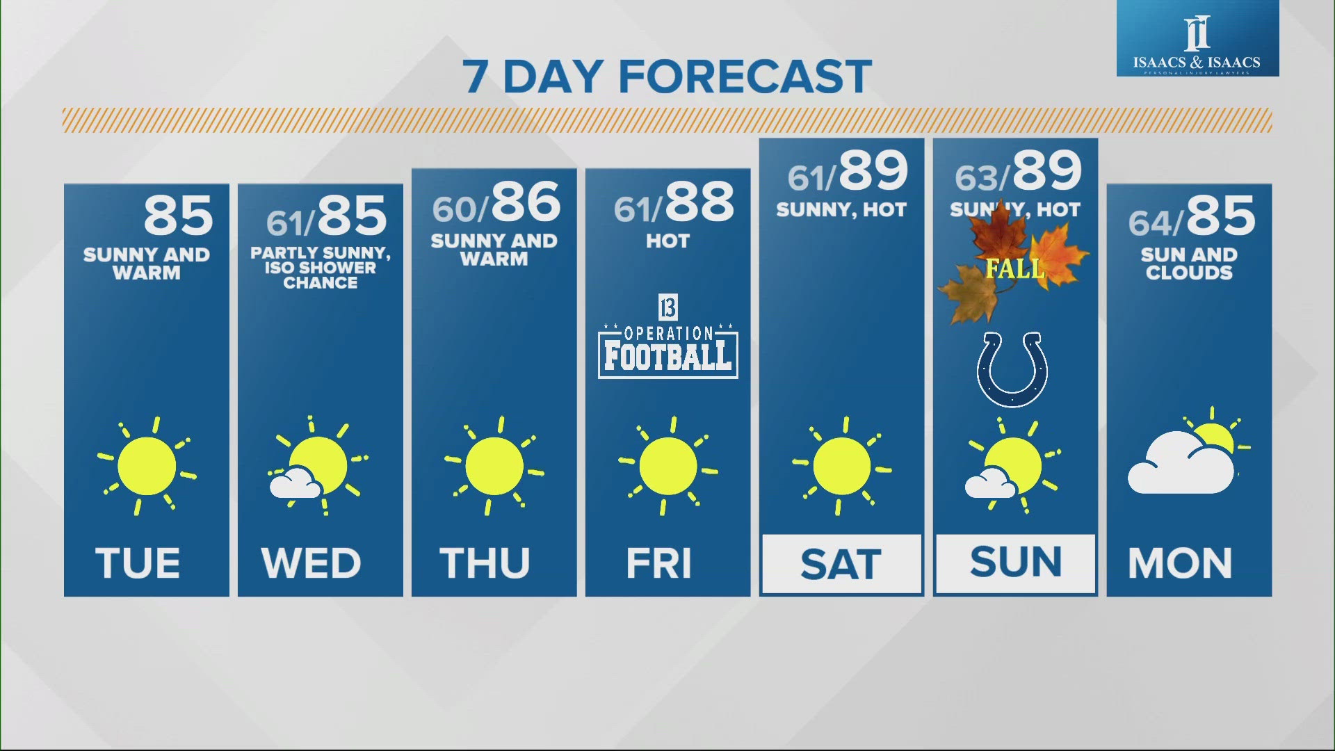
That's great news for those that still have their pools open, get the boat out the lake, have to work outside, and/or like the weather you typically have out in California. The parched landscape (moderate drought) and equally dry air (dewpoints in the 30s/40s at times) is like a desert climate locally for now providing pleasantly cool evenings/nights/mornings to be followed by unseasonably warm afternoons near 90°.
Big Diurnal Temperature Swings

Drought Worsening As Burn Bans Increase
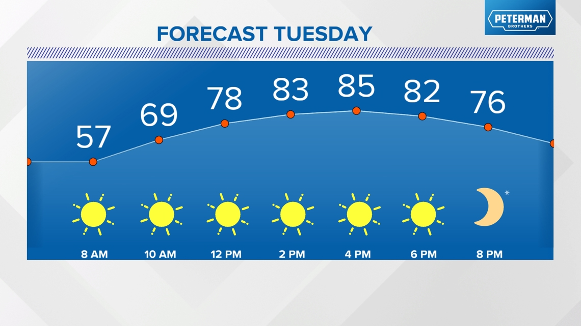
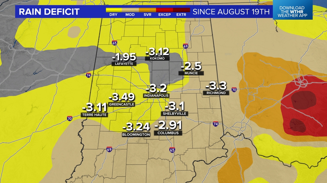
The drought, dry air, and clear sky leads to efficient warming and cooling for significant diurnal temperature swings of some 30°+ at times from low to highs. Sunshine continues to dry soils quickly and much of central Indiana is 3" to nearly 4" below average rainfall since mid-August. We expect quite an expansion of moderate drought conditions when the new Drought Monitor Index is released this Thursday.


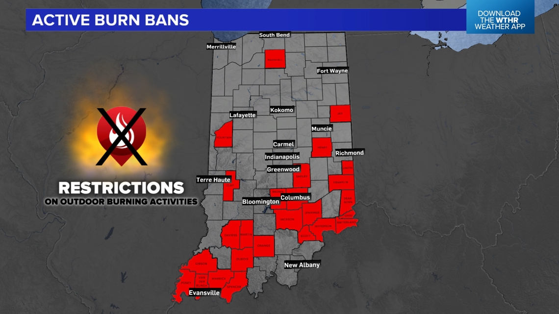
It's not surprising to see new counties added to the burn ban list daily, with 20 counties at the time of this posting. Please heed these warnings seriously as even small sparks can spread fire quickly in these conditions. Typically, during summer droughts severe storm complexes and/or tropical systems are required to bust them up.
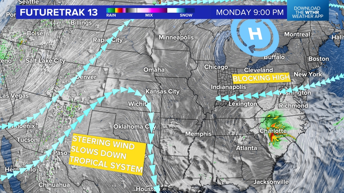
Another Miss On A Tropical System
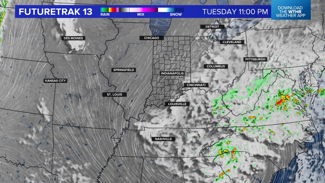
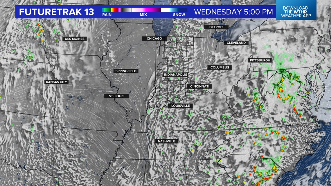
Unfortunately, we whiffed on remnants from Francine and a blocking high pressure system to our north (combined with the dry air) offers stiff resistance to what's left of a tropical drifting northwestward into the Ohio Valley Tuesday into Wednesday.
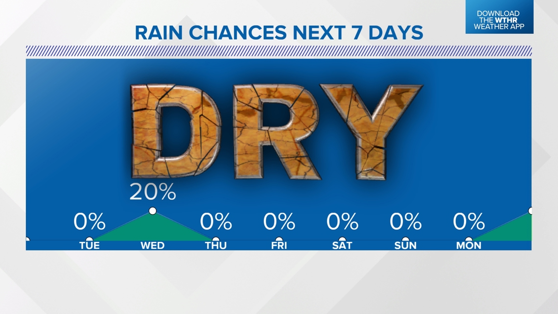
There may be a slight uptick in humidity on Wednesday along with some scattered clouds. But we're not expecting much impact locally and we're forecasting only a 20% chance of isolated showers Wednesday.


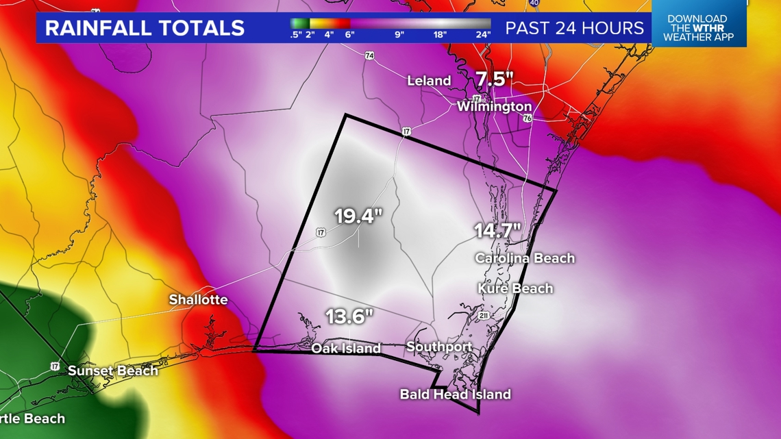
In a show of how cruel nature can be, while we're needing any rain possible, portions of the North Carolina coast had historic rain and flooding from this system on Monday. Several locations along the southern North Carolina coast had several months worth of rain in just 12 hours! Fifteen to 20 inches of rainfall led to flooding that still has that area under a Flash Flood Warning. For perspective, Indianapolis average around 3" for the entire month of September.

New Relief In Sight
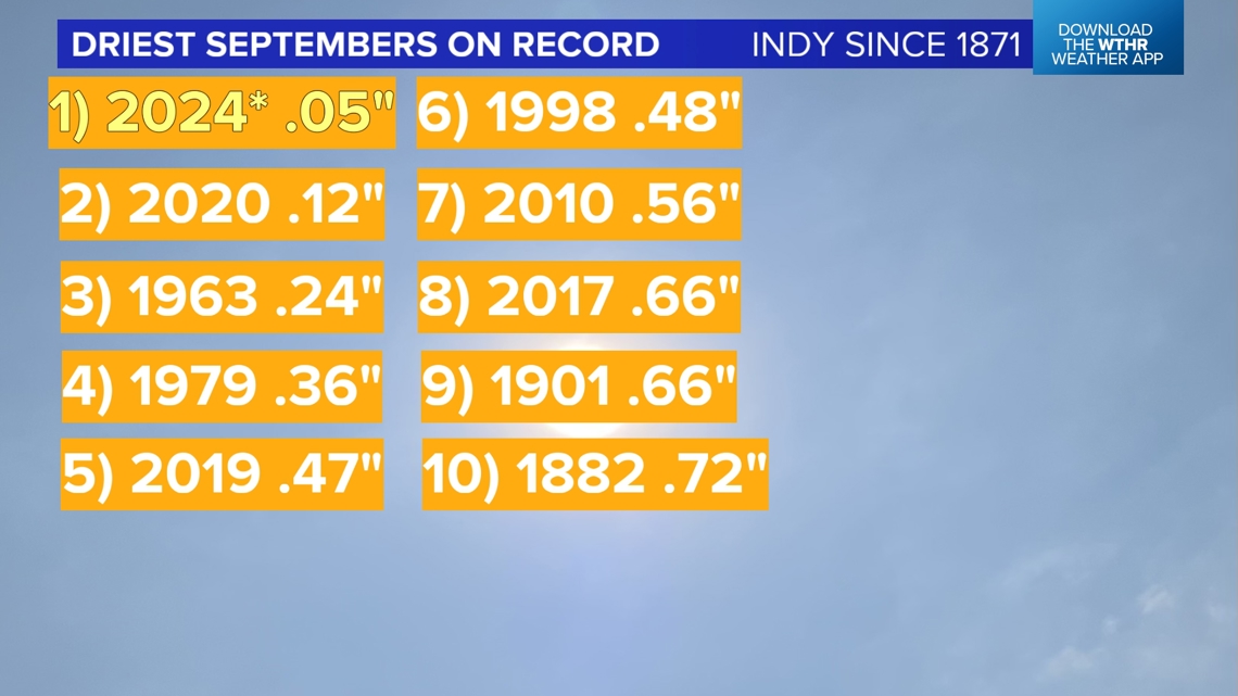
The long-range forecast, at least right now, doesn't look promising either. Afternoon highs reach the upper 80s to near 90° going into the weekend and this could become one of the driest Septembers on record in Indianapolis if significant pattern changes don't occur.


Don't forget that a supermoon partial lunar eclipse occurs Tuesday night. Lindsey Monroe has more on the "lunar trifecta" ahead tomorrow night.