
INDIANA, USA — A good dose of cooler air is pushing south into Indiana. Light north winds to start the week will keep many mornings in the 40s, with a few brief 30s north of Indianapolis. The afternoons looks pleasant and seasonable in the 60s and 70s.
Tap HERE to track the cooler air pushing south with our interactive weather maps.
A cold front with some wildfire smoke haze pushed in Sunday (Oct. 6), and it will be cooler for a few days after that. The first half of the week will be a bit chilly at times with quickly dropping temperatures in the night. Later in the week we will rebound to some 70s, but the low humidity will continue.
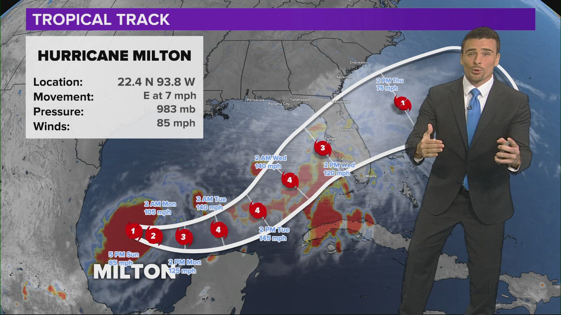
(Note: Now Hurricane Milton)
Tuesday morning
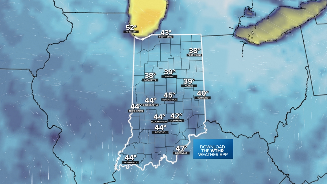
While every morning this week will be a bit chillier with starts in the 30s/40s, however Tuesday morning will be one of the coolest mornings of the week, if not the coldest.
Lots of 40s are expected across Indiana, btu a few locations may briefly drop to the 30s in north-central Indiana around Lafayette, Kokomo, Tipton, Muncie, and Fort Wayne.

The afternoons will quickly warm up into some 60s and 70s this week. It will feel more fall-like across central Indiana. However once the sun starts going down, expect to cool off quickly. Some chilly, fall evenings are ahead.
Not much rain in sight
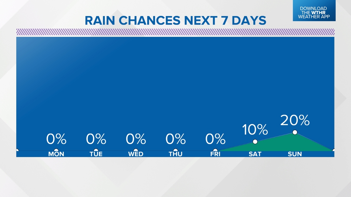
No rain is expected this work week. We'll stay dry with higher pressure staying in control.
Our next front may arrive Sunday (Oct. 13). A few more clouds may pass by with a small rain chance. Right now most of the rain chances may stay north.

-13News Meteorologist Matt Standridge