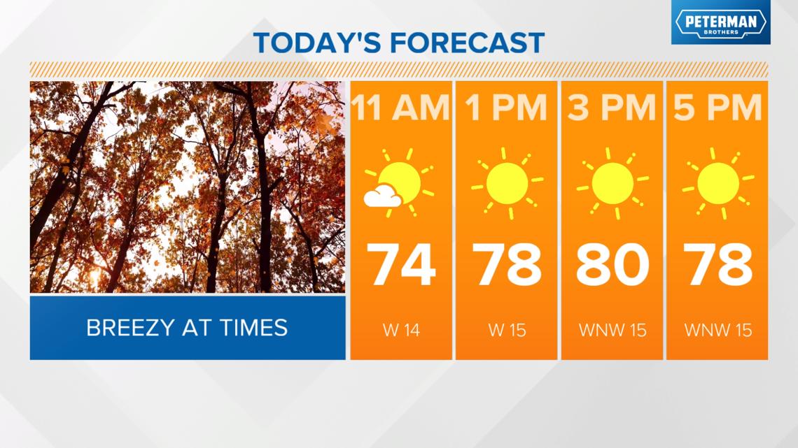
INDIANAPOLIS — We'll be on the warm side of a cold front during the first part of the day today, allowing temperatures to recover into the upper 70s and low 80s. This system lacks moisture, so expect increased clouds and gusty winds from 20-30 mph as the front moves through in the afternoon.
TODAY'S HEADLINES:
- Highs in the upper 70s, low 80s
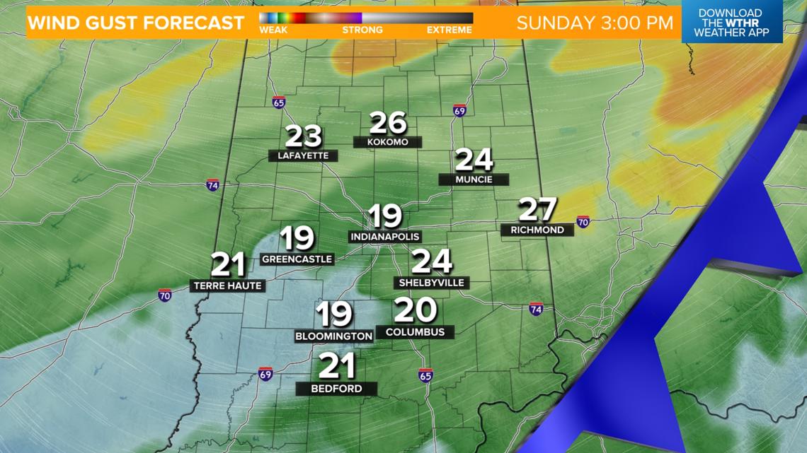
- Expect a few clouds and gusty winds from 20-30 mph as the front moves through in the afternoon


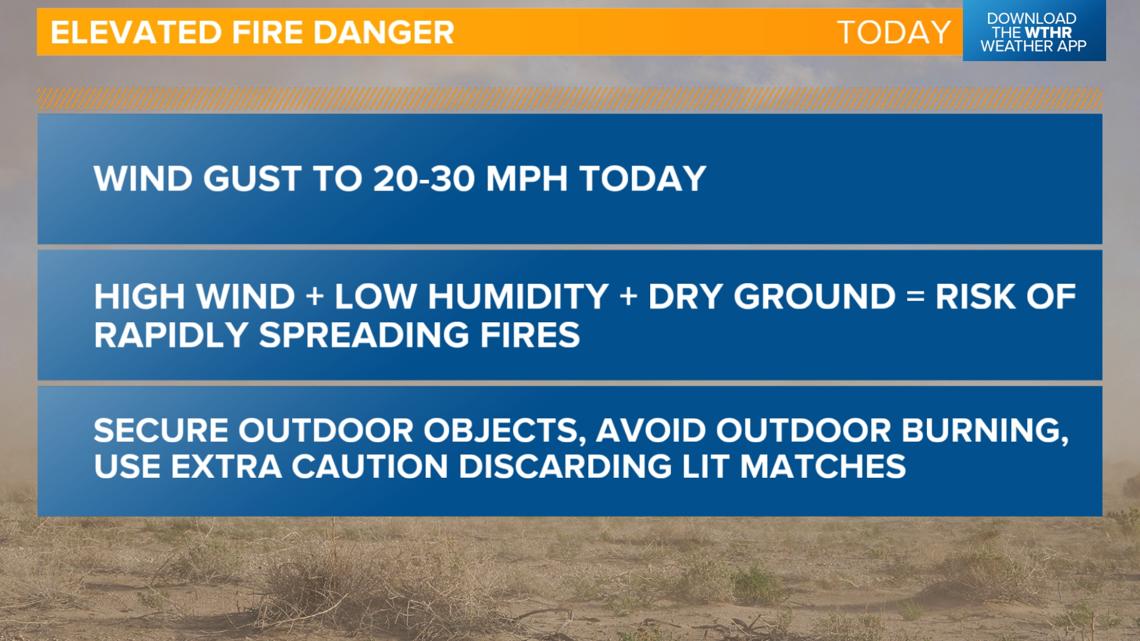
Avoid outdoor burning today
With the increased wind speeds, a dry ground, and low humidity, the National Weather Service is discouraging any kind of outdoor burning as the risk of rapidly spreading fires is increased under these conditions.

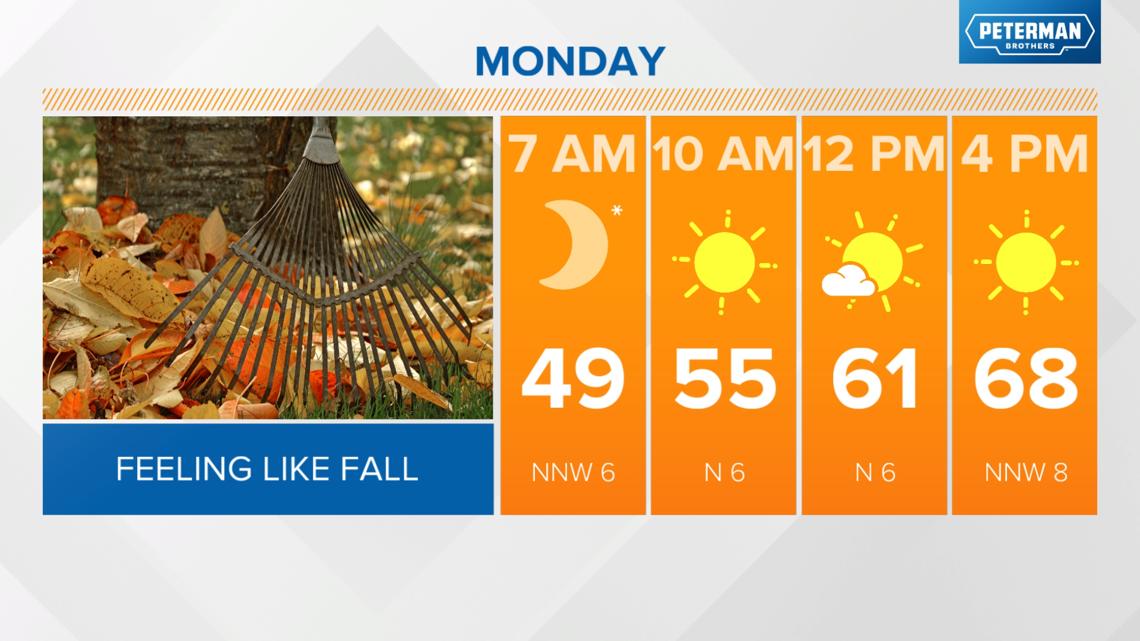
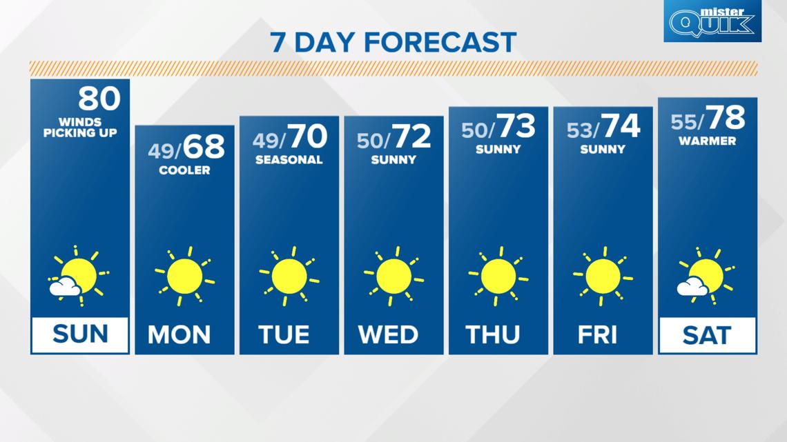
Much cooler air arrives overnight and for Monday
- Winds will decrease behind the front this evening
- Winds shift from the south to the northwest
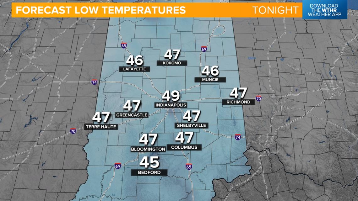
- Temperatures fall into the upper 40s overnight
- High temperatures in the upper 60s, near 70 for both Monday and Tuesday
- Sunny and dry


Staying dry but gradually warming up in the extended forecast
Temperatures will begin to moderate by mid-week as the dry pattern rolls on. Look for highs in the 70-75 degree range through the end of the work week. We'll eventually be back near the 80-degree mark for next weekend.
With no significant rain chances in the extended forecast, drought conditions may begin to worsen again by late next week.

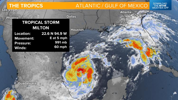
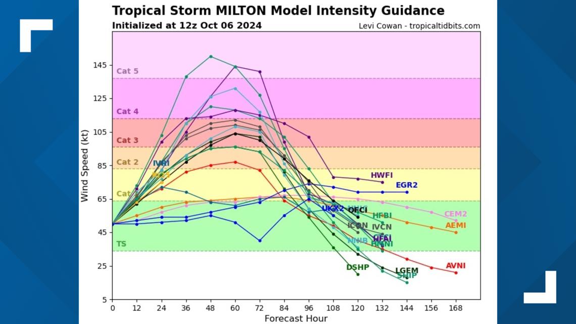
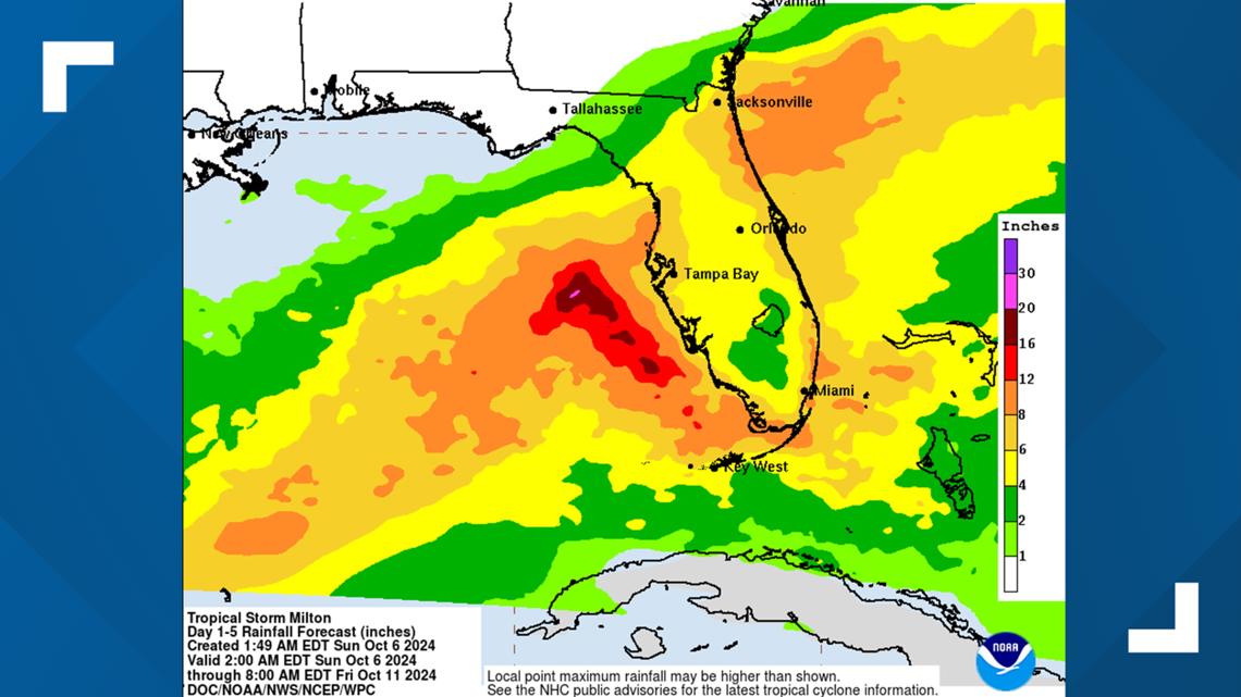
Latest on Tropical Storm Milton
- Tropical Storm Milton is located in the western Gulf of Mexico
- Sustained winds of 60 mph
- Tracking east at 5 mph


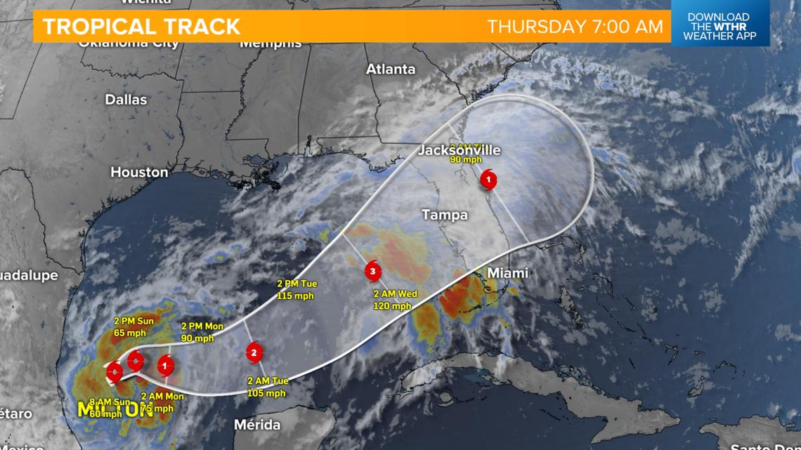
Key messages from the National Hurricane Center:
1. Milton is forecast to quickly intensify while it moves eastward to northeastward across the Gulf of Mexico and be at or near major hurricane strength when it reaches the west coast of the Florida Peninsula mid week. Hurricane Watches could be issued as early as late today for portions of Florida.
2. There is an increasing risk of life-threatening storm surge and wind impacts for portions of the west coast of the Florida Peninsula beginning late Tuesday or Wednesday. Residents in these areas should ensure they have their hurricane plan in place, follow any advice given by local officials, and check back for updates to
the forecast.
3. Areas of heavy rainfall will impact portions of Florida Sunday and Monday well ahead of Milton, with heavy rainfall more directly related to the system expected later on Tuesday through Wednesday night. This rainfall brings the risk of flash, urban, and areal flooding, along with minor to moderate river flooding.


If you have friends or family or travel plans in this area, please stay updated on the latest tropical information from the National Hurricane Center.