INDIANAPOLIS — There were several severe storms Monday afternoon across central Indiana.
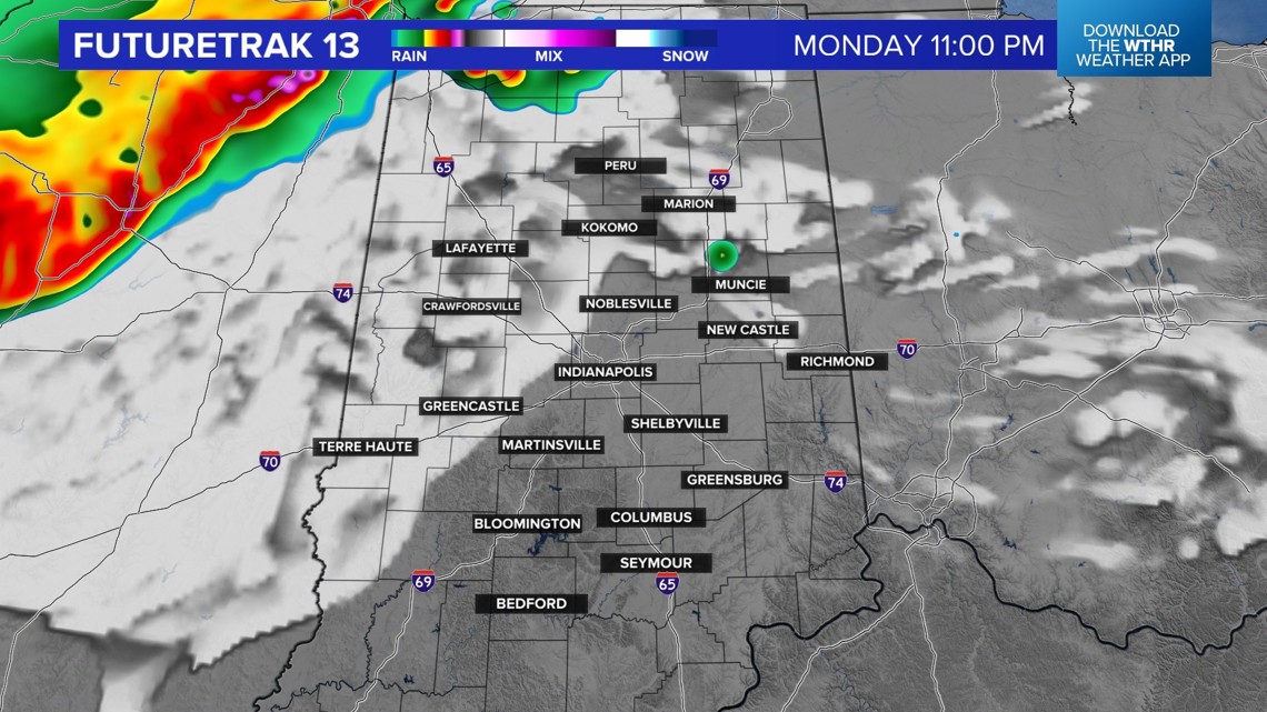
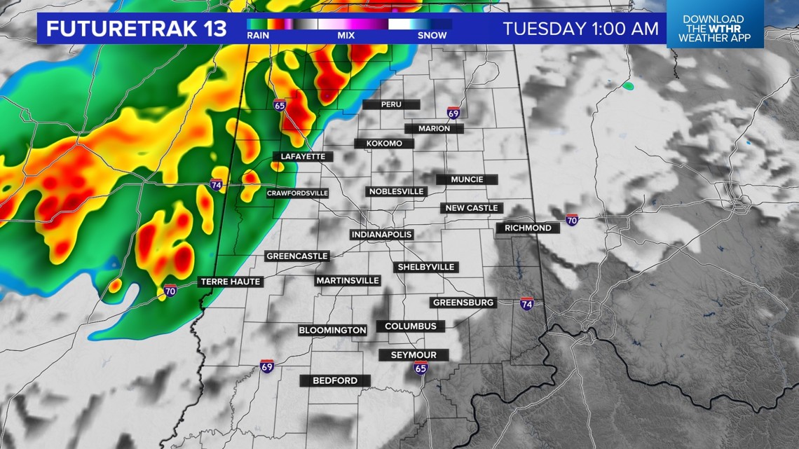
Heavy rain, flooding, hail and funnel clouds were reported and additional severe storms are in the forecast overnight. Make sure your cellphone volume is on and turned up so you can hear alerts while you sleep.
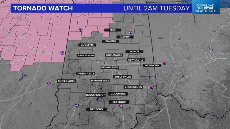
A tornado watch is in effect for northwest Indiana and northern Illinois until 2 a.m. Tuesday. Locally, this includes White and Cass counties.


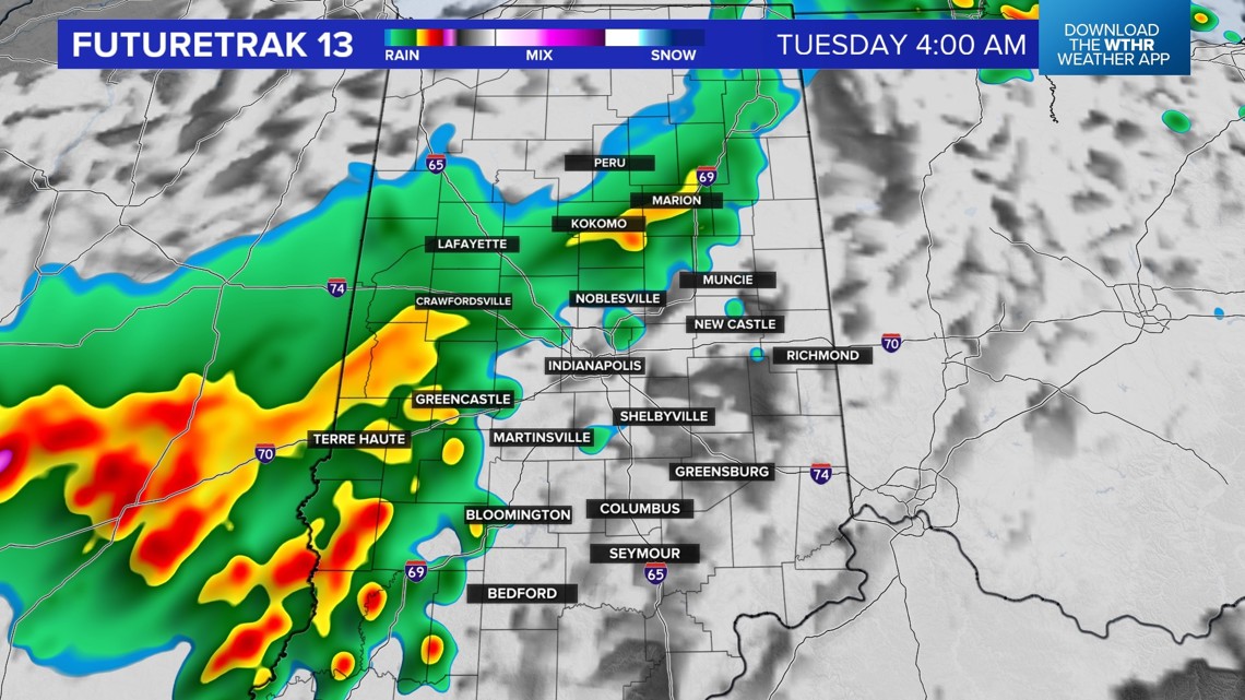
A complex of severe storms will move through central Indiana between 1 a.m. and 6 a.m. We do expect the line to weaken but all of central Indiana is under the threat of severe weather.


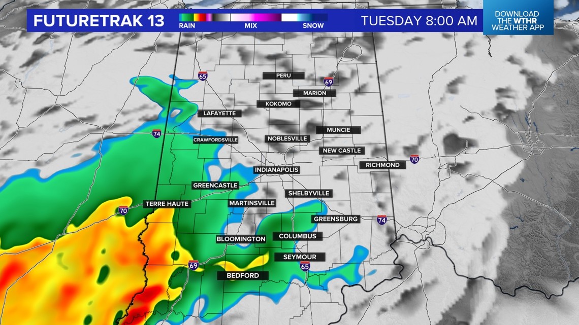
There will be some dry time during the middle of the day on Tuesday before additional storms develop later in the day. We are under the threat of severe weather again on Tuesday. It will be another hot and humid day, too, with highs near 90 and feels like temperatures near 100.
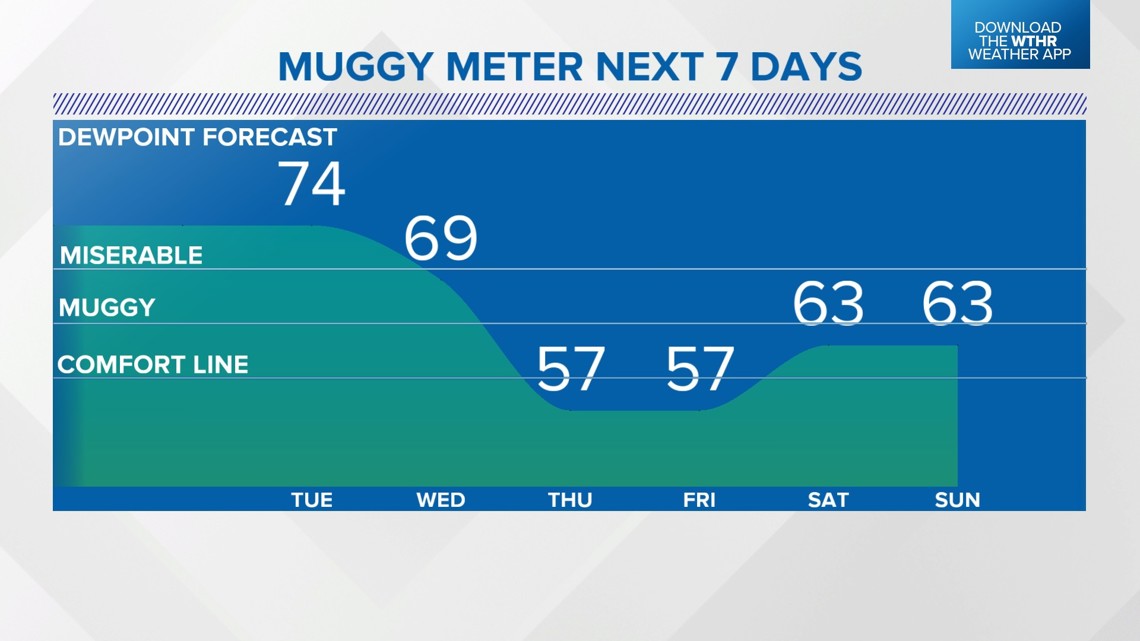
Wednesday will still be muggy with a few storms possible. The overall threat will start to move south mid-week.
A big drop in the muggy meter is coming on Thursday. We are forecasting upper 70s and lower 80s Thursday through Sunday. There is sunshine in the forecast, too.