INDIANAPOLIS — We're definitely in Weather Aware mode over the next 36 hours, with dangerous heat and potentially dangerous thunderstorms.
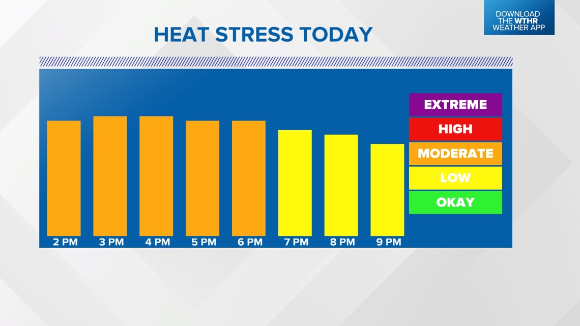
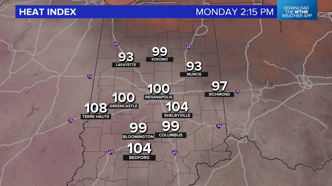
First, the heat this afternoon. Heat indices, away from thunderstorms, peak in the 100°-110° range, and the Heat Stress Index is "moderate," which is then recommended that you take half-hour breaks for each hour outside. To stay safe from the highly humid heat, you're recommended to drink plenty of water/sports drinks, seek A/C as much as possible and limit outdoor activity, if possible.

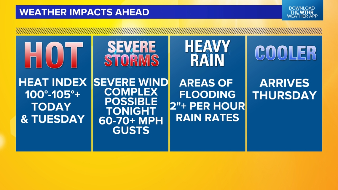


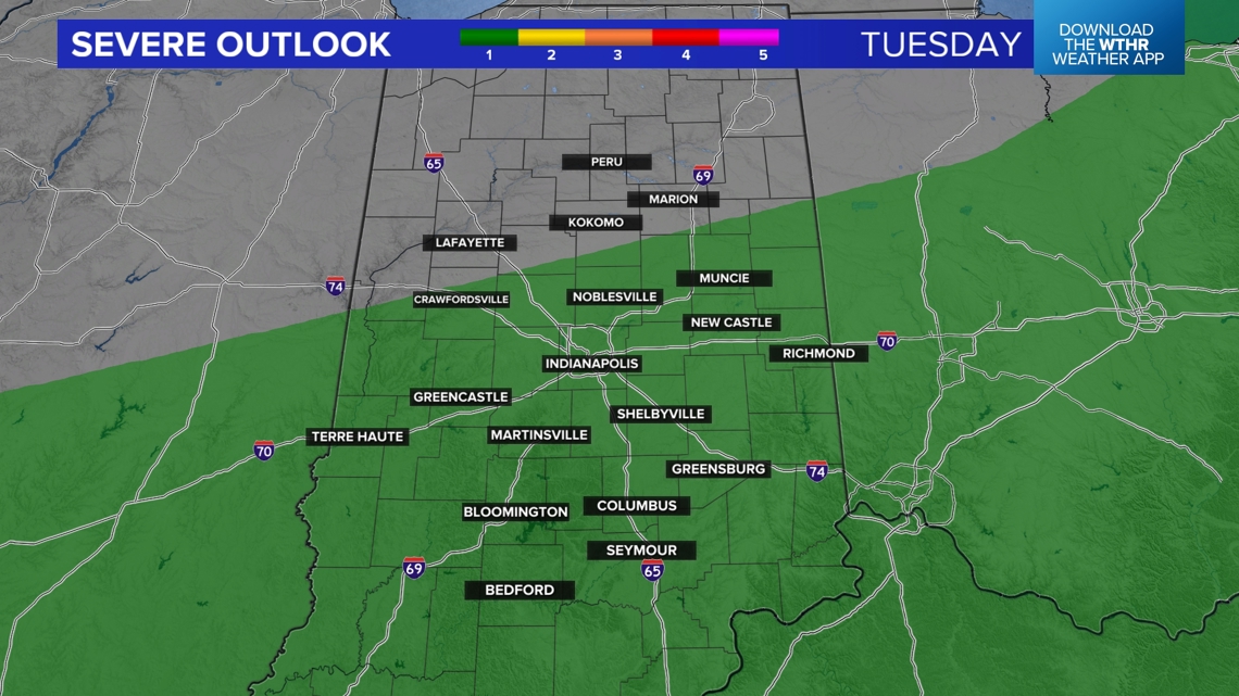
Severe storms possible this afternoon and likely overnight
It's hot enough that we've hit the "convective temperature," which is required to allow air parcels to puncture the warm air "lid" and allow thunderstorms to build. Isolated but heavy storms are taking full advantage of the high levels of storm energy in central Indiana, and anything on radar this evening will produce localized heavy rain, some hail, frequent lightning and gusty wind. These storms appear to be more focused on the east-central portion of the state from near Indy to Ohio.
A more widespread storm and severe weather threat emerges late tonight and comes from an expected severe storm complex that initiates around Iowa later this evening. Individual thunderstorm cells there quickly merge into a "bowing" storm complex that likely produces swaths of significant (75+ mph) wind gusts from Iowa, northern Illinois and possibly northwestern Indiana (around midnight to 2 a.m.) before it "weakens" on approach to the I-70 corridor around 3-4 a.m. early Tuesday morning.

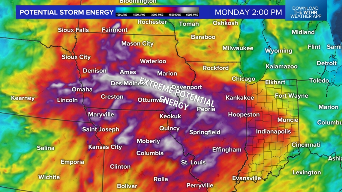

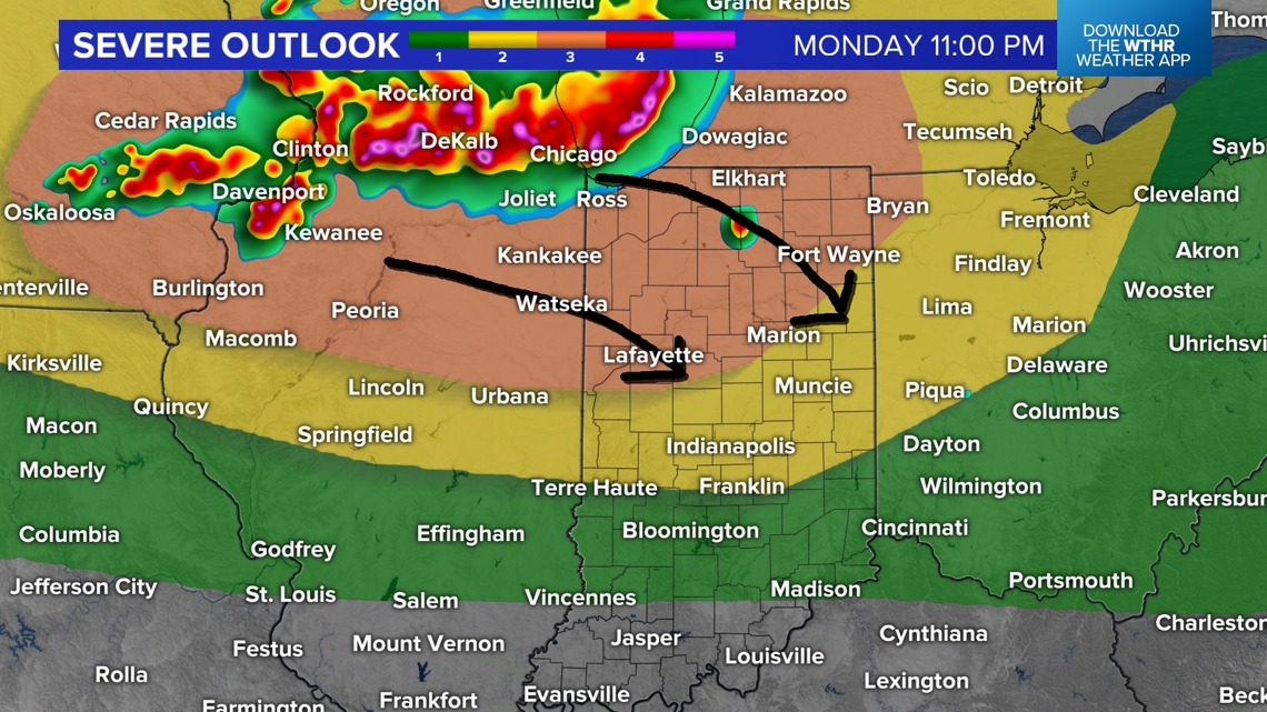

A more widespread storm and severe weather threat emerges late tonight and comes from an expected severe storm complex that initiates around Iowa later this evening. Individual thunderstorm cells there quickly merge into a "bowing" storm complex that likely produces swaths of significant (75+ mph) wind gusts from Iowa, northern Illinois and possibly northwestern Indiana (around midnight to 2 a.m.) before it "weakens" on approach to the I-70 corridor around 3-4 a.m. early Tuesday morning.
Stormy at times Tuesday — and uncomfortably humid
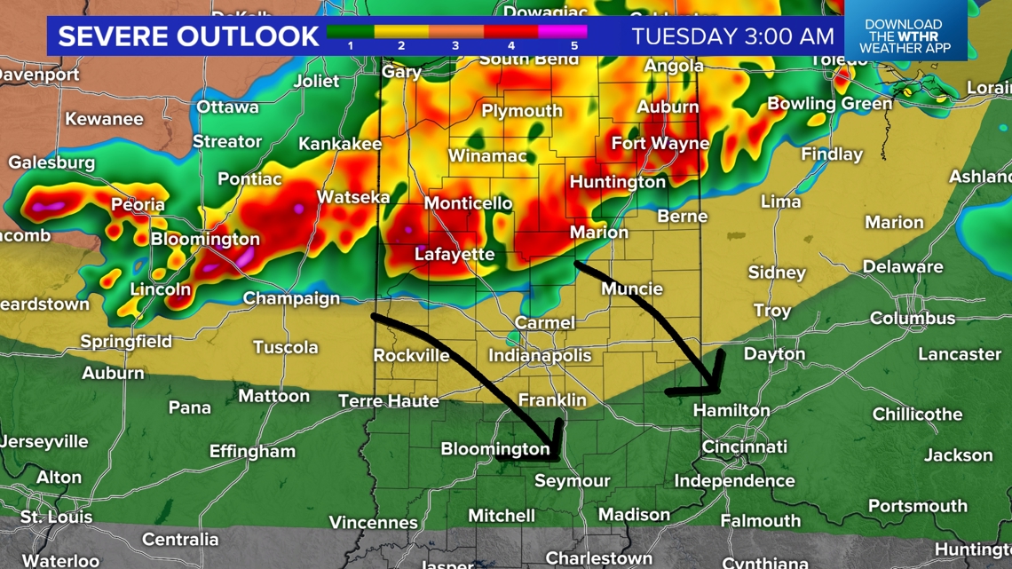
Though weakening, this complex is still expected to bring flash flooding rainfall to many areas in central Indiana, severe wind gusts, power outages and Watches/Warnings between midnight and 7 a.m. Please have ways to get those Watches/Warnings, and be prepared to manage without potential power in some areas and/or street flooding early Tuesday.
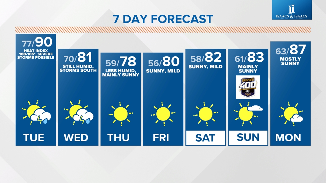
Morning rain/thunderstorms diminish by midday, and there will be plenty of rain-free time on radar. There will also be plenty of highly humid air again tomorrow, with heat indices in the upper 90s to 100° before the next round of storms develop in the late afternoon/evening along an approaching front.


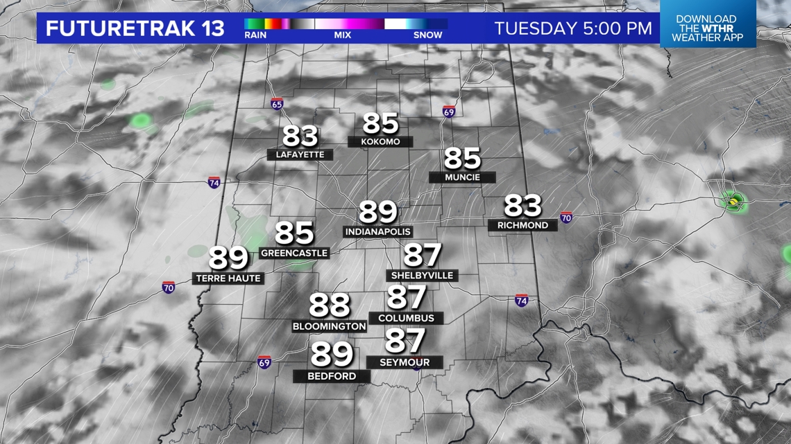

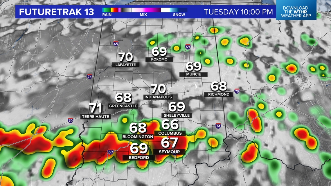
Morning rain/thunderstorms diminish by midday, and there will be plenty of rain-free time on radar. There will also be plenty of highly humid air again tomorrow, with heat indices in the upper 90s to 100° before the next round of storms develop in the late afternoon/evening along an approaching front.
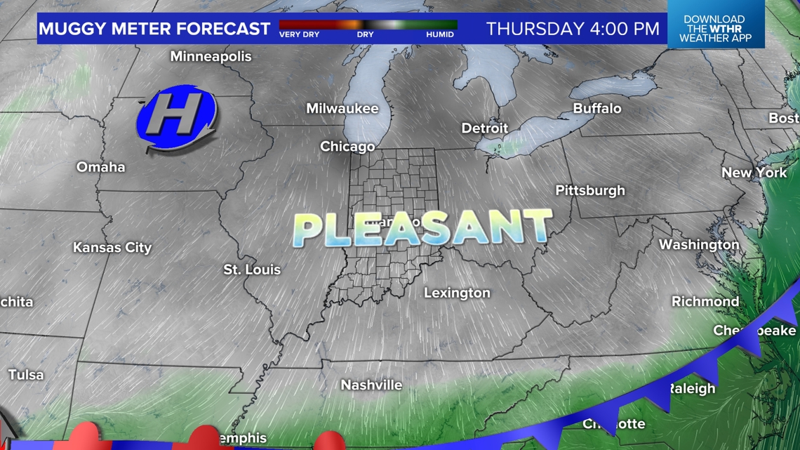
Pleasant finish to the week
That front sets up in southern Indiana on Wednesday, where the greater storm odds will be before the transition to much more comfortable air arrives Wednesday night into Thursday. The pleasant air mass has some staying power too and lingers into the weekend, producing multiple mornings in the 50s, sunny days and comfortably mild afternoons.