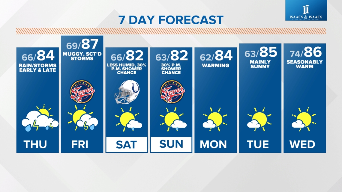
INDIANAPOLIS — One last quiet day before unsettled weather, along with much muggier air, returns to central Indiana on Thursday. Highs are in the mid to upper 80s this afternoon in what will be Indy's 12th straight day without measurable rainfall. Drier soils, combined with relatively drier air, heat up more quickly, and it results in some locations flirting with 90° the next few hours.
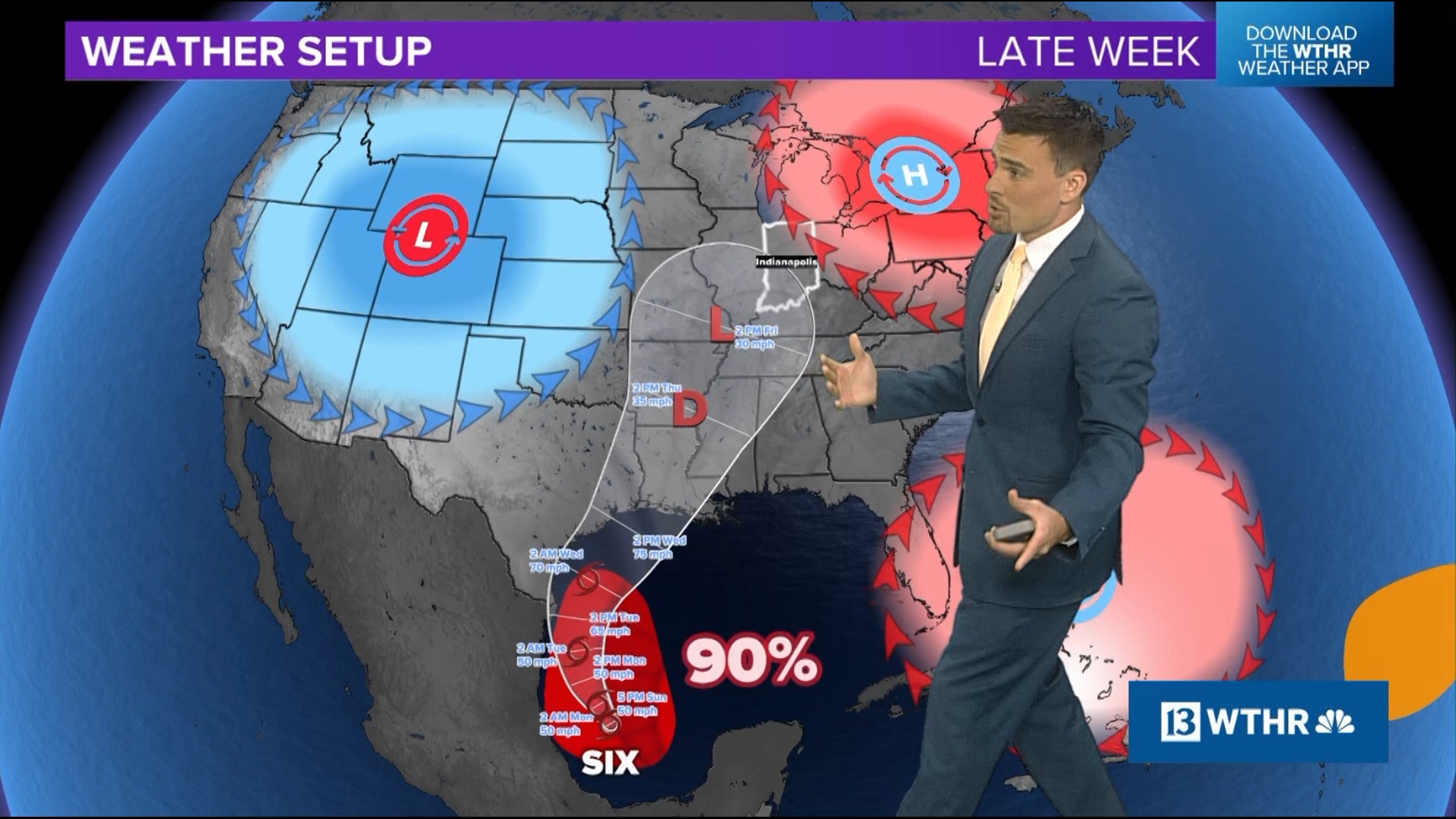
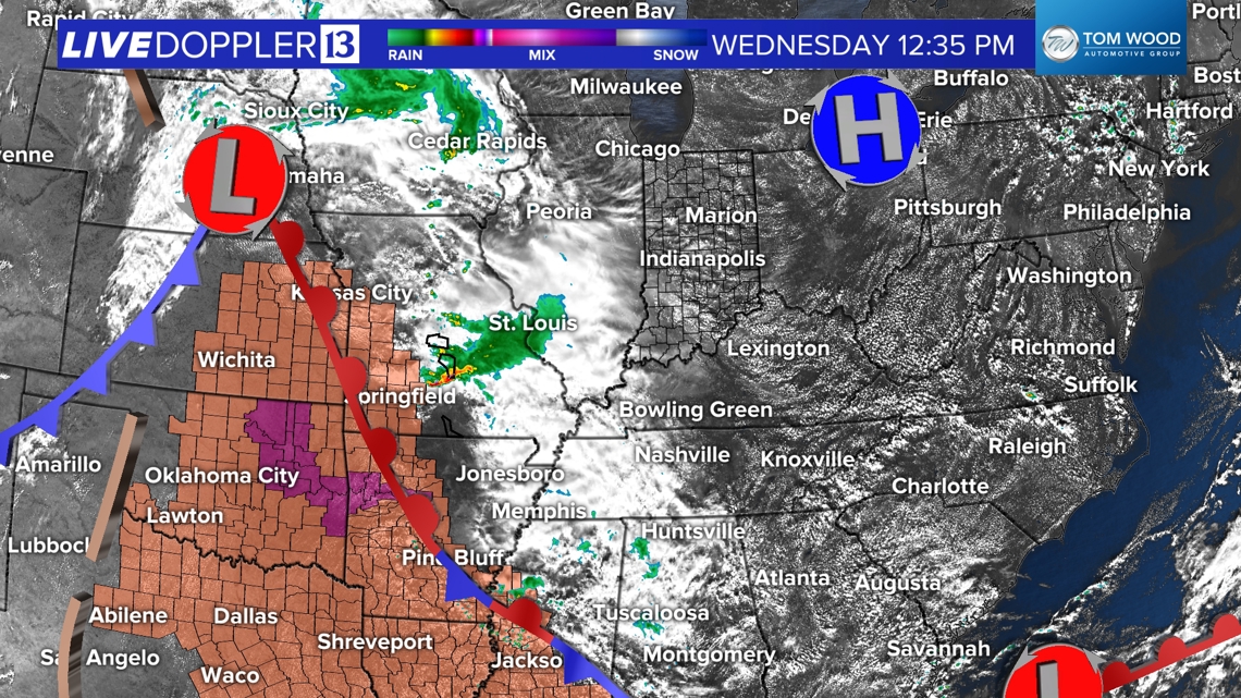
We continue to watch the heavy storm cluster axis remaining to our west today, along the eastern edge of the hot dome impacting the central and southern U.S. That axis gradually pushes into the state over the next 24 hours and brings an increase in muggy air, along with rounds of downpours and storms with varying degrees of strength and coverage.


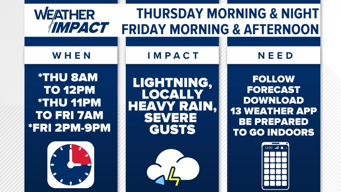
Impactful weather Thursday and Friday
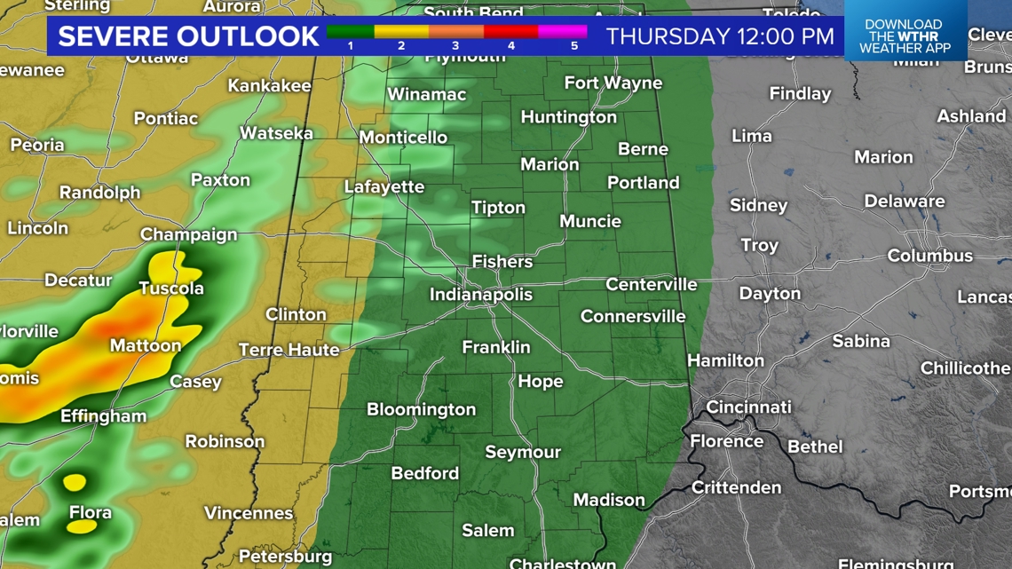
The first round is expected Thursday morning into midday. However, it should be noted that these will be the leftovers from an expected overnight complex. They should be weakening on approach but could still produce a few severe gusts in western Indiana before that happens. We still expect there will be rain-free radar hours Thursday afternoon before the atmosphere recovers and destabilizes heading into the next storm chance.
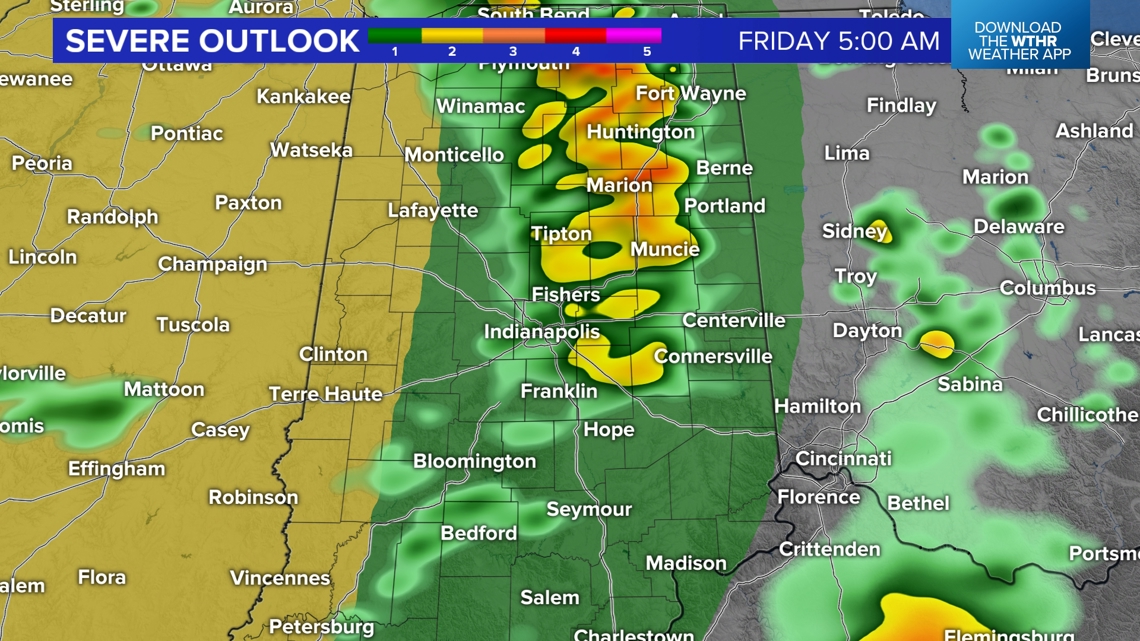
Stronger storms and a higher probability for pockets of severe gusts within the Thursday 10 p.m. - Friday 6 a.m. timeframe. These storms also bring much-needed rainfall for quickly drying soils over the past two weeks.
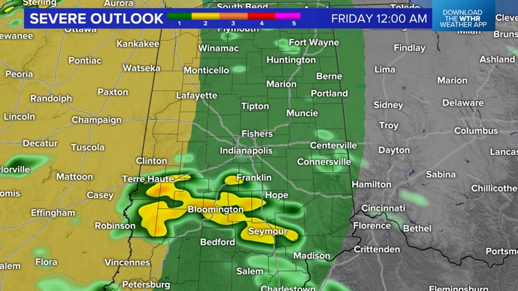
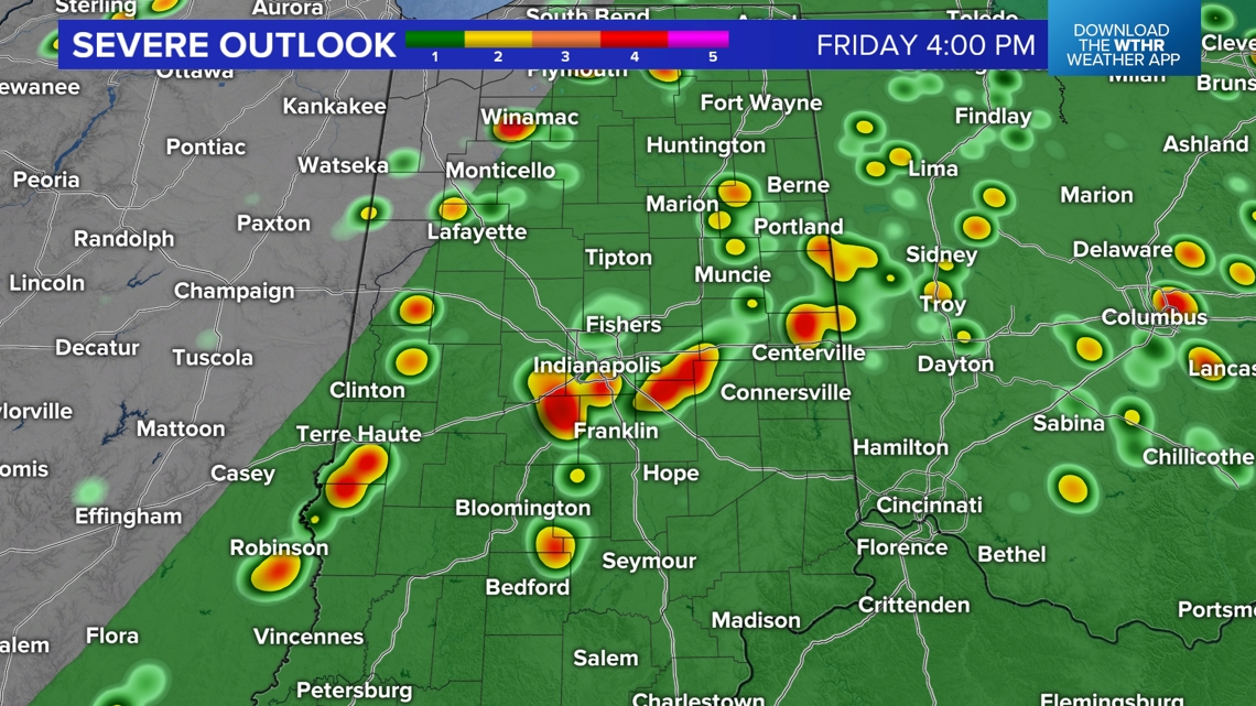
Friday still looks to be the most miserably humid day as dewpoints reach the 70s and heat indices of 90°+ before a cool front crosses the state Friday night. Scattered to numerous storms develop within the warm sector Friday afternoon, and some of those storms could reach severe levels.


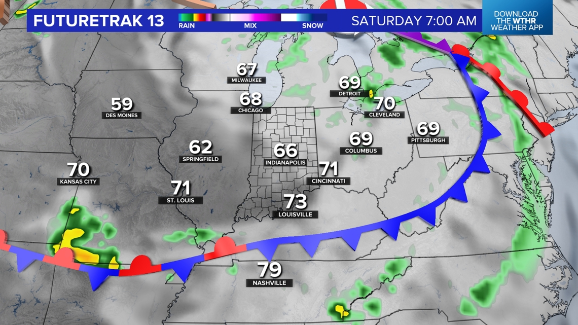
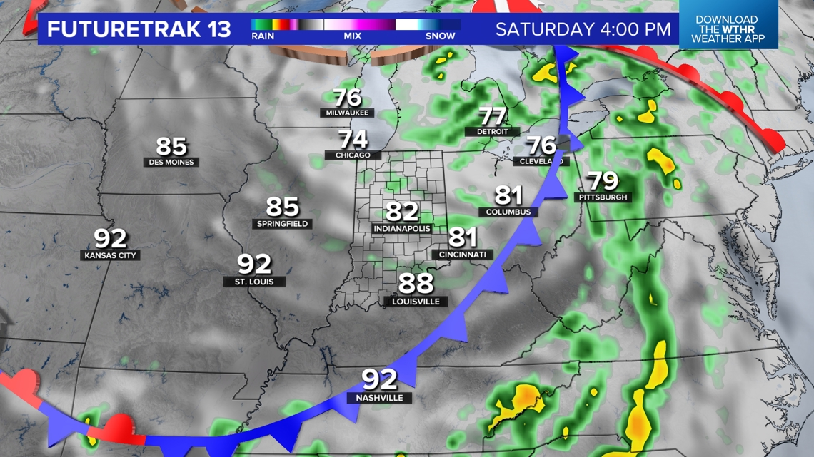
Weekend
The front settles toward the Ohio River for the weekend to allow less humid air to return. Sun mixes with low-level clouds and spotty shower chances Saturday and Sunday afternoons, but there should be many dry hours this weekend.