

INDIANA, USA — August is here! The summer quickly rolls on. Students are heading back to school. Expect summer weather to continue across Indiana. However we generally do start to notice some slightly cooler air by the end of the month.
What is this August 2024 looking like? We have the outlook for Indiana.
Tap HERE for the latest weather forecast from the 13News Weather Team.
Average August in Indiana
Before we get into the outlook, let's start with a foundation of what August typically brings to Indiana.
August is hot. August is humid. August can be stormy at times. That pretty much sums it up.
Average highs stay in the mid 80s most of the month. The final days tend to be in the low 80s. That slight decrease will accelerate into the fall with cooler air slowly coming into Indiana.

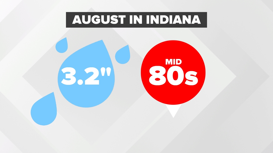
By August, we typically start to get lower rain chances. After 5 inches on average for both June and July, the month of August brings an average of 3 inches to central Indiana (climate data: Indianapolis NWS). August is a typically drier month for much of the central United States.
Daylight loss
August starts to bring bigger losses in daylight across the Northern Hemisphere. Most of Indiana will lose more than 1 hour of daylight by Aug. 21.

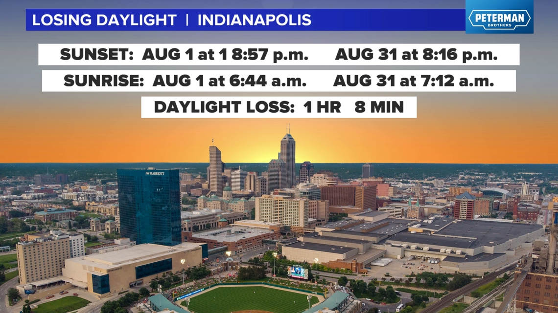
This is the month when we lose 6 a.m. sunrises. By the middle of the month, sunrise will be in the 7 a.m. hour (EDT) for central Indiana.
These daylight losses bring the start of slightly cooler air to the Great Lakes and Corn Belt. September, the next month, has the biggest daylight loss of the year.
What are we expecting this August?
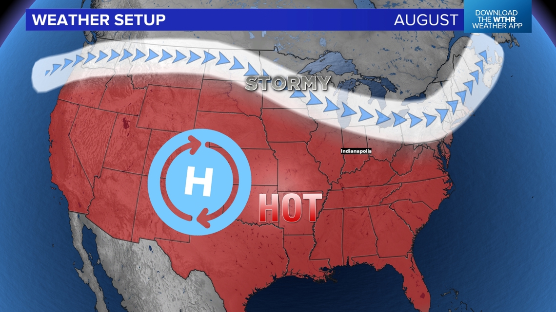
Overall pattern
August's weather setup looks very similar to July's, however the jet stream may be just slightly farther north. That will keep storm zones in the northern states while much of the rest of the country stays warm and humid. Best chances for pop-up storms will be farther away from the high pressure centered over the Front Range.

Temperatures
This pattern should keep the hottest weather in the western United States. However, the tilt back to the north near the East Coast may also allow warmer than normal weather along the eastern seaboard.

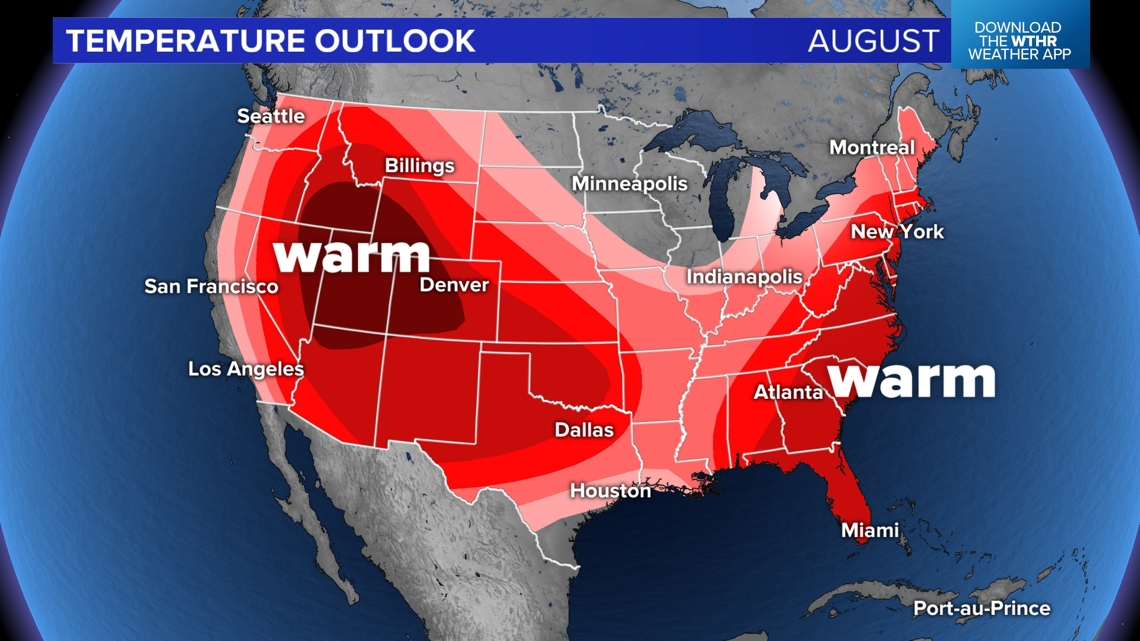
(Note: This map shows the chance that warmer than average or cooler than average temperatures are expected. The deeper the color, the higher the chance of a departure from normal. For areas not colored, there isn't a huge signal either way. Expect hotter days and cooler days.)
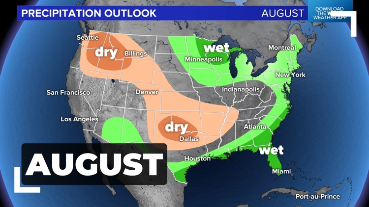
Rainfall
Areas near the higher pressure will likely be drier. That includes the northwest and the south-central plains. Wetter than average weather is possible in the Great Lakes, the northeast, and the southeast.

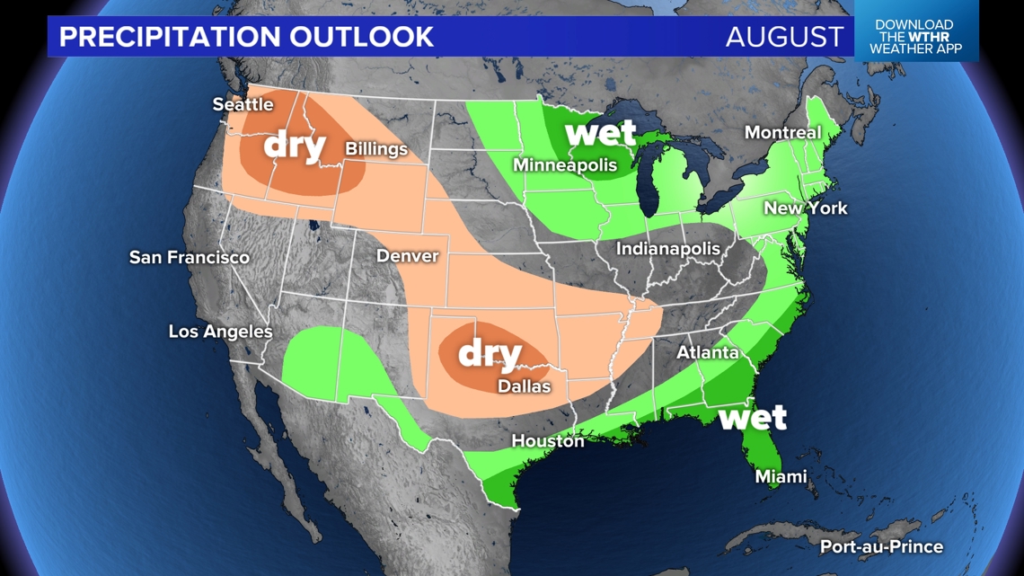
(Note: This map shows the chance that higher than average or lower than average rainfall are expected. The deeper the color, the higher the chance of a departure from normal. For areas not colored, there isn't a huge signal either way. Expect dry days and wet days.)
What about Indiana?
There are not many huge signals either way for Indiana. There is a higher chance that we are overall warmer than average for the month of August. Generally we have lots of low and mid 80s this month. Expect more upper 80s at times. There will be cool downs at times too, but these periods may be limited.
Expect more scattered pop-up storm chances at times this month. Many days will be dry, but as slow-moving systems arrive, they may spark heavy downpours in spots while other spots stay mostly dry.
Summary: Lots of 80s, high humidity, and watch for pop-up storms. There may be a few less compared to what July brought.
