INDIANA, USA — Anywhere between 0.25" (southeast) to 1" (northwest) of rain is expected the next four days across Indiana as a slow-moving storm system hits the central U.S.
The vast majority of rain will fall from the Ozarks to the upper Midwest, so much so that flooding concerns are growing after the summer and fall drought.
Indiana is on the edge. We will get skimmed by showers at times Sunday through Wednesday (Nov. 6).
Tap HERE to track the incoming rain with our interactive radar.
Rain chances ahead
While heavy rounds of rain hit the central Plains, Indiana will get the outer edges. Most times expect dry weather the next few days, but showers will move in at times.
The farther west and north you live in Indiana, the more rain you can expected.

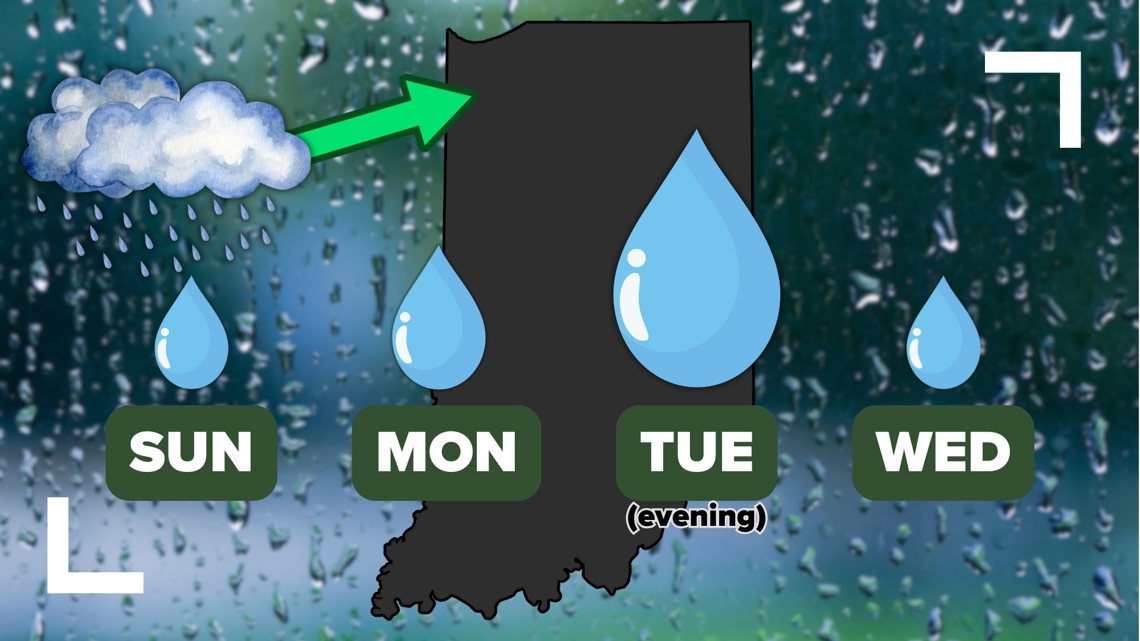
Let's walk day-by-day with our rain chances.
- Sunday: Isolated showers possible 2 p.m. to 8 p.m. (30% rain chance)
- Monday: Few showers throughout the day, mainly northwest of Indianapolis (40% rain chance)
- Tuesday: More widespread rain possible in the evening and night (80% rain chance)
- Wednesday: Leftover morning showers (30% rain chance), followed by sunshine
As we get closer to each day, check back for updates. The timing of individual rain showers may change. But generally expect mostly cloudy skies through Wednesday morning with rain showers at times. The heaviest round is trending for late Election Day Tuesday.
Latest Local Forecast: Live Doppler 13 evening forecast | Saturday, Nov. 2, 2024
How much rain can we expect?
This isn't a lot of rain. In fact some of us picked up over half an inch of rain last week in a few hours. Over the course of four days of rain chances, these totals are pretty weak. However we will take as much as we can get as drought continues to hold across Indiana.

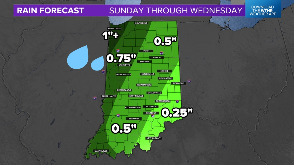
The highest rainfall is most likely in northwest and far western Indiana. Rain should be more consistent the farther west you go. The heart of the entire storm system is closer to the Mississippi River.
Central Indiana may get roughly a half inch of rain by Wednesday afternoon.
Eastern Indiana will be drier. Rain that arrives will likely be on the lighter side. Roughly around a quarter inch of rain is possible. Some Hoosiers near the Ohio state line may barely get anything.
(Note: Rainfall totals and zones may adjust with time as we get closer to each rain opportunity. This is our best guess as of Saturday night.)
Sunday rain chances
Most of Sunday will be dry. In fact enjoy a mix of sun and clouds in the morning. Later in the afternoon, after 2 p.m. for central Indiana, watch for a few hit-or-miss showers and southerly winds pick up.

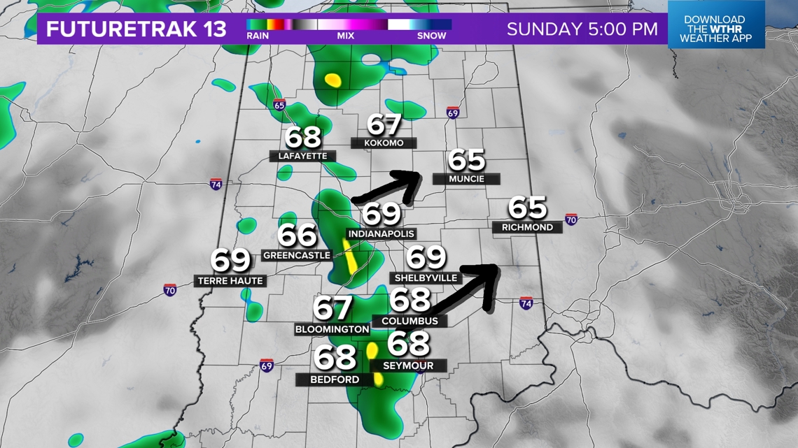
Most of these isolated showers should be gone by 9 p.m.
There may be additional showers late Sunday night into Tuesday morning for far western and northwestern Indiana, but central Indiana should trend mostly dry.
RELATED: What will the weather bring this November 2024 across Indiana? | Live Doppler 13 Weather Blog
Monday rain chances
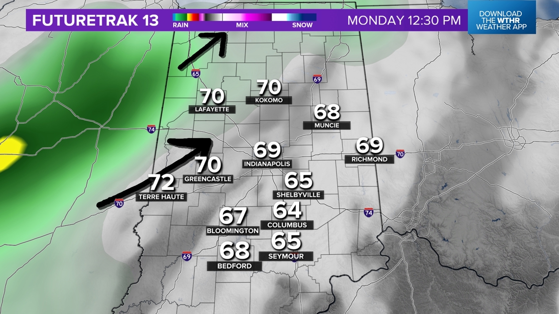
Some Hoosiers will get rain on Monday, and some will not. We will be tracking a heavier rain band in Illinois that will try to move into western and northern Indiana in the late morning, lasting through the afternoon.
Central Indiana may get clipped at times throughout the day with rain.
Some Hoosiers to the south and east will stay dry.

— 13News Meteorologist Matt Standridge


