
INDIANA, USA — Our nice stretch of weather for October so far is about to end with a strong cold front coming right to Indiana. It will bring highs back down to 50s next week and start up the lake-effect machine. We're not talking snow, but rather lake effect mist and clouds.
We will likely get our first widespread frost next week, and some places may even get a freeze.
Tap HERE to track the cold front with our interactive weather maps.
Let's go day-by-day and chat about how things will likely unfold with this cold front. It doesn't all hit at once. It is spread out.
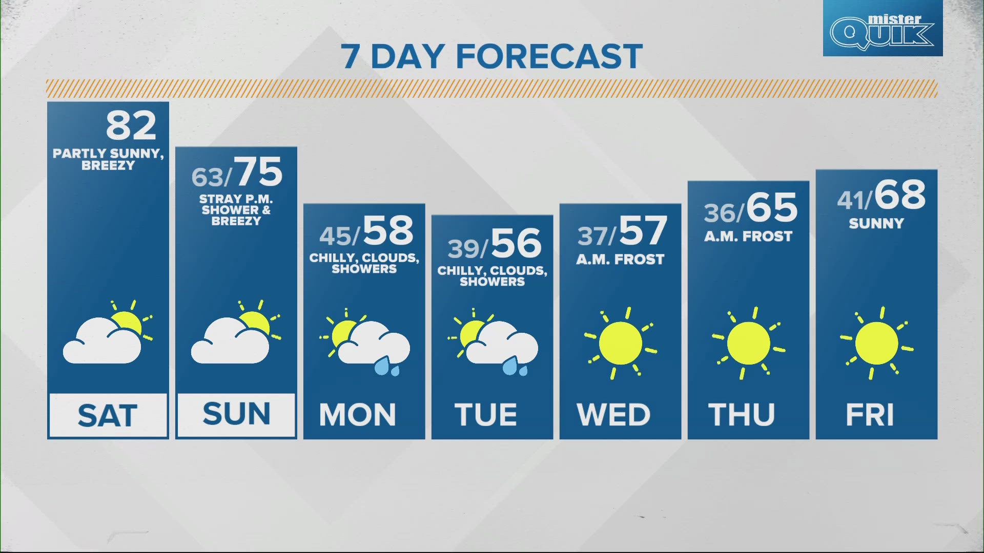
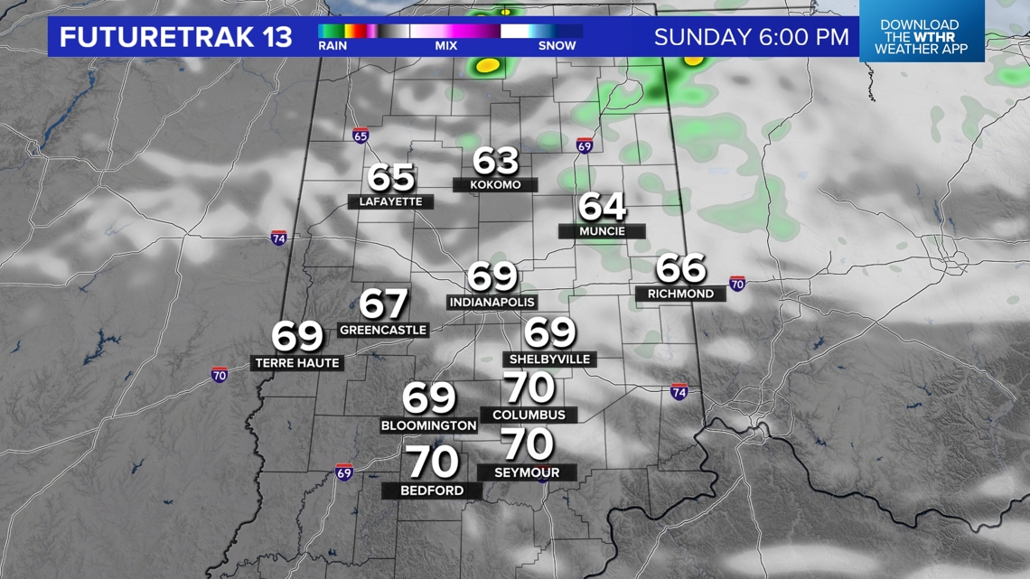
Sunday: Spotty shower north
Winds will be picking up across Indiana as the cold front pushes through. We may still get to a lot of 70s, but expect temperatures to drop quickly later that night. A spotty shower will be possible north of Indianapolis later Sunday evening. Otherwise expect a good mix of sun and clouds throughout the day.

Monday: More clouds and mist
Lake Michigan will be creating a lot of extra clouds on Monday. Northwest winds will carry them over vast areas of Indiana. Expect mostly cloudy skies, with a few sun breaks. Plus some misty showers are possible. Totals should stay under a tenth of an inch.

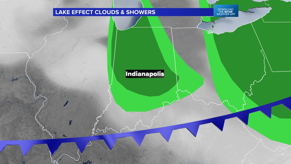
In some places the rain will not be heavy enough or consistent enough to fully wet the ground.
Expect chilly weather with highs only in the 50s.
RELATED: Frost in the forecast, find out when temperatures drop into the 30s | Live Doppler 13 Weather blog
Tuesday: More clouds and mist
We'll do the same thing on Tuesday. Highs will stay in the 50s with mostly cloudy skies and sporadic misty showers.
Wednesday: Frost
The clouds will clear out more on Wednesday. However clouds act as a blanket at night. Because those are leaving, temperatures will plummet at night. Expect to start in the mid 30s across much of Indiana. Wednesday morning will likely be our first widespread frost of the season
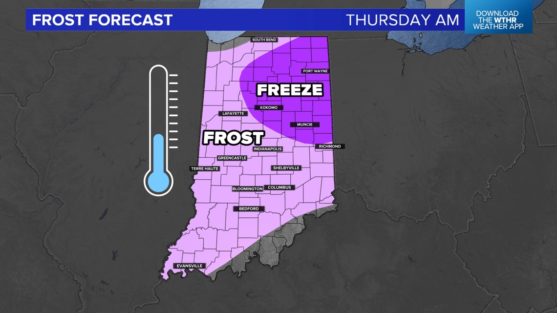
Thursday: Frost & freeze
We may drop down even more for Thursday morning, likely the coldest morning of the week. The vast majority of the state has a threat for frost, but parts of northeastern Indiana may get cold enough to have their first freeze.

After this big cool down, we will try to rebound to 60s and 70s by next weekend.
— 13News Meteorologist Matt Standridge