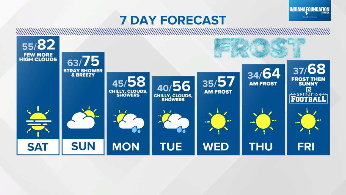
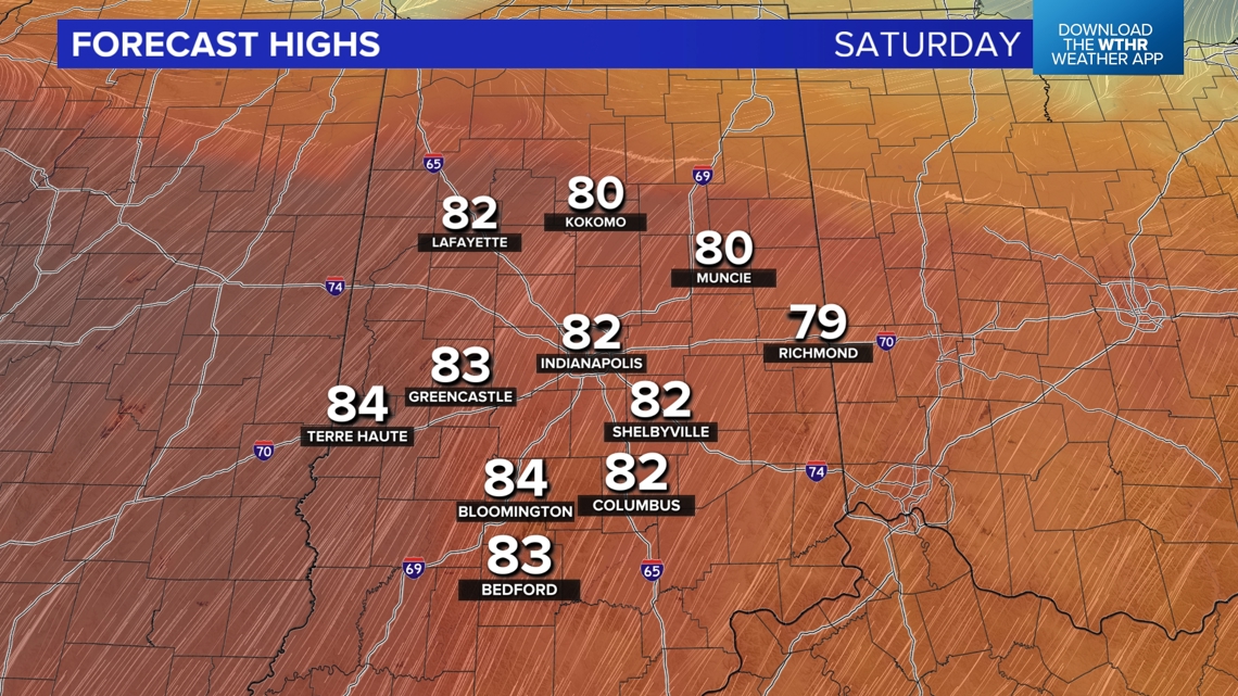
INDIANAPOLIS — Buckle-up for a rollercoaster ride in temperatures between now and Monday morning. We're on the warmer side of the fence this afternoon with unseasonably warm temperatures in the upper 70s and low/mid 80s depending on your location. That's 15-20° above average for mid-October. Not record-breaking warmth, but more like September.
Warm Start To The Weekend
Plenty of sunshine to team-up with a southwesterly wind to deliver this warmth. A little haze noted in the sky today that becomes noticeably "milkier" in the sky by Saturday morning as a denser remnant smoke layer aloft drifts into the state. This results in a fiery sunrise/sunset tomorrow and filters the sun and blue sky.


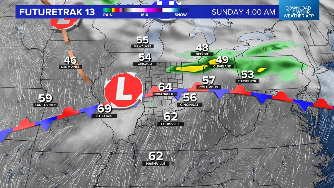
Saturday Night Showers And Thunder?
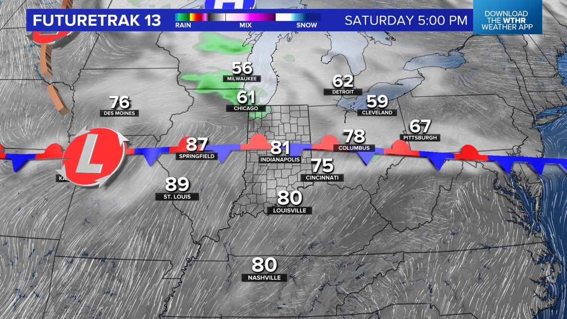
But it does not slow down our warm-up into the 80s Saturday afternoon as much of the area remains south of a boundary the first half of the weekend. The exception will be the northern third of the state, where there's a chance for a narrow zone of showers and possibly rumbles of thunder too as a wave of low pressure moves through the state.


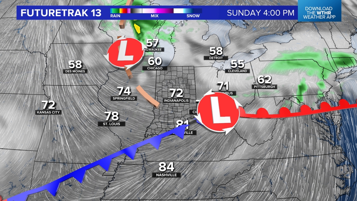
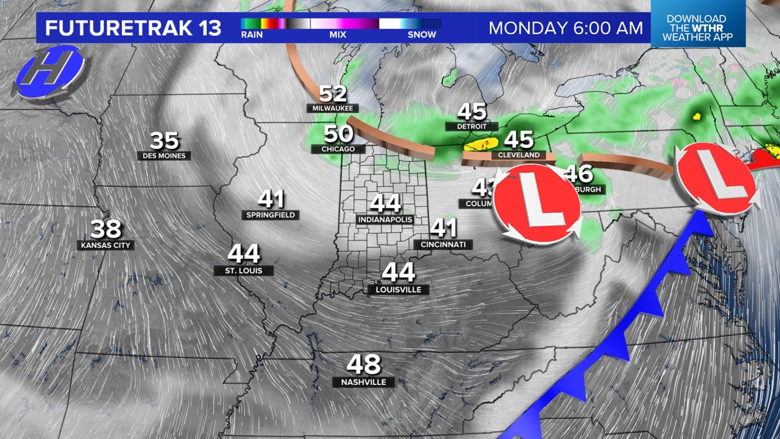
As that low moves east of Indiana, a wind-shift to the west-northwest emerges and knocks highs into the 70s. That breeze will be stiff and eventually becomes much colder with secondary front Sunday night. In its wake, the coldest air since mid-April overspreads the state by Monday afternoon and overspreads the much warmer Great Lakes.
Blustery, Showery Start Early Next Week
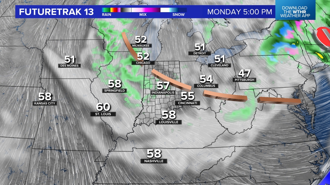
The latter produces a sizable amount of lake-effect cloud cover and embedded lake effect showers resulting in an unseasonably chilly afternoon in the 50s that will be overcast at times.
Varying amounts of lake effect cloud cover continues into Tuesday to keep temperatures chilly and limits sunshine before the wind eases off the lakes Tuesday night into Wednesday morning.


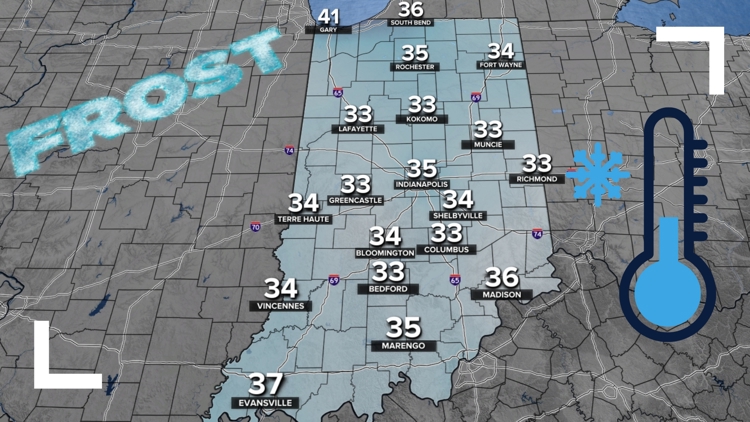
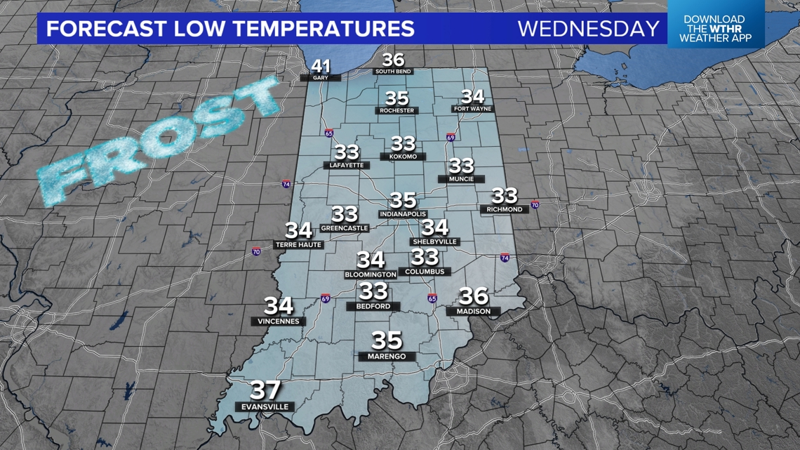
First Frost Next Week
That's when temperatures quickly drop into the 30s and will be our first opportunity of widespread frost. We're forecasting lows in the lower/mid 30s Wednesday morning and closer to freezing area-wide come Thursday morning.
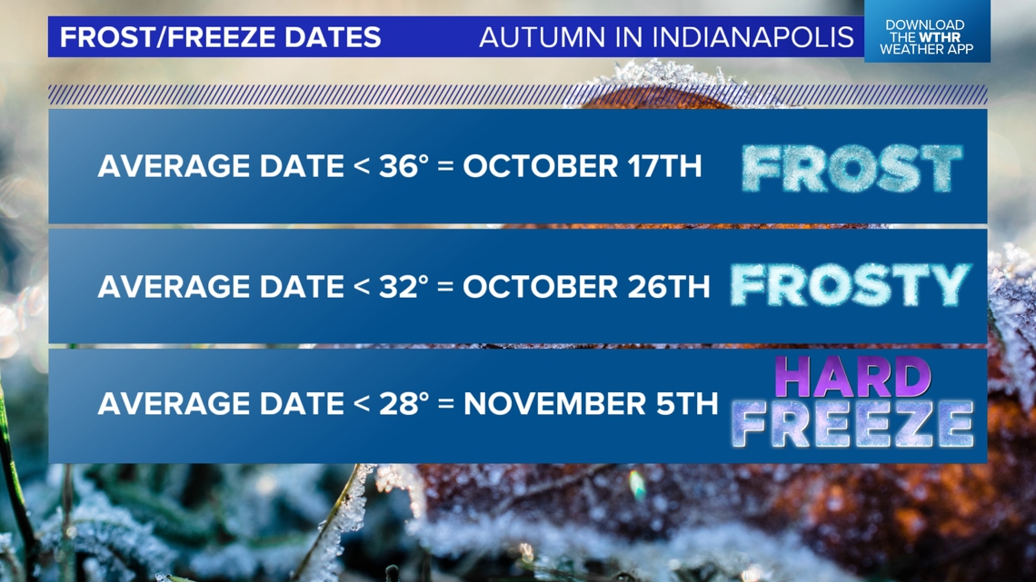
This is about the right time for our first frost too with climatological averages around Oct. 17.


After Tuesday, we're on track for plenty of sunshine again into later next week with increasingly warmer afternoon temperatures approaching the 70s again around the 18th of the month.