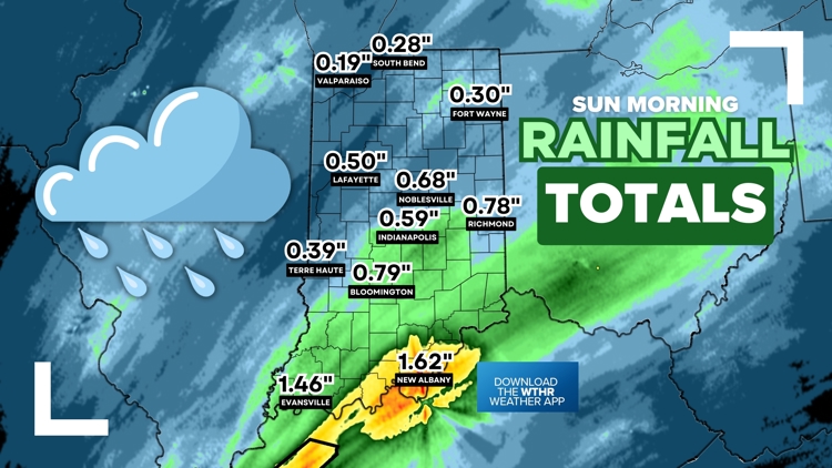
INDIANA, USA — We picked up a decent round of rain across Indiana Saturday night through Sunday morning. A few sprinkles are wrapping up in far eastern Indiana, but the majority of rainfall reports are in. We have over 50 rainfall totals from across the state (below).
Tap HERE to track the rain pushing east with our interactive radar.
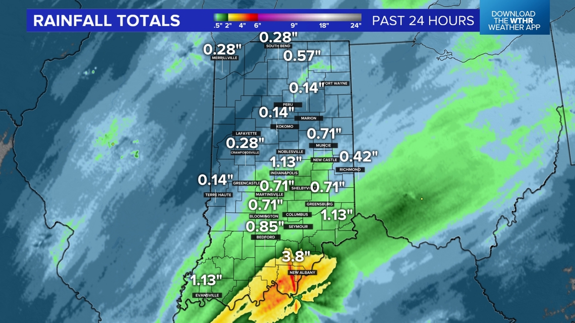
The highest rainfall totals were in eastern and southern Indiana, with some Hoosiers picking up near or more than 1 inch of rain. But it looks like the entire state at least picked up 0.1" of rain. We'll take anything we can get! We are slowly crawling out of drought conditions, but we still need a couple more inches of rain to fall.
Enjoy sunshine breaking out across the state for the rest of the weekend. It's turning out to be a beautiful Sunday evening.


(Radar estimated totals. Actual rain gauge reports below.)
50+ rainfall reports across Indiana
(ranked highest to lowest)
- New Albany: 1.62"
- Evansville: 1.46"
- Edinburgh: 1.27"
- Bedford: 1.10"
- Batesville: 1.04"
- Shelbyville: 1.01"
- Cambridge City: 0.99"
- New Castle: 0.98"
- Greenfield: 0.94"
- Columbus: 0.90"
- Greenwood: 0.88"
- Hagerstown: 0.88"
- Rushville: 0.84"
- Meridian Hills: 0.79"
- Bloomington: 0.79"
- Richmond: 0.78"
- Bargersville: 0.72"
- Centerville: 0.71"
- Brookville: 0.70"
- Avon: 0.68"
- Noblesville: 0.68"
- Fortville: 0.67"
- Mooresville: 0.66"
- Connersville: 0.66"
- Martinsville: 0.60"
- Fishers: 0.59"
- Indianapolis (airport): 0.59"
- Vincennes: 0.59"
- Greensburg: 0.55"
- Bunker Hill: 0.50"
- Muncie: 0.48"
- Greencastle: 0.47"
- Portland: 0.46"
- Brownsburg: 0.44"
- Elkhart: 0.43"
- Lafayette: 0.43"
- Carmel: 0.41"
- Westfield: 0.41"
- Terre Haute: 0.39"
- West Lafayette: 0.39"
- Crawfordsville: 0.38"
- Delphi: 0.38"
- Anderson: 0.33"
- Kokomo: 0.30"
- Fort Wayne: 0.30"
- South Bend: 0.28"
- Merrillville: 0.27"
- Zionsville: 0.22"
- Gary: 0.22"
- Marion: 0.21"
- Valparaiso: 0.19"
- Huntington: 0.19"
Next chance for rain
We have another storm system coming in midweek. Expect rain chances Wednesday night into Thursday. This batch looks fairly week with lower rainfall totals than this past round. Possibly expect 0.1" to 0.4" of rain by Thursday afternoon. We'll have updates as we get closer.


