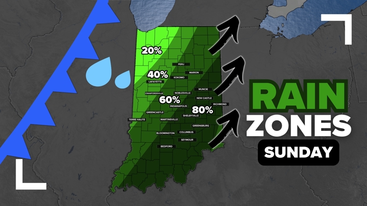
INDIANA, USA — Rain is moving into Indiana, with the heaviest generally tracking south of I-70. Expect on-and-off showers and downpours from Saturday 8 p.m. to Sunday 12 p.m.
Tap HERE to track the rain with our interactive radar.
Severe weather is not expected as temperatures cool off down by the ground. This should mainly just be a batch of rain, somewhat heavy at times, with a few rumbles of thunder possible at times.
Saturday stayed mostly dry, except for northern Indiana, thanks to leftover dry air in place. We should overcome that slowly into Saturday night so that by Sunday morning we will be wet. A good 0.25" to 0.75" is expected across central Indiana. Some places farther south by the Ohio River may reach nearly 1 inch or rain by Sunday afternoon.

RELATED: When does Indiana typically get its first accumulating snow? | Live Doppler 13 Weather Blog
Rain Zones
Let's walk through some rain zones. These are estimations of rainfall chances across the state to roughly show the timing of when to expect rain and when to expect it to move out.
Saturday late evening (after 7 p.m.)
Most of the rain will be in northwest Indiana and southwest Indiana. This coming storm system will have two axis' of energy as it splits. A good quick wave of rain to the north and stronger wave of rain arriving in southern Indiana.

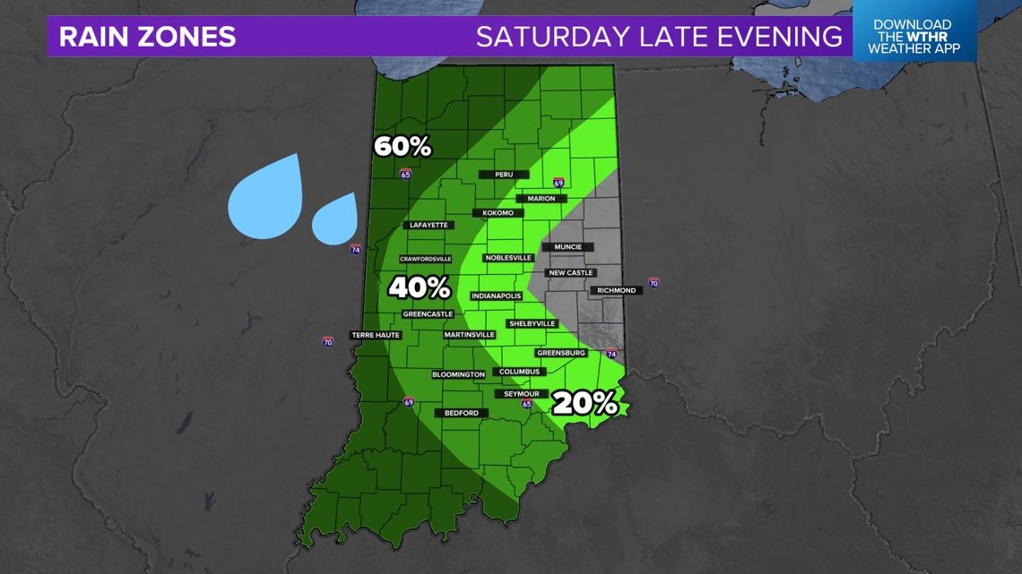
This southern wave will become the dominant rain band, hopefully giving much of central and southern Indiana a good dose of some water.
Sunday morning (4 a.m. to 10 a.m.)
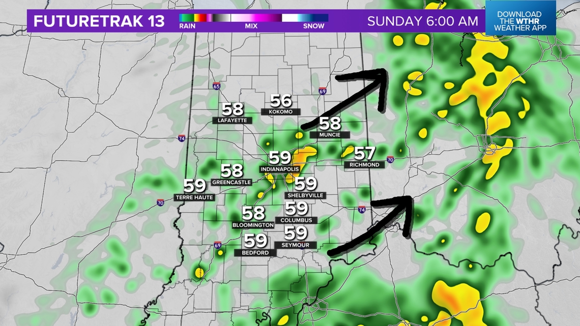
As northern Indiana's rain fizzles out, the southern batch of rain should be sitting right over most of central and southern Indiana. Expect scattered showers and downpours around Indianapolis, and especially areas south and east.

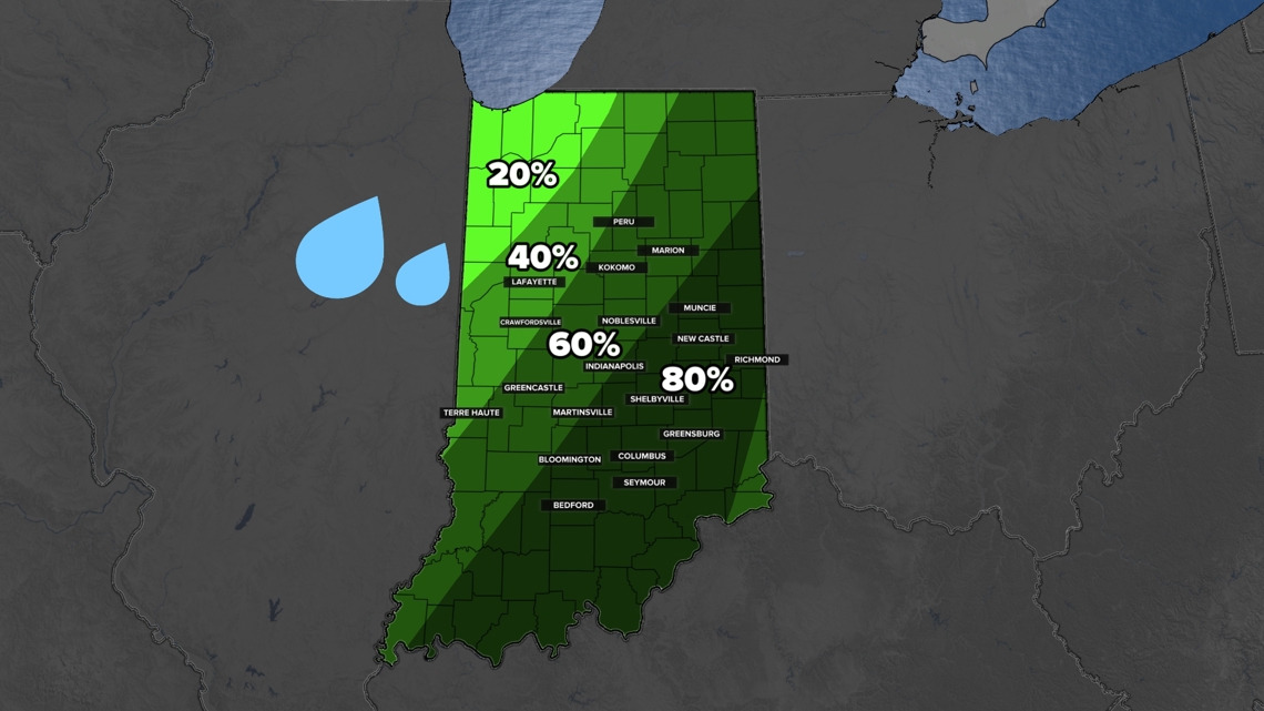
It won't rain the entire time. Expect some breaks. For some Hoosiers, the breaks won't last too long.
Sunday early afternoon (11 a.m. to 3 p.m.)
This is the tricky part of the forecast: when does the rain get out?
We will be watching scattered showers and downpours exit into eastern Indiana, but there may still be some clouds at times with light sprinkles. Around Indianapolis, expect the consistent rain to end but don't be surprised if you get a few raindrops around the middle of the day at times.

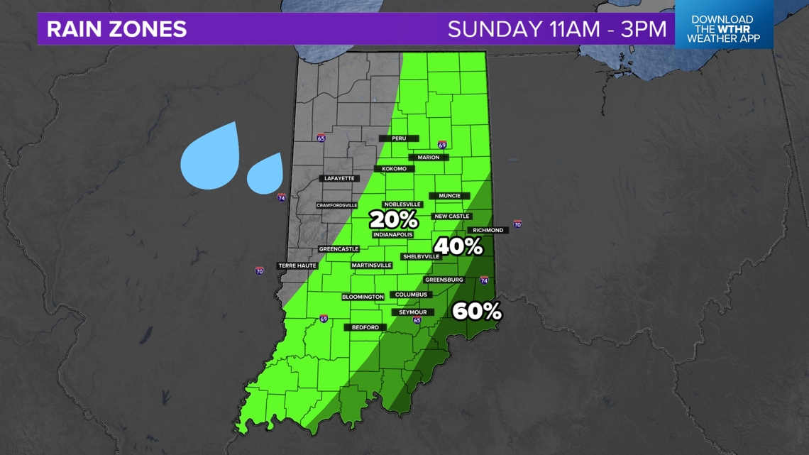
For Colts tailgaters, you may start wet and then slowly dry out. Expect scattered downpours and showers outside Lucas Oil Stadium until about 10AM. Afterwards you may still run into some sprinkles at times before gates open.
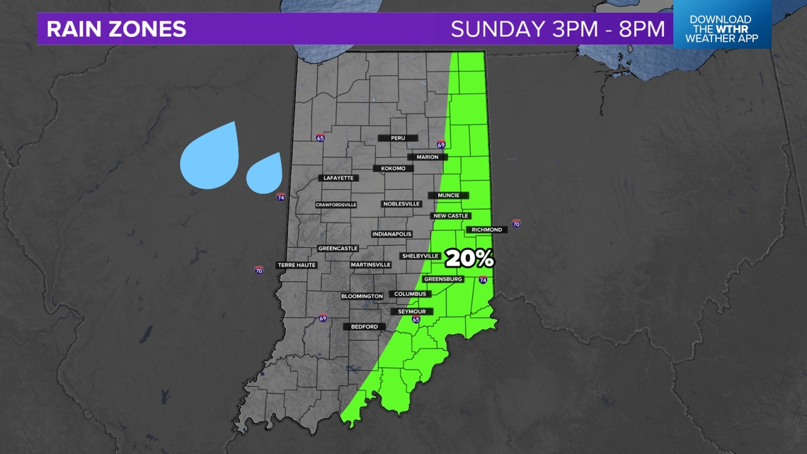
Sunday evening (3 p.m. to 8 p.m.)
Clouds will slowly clear out across Indiana and we should end the weekend on a dry note. There is a chance for an isolated shower or sprinkle in eastern Indiana, but anything would be pretty light.

Rainfall expectations
Because of the scattered downpours, there will likely be ranging totals across the state, but this forecast is a good ballpark estimate of what to expect. Your exact total will likely be a little less or a little more.

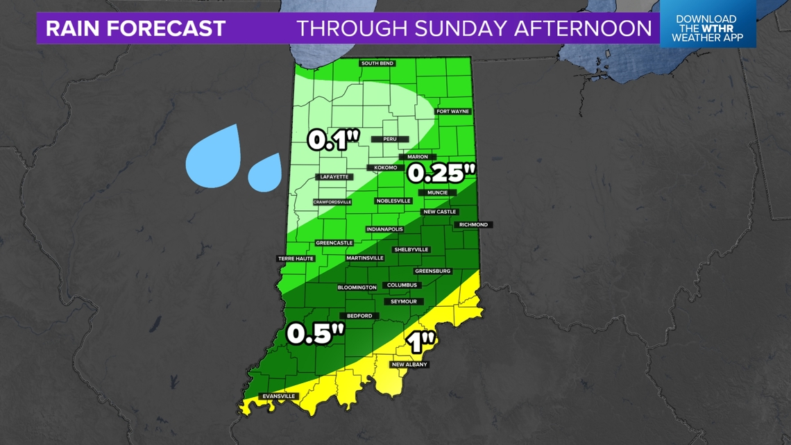
- Northern Indiana: 0.1" to 0.25"
- Central Indiana: 0.25" to 0.5" (A few Hoosiers south and east of Indianapolis may get closer to 0.75")
- Southern Indiana: 0.5" to 1"
Looking ahead
The start of the coming week looks cool and sunny. Most of the week is pretty quiet. There may be some extra clouds Wednesday with scattered showers on Thursday, but it doesn't look like a big deal for Indiana.
-13News Meteorologist Matt Standridge


