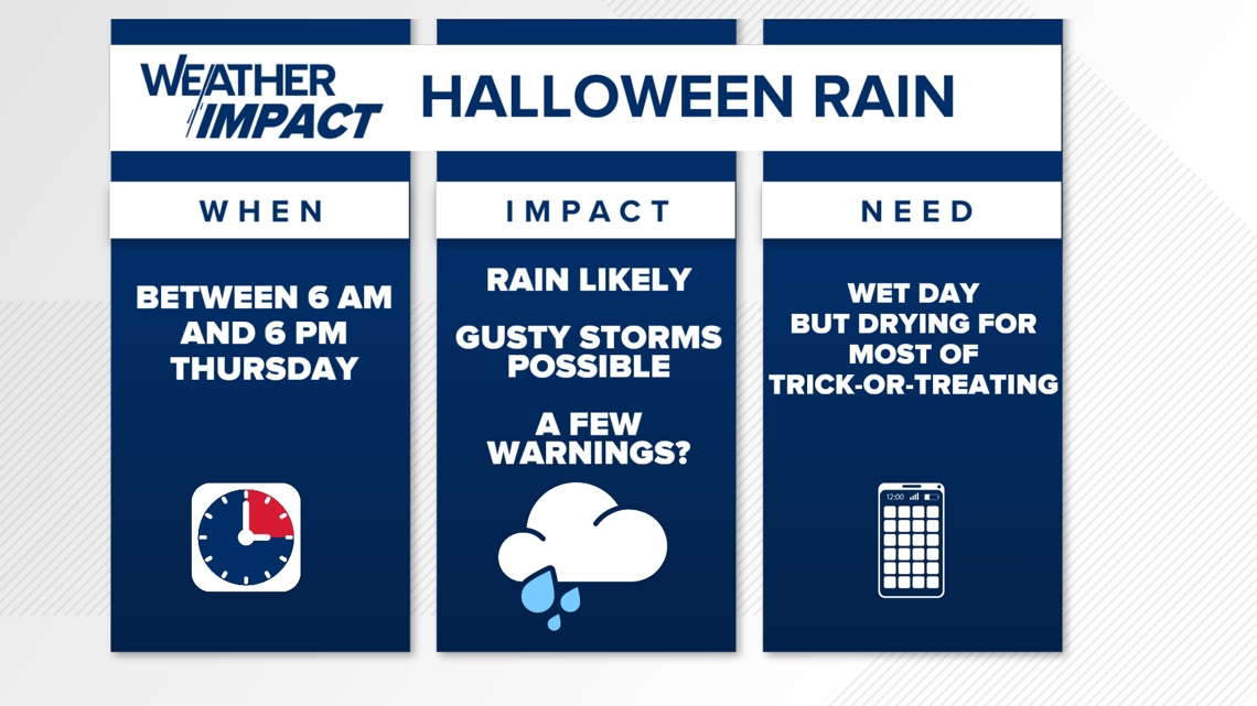
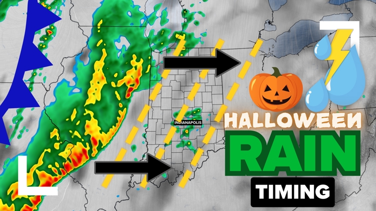
INDIANA, USA — After one of the driest Octobers on record, a cold front will bring scattered showers and storms to Indiana for Halloween, with a low chance for some severe winds.
Tap HERE to track the rain and storms forming to the west with our interactive radar.
(Note: If the rain misses Indianapolis, it will be the driest October on record. We think there is a high chance of at least 0.1" to 0.2" for Indianapolis.)
Other than an early isolated shower, the vast majority rain will come into Indiana near or after sunrise. This front will spark a line of rain and storms in the Plains and march east toward Indiana Halloween morning.
General timing to watch for rain: 6 a.m. to 6 p.m. (greatest chance from 9 a.m. to 3 p.m.)
General timing for severe threats: 8 a.m. to 11 a.m.

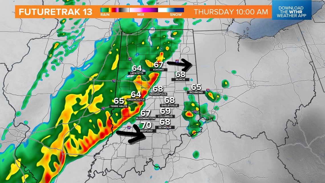
Timing out the rain across Indiana
There are three parts to the rain:
- Isolated showers may develop in the early morning for central and southern Indiana ahead of the main line of rain and storms. A strong push of warm, humid air may develop clouds enough to create separate showers 5 a.m. to 8 a.m.
- The main line of rain and storms will cross the Illinois - Indiana state line after 6 a.m. for the most part. This will be the main source of rainfall totals and possible severe weather in the morning. The main threat will be gusty winds along the leading edge of the rain and thunder. A shelf cloud will be possible in the morning.
- Lingering, spotty rain is possible after the heavy rain. We'll get some light showers from 2 p.m. to 6 p.m. This rain could be a little misty at times at northwest winds pick up 20-25 mph.
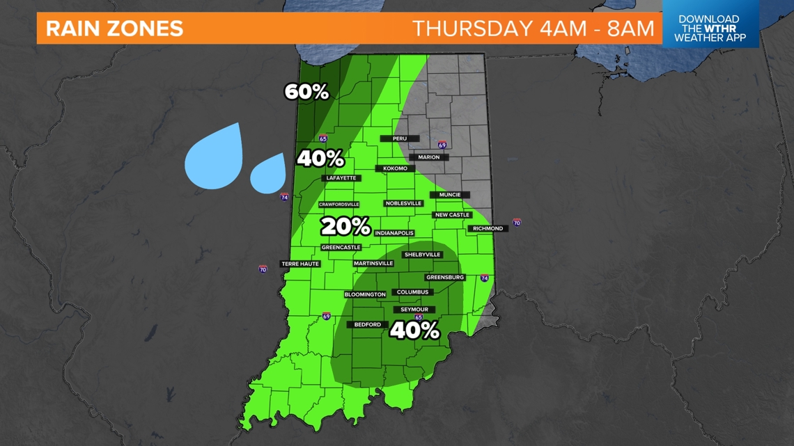
Rain zones - 4 a.m. to 8 a.m.
Most of the heavy rain will just start to enter western Indiana, especially up in the region, before sunrise. There is also a slightly elevated rain chance south of Indianapolis for some isolated showers developing ahead of the main line.

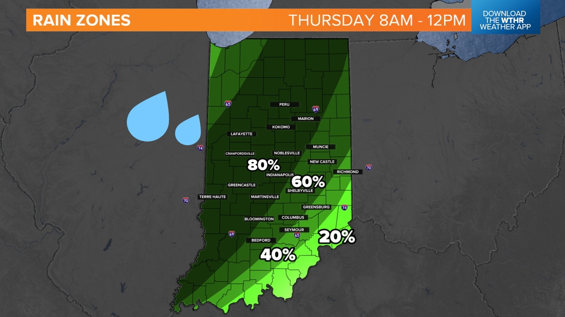
Rain zones - 8 a.m. to 12 p.m.
Scattered heavy rain and storms really get into much of Indiana after 8 a.m. Over time the line should weaken, but still expect some downpours generally west and north of Indianapolis.
Some Hoosiers in southern and eastern Indiana may be waiting for rain closer to noon.

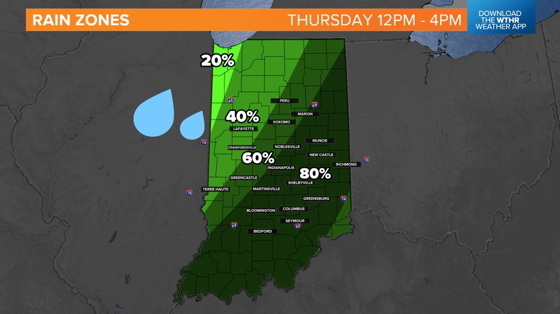
Rain zones - 12 p.m. to 4 p.m.
Slowly, western Indiana will dry out with spotty light showers. Eastern Indiana will begin to get heavier rain after lunch time. By this time the severe threat will lower.

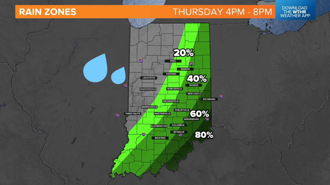
Rain zones - 4 p.m. to 8 p.m.
Now, we are talking about afternoon practices and trick-or-treating. Much of the western half of Indiana will dry out. Expect a mix of sun and clouds, plus northwest winds 20-25 mph, to start drying off roads and sidewalks. Temperatures will start to quickly drop.
Rain may still continue in the evening for eastern and southern Indiana; however it should be light and spotty by this time.

How much rain to expect?
This one is tough. Western Indiana may get more consistent rainfall as the line of rain and storms tries to hold. As the line weakens, rainfall may range more to the east. There may be some Hoosiers that do not pick up a lot of rain. However, this is our best chance in over a month since the remnants of Hurricane Helene.

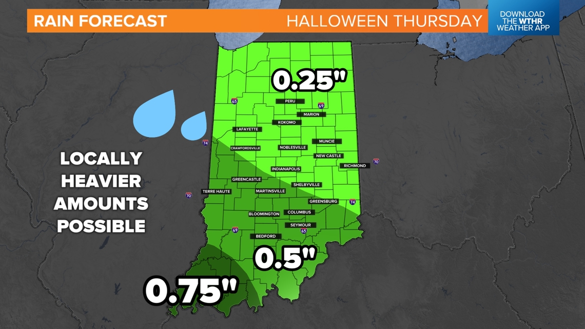
As the frontal system slows, the southern half of the line will slow more than the northern half. This may lead to a few higher rainfall totals in southern Indiana.
However, rainfall is tricky depending on how the line holds together or falls apart slowly over time. We may see widely ranging amounts.

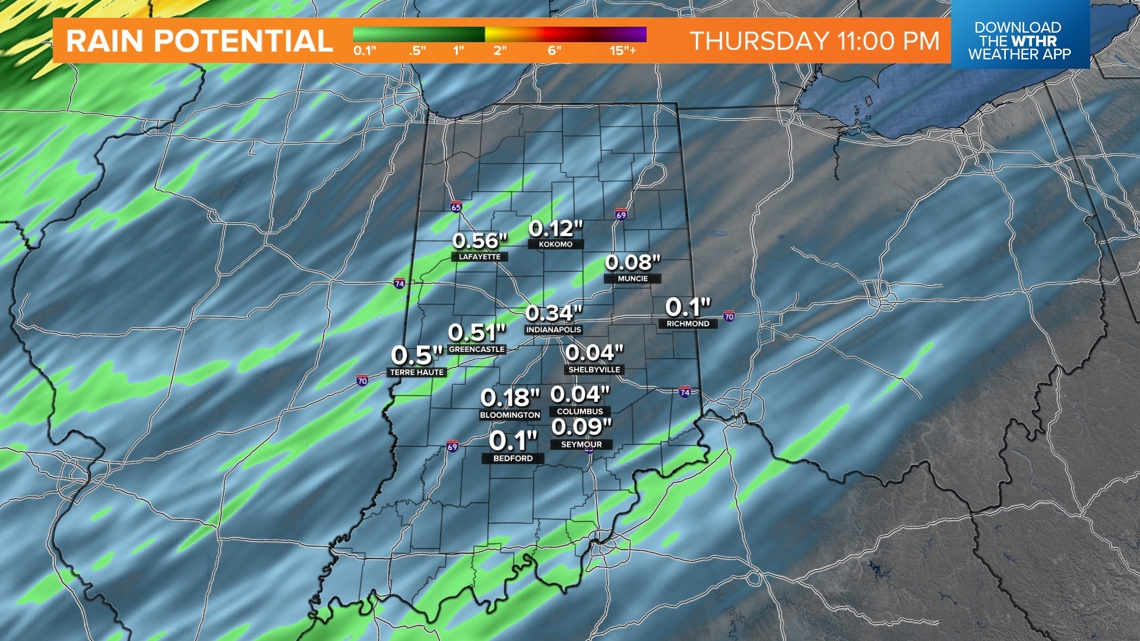
Severe threats
There is a level 1 (lowest level) severe risk for parts of Indiana on Thursday. Most of the risk comes in the mid and late morning hours. Wind storms embedded in the line of rain will be our biggest threat.

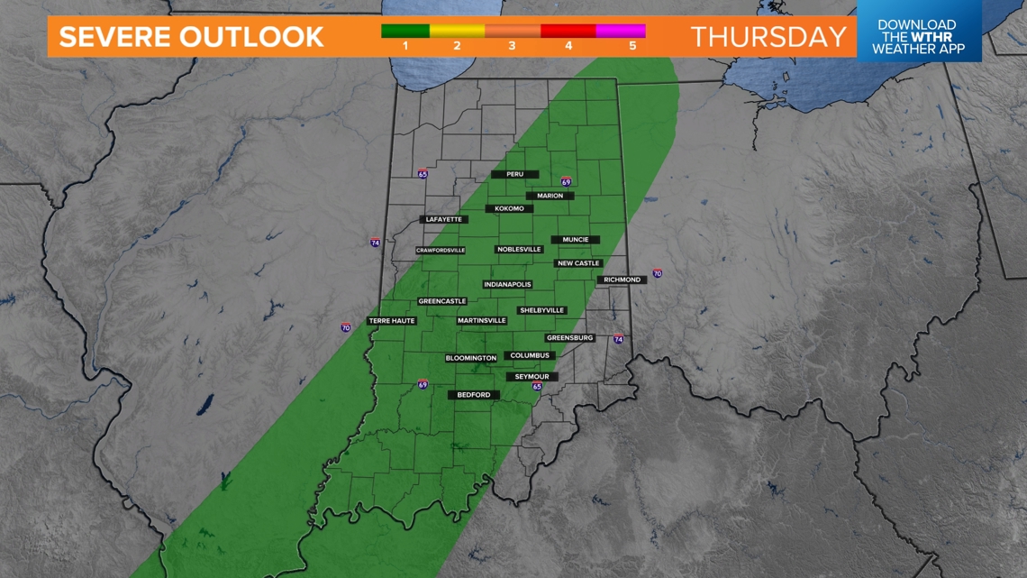
The vast majority of Hoosiers will not get severe weather, but rather rain at times, wind at times, and possible some rumbles of thunder.
Impact on Trick-Or-Treating
We are thinking much of the rain clears out in time for Halloween evening for western and central Indiana. There may still be some wet sidewalks, but they should be drying out.
Eastern Indiana and southern Indiana will still be on the lookout for leftover spotty rain showers. The rain shouldn't be too heavy, but some rain at times is still possible until 8 p.m. After 8 p.m., most of Indiana should be dry.
The wind and temperature drop will be some of the bigger factors. After 6 p.m., expect to start dropping to the 50s. Winds may make it feel a bit colder. Expect a mix of partly cloudy skies for the evening.

