INDIANAPOLIS — It's been a long time since we've had temperatures this warm this late in the season.
The high so far Tuesday in Indianapolis is just shy of the daily record (81°), but it is the first day of at least 80 degrees this late in the season in 74 years. In fact, it's one of only eight days since 1871 of 80°+ on or after Oct. 29.

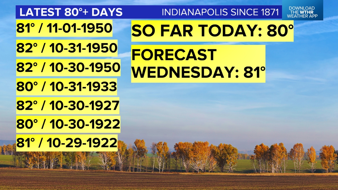

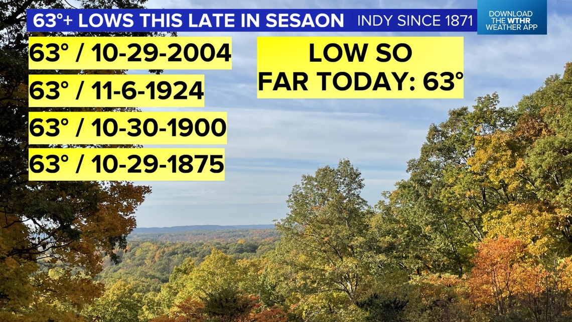
The "low" temperatures are also notable in central Indiana. Many areas woke to a balmy breeze and the 60s. Indianapolis only dropped to 63° so far today, which ties the daily warm minimum temperature for today and is one of only five days this late in the season with of low of 63°+. Truly "rare air" anyway you slice it and we've got another day of similar ahead on Wednesday.
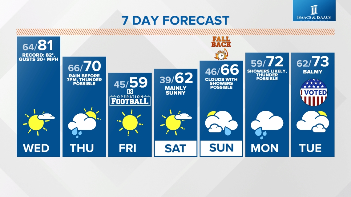
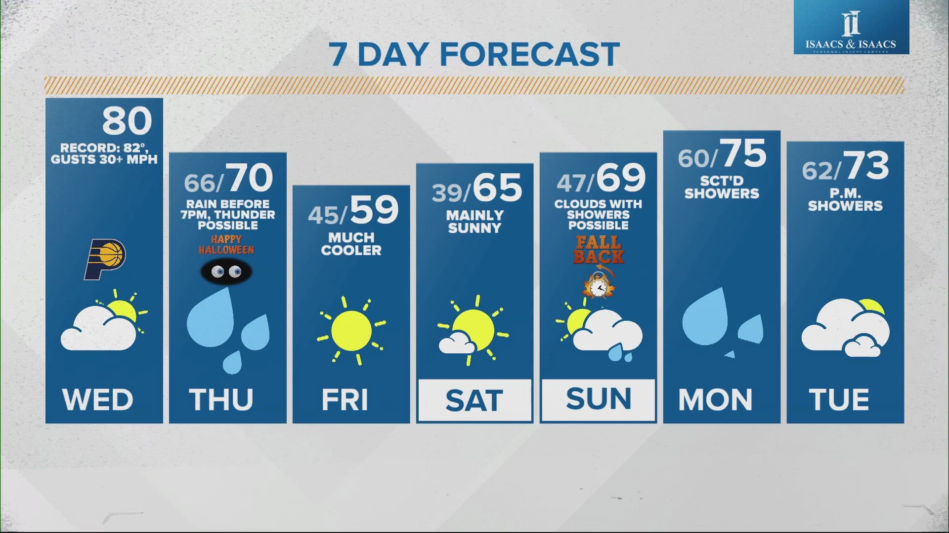
Expect morning lows in the 60s and near-record highs in the 80s Wednesday afternoon courtesy of hazy sunshine and gusty southwesterly wind over 35 mph at times.
Elevated fire risk
The stiff wind combined with dry soils and near-record warmth is an ideal recipe for fire promotion after what's been a historically dry October in Indiana. Many areas of 2"-4" below average for rainfall this month and it's playing a role in the elevated fire risk today and Wednesday.

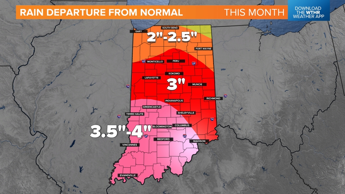
Burn bans remain in place and even rare Red Flag Warnings are in place for parts of the state. The last Red Flag Warning issued by NWS Indianapolis was 555 days ago in late April 2023. Please avoid any burning until further notice and know that even small fires can spread rapidly in these conditions.
Rain with severe storm potential Thursday
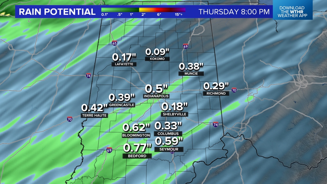
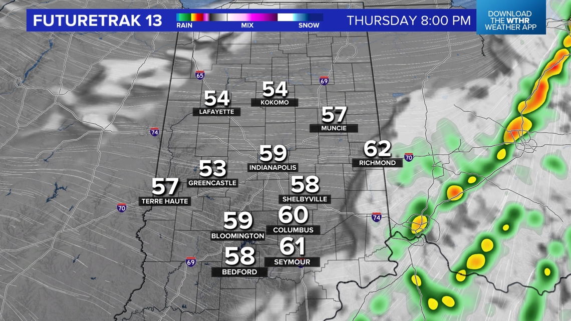
Rain is on the way and will impact a large chunk of Halloween on Thursday, but trends are our friend with the bulk of rain and thunderstorms departing for most by trick-or-treating in the evening. But you should be planning on a wet day with the likelihood of widespread rain along an approaching frontal system.

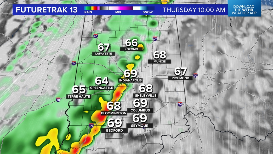

Pockets of heavy rain are possible along with embedded thunderstorms...some of which could produce severe wind gusts. While most areas avoid severe weather on Thursday, some Severe Thunderstorm Warnings are possible, and you should be Weather Aware for those potential impacts.

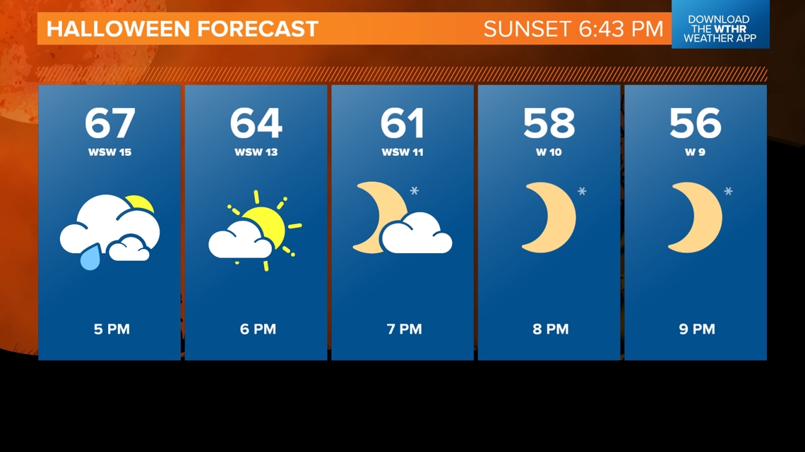
But we want to stress that as of now the main threat of rain/storms/severe weather will be ending rapidly for most of the area by 6 p.m.
The exception will be far eastern-southeastern Indiana that will still be closer to the front and the axis of rain. Please follow our forecast blog for updates and our app for rain timeline adjustments.

