INDIANAPOLIS —
TODAY:
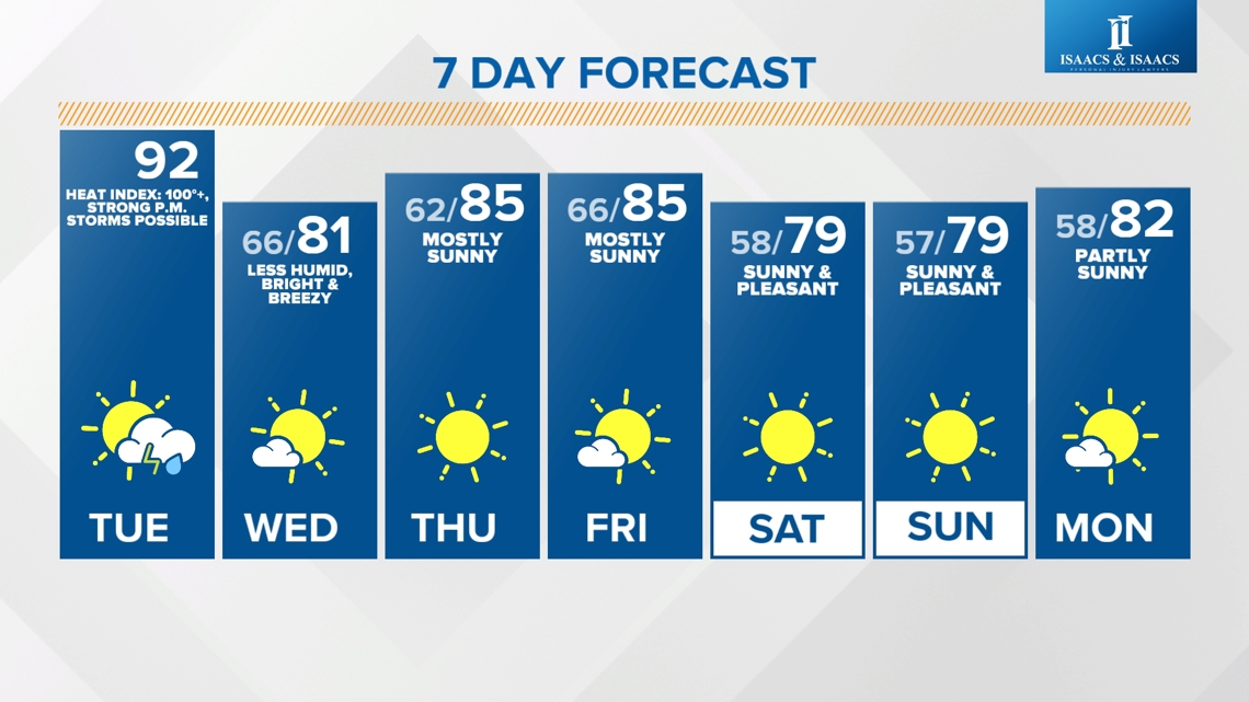
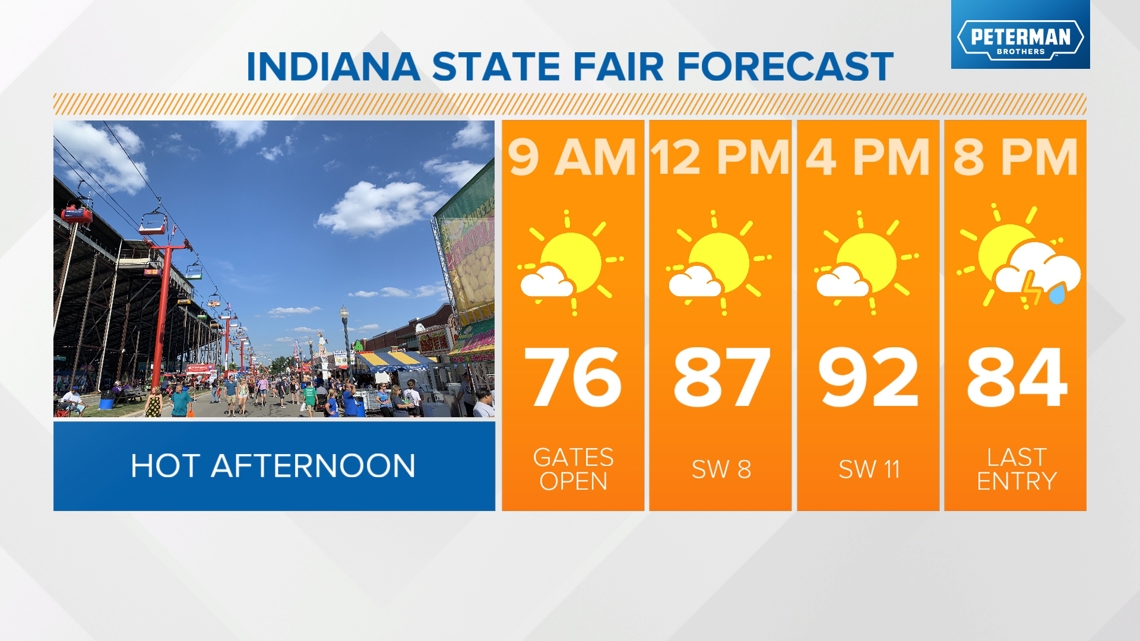
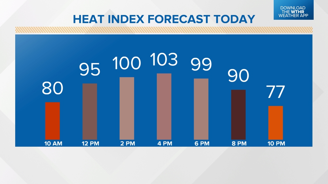
Sunny and hot again with highs in the low 90s and a heat index of 100-105 degrees.


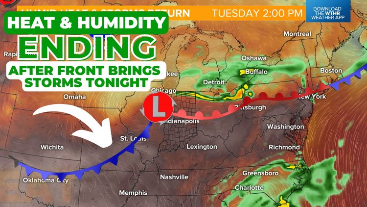
The cold front arrives tonight bringing a storm risk and a break from the heat.
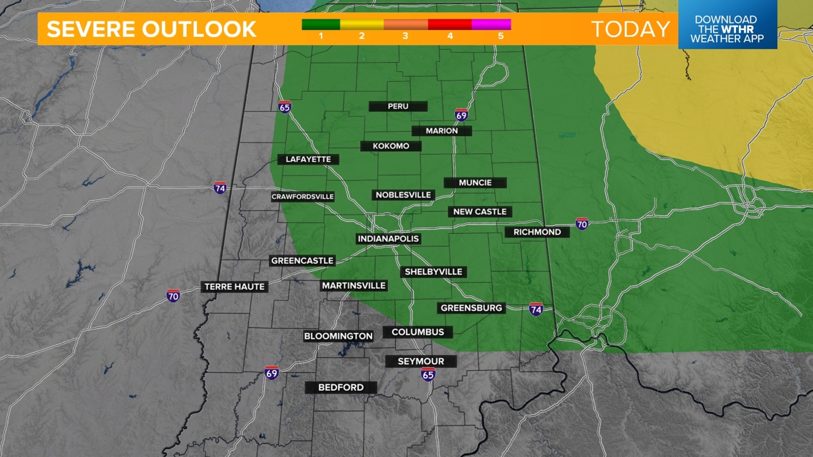
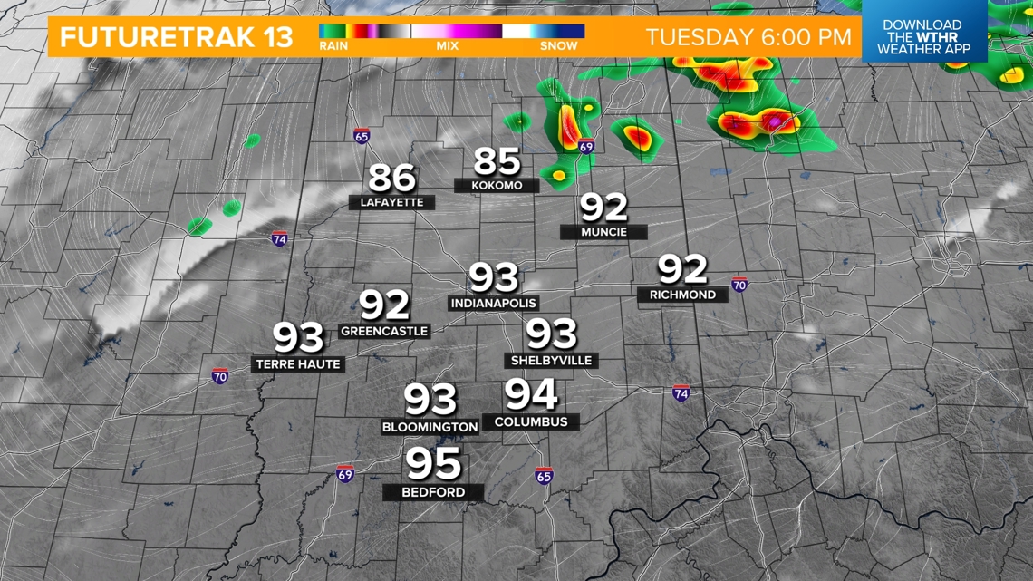
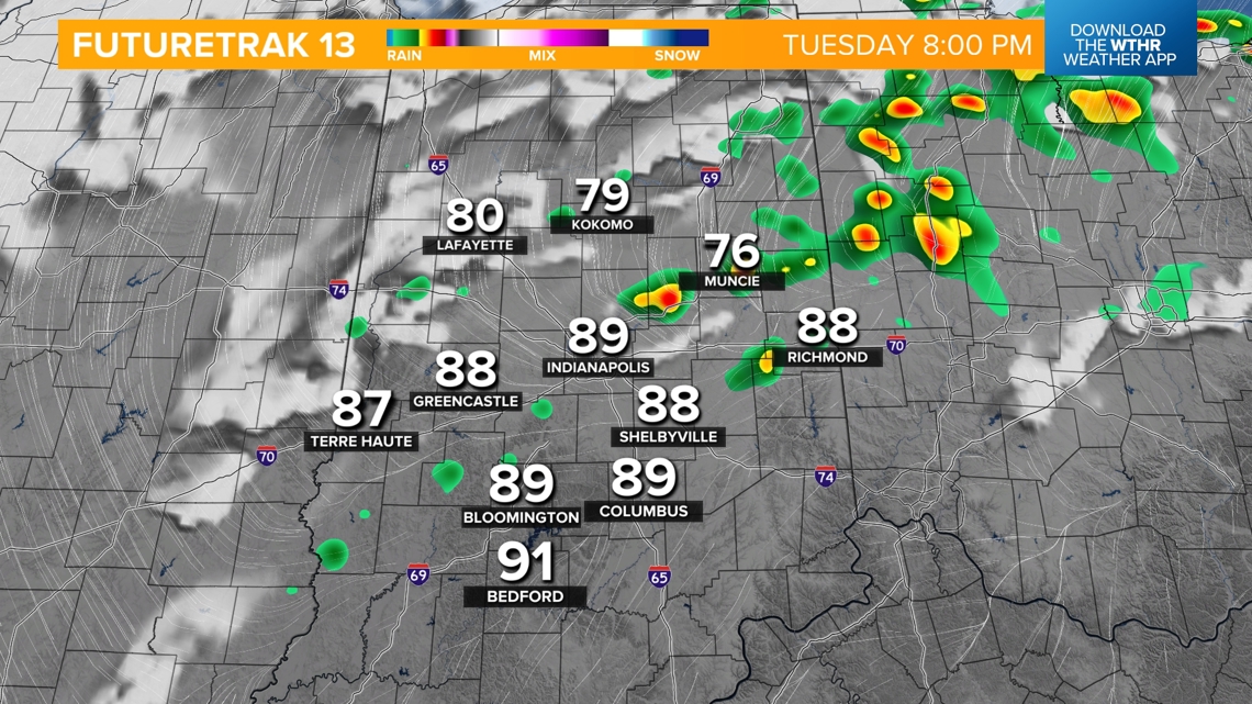
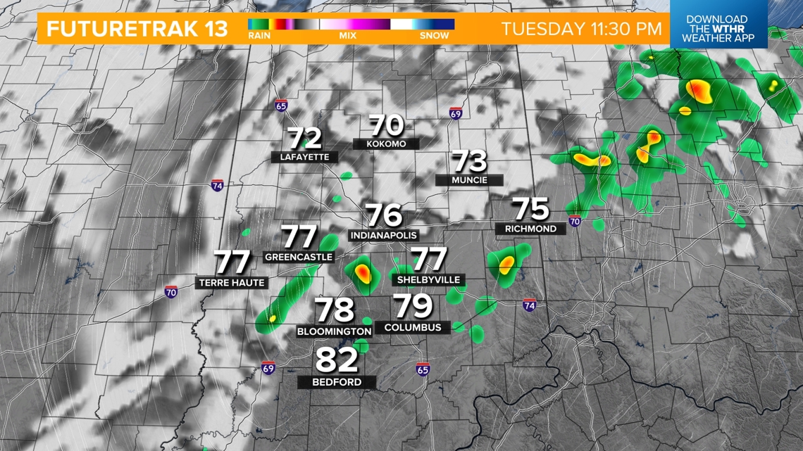
This will be a relatively dry front but a few showers or storms will be possible tonight after 6 p.m. into the early morning hours on Wednesday. An isolated storm may be strong to severe with damaging wind gusts as the primary threat.


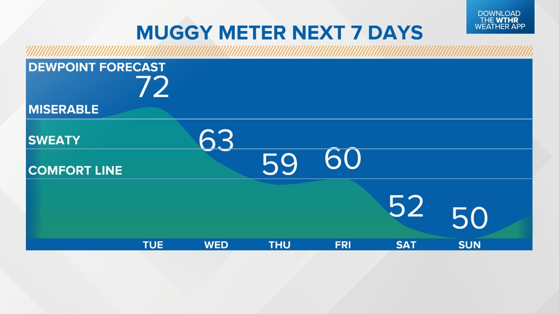
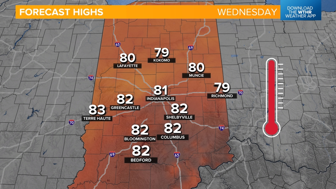
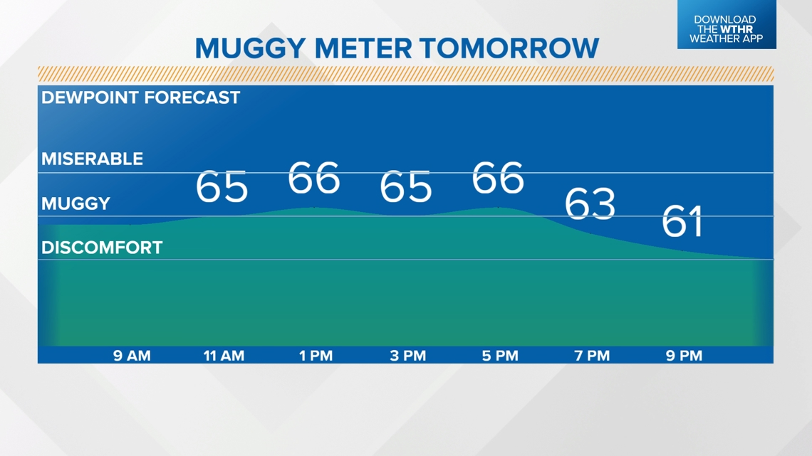
Skies will clear during the day Wednesday and it will be much more comfortable with highs near 80. While dew points stay in the mid 60s, it will feel noticeably less humid.


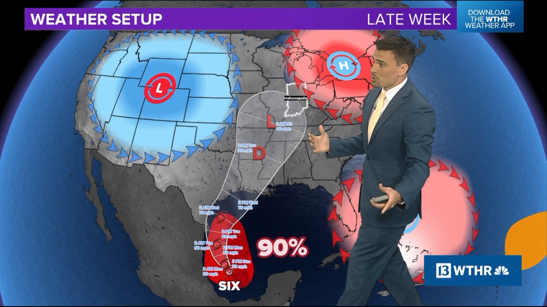
How long will this better weather last?
The pattern will then stay more pleasant with dew points in the "comfortable zone" through next weekend. We'll be mainly dry and more seasonal with highs in the mid 80s Thursday and Friday then a secondary dry cold front takes overnight lows into the upper 50s with highs only in the upper 70s this weekend.