INDIANA, USA — Update: New severe thunderstorm watch for the southern half of Indiana has been posted until 8 p.m. Gusty winds are possible south of Indianapolis.
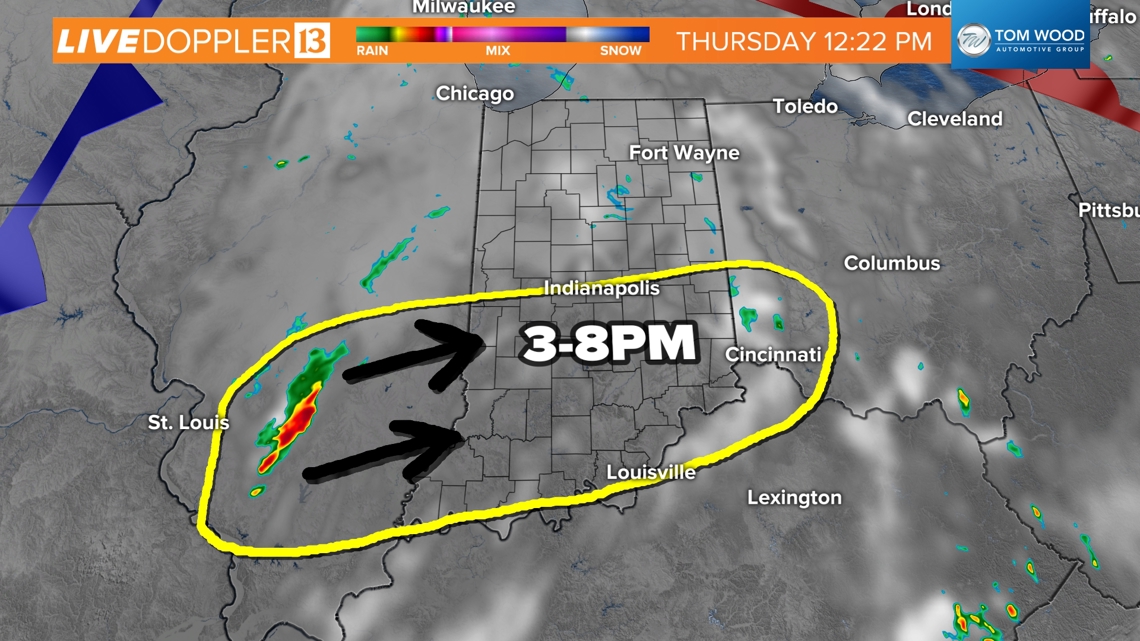
Watch out for severe weather later this afternoon and evening across Indiana. A cluster of wind storms is pushing east from the Mississippi River, slowly strengthening over time. Scattered wind and heavy rain storms are possible from 3 to 8 p.m. across central Indiana. Indianapolis' time window looks to be 4-6 p.m.
Tap HERE to track the incoming wind storms with our live interactive radar.
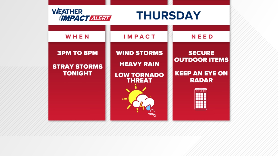
The biggest threats will be winds up to 60-65 MPH, some localized flooding, and a very low chance of a tornado. The worst of the weather may be south of Indianapolis.
After some morning showers, the skies have been able to clear and now the atmosphere is recharging for a round of storms this afternoon and evening.
Tracking growing storms
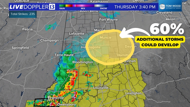
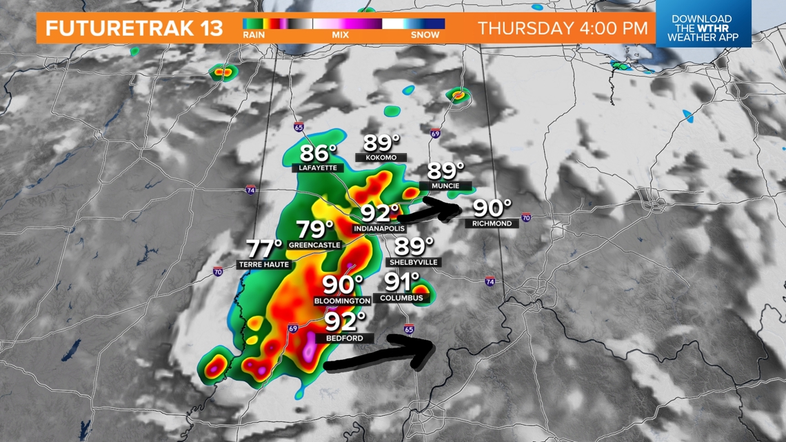
Storms are starting off to the west, running into warmer air across southern Indiana. The yellow highlighted zone shows where we think the storms are likely to make the biggest impact. The highest chance of wind will likely be south of Indianapolis.

Additional cells may also fire north of Indianapolis, but confidence is lower. We are watching some more lingering clouds to the north, which may limit storm growth.
Weather Impact Alert Day - Thursday afternoon/evening
Keep an eye on the skies and the radar for the rest of the day. Scattered strong storms are possible. However the coverage may be "scattered." That means not everyone will get a storm. However there is a level 2 severe risk across the vast majority of Indiana.

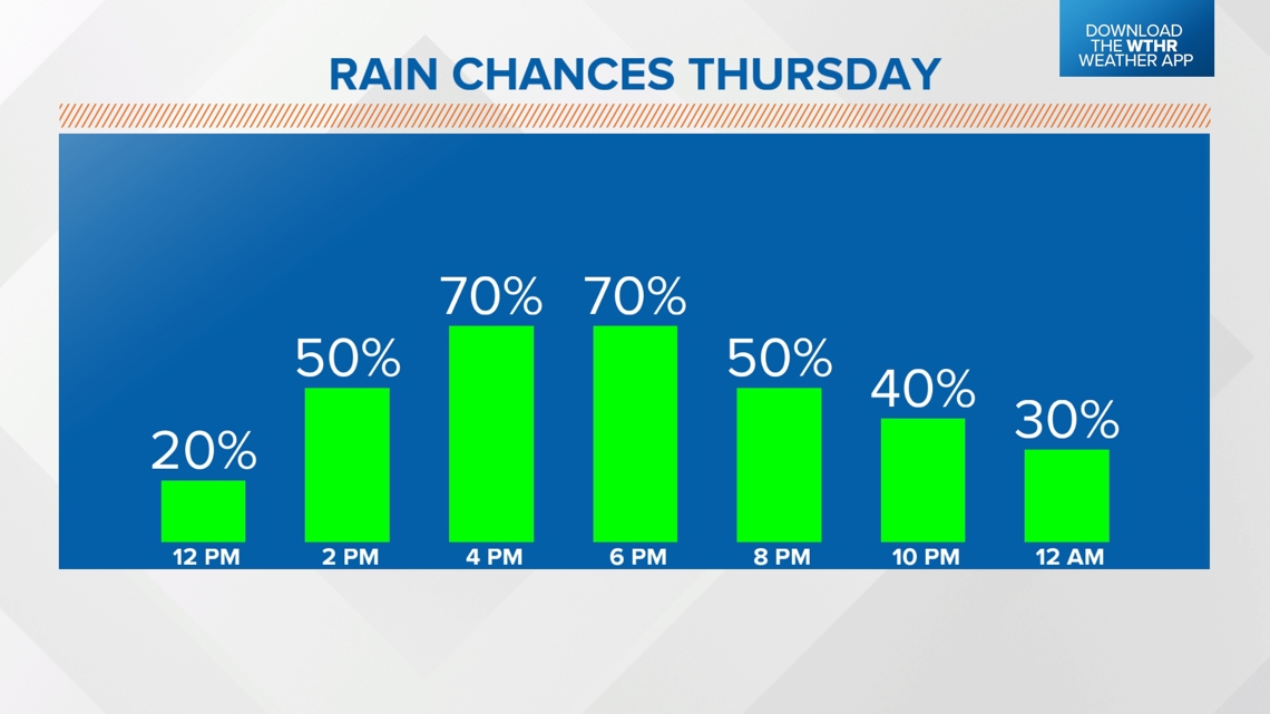
Timing the rain chances
While storms are possible from 3PM to 8PM across all of central Indiana, we think the highest rain chances around Indianapolis will be from 4PM to 6PM. Areas farther west will start first, while areas farther east wait longer. These storms are tracking east roughly at 30 MPH.

The highest concentration of available energy for storms is near and south of Indianapolis. The highest wind threat is over Bloomington, Bedford, Columbus, and Seymour. The farther north you go, the rain chance goes slightly down.

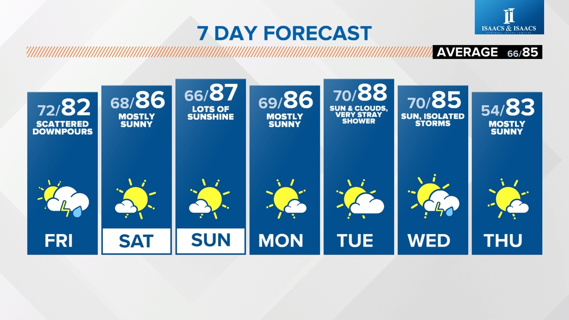
Looking ahead
More scattered downpours are possible Friday, with quieter weather by the weekend.