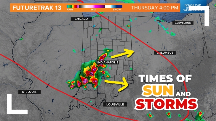
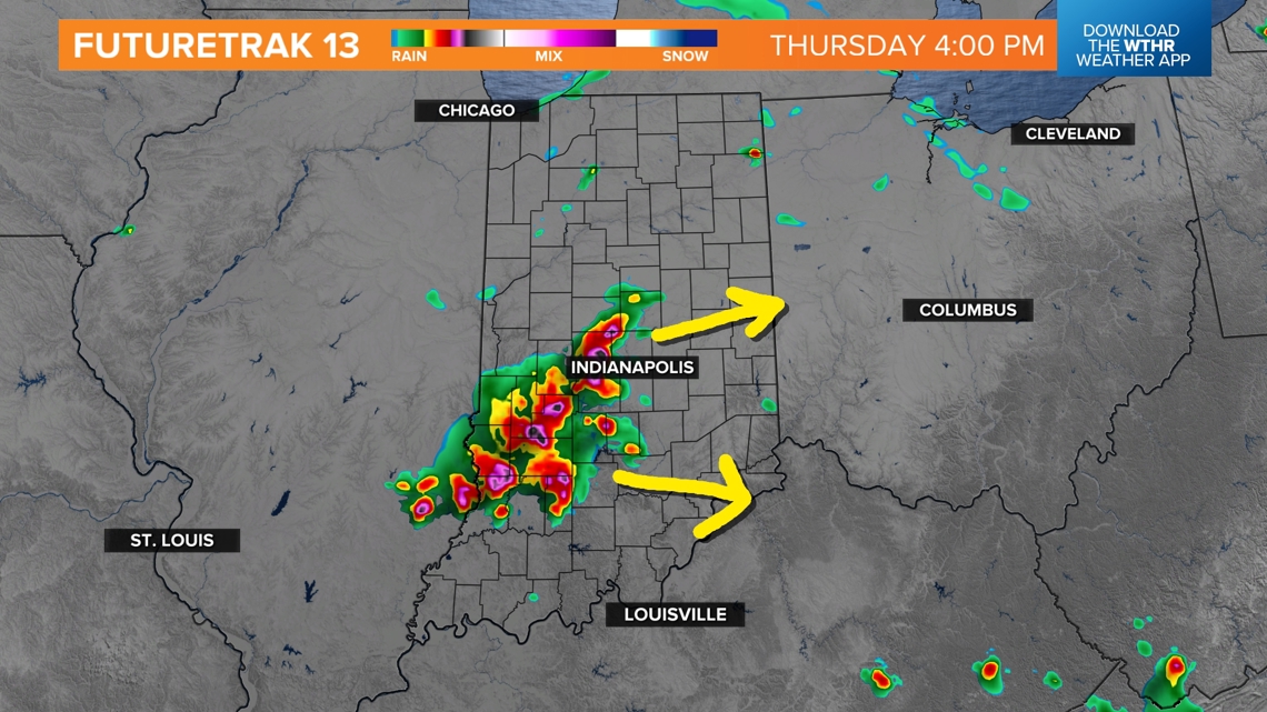
INDIANA, USA — Here we go again: more unsettled weather is likely the rest of Thursday. Some of us will get scattered storms across Indiana later this afternoon and evening. After some spotty morning rain, additional storms are firing up near the Mississippi River over by St. Louis. Some may arrive in Indiana after 3 p.m. Expect storm chances to continue into the evening with spotty chances tonight.
Tap HERE to track the rain and storms with our interactive radar.
This northwest flow pattern is keeping rain chances on-and-off over Indiana for the rest of Thursday and Friday. We're expecting it to end this weekend with more sunshine and quieter weather returning. In the meantime, watch for some storms here and there. Not everyone gets one.
Afternoon: Spotty storms possible, some lingering clouds and sun breaks
Evening: Scattered strong storms possible, but not everyone gets them
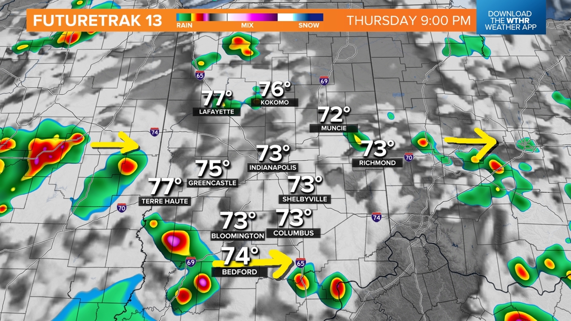
Thursday night: Spotty showers and storms continue
Severe chances | Level 2 out of 5
Another day, another severe risk. Indiana has been under a severe risk every day this week so far. However not everyone has received some rain, or even storms for that matter. That will continue. The atmosphere is soupy and unsettled.

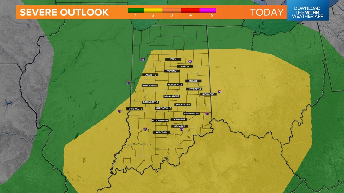
Most of central and southern Indiana is under a level 2 severe risk for Thursday evening and night. Out of these zones, expect the strongest storms to be in the southern areas of the highlighted zones.
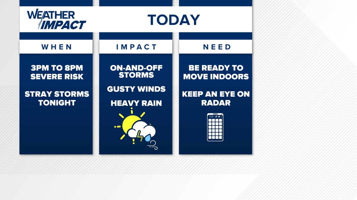
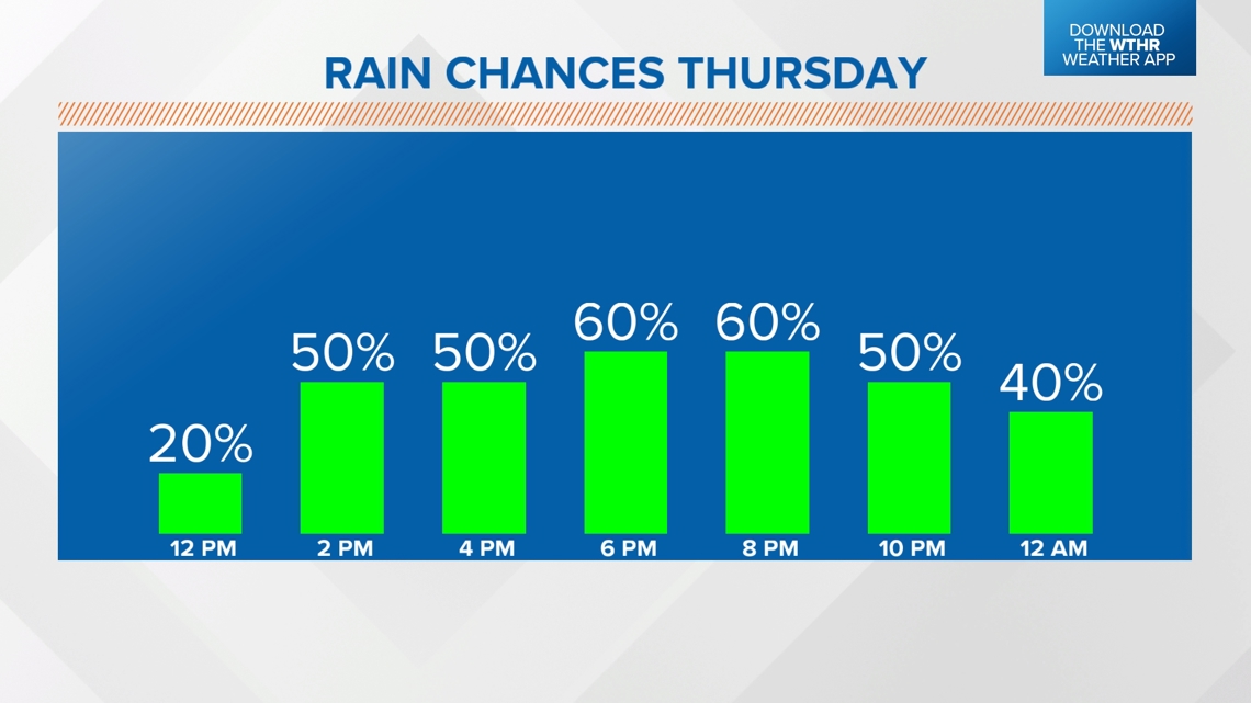
Stay weather aware today. Downpours here and there may impact your plans. Generally we think the highest severe threat (scattered in nature) is 3 p.m. to 8 p.m. After that, storm chances will be more spotty into the night. There may still be some strong storms, but they will likely be more hit-or-miss.

Rain chances are likely to peak this evening. Overnight the chance will drop to 40%. Technically you may have a higher chance of not getting anything, but storms are still possible.

Take model solutions with a grain of salt. It's hard for computer data to figure out how much the atmosphere has cooled or been exhausted after a previous round of rain.
Once morning showers are gone, there may be more storms that come in from Illinois after 3 p.m. The highest chance of rain will be south of Indianapolis.

Later into the night, spotty storms are possible. Many of us may not get a drop of rain tonight. Coverage will be isolated in nature.

Looking ahead
More scattered rain and storms are possible Friday. A low pressure will be pushing over northern Indiana, trying to stir up the atmosphere. These chances looks fairly on-and-off all day long. The severe threat will be a lot lower. Many of the rain chances will just be showers and downpours with some occasional thunder.
Enjoy quieter weather this weekend with lots of sunshine!
-13News Meteorologist Matt Standridge