INDIANAPOLIS — The unseasonably cold temperatures have staying power and will linger into next weekend.
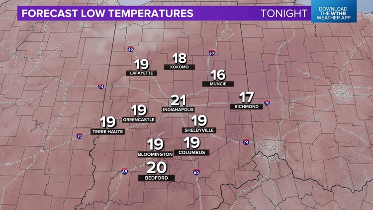
Cloud cover that blanketed the sky Sunday will gradually clear out overnight and set the stage for our coldest temperatures since mid-March. We're forecasting Monday morning lows of 15°-20° which means the heavy coats, winter hats, and gloves will be needed heading into work and school.
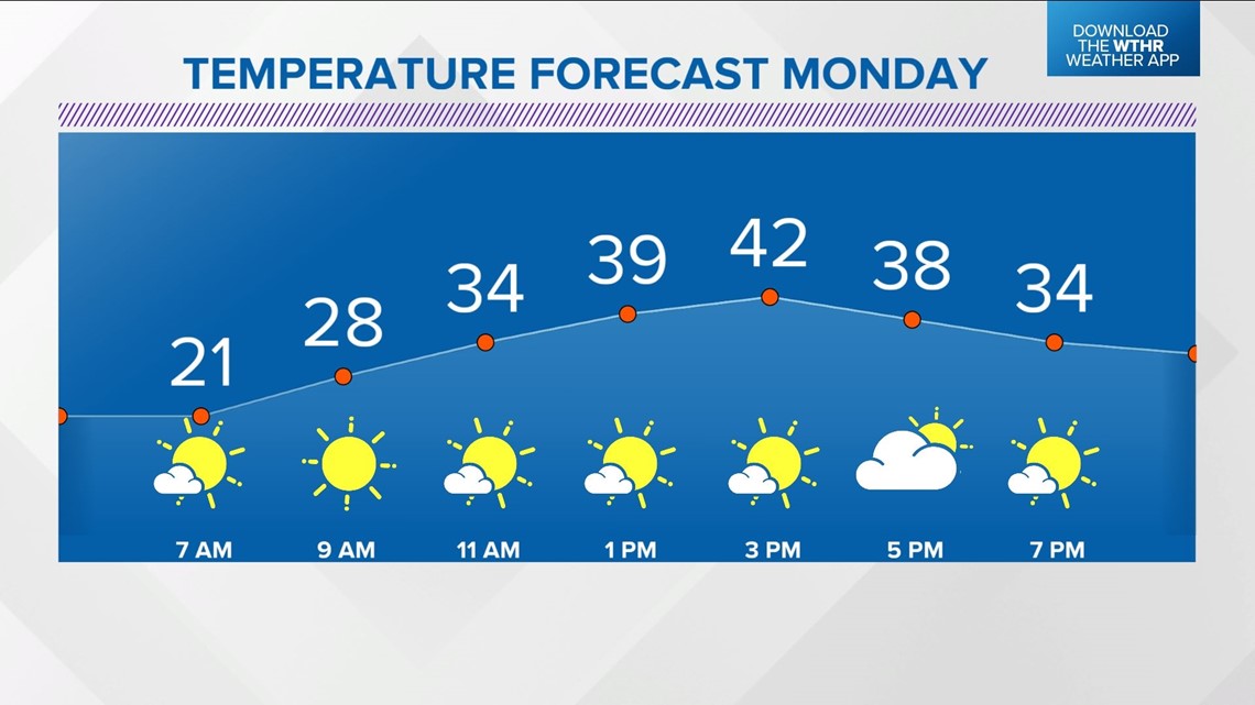
With sunshine, afternoon highs will reach the lower 40s which is a nice recovery but still a good 10° below daily average highs for mid-November.

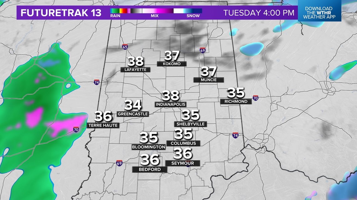
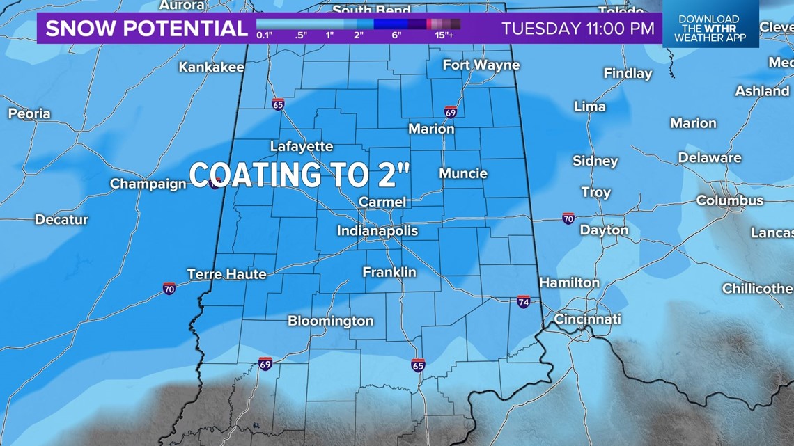
We continue to advertise another wintry system arriving late Monday night into the Tuesday morning commute. This feature brings another batch of snow that will mix with sleet and rain at times.

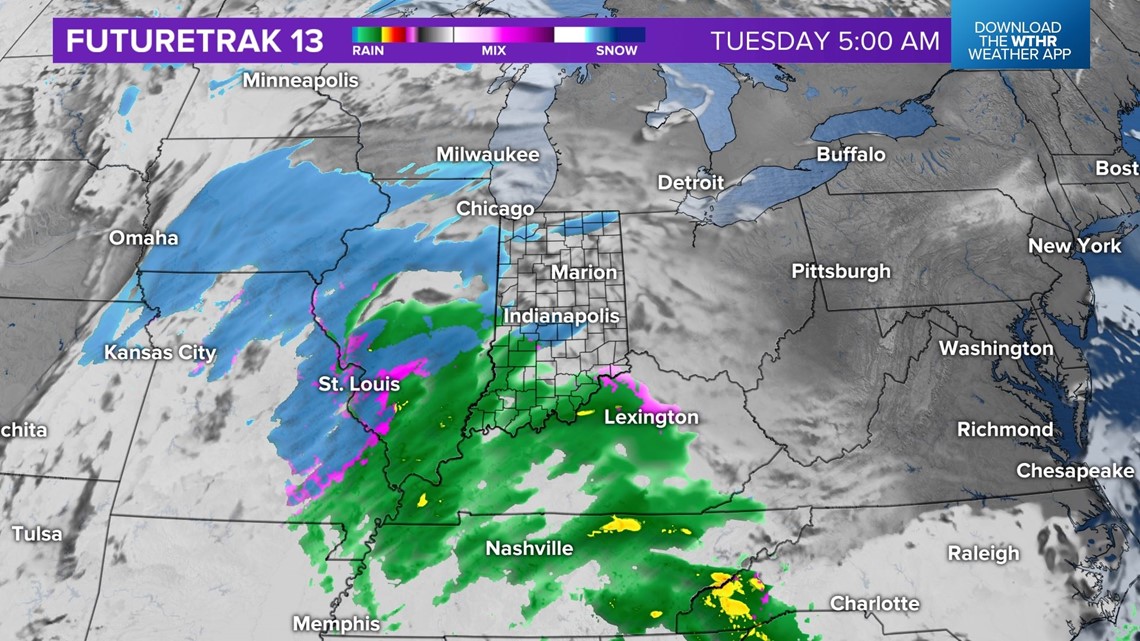
While it won't be terribly heavy, it will be terribly timed with potential impacts to bridges/overpasses/untreated roads into midday Tuesday.

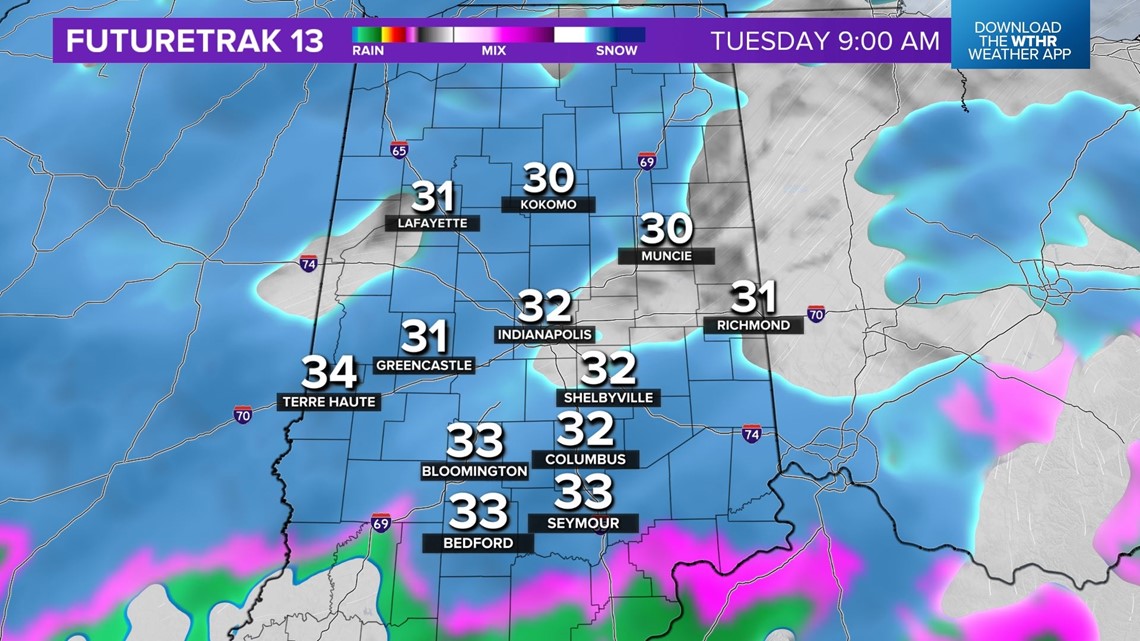

Snow amounts of a dusting to, locally, 2" are expected. We'll fine-tune amounts and locations over the next 24 hours.

This is one of several chances of flurries and snow showers this week, some of which will be lake-induced as another surge of cold air flows in Thursday into Friday. Any sustained lake bands could produce bursts of heavier snow later this week and will require our attention.
The upper-level pattern will be conducive of well-below-average temperatures this week with the coldest hitting Friday into the weekend.
Furnaces will be cranking over time.