
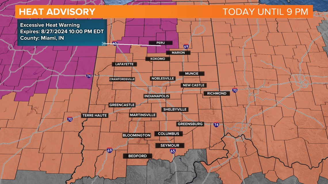
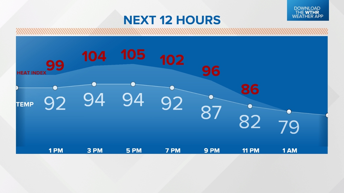
INDIANAPOLIS — A heat advisory is in effect for central Indiana until 9 pm. This afternoon, highs will climb to the mid-90s, and heat index values could range from 100-110 degrees. Limit time outdoors/take frequent breaks and stay hydrated.

It will remain hot through 9 p.m. with heat index values expected to still be in the 90s. Lows will drop to the 70s.

RELATED: Here's how to prevent heat-related illness if you have to be outside in extreme temperatures
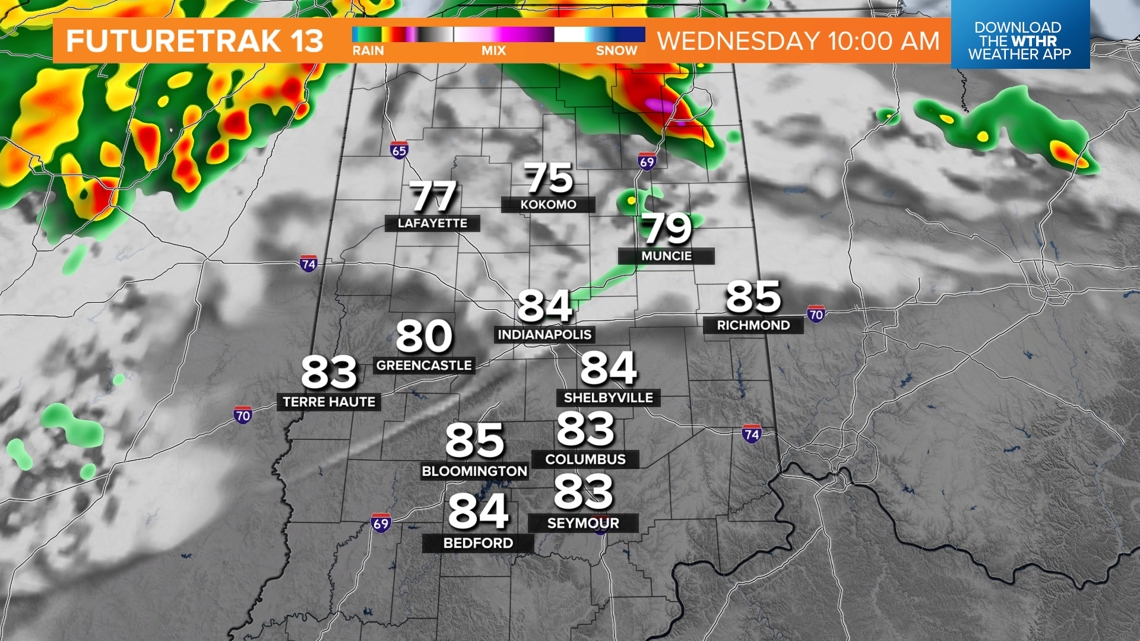
A few storms will be possible first thing tomorrow morning across northern Indiana, and may extend into northern portions of central Indiana. This could help keep the heat in check across those areas.

Otherwise, temperatures are expected to warm back up into the upper 80s and low 90s. Heat index values could range from 100-110 degrees. There is a chance for afternoon and early evening thunderstorms. There is a level 1 out of 5 threat for storms to produce damaging wind gusts.

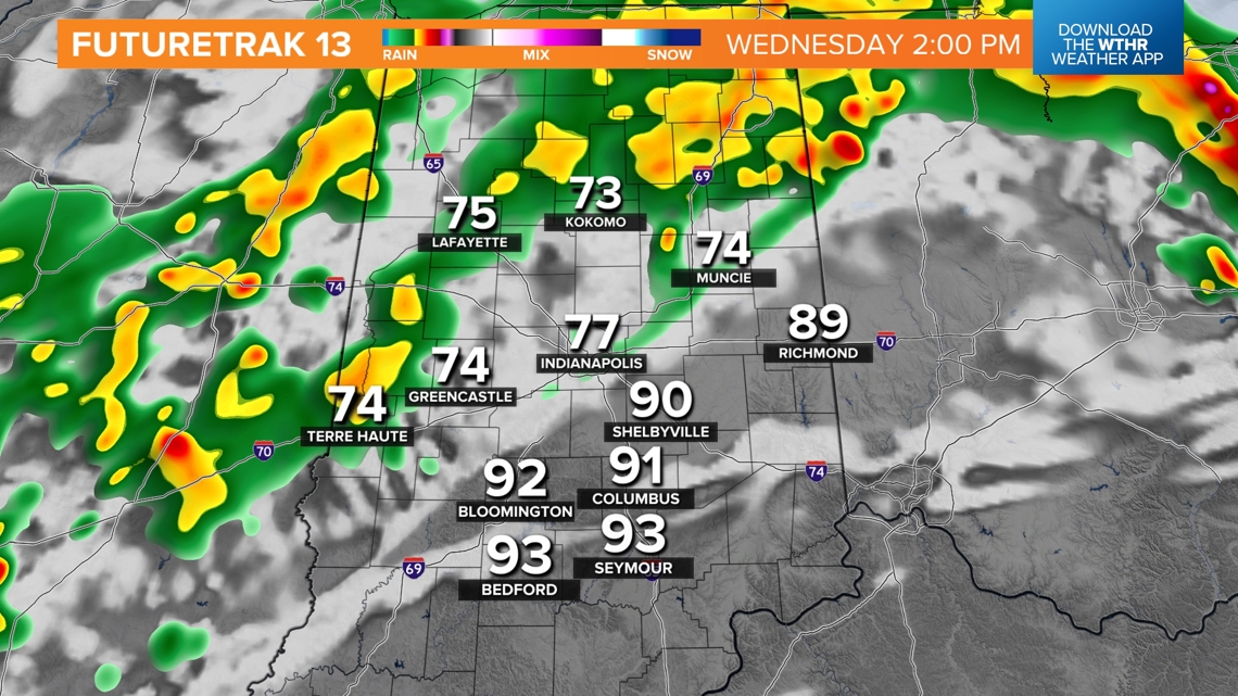
Any rain will help bring relief from the high heat. The hottest temperatures will likely be across southeastern portions of the state, as the chance for storms arrives later in the day.
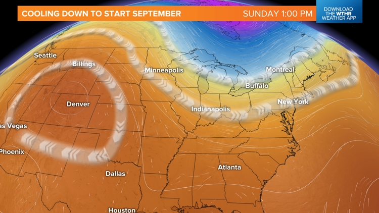
The upper level ridge will begin to break down by the end of the week. A cooler and pleasant Canadian air mass will arrive by the end of the weekend and for Labor Day.


