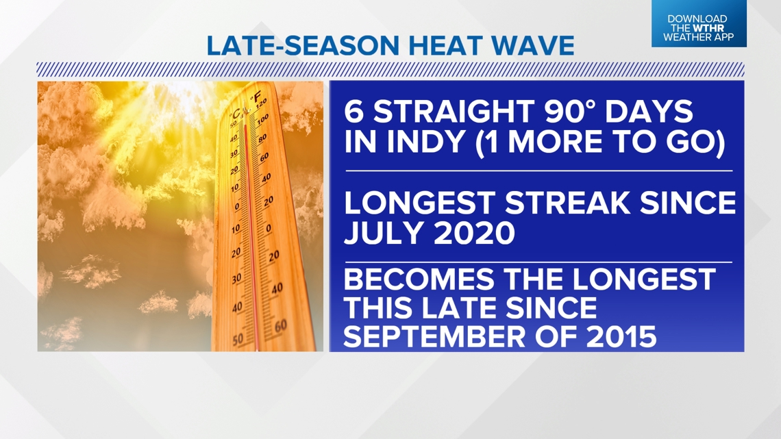
INDIANAPOLIS — The late-season heat wave continues today in what is the sixth straight 90+ day. That's the longest streak in Indianapolis since July 2020, and with the addition of another 90° Friday, it will become the longest streak this late in the season since September 2015.
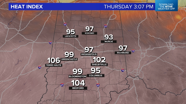
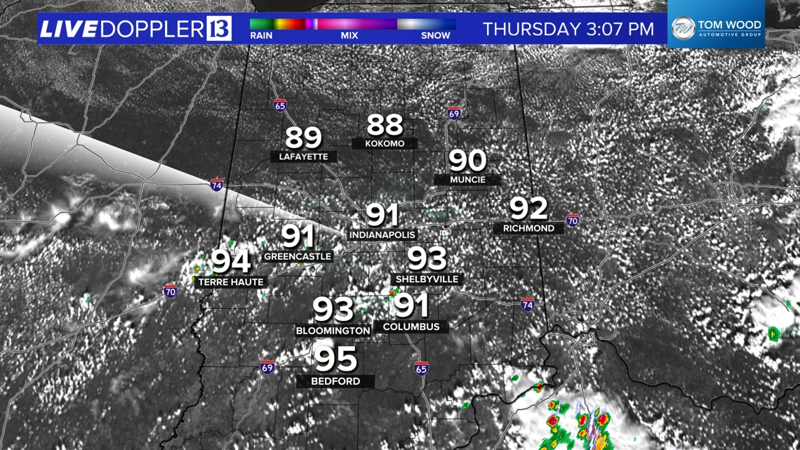
Unlike yesterday, we don't have much cloud cover to slow down the heating process as temperatures quickly climb into the 90s and heat indices peak near 100° between 1 p.m.-7 p.m. That's the time you should be hydrating frequently, taking plenty of breaks and seeking A/C if you must be outside for extended periods of time.

The Heat Stress Index (which takes into account temperature, humidity, sun, clouds and wind) will be in the Caution to Moderate zones, which recommend 15-30 minute breaks for every hour outside.


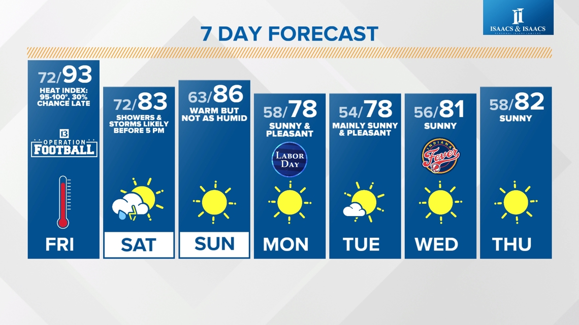
There's no atmospheric triggering mechanism for organized rain/storms today, with the exception of daytime heating. We're only expecting spotty rain/storm development during peak heating today and Friday now due to a slower arrival of cool front.

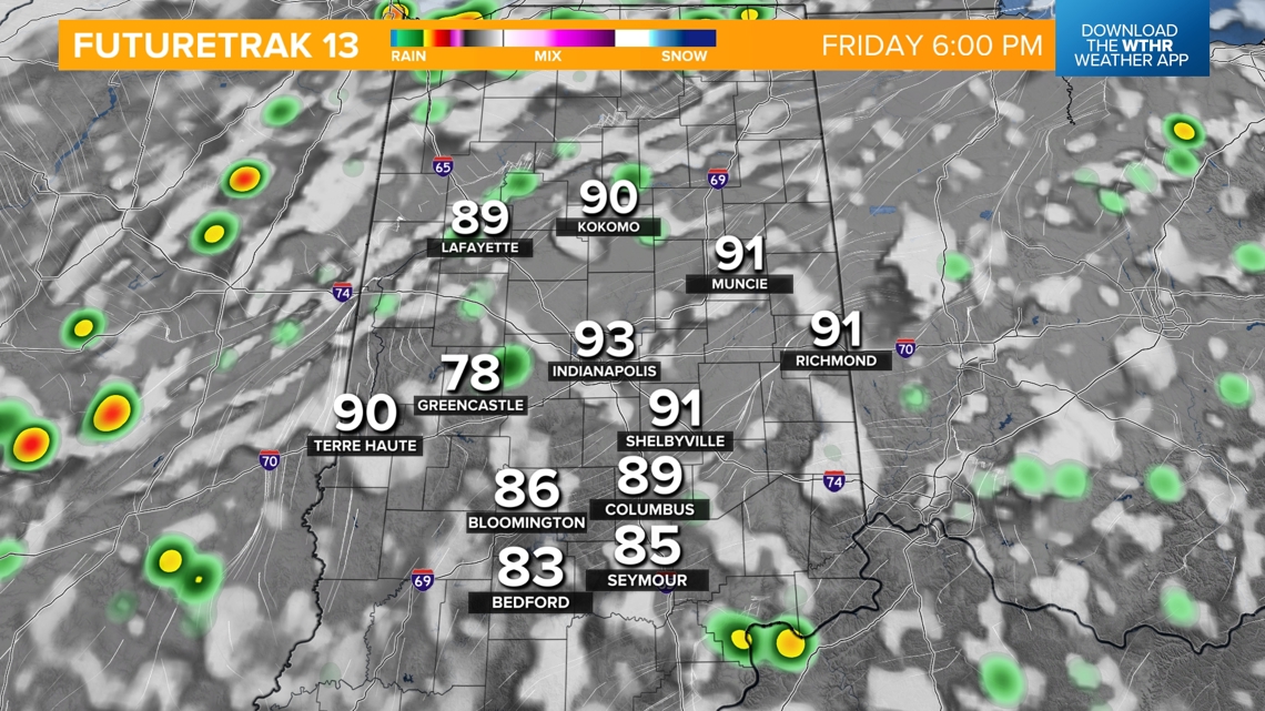

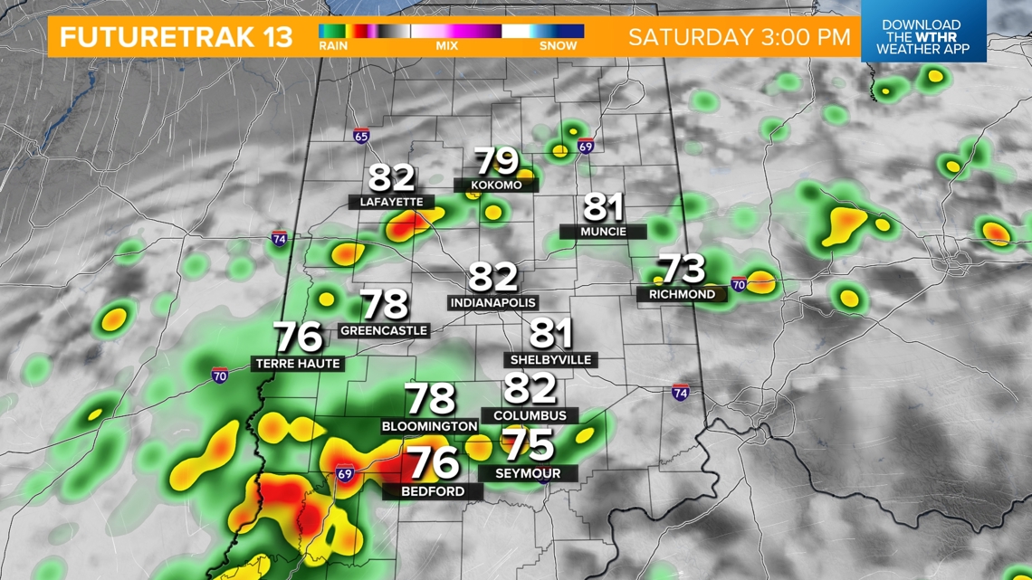
The slower arrival time means less rain/storm coverage during Operation Football games Friday night but also means greater rain/storm coverage lingering into Saturday afternoon now. Though temperatures will be in the 70s/80s Saturday, the air will be highly humid with dewpoints well in the 70s.
That front settles to south on Sunday in what will be a mainly sunny and seasonably warm day in the mid-80s. A secondary front arrives late Sunday afternoon from north-to-south. It has a stronger push of drier, cooler air just in time for Labor Day. We'll need to monitor moisture fields along the front for the potential of adding a narrow band of shower/storms along the front to finish Sunday.
Otherwise, we focus on the pleasant air next week that delivers multiple mornings in the 50s and milder highs in the 70s with plenty of sunshine.