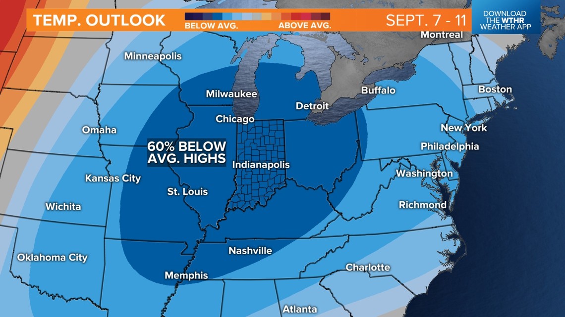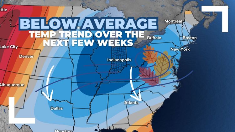
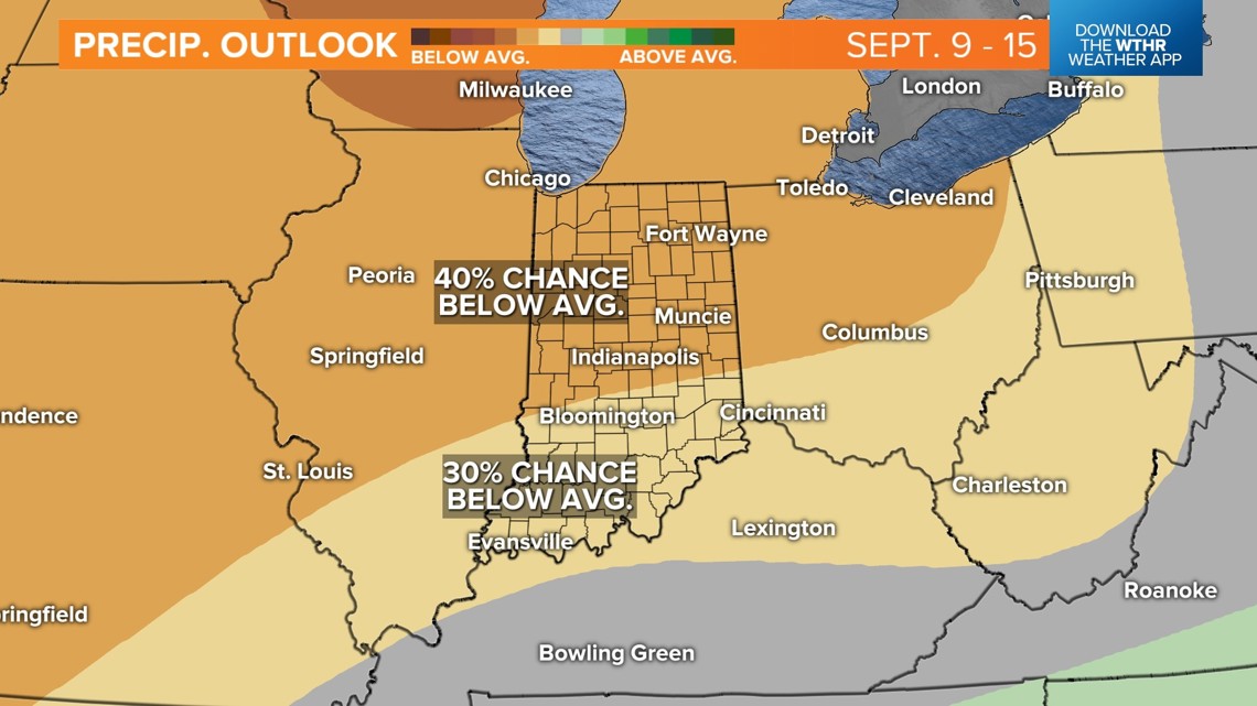
INDIANAPOLIS — The outlook for the first few weeks of September calls for a 40% chance of below-average rainfall and a 60% chance of below-average temperatures.


Next few days
A dome of high pressure over the Great Lakes region will have a heavy influence on our weather over the next few days, keeping dry air in place and a cooler northeast wind ushering in unseasonably cool temperatures.
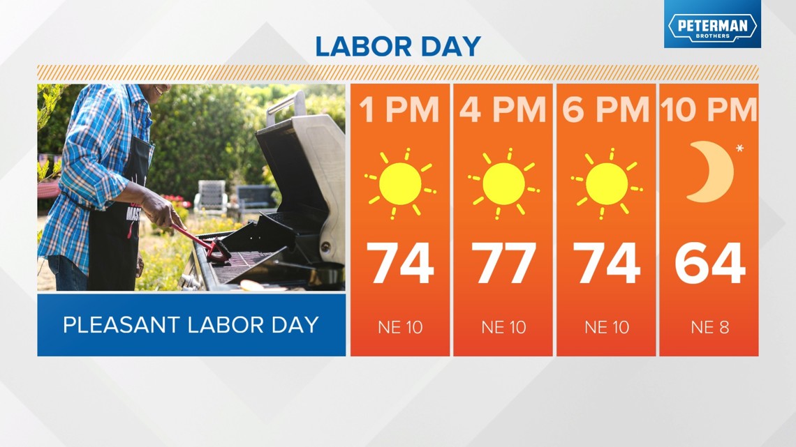
Rest of Labor Day
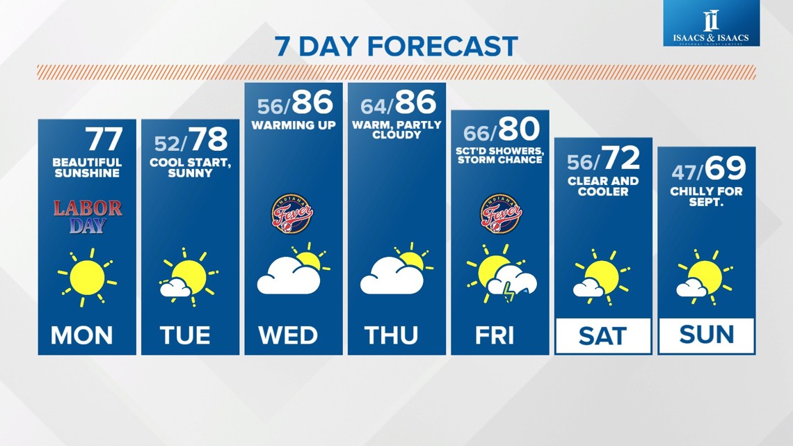
- Highs in the upper 70s
- Mainly sunny
- Cool northeast breeze at 10-15 mph

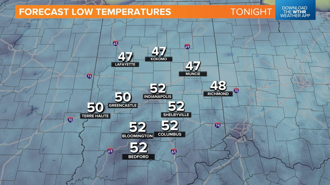
Tonight and tomorrow
- Clear and cool overnight with lows in the low 50s around the metro area
- Outlying locations dropping into the upper 40
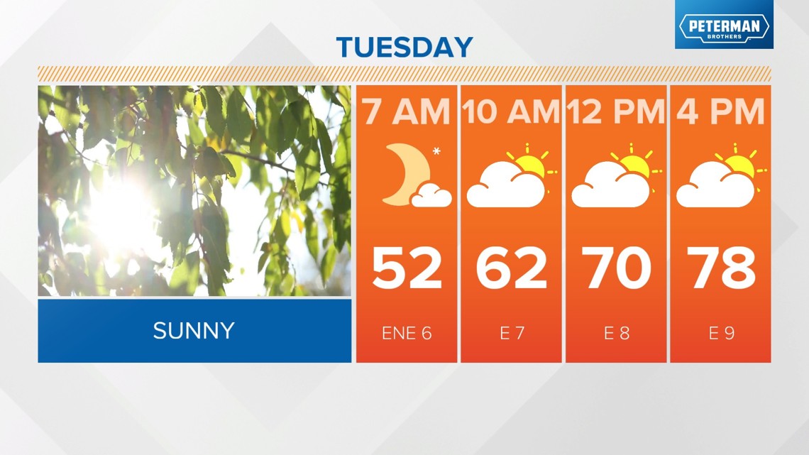
- Highs in the upper 70s Tuesday
- Mostly sunny


When will temperatures warm back up?
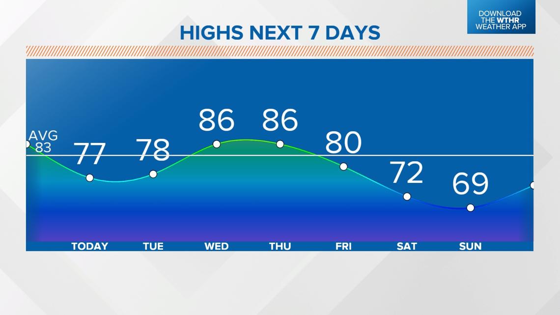
Temperatures will trend warmer by mid-week, with highs back in the mid-80s starting on Wednesday. Look for highs to stay in the mid-80s again Thursday, with increasing clouds as our next storm system approaches.

When is the next rain chance?
A spotty storm is possible overnight Thursday into Friday morning, but the better chance of scattered rain and isolated storms will be along a cold front during the day Friday. Highs will still reach near 80 ahead of the frontal passage Friday afternoon.

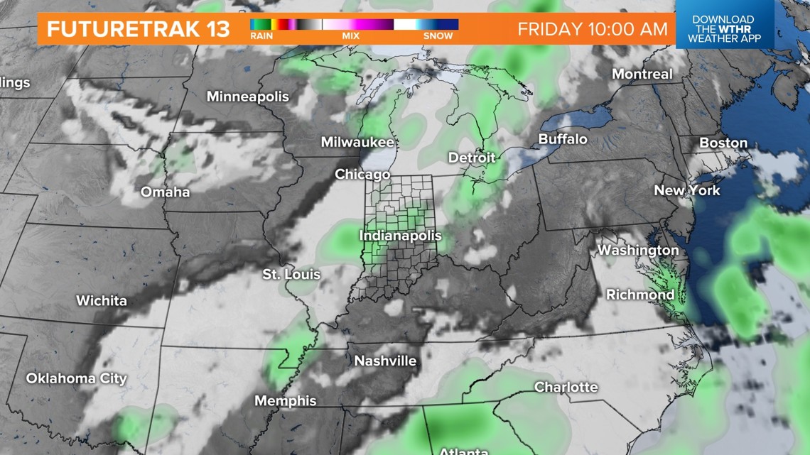
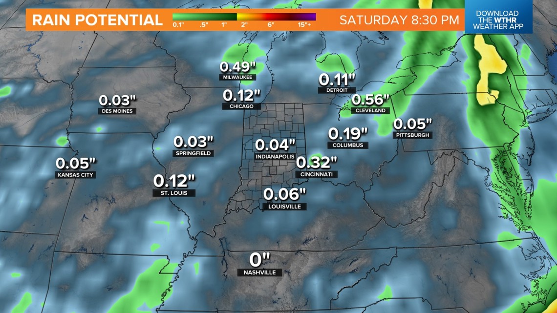
Rain is set to wrap up by Friday evening — likely around the start time of Operation Football. Overall, there isn't a ton of moisture associated with this system, and at most, parts of central Indiana could see up to 0.2" of rainfall. This is the only rain chance in the extended forecast as well, so we'll likely settle into a drier-than-normal stretch for the first few weeks of September.


Cooler air returns for the weekend. Sunshine returns as well, but highs will only be in the low 70s Saturday afternoon. Lows fall into the upper 40s Sunday morning, with highs likely only in the upper 60s. The average high for this time of year is in the low 80s still.
Longer-range weather models are still hinting at below-normal temperatures lingering through the following week as well.