

INDIANAPOLIS — Multiple rounds of storms are expected to impact central Indiana Wednesday, with a risk of widespread severe weather this evening.
Check out the latest Live Doppler 13 weather forecast, check out the weather conditions in your neighborhood with our Interactive Radar or watch a live stream of Live Doppler 13 Radar.
People under a Tornado Warning should move to a safer place in their homes, such as an interior room or basement away from windows.
There are multiple ways to share photos with us from your area:
Here are the latest updates on the severe weather:
10:00 p.m. - Utility companies are providing important tips about downed power lines and how you can report them:
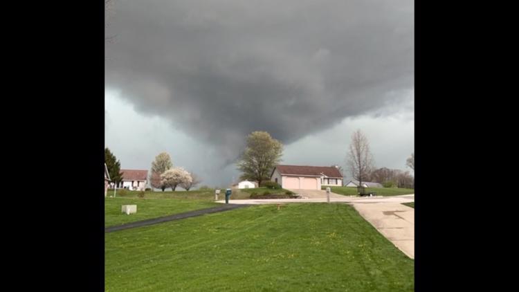
8:56 p.m. - Meteorologist Sean Ash says it's likely there was a tornado earlier in southeastern Decatur County between 8:27 p.m. and 8:45 p.m.
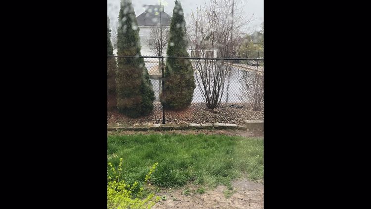
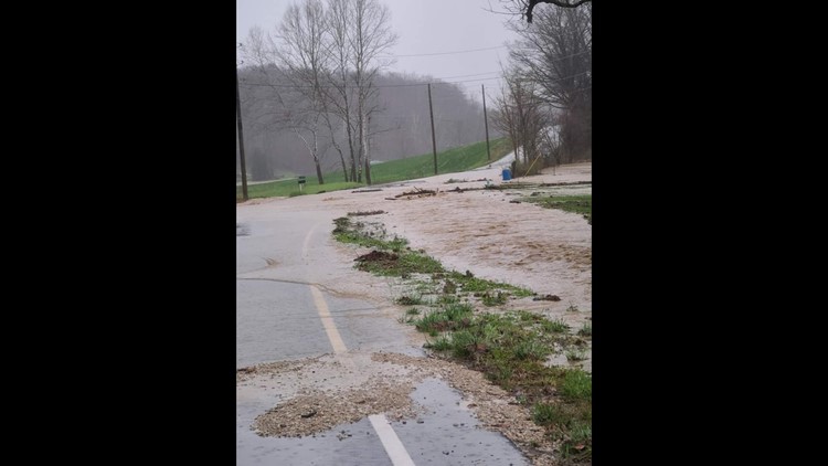
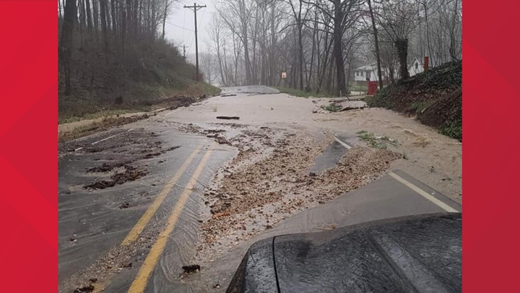
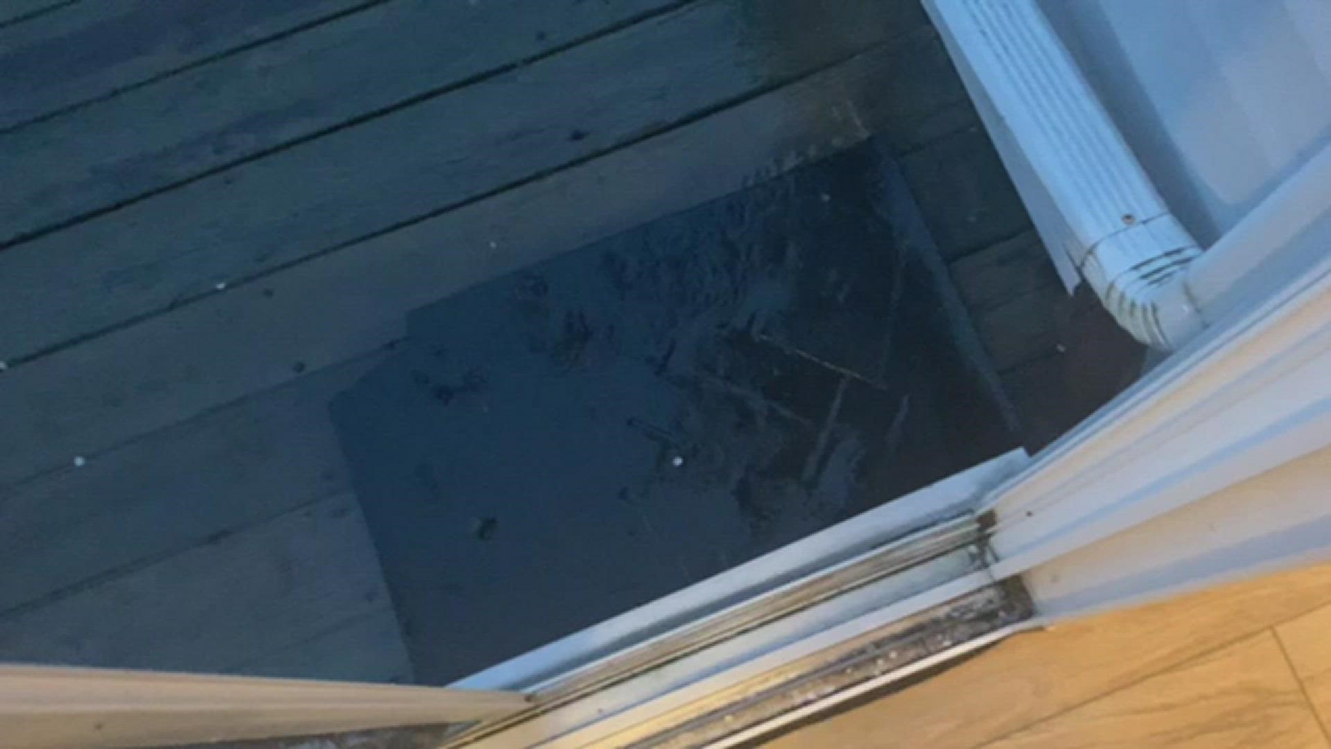
8:50 p.m.- The Martin County Sheriff's Office posted pictures showing roads flooding and urged residents to use extreme caution if they are traveling.
8:45 p.m. - A tornado warning has been issued for central Decatur County, Indiana until 9 p.m.
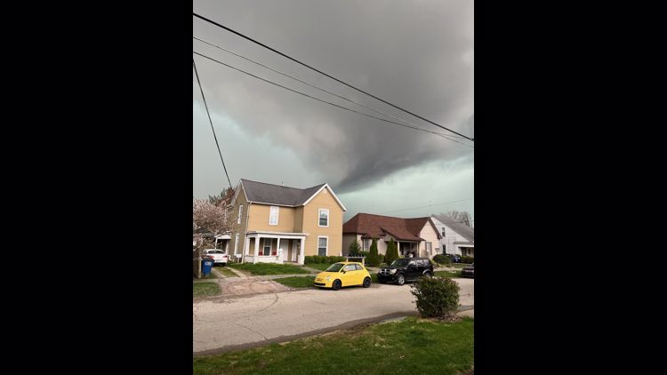
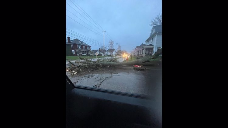
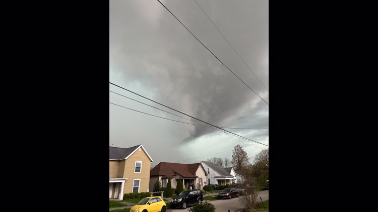
8:35 p.m. - Residents of Bedford, Indiana are reporting storm damage in their area. Some shared photos of large ominous clouds. The City of Bedford said there have been no reports of a tornado touching down.
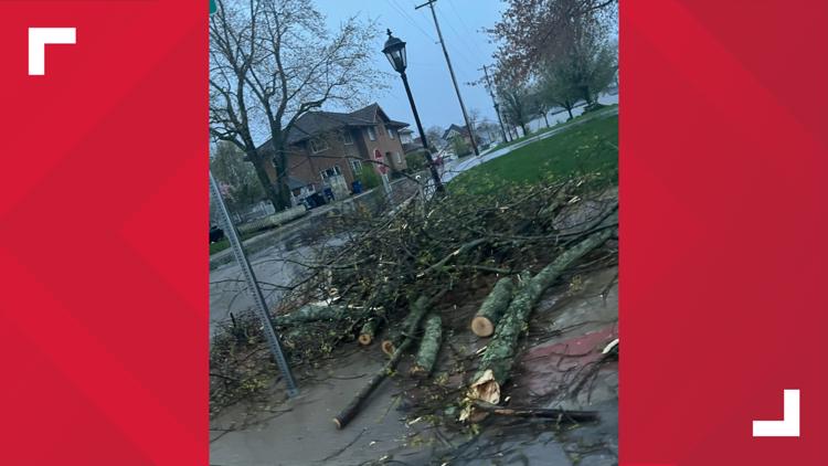
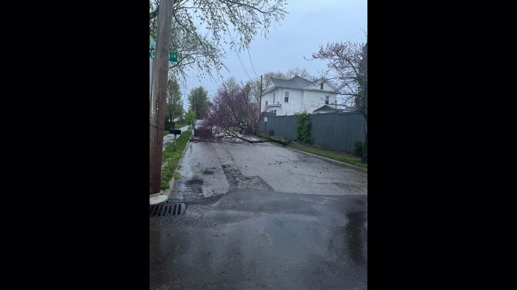
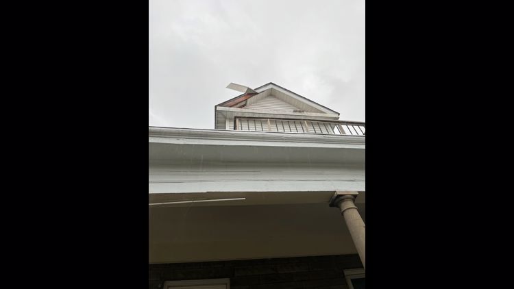
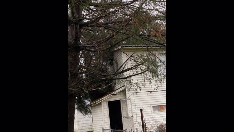
GALLERY: Storms sweep through central Indiana on Wednesday, April 13, 2022


8:11 p.m. - A view of strong storms in Marion County at around 8 p.m.
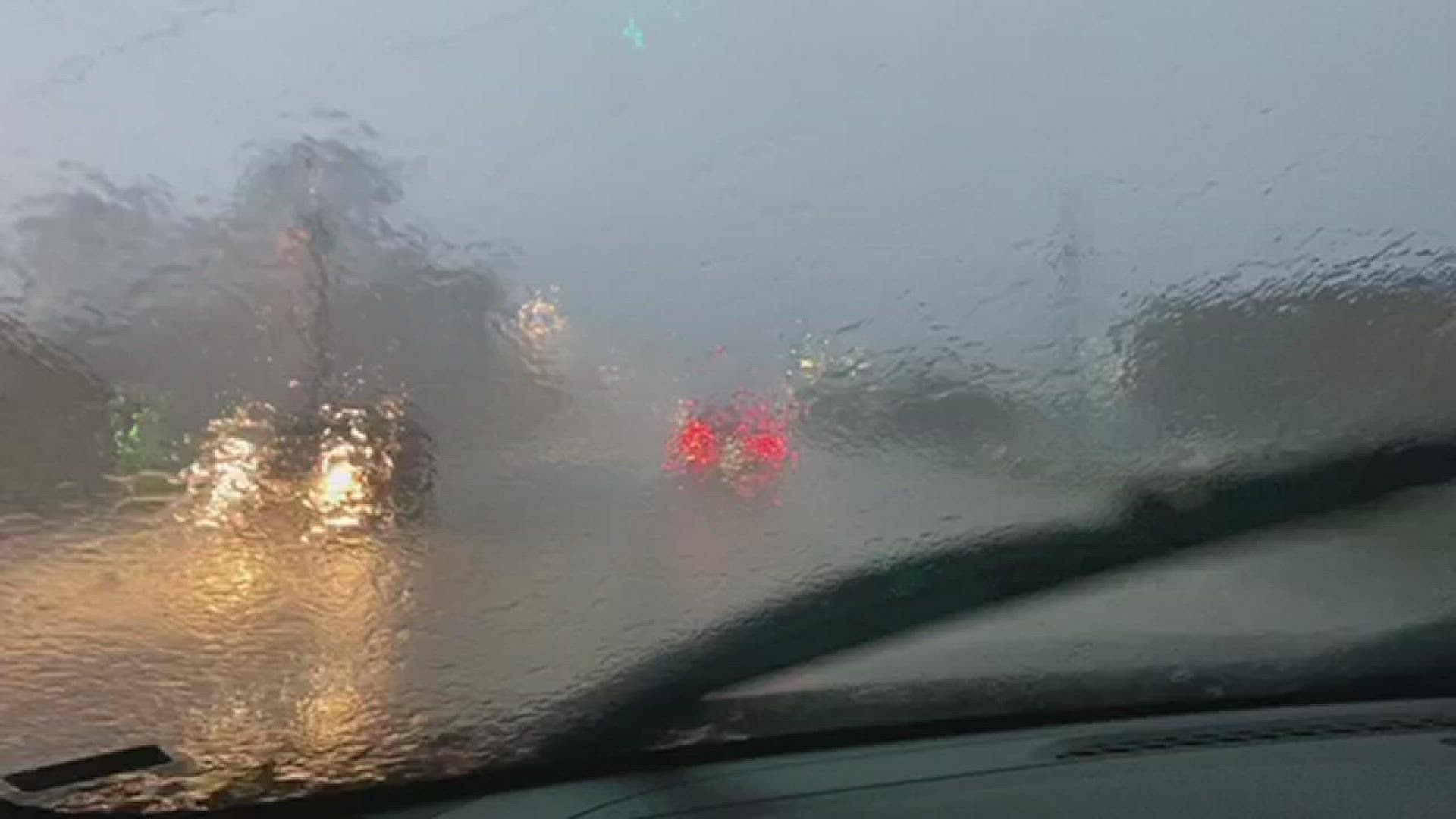
8:03 p.m. - A viewer shared a video showing heavy rain pouring down on the northwest side of Indianapolis.
7:55 p.m. - A Severe Thunderstorm Warning is in effect for Bartholomew, Decatur, Jennings and Rush counties until 8:45 p.m. A severe thunderstorm was located near North Vernon, moving northeast at 45 mph, the National Weather Service reported.
7:29 p.m. - The Tornado Warning for Jackson and Lawrence counties has lifted.
7:14 p.m. - A Severe Thunderstorm Warning is in effect for Bartholomew, Brown, Jackson, Jennings, Johnson, Monroe, Morgan and Shelby counties until 8 p.m.
7:03 p.m. - A Severe Thunderstorm Warning is in effect until 7:30 p.m. for Brown, Jackson, Lawrence and Monroe counties.
7:00 p.m. - A Tornado Warning was issued for Jackson and Lawrence counties until 7:30 p.m.
4:55 p.m. - See Sean's latest forecast.
So far, so good in regards to the local severe weather threat, and the persistent cloud cover and rain is just what the doctor ordered to lessen our chance of widespread severe storms. However, central Indiana is just beginning to enter a strengthening, twisting wind field.
There are several parameters that remain in place to warrant the need to be Weather Aware. But the aforementioned cloud cover has displaced the more favorable set-up for tornadoes/widespread wind damage closer to and south of the Ohio River.
With all that said, twisting storms and areas of wind damage remain possible in our viewing area, especially south of I-70 where some breaks in the cloud deck have been noted in satellite imagery.
The main line of storms moves across the state between 6 and 10 p.m. and could continue areas of rotation and severe wind gusts.
2:30 p.m. - Do you know the difference between a tornado watch and a tornado warning? That's especially important during severe weather season.
A tornado watch is issued when the ingredients are perfect for a tornado. You've got wind shear, or fast changes in wind speed or direction over a short period of time or distance. There's also moisture in the atmosphere. But there's not actually a tornado on the ground.
But a warning means the tornado is here. That's the time to get to a safe shelter as fast as possible.
1 p.m. - Steady rain and cloud coverage is likely to lessen the potential of a high-end, widespread severe event. That being said, all of the WTHR viewing area remains at risk of storms capable of producing either damaging wind, tornadoes, and/or flooding — mainly within the 4-10 p.m. timeframe.
12:30 p.m. - Kelly Greene shares the latest update on storm projections across central Indiana.
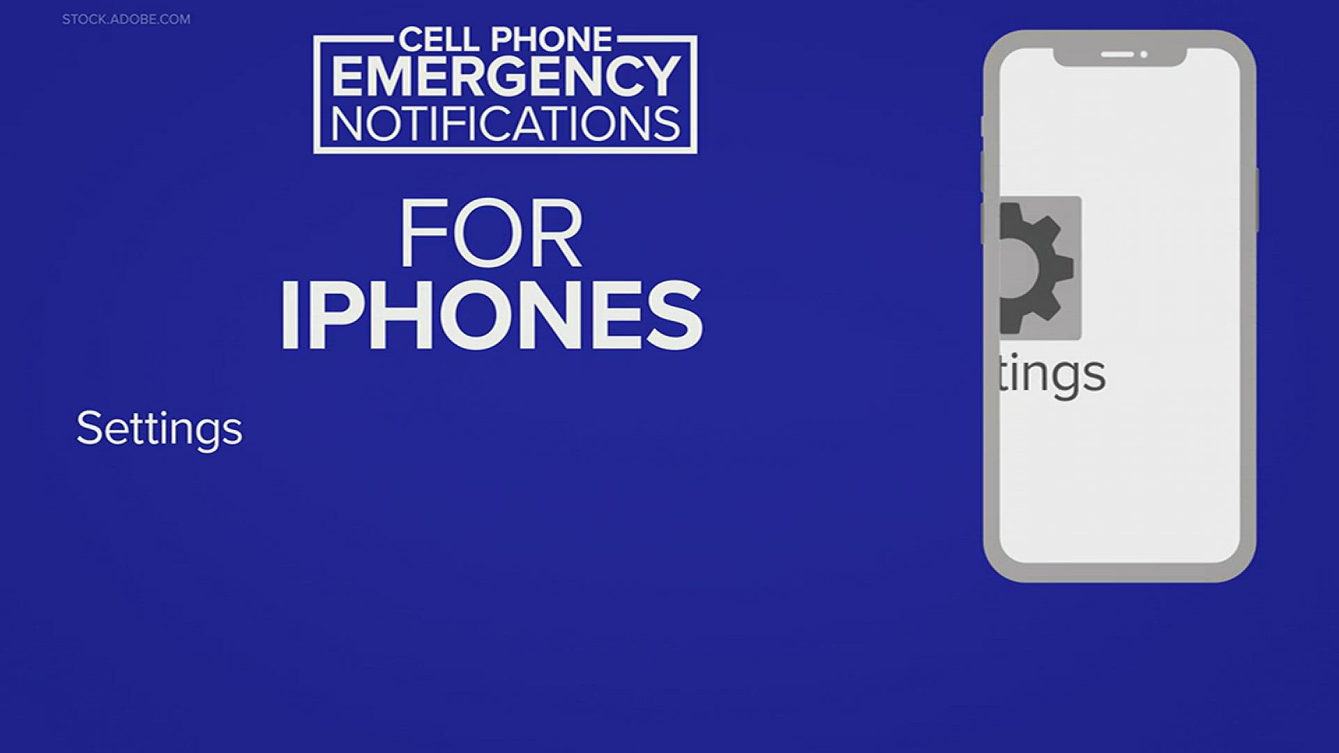
11:00 a.m. - Here's an explainer on how to set up weather emergency notifications on iPhones and Androids.
10:30 a.m. - Indianapolis Public Library is closing all of its locations Wednesday at 3 p.m. This includes the libraries, bookmobile routes and library services center.
8:05 a.m. - Lindsey Monroe shares the latest update on storm projections across central Indiana.
7 a.m. - It's important to know the difference between a watch and a warning in terms of severe weather.
A watch is typically issued several hours before a warning. This is the time to review your safety action plan as the ingredients are in place for severe weather to occur.
A warning is then issued several minutes ahead of time as a storm moves in after severe weather is being indicated on radar or storm spotters have reported from the field.