INDIANA, USA — It's been a warm weekend so far and it's about to get hotter for Sunday and this coming week. No cold front will come until Wednesday and Thursday. In the meantime, enjoy the summer-like heat across Indiana. Higher pressure will also keep air quality a bit lower.
Tap HERE to track the temperatures moving north with our interactive weather maps.
We hit 80 degrees yesterday on Saturday, but mid 80s are likely across most of Indiana for Sunday. The humidity is also inching up. We have to start talking more about the heat index. Once the crops are to full height, then we can expect the humidity to skyrocket, but we still have a couple months for that.
We will be running about 10 to 15 degrees above average the next 3 or 4 days across Indiana. With the extra heat and humidity, stray heat showers may form in the afternoons and evenings, especially north and west of Indianapolis. High pressure is trying to hold the sunnier weather for a few more days.
Tracking the humidity
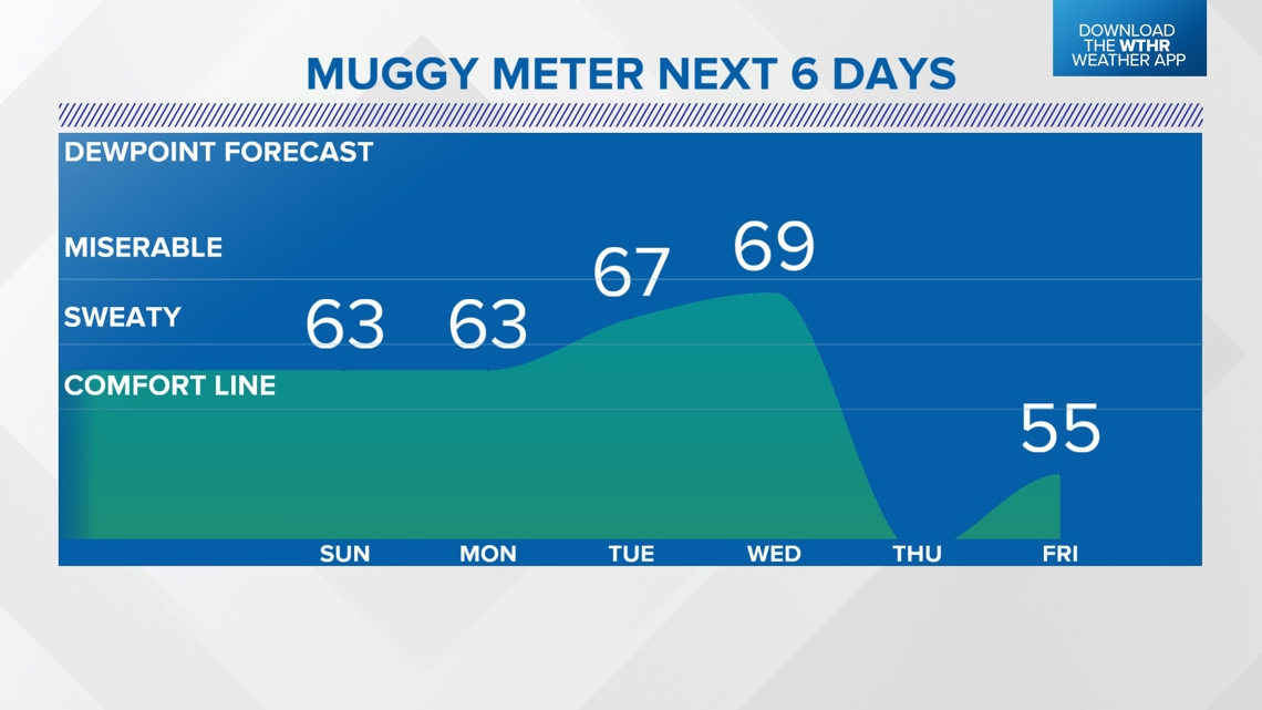
Once you have dew points in the 60s, you start to notice the humidity a bit more. Once you get over 65, and especially once you near the 70-degree mark for dew points, that's the air you where. We'll watch the most humid days arrive Tuesday and Wednesday.


A cold front will bring scattered rain and storms Wednesday, eventually dropping the humidity by Thursday. Much more seasonable temperatures are likely the rest of the week.
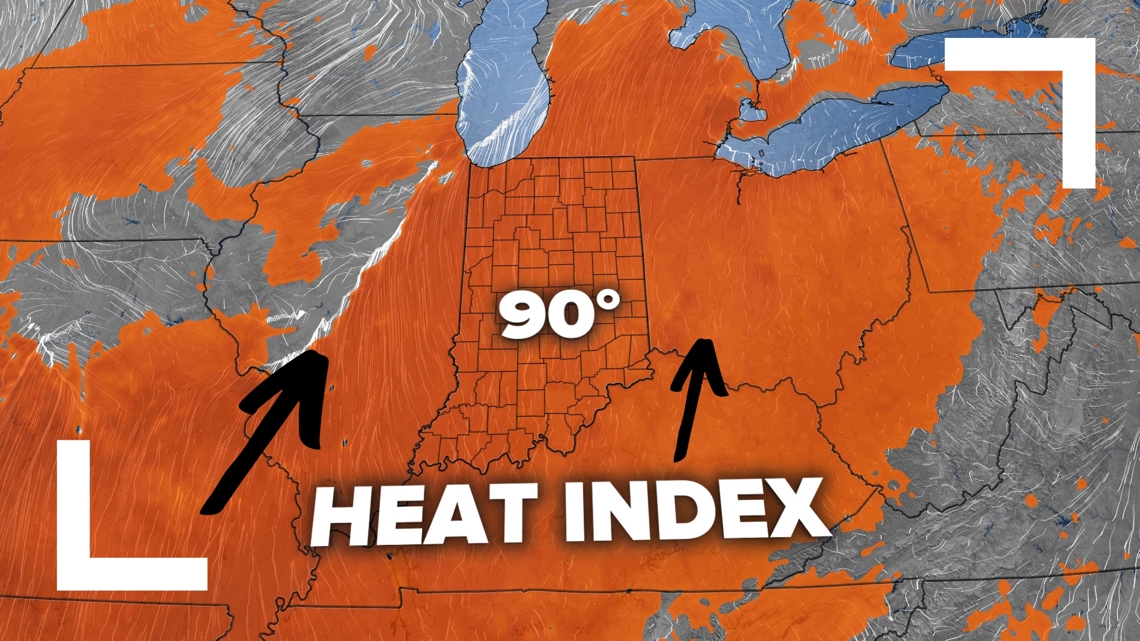
With the higher humidity, we have to start tracking the heat index, or what it feels like. It's harder for the body to cool off by evaporating sweat when the air has a high relative humidity.
By Tuesday we may have a heat index near 90 degrees, especially south of Indianapolis.


-13News Meteorologist Matt Standridge


