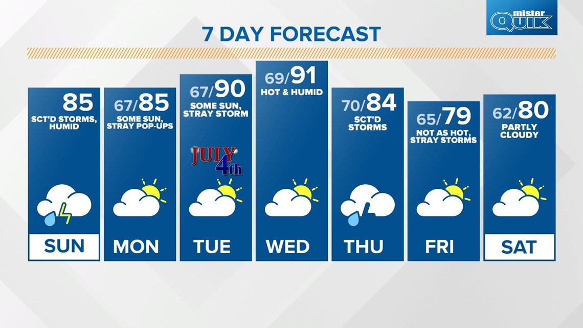
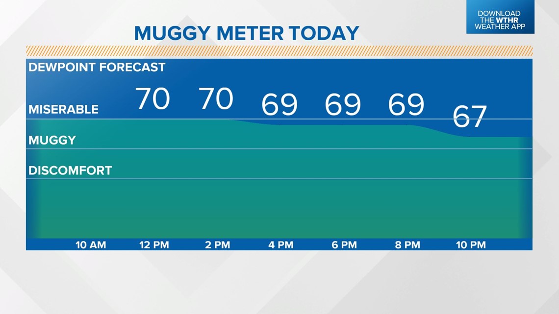
INDIANAPOLIS — It will be a fairly quiet start to the day with only a stray shower or storm passing through, especially across northern Indiana. Look for clouds in the morning to mix out around lunchtime, allowing for more sunshine. Temperatures recover to the low-to-mid-80s this afternoon, but with ample moisture in the atmosphere and dew points holding steady in the low 70s, it will be miserably humid at times.

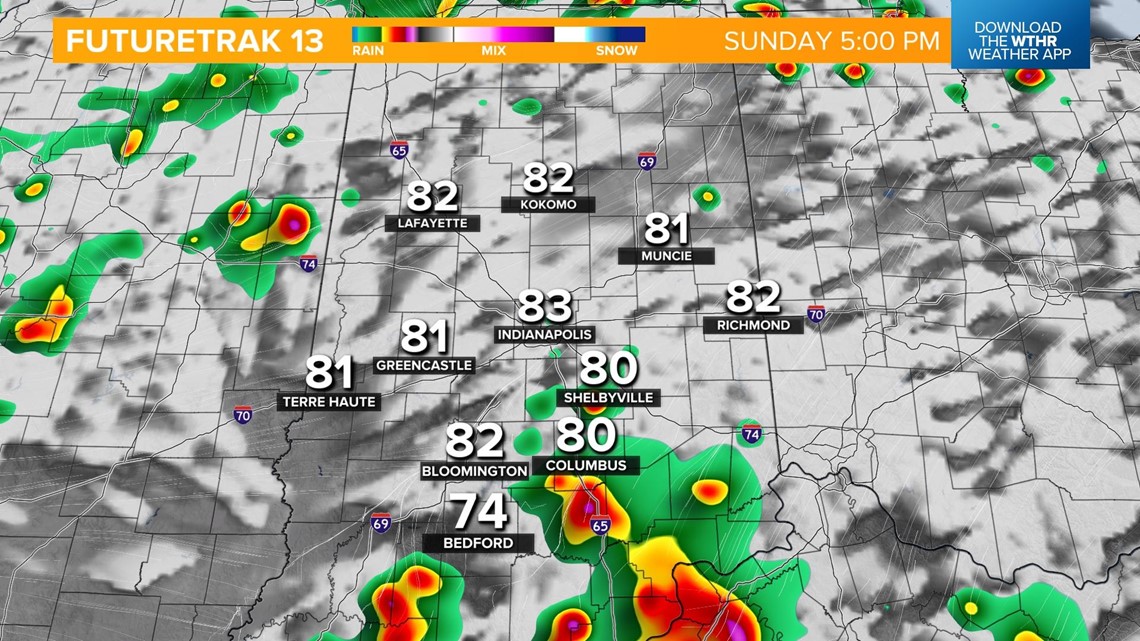
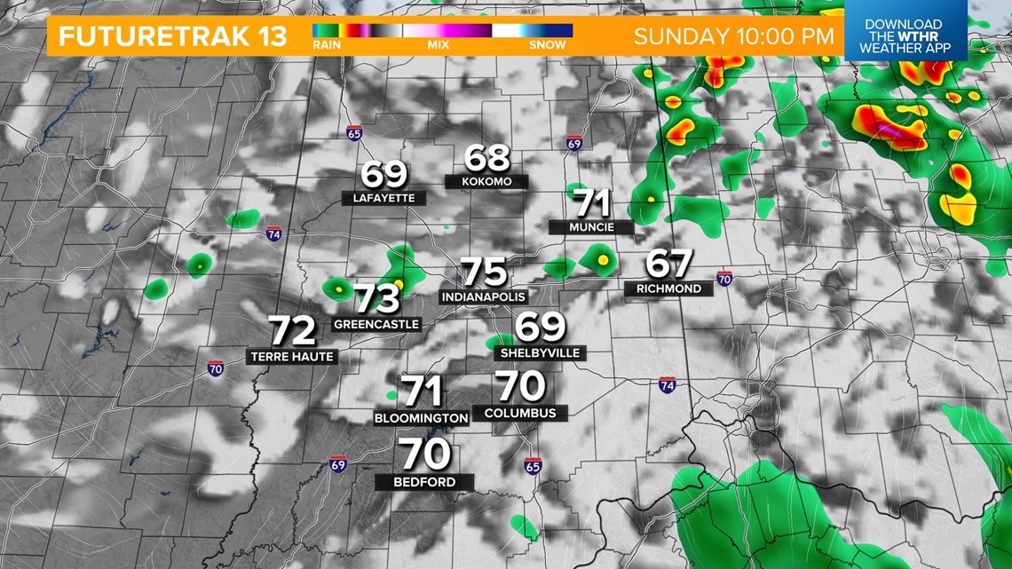
Storms will fire back up around 4 p.m. ahead of a cold front. Storm activity will then become more widespread through the late afternoon and into the evening as the cold front swings through. The threat of storms will wrap-up around sunset as the front pushes east.


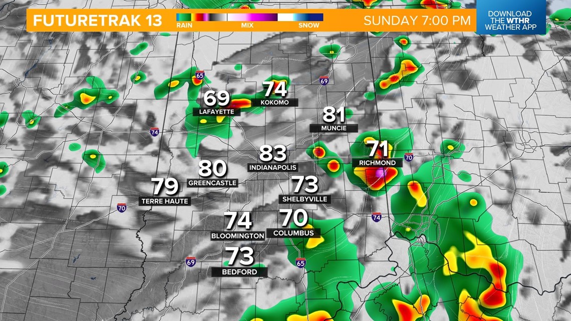

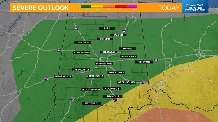
The Storm Prediction Center pushed the highest risk of severe weather south of the area, but an isolated strong to severe storm is possible. Damaging wind gusts will be the primary threat if storms do reach severe limits. Keep in mind that lightning is a threat within any thunderstorm, and if you are outside and hear thunder, head inside to prevent being struck.


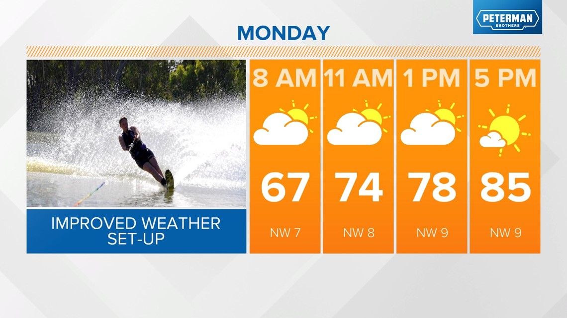
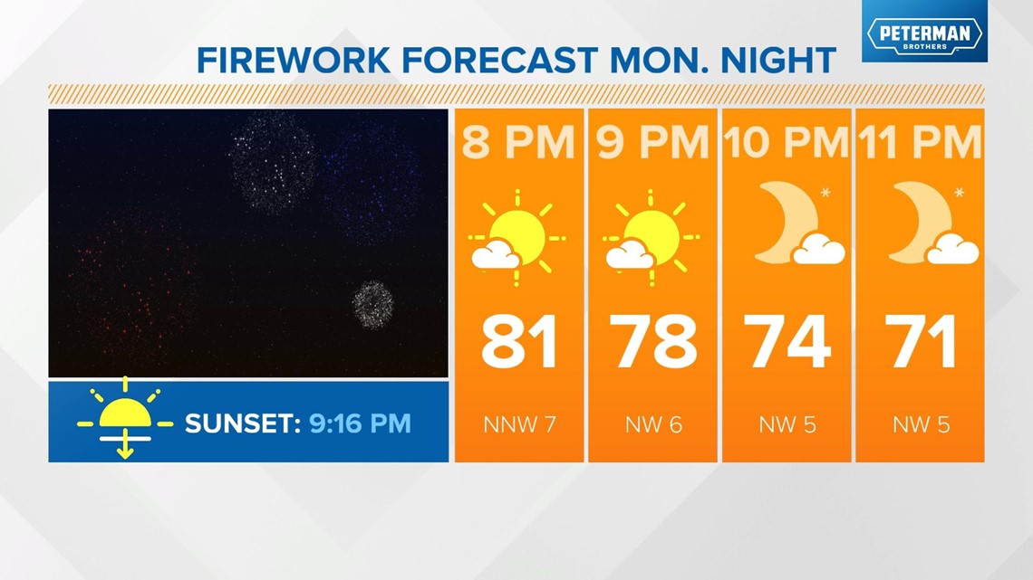
We're looking at a mostly sunny day Monday with only a stray pop-up storm in the afternoon. Highs will be in the mid-80s. Firework displays that were postponed look to be in good shape with a clearing evening sky and temperatures dropping into the 70s.


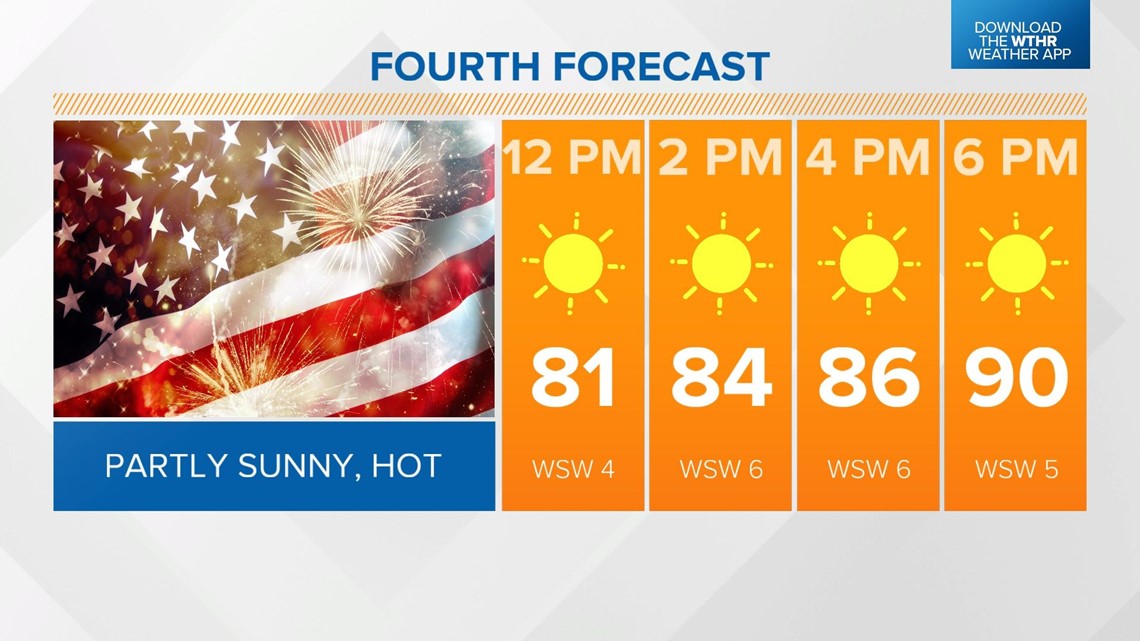
We're looking hot for Independence Day with highs near 90 under a mostly sunny sky. A few storms are possible on the fourth, mainly late in the day.

The heat and humidity continue into Wednesday with highs in the low 90s. We're watching another storm system to bring rain and storms back into the forecast on Thursday, which will eventually bring a late-week cooling trend.