


INDIANAPOLIS — UPDATE: As of 10 p.m. Saturday, counties are being shaved from the severe thunderstorm watch as storms begin to track east of I-65.
While there have been a couple of severe thunderstorm warnings, the majority of storms have stayed below severe criteria. Most storms will likely remain sub-severe with stronger storms producing wind gusts 50 mph or greater.
There has been a report of downed trees and power poles near Mitchell in Lawrence County.
Torrential rainfall on top of rain we have already received may lead to flooding for rivers, streams, and low-lying/flood prone areas.
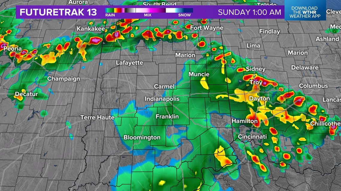
There will be lingering rain and rumbles of thunder behind the initial line of storms. The threat for strong to severe storms should wrap up between 11 pm and midnight.
Previous weather blog:
A cluster of thunderstorms are tracking east out of Illinois and into Indiana. Thunderstorms have a history of producing damaging wind gusts, hail, flash flooding, and a few tornado warnings have been issued.
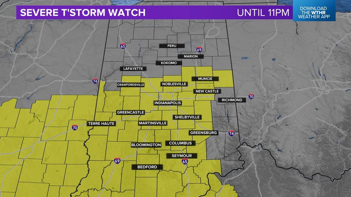
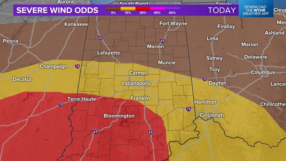
Majority of central Indiana is under a severe thunderstorm watch until 11 pm.

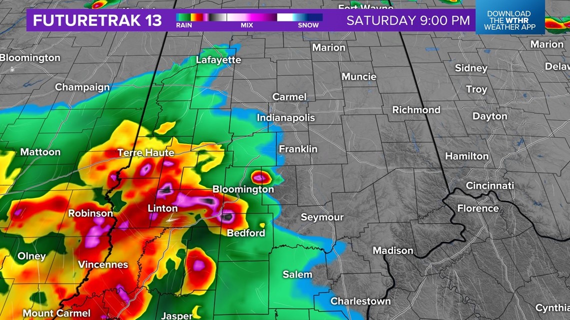
Storms are expected to move into the southwest portions of central Indiana between 8 pm and 9 pm.

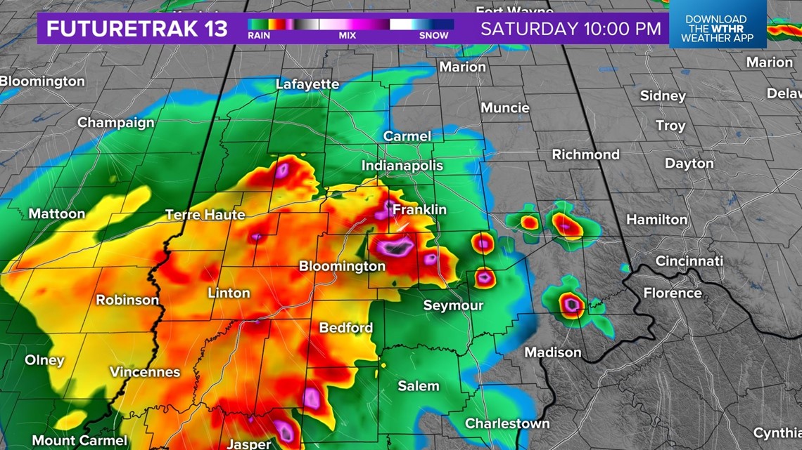
The storms will continue to track east and be closer to Indianapolis around 10 pm.

The threat for severe weather across our area will begin to die down between 11 pm and midnight. Lingering rain and non-severe thunderstorms will wrap up overnight.

While all threats are a concern, the biggest risk is damaging wind gusts. Those across the southwestern portions of the state have the higher potential.

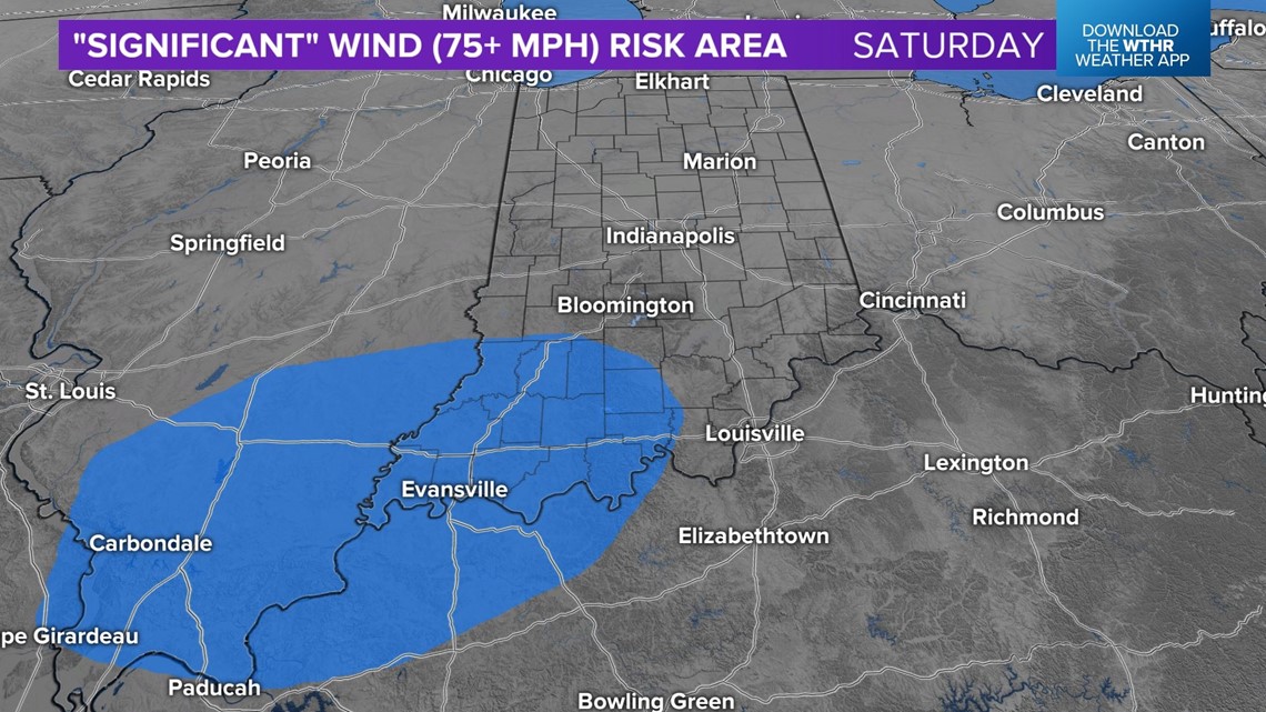
The concern for significant wind (75+ mph) is mainly for areas southwest of Bloomington.

Stay weather aware and have multiple ways to receive warnings.
