INDIANAPOLIS — The round of widespread morning precipitation including a wintry mix to the north and rain elsewhere will taper off around the lunch hour today.

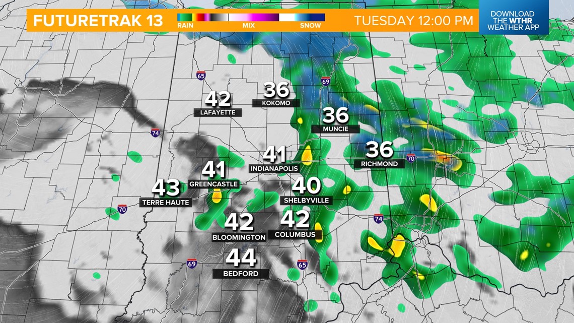
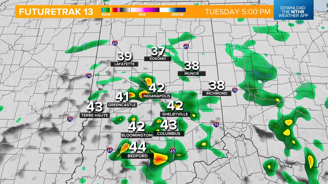
As surface temperatures warm back above freezing, eventually into the low-to-mid-40s this afternoon, all precipitation changes into scattered rain showers. This round of rain will continue through the evening.


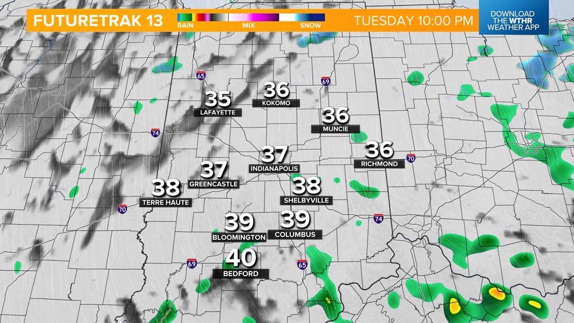
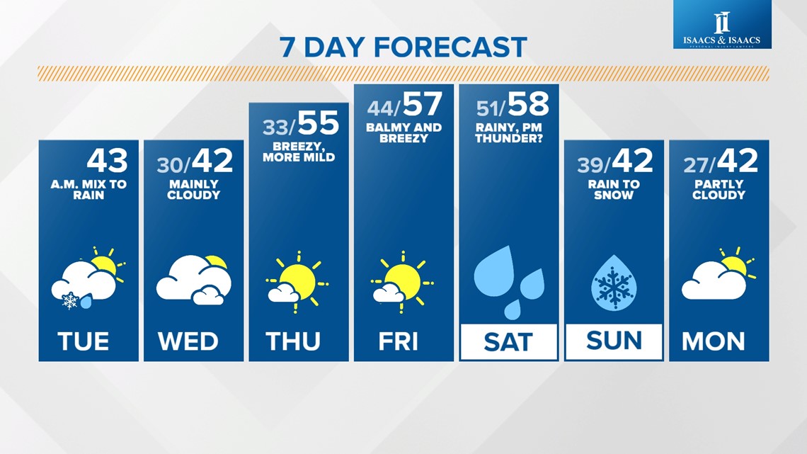
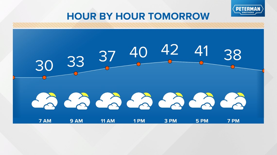
We're looking at a mainly dry pattern starting Wednesday, but it will be a touch cooler with highs dropping into the low 40s.

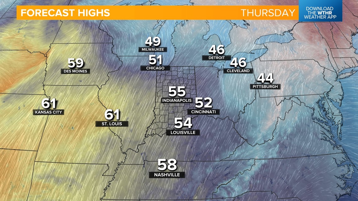
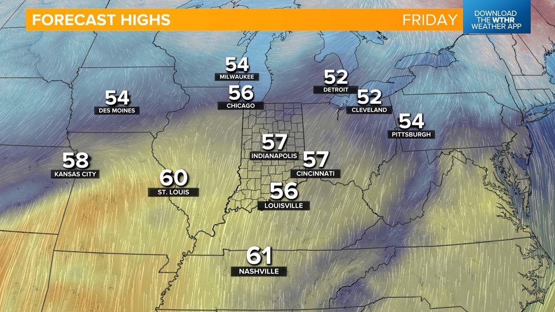
The dry stretch continues for Thursday and Friday as we experience gusty winds, bringing in a warming trend, taking highs back above average in the mid-to-upper 50s.


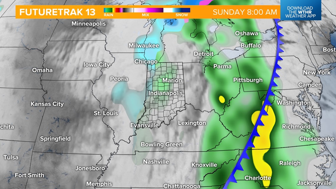
Our next rain chance returns Saturday morning along a potent storm system. Temperatures on the warm side of this system will top out in the mid-to-upper 50s Saturday afternoon. The heaviest of the rain, as well as a chance of a few rumbles of thunder, arrives Saturday evening.

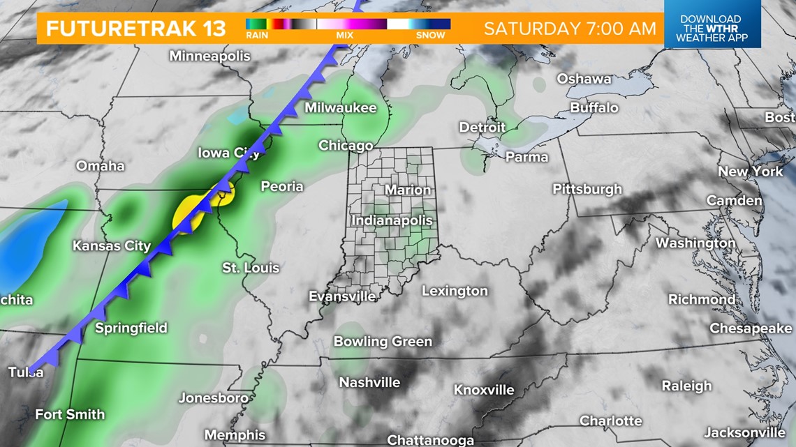

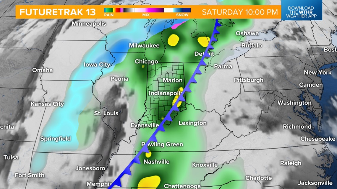
There are still some disagreements on the exact timing of the frontal passage late Saturday into Sunday, which will have an impact on our precipitation type, with rain possibly changing into snow chances Sunday. Make sure to check back on the forecast for weekend plans.

