INDIANAPOLIS — Depending on your location, it was either cloudy this afternoon or you might've enjoyed some welcomed peeks of sunshine. The latter was mainly for those along the I-70/74 corridors, and the window of clearing is closing quickly this evening.
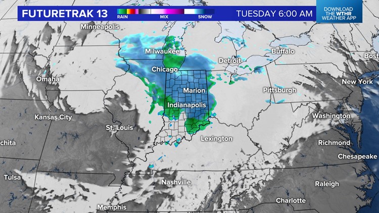
In case you haven't heard, we're expecting a quick-moving weather system to arrive just before/during the Tuesday morning commute.
While it won't have a plentiful atmospheric moisture to work with, it will make efficient use of what is available, and that will come in the form of a mix of either snow, freezing rain, and/or rain depending on your location.

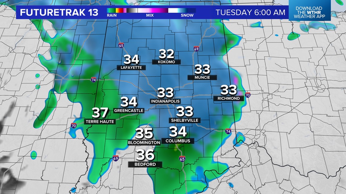

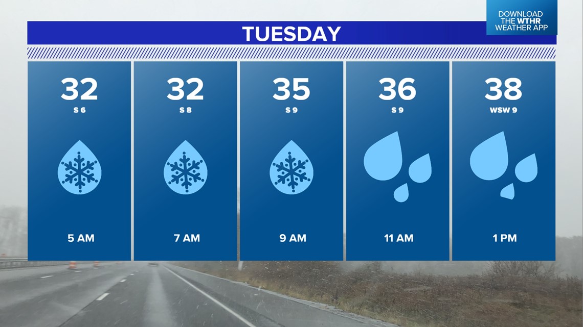

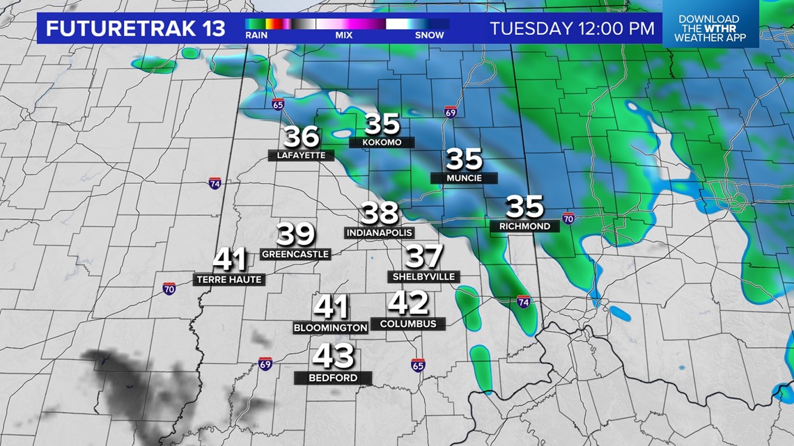
We're expecting temperatures to remain near/above freezing, which should mainly keep roadways wet. The exceptions could be bridges/overpasses and/or any areas where precipitation might become slightly heavier to overcome a relatively warm ground.
The area more likely to see mainly snowfall would be northern Indiana, where some light grassy accumulation will be possible before midday tomorrow. For some areas (mainly south of Indy), it may just a be a cold rain with temperatures in the mid-30s. Eventually, a transition to mainly light liquid precipitation occurs by midday and early afternoon.
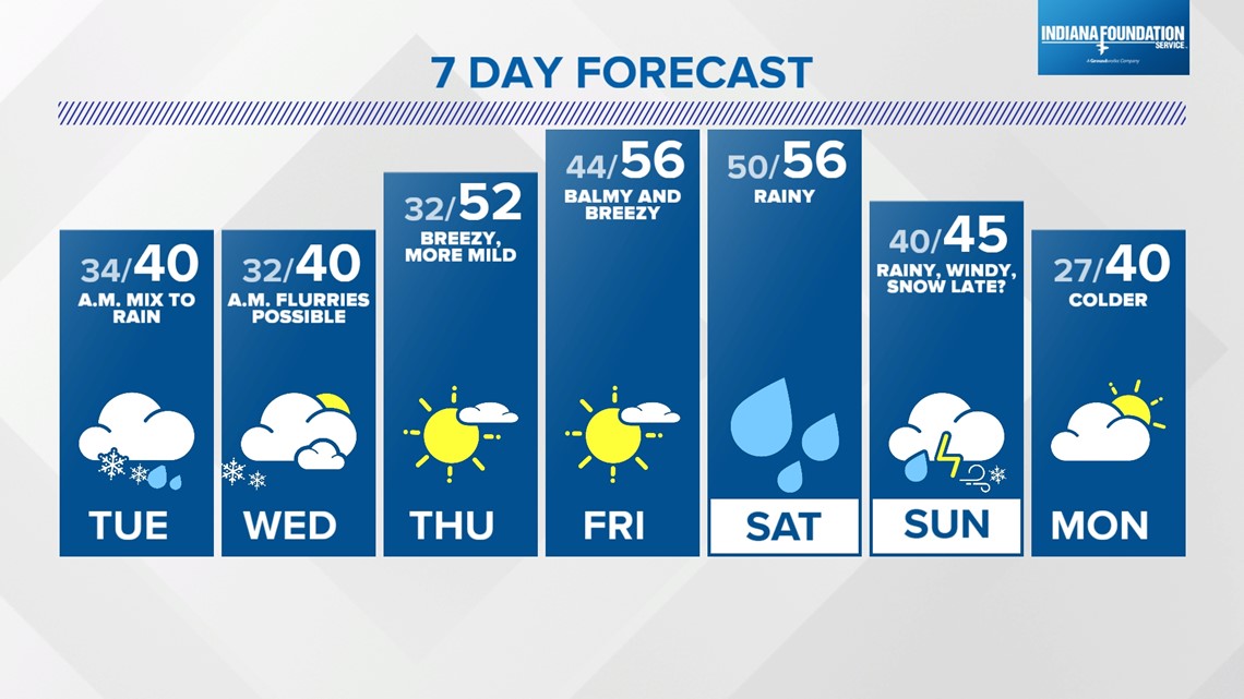
Plan to send the kids to the bus stop with clothes suitable for temperatures in the 30s and to combat the precipitation — boots and raincoats will be good ideas.

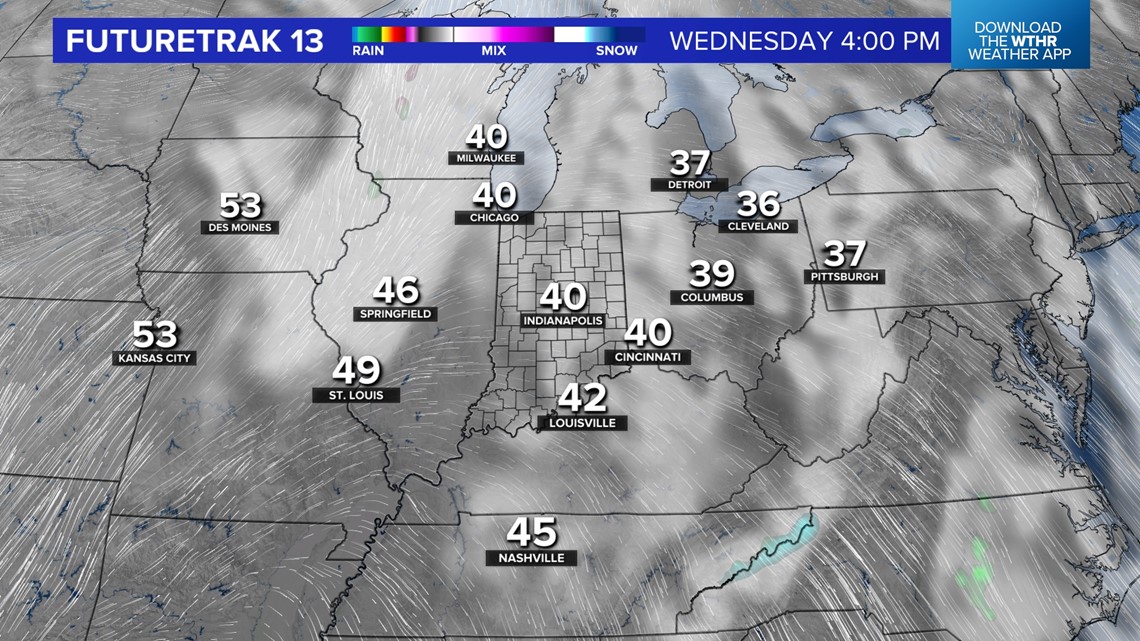

With the expectation of scattered lake effect flurries/snow showers Tuesday night/early Wednesday morning, Wednesday should be mainly dry and seasonably chilly with highs near 40°.
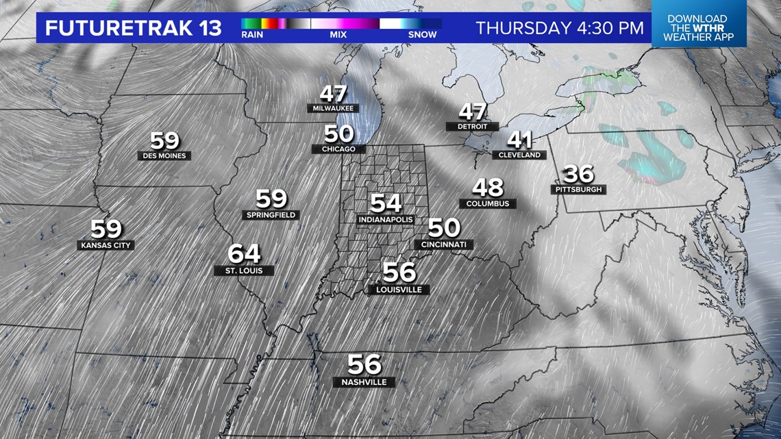
We're still on target for a balmy stretch of December air beginning with low/mid 50s Thursday, mid/upper 50s Friday and mid-50s Saturday. Thursday and Friday will be picks-of-the-week due to expected sunshine.

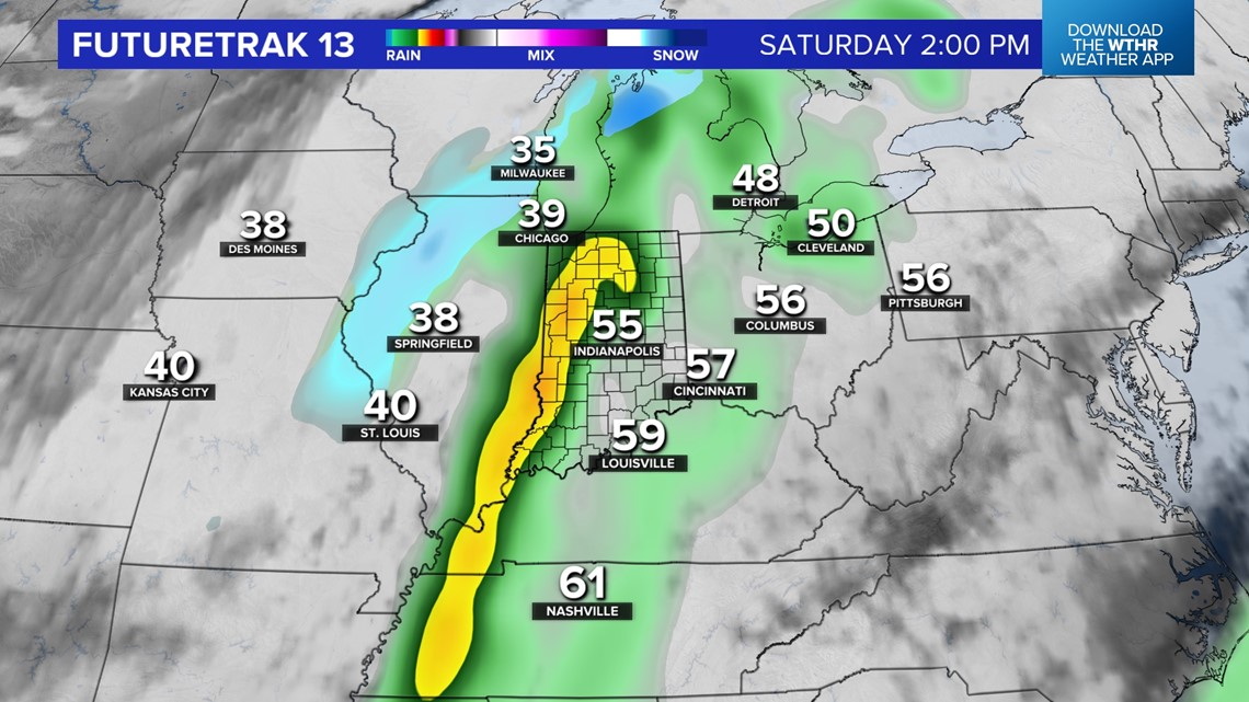
Right now, modeling indicates that this weekend will be rather wet and possibly could end with a period of wind-whipped snow depending on the track of expected strengthening storm system cutting through the Ohio Valley/Great Lakes at some point between Sunday and Monday.
It will be good idea to follow the forecast closely going into the weekend, as there are several potential outcomes to central Indiana. We'll update accordingly.