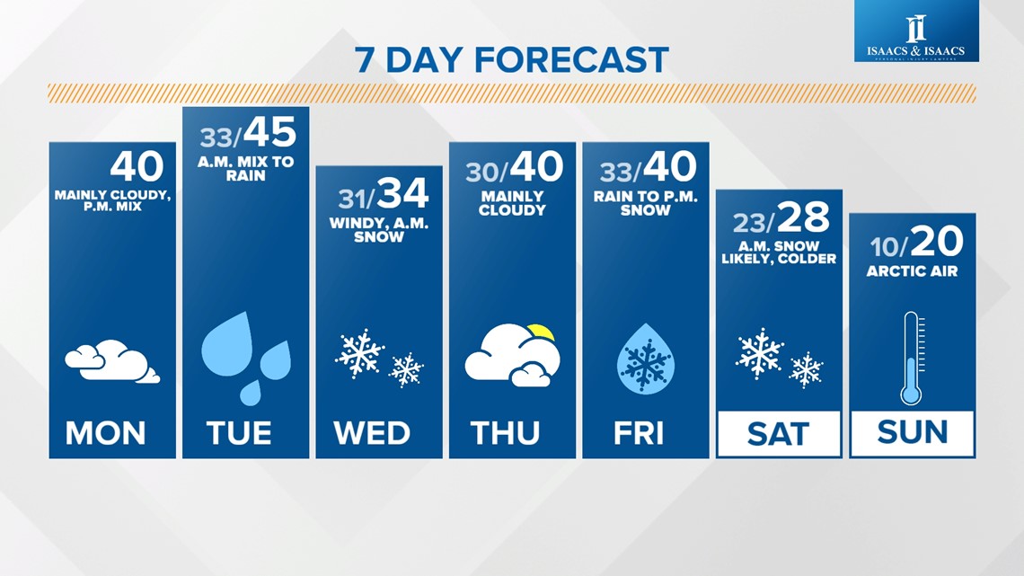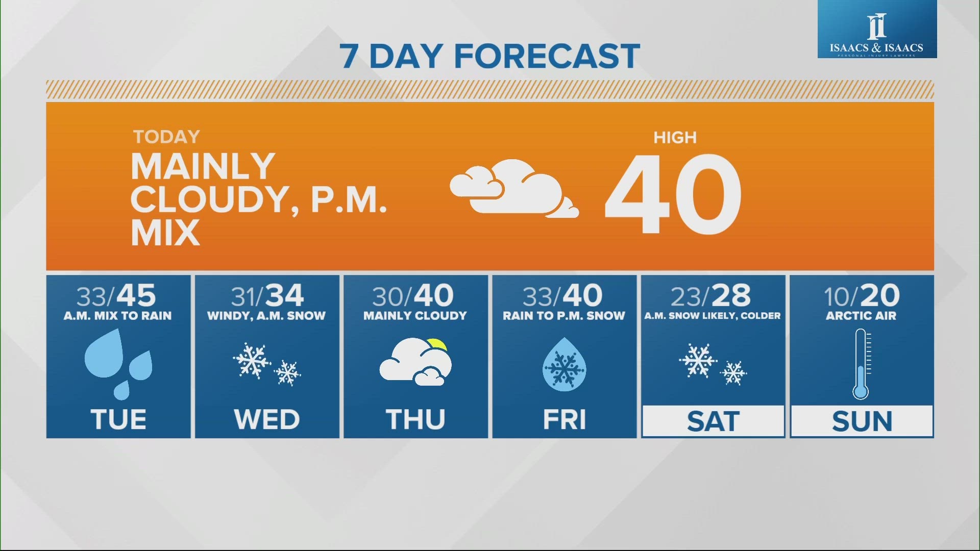
INDIANAPOLIS — We've got a quiet day today with mainly cloudy skies and highs near 40 in the afternoon.

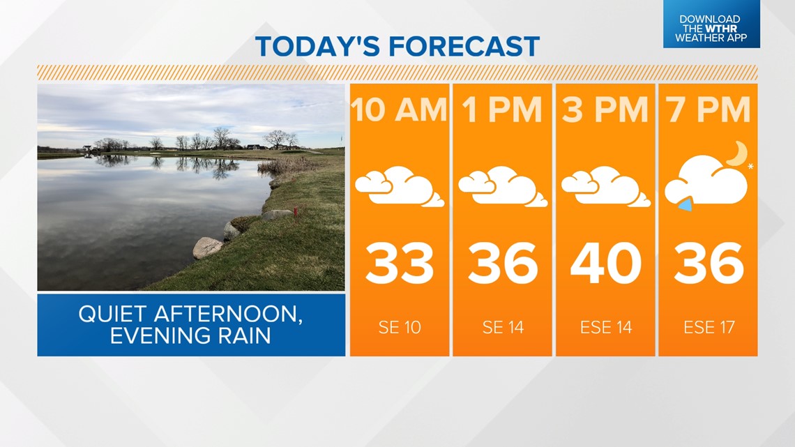
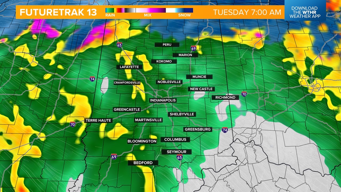
A potent storm system arrives this evening and will bring all forms of precipitation as it moves through (eventually exiting Wednesday morning). First, rain returns mainly after 5 p.m.

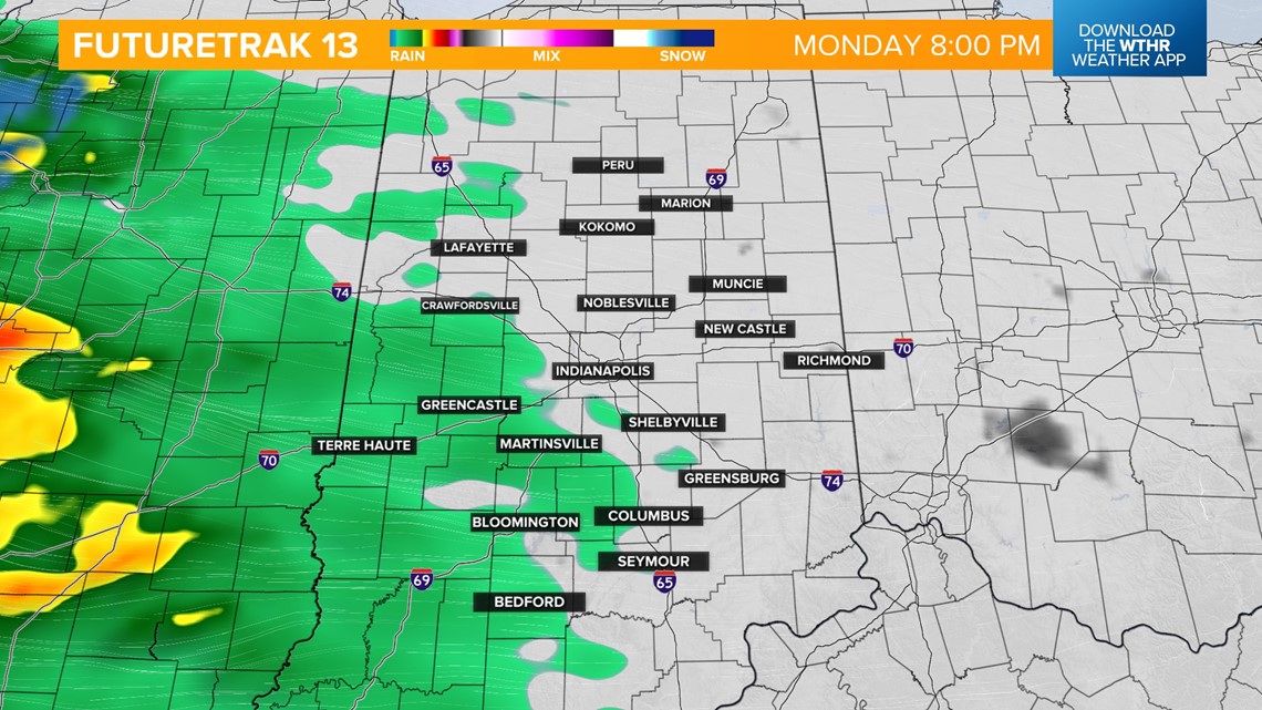
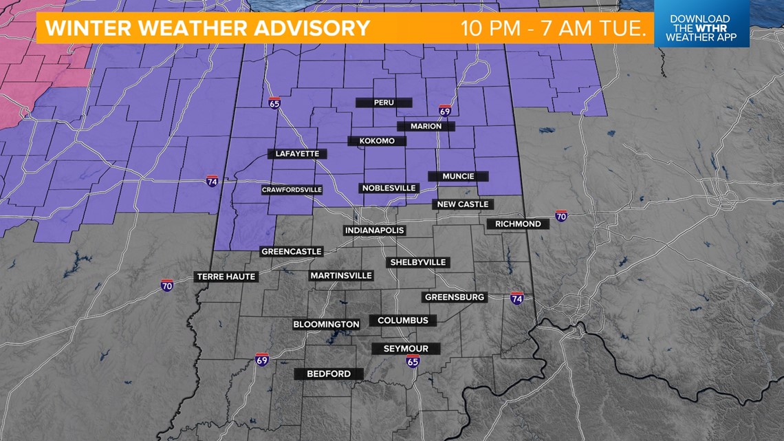
Rain becomes heavy overnight for most of central and southern Indiana, where temperatures hold steady in the mid-to-upper 30s. Where temps are a few degrees colder in northern Indiana, a snow/rain combination is likely. In fact, it will be a fine line on who gets a steady, cold rain versus heavy snow.
Due to this snow risk, a Winter Weather Advisory has been issued for all counties north of the I-70 corridor for 10 tonight through 7 Tuesday morning, where some spots could see 1-3", mainly north.


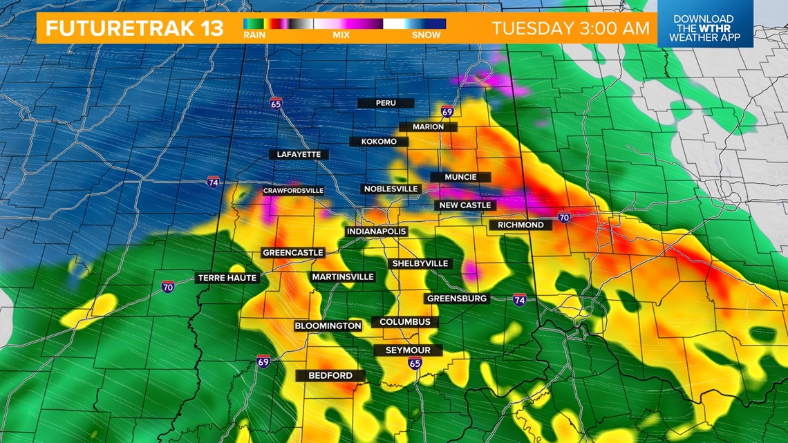

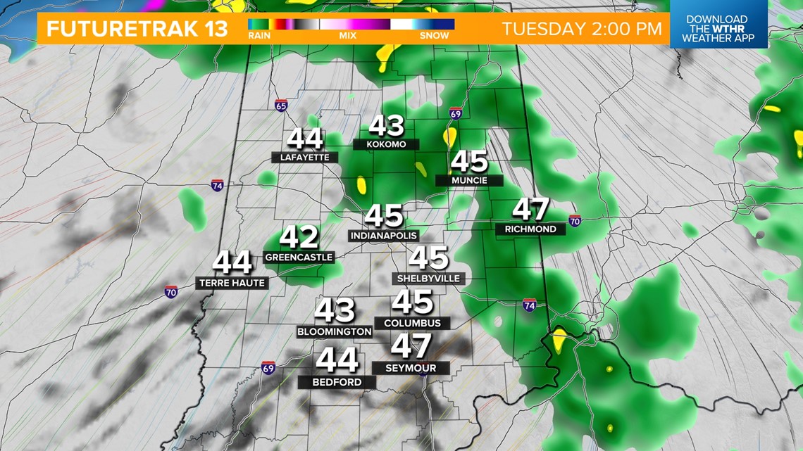
By Tuesday morning, the state will be in the "warm sector" of this storm system, changing our precipitation type into all rain. Rain will become heavy rain at times through Tuesday afternoon and evening as temperatures warm into the mid-40s. We could see upwards of 1" of rain.


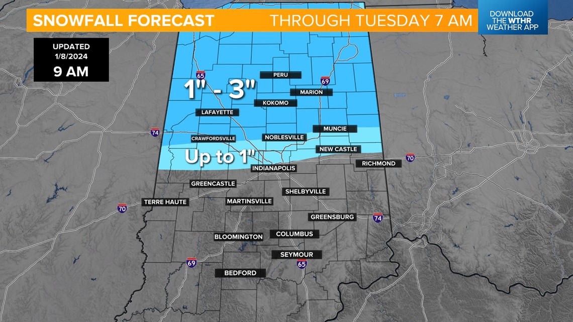
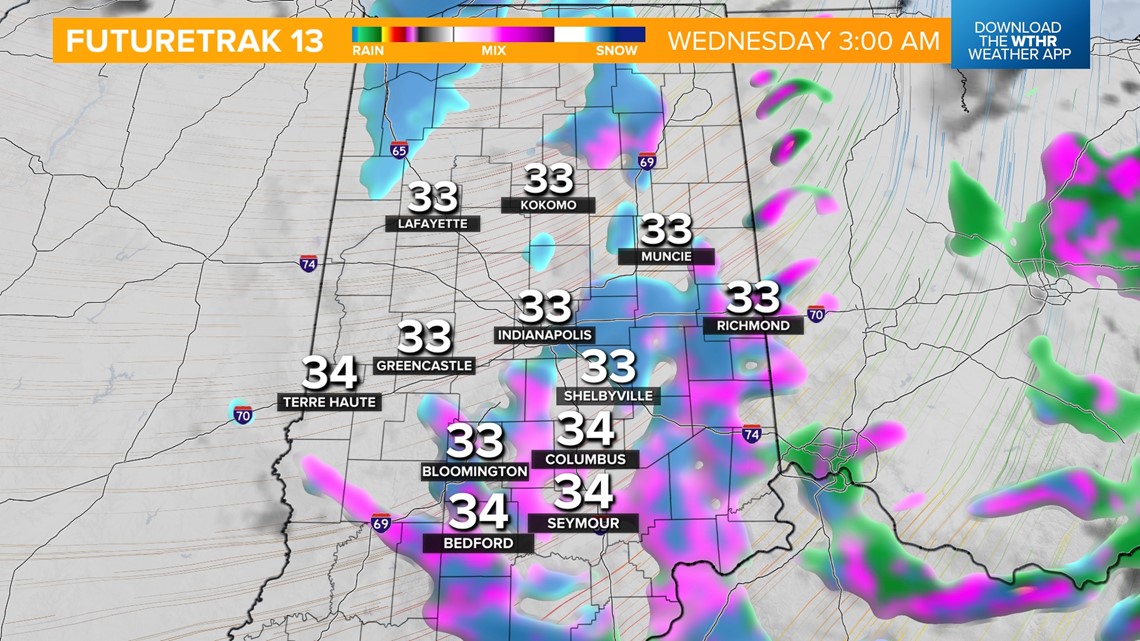
The core of the storm system will lift northeast, allowing for colder air to wrap around the back side of this system. Remnant moisture will transition into mainly snow after midnight early Wednesday as temperatures drop below freezing. Wind gusts will increase to 35+ mph. Light snow accumulations up to 1" are possible before snow exits in the mid-morning. Temperatures only recover a few degrees into the mid-30s in the afternoon.

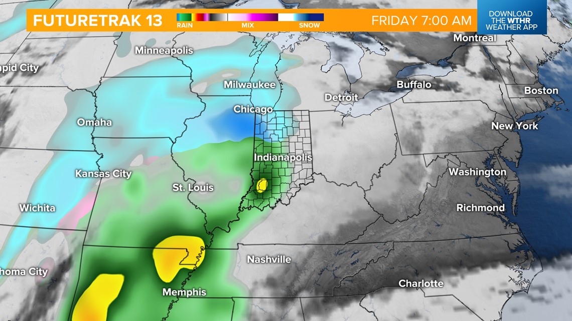
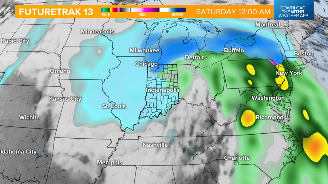
The pattern remains active with another wintry system set to bring a rain/snow combination Friday into Saturday. Snow accumulations look possible with this system, especially late Friday night into Saturday morning. Wind will be a concern with this system, too, with gusts to 40+ mph possible.


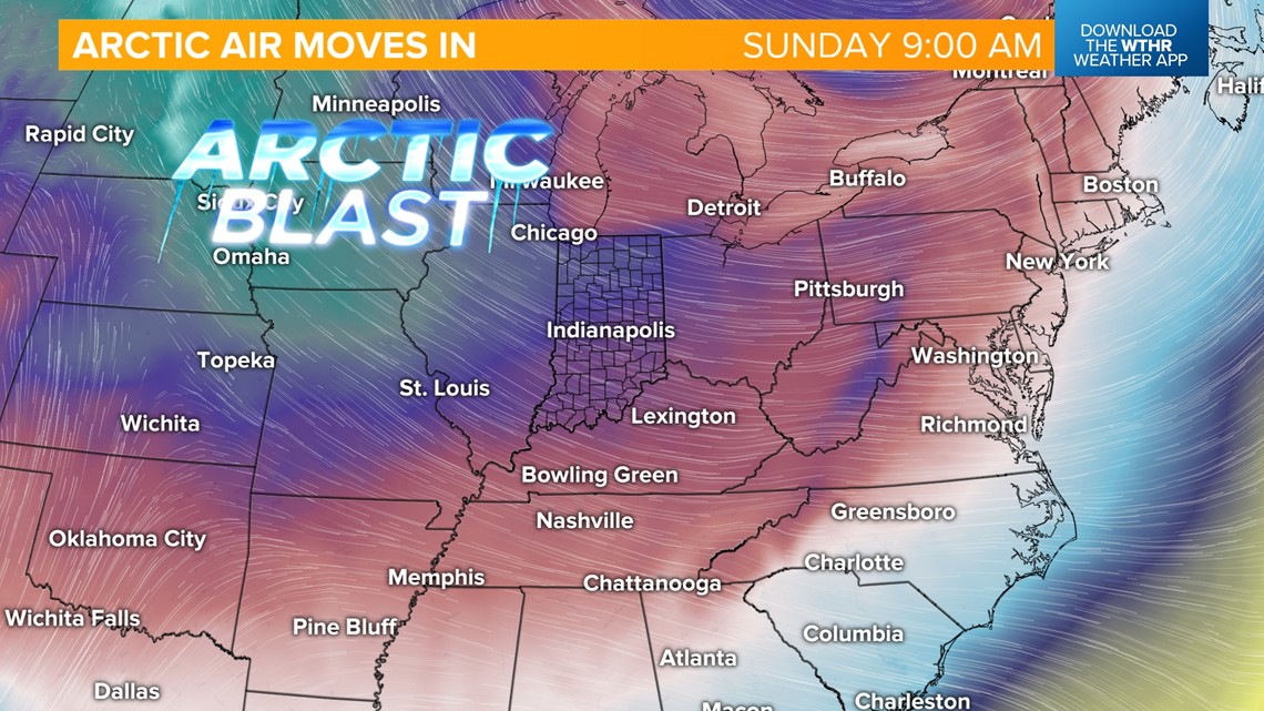
Also worth monitoring is a potential arctic blast expected to return behind this system. Much colder than average temperatures look likely starting Saturday with highs in the 20s. We'll continue to fall Sunday with highs only in the teens and lows in the single digits. This cold snap looks to linger through early next week.