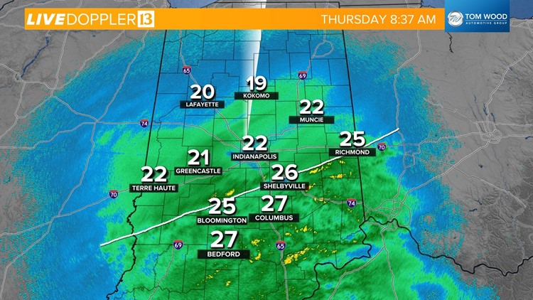
INDIANAPOLIS — Here's some radar analysis on our winter storm as we near the 9 a.m. hour on Thursday.
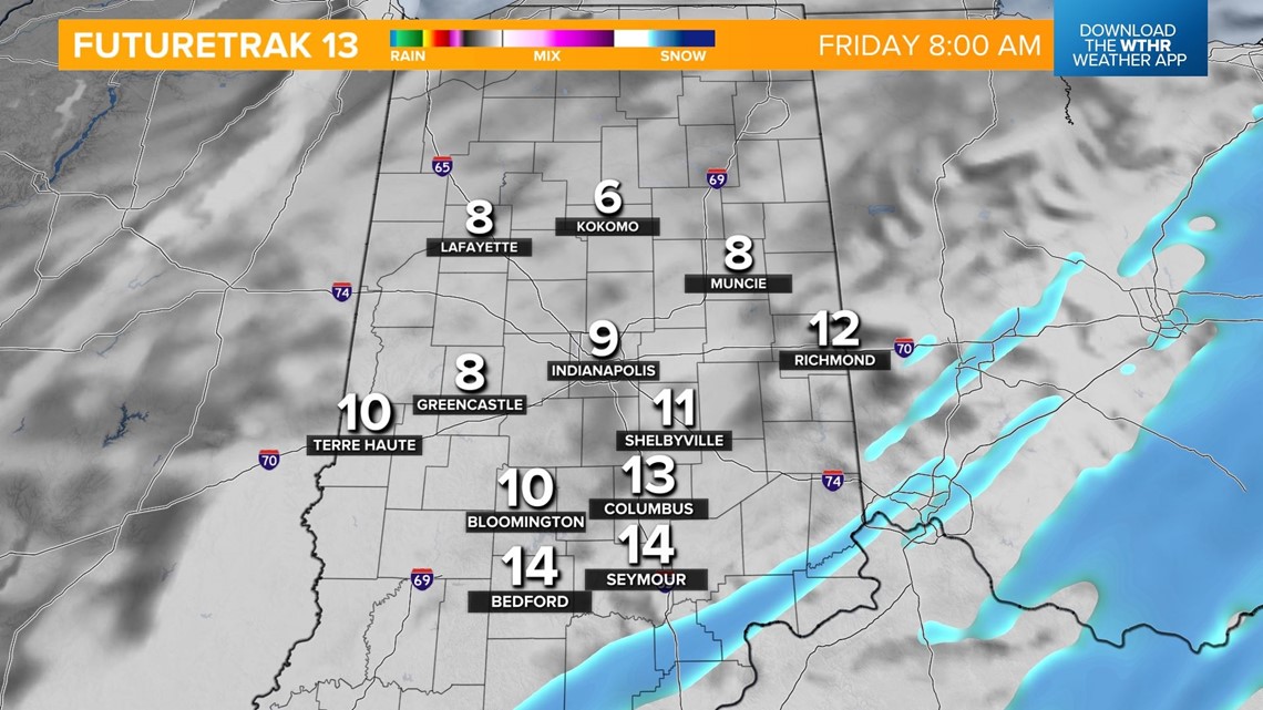
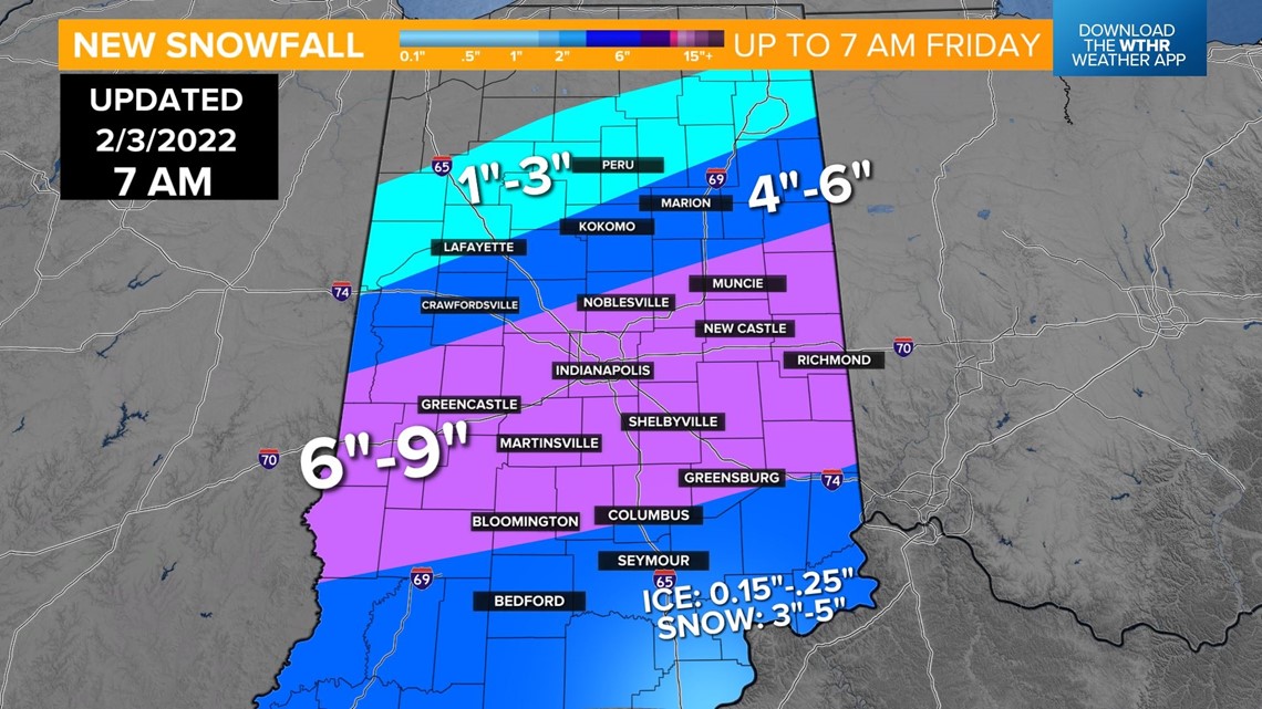
Areas along and north of the I-70 corridor can expect snowfall rates to increase heading into midday and visibility to drop as wind gusts pick up. Blowing and drifting of snow increases the remainder of the day, and we're still anticipating a range of 6 inches to locally 9 inches for much of central Indiana from what's fallen and additional into Friday morning.

South of the line I've drawn on Live Doppler 13 Radar is sleet and freezing rain — and this is the "wild card" of mix we've mentioned many times in the days leading up to this storm.

The timing of its departure dictates how ice vs. snow occurs, and it's the most challenging area of the forecast.
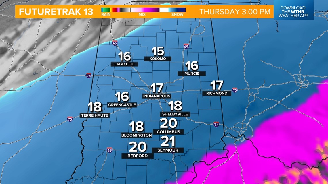
The mix line gradually departs to the southeast this afternoon as colder air eventually wins the war and changes southern Indiana over to snow into the evening.
Please consider avoiding travel today with already bad road conditions only going to get worse.