INDIANAPOLIS — Buckle up, central Indiana. We've got a rather bumpy weather ride the next 48 hours, so it's best to get any outdoor work done today, as this is likely our quietest weather day for awhile.
We're enjoying some sunshine today and highs near 40°, but we're also monitoring the newest computer model data and updating the impacts of the well-advertised winter storm system arriving tomorrow. Here's what we know now and what we're most/least confident within this forecast.


Highest forecast confidence:
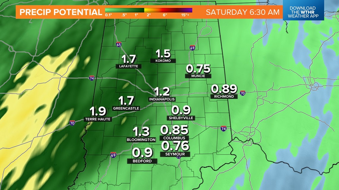
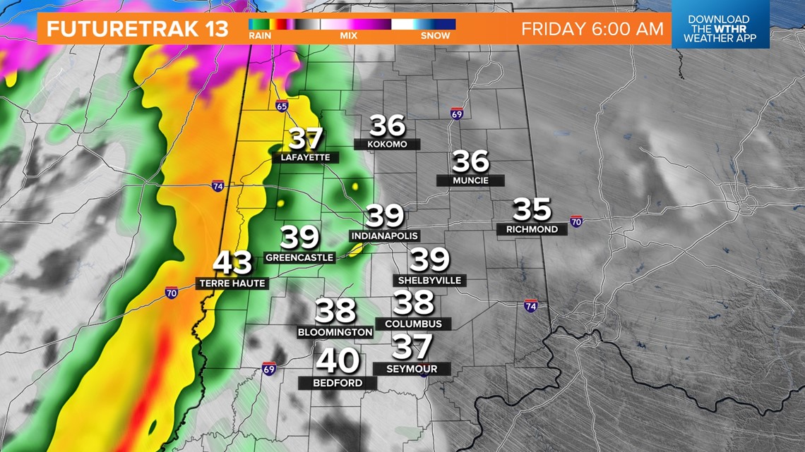
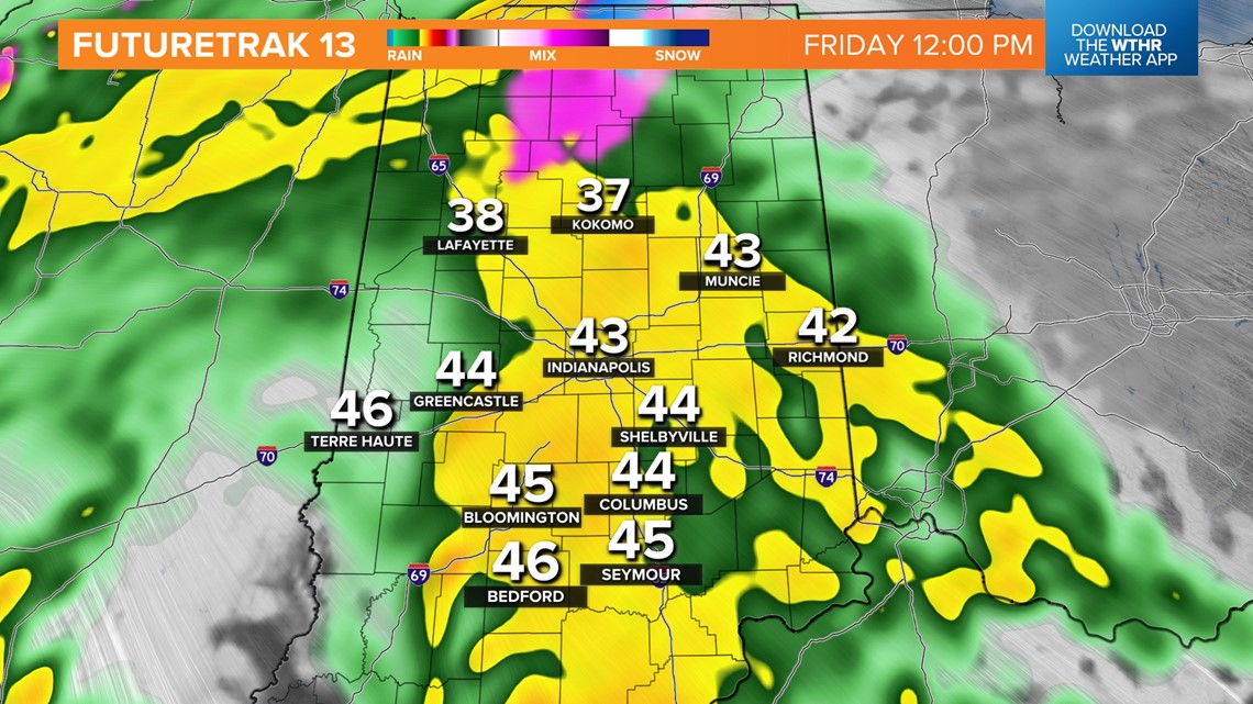
- 1"-2" rainfall that may be heavy at times Friday 6 a.m. - 6 p.m.
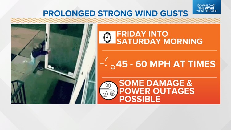
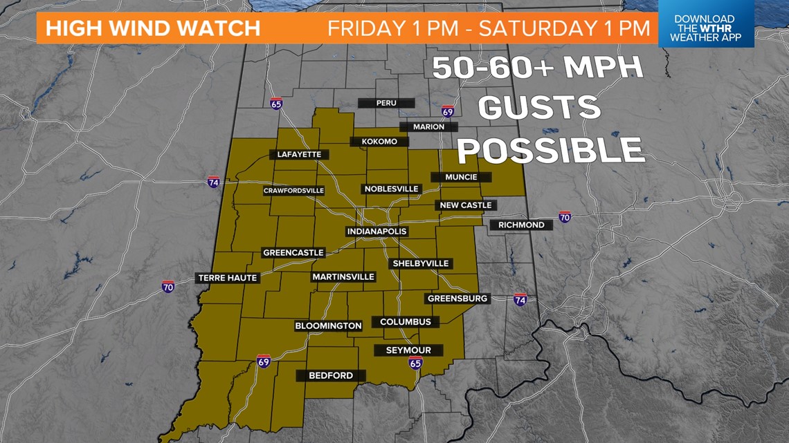
- High wind gusts (45-60+ mph) Friday into Saturday
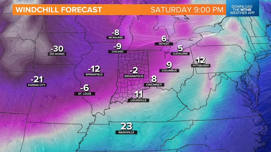
- Sub-zero windchills Saturday night into mid-week
- 7+ day streak below freezing
Lowest confidence:
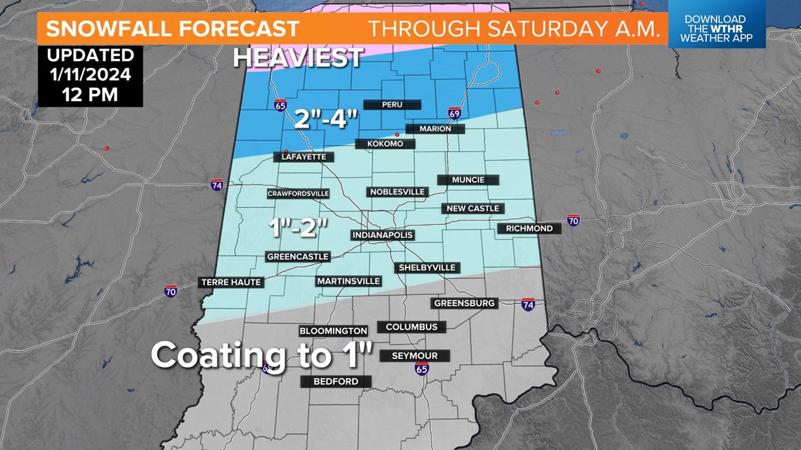
- Timing of rain changing to snow
- Snow amounts (some locally heavy amounts remain possible)
- Whether a flash freeze occurs Friday night

Not surprising, but a High Wind Watch was issued for all of central Indiana for the potential of 60 mph gusts between Friday 1 p.m. - Saturday 1 p.m. Whether it's upgraded to a Warning remains to be seen, but either way, damaging wind gusts and/or power outages are possible, if not likely, Friday into Saturday.

Rain arrives with this storm Friday morning. Plan on a wet, windy morning commute with periods of heavy rain into early afternoon. As the storm intensifies and moves across northwestern Indiana into Lower Michigan, colder air quickly wraps around into the center of the low.


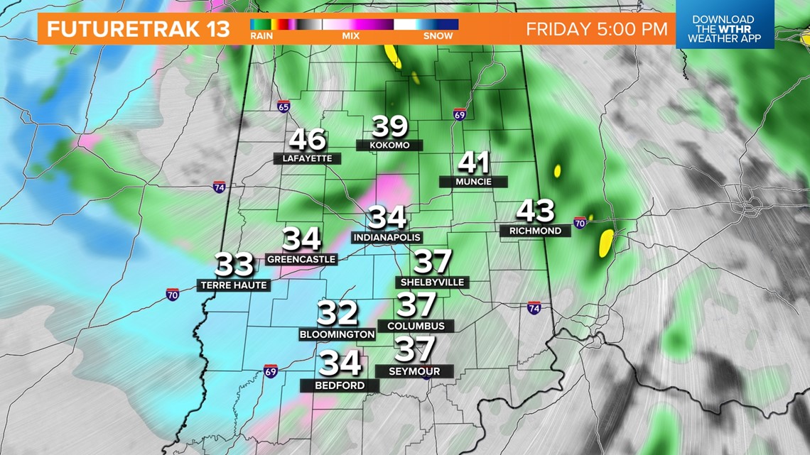
This causes a rapid transition of rain changing to snow from west-to-east. The specific timing of the changeover remains uncertain, but we're bracketing the hours between 4 p.m. and 9 p.m. Friday.

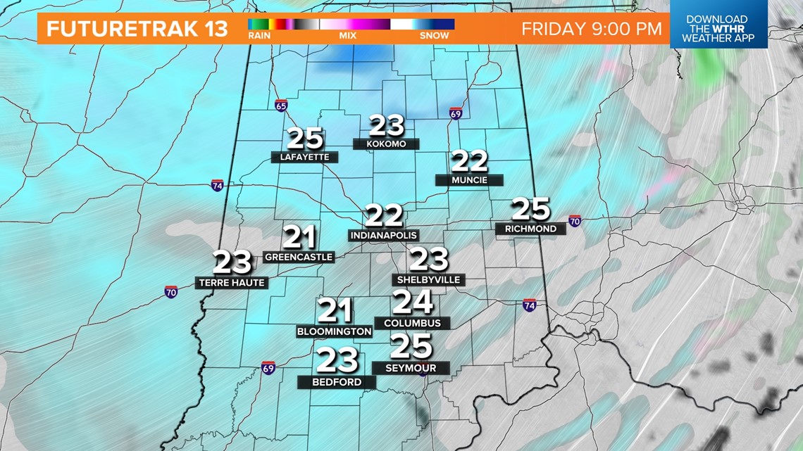

Snowfall rates could be heavy at times during the transition and overnight Friday. The snow, combined with high wind and falling temperatures, will make for difficult travel conditions due to low visibility and potentially a "flash freeze" of any moisture on the roads.

Please follow road conditions closely Friday night into Saturday.
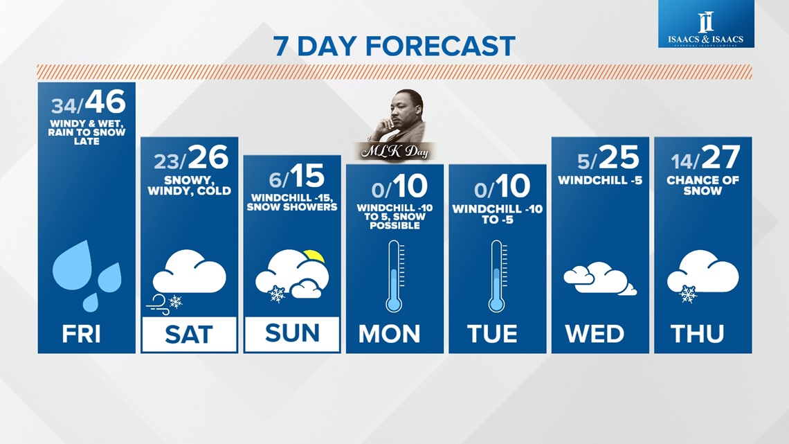
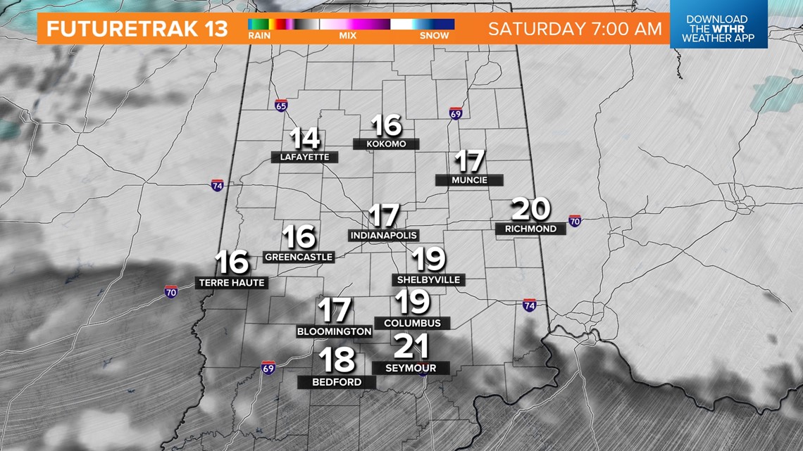
Wind-whipped snow, likely lighter, continues Saturday as bitter cold air arrives. "Highs" will be only in the 20s Saturday with windchills reaching sub-zero by 10 p.m. Saturday night.


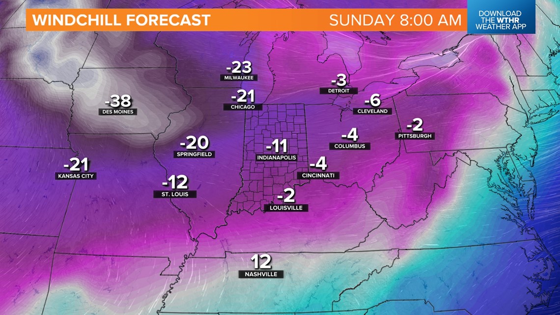

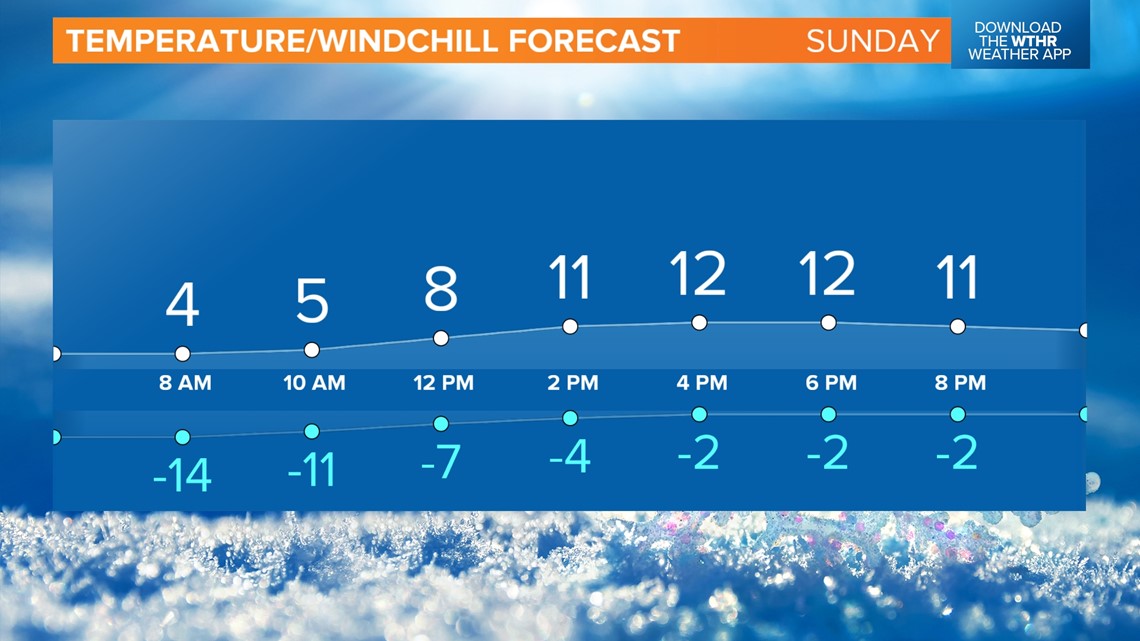

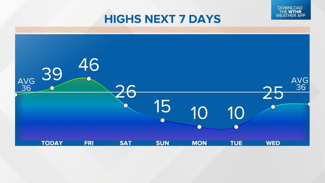
Sunday morning windchills bottom out around -15° and remain bitter into mid-week. Expect very little temperature recovery Sunday, with highs only in the mid-teens, and the coldest days appear to Monday (MLK Jr. Day) and Tuesday.
As it often is the case, this bitterly cold air won't retain moisture very well, and even subtle upper-level disturbances can trigger bouts of light, but highly impactful snow that can make roads slick in short notice. More to come.