INDIANAPOLIS — What an "interesting" weather day in central Indiana and much of the country for that matter — from severe storms/tornadoes in the southeast, blizzard warnings in the northwest, and an impressively intense storm locally.
In fact, the storm center that passed through northwestern Indiana today produced the lowest atmospheric pressure on record in January in Indianapolis, with the barometer bottoming out at 28.97 inches, or 981.2 millibars. For perspective, that's a lower pressure than the infamous Blizzard of 1978 that had a low pressure in Indy of 984.4 mb. The lower the pressure, the stronger the storm system.
It should be noted that the upcoming storm on Friday could potentially break the all-time lowest pressure for Indianapolis (974.6 mb Feb. 28, 1902) and comes with an impressive gradient wind field, too.
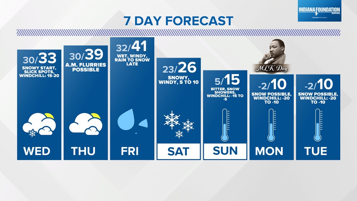
More on that storm in a bit, but you need to be prepared for a messier commute Wednesday morning.


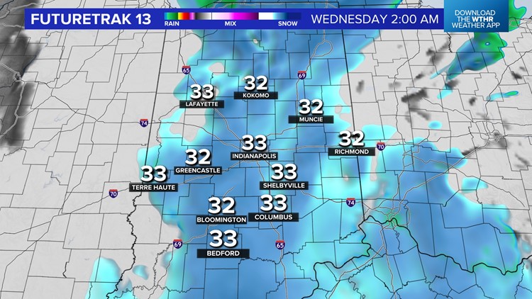
This is due to rain changing to snow by midnight and temperatures dropping to near/below freezing. Bridges, overpasses and untreated surfaces may get slick, and it will be a good idea to get up earlier to check on road conditions with Chuck Lofton and Lindsey Monroe on 13Sunrise starting at 4 a.m.
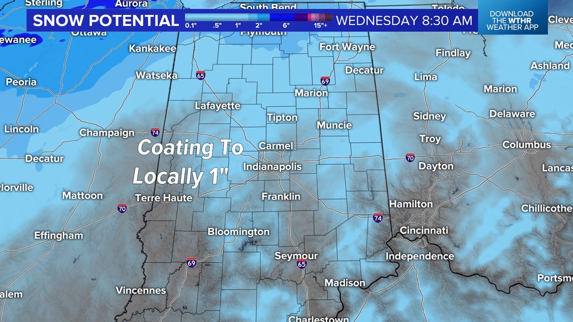
The wind-whipped burst of snow overnight could accumulate up to 1 inch in some locations. But even a coating of snow may make some slick spots in the morning.

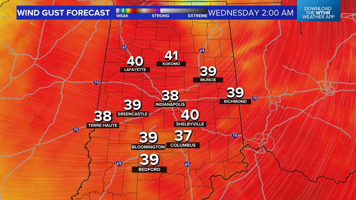

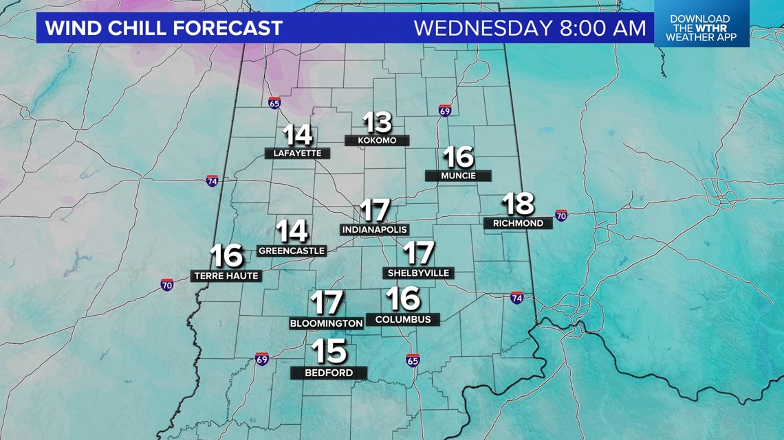
In addition, wind gusts near 40+ mph will shake the house and drop visibility in areas of snow, while producing wind chills in the teens for much of Wednesday.
While I'm typically not a fan of cold rain, the precipitation amounts over the past 24 hours with this storm were a sight for sore eyes. Liquid equivalent near and above 1 inch for most is just what the doctor ordered for the drought-stricken landscape in central Indiana.

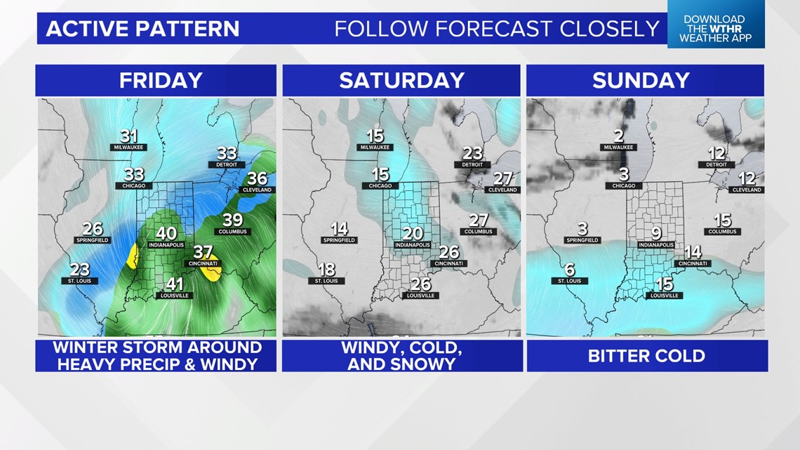
The focus quickly shifts to another heavy precipitation event on deck Friday, with amounts of snow/rain to be determined once confidence grows on a storm track. Regardless of how much snow, there's a high probability for strong (possibly damaging) wind gusts Friday night into Saturday that's quickly followed by bitter cold that lingers into the middle of next week.
Please follow the forecast closely in the coming days for updates to the storm track, which dictates specific impacts.