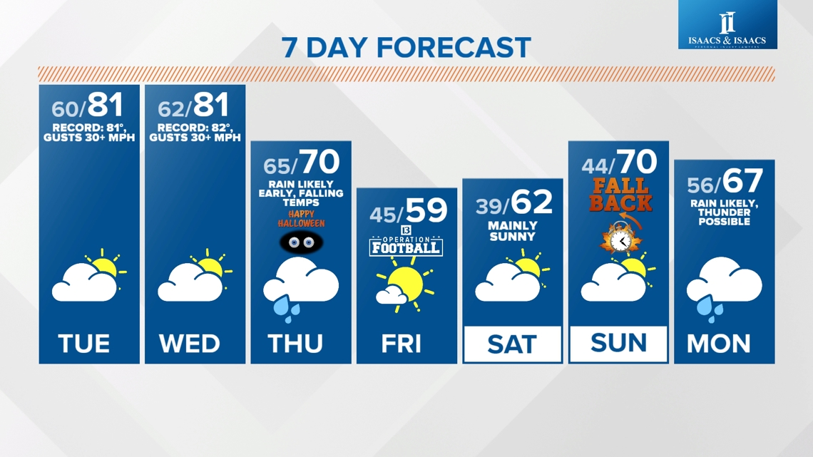
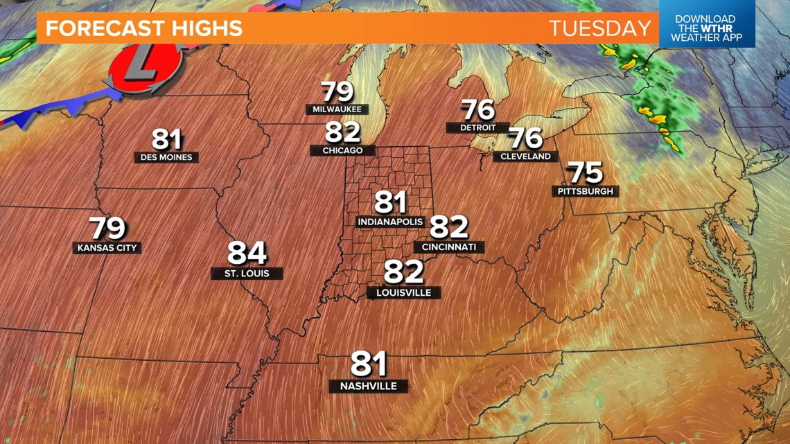
INDIANAPOLIS — You can definitely feel the warmer wind change this afternoon as temperatures are running some 10° above the pace from this weekend, and that puts highs today in the 70s.
This is part of the well-advertised transition back to unseasonably warm air for much of this week. With a steady south-southwest wind overnight, expect noticeably warmer morning temperatures beginning Tuesday with morning lows near/above 60° into Halloween morning.
Rare air inbound
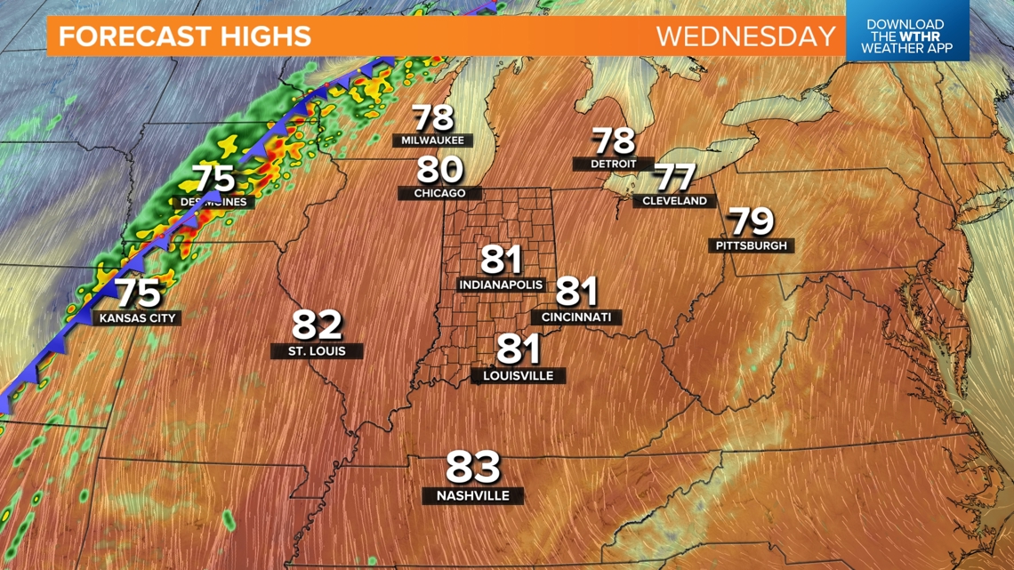
We remain on target for some "Rare Air" days this week with a late-season early September-like airmass blowing in to close out October. There have only been seven days in Indianapolis since 1871 with a high temperature of 80+ degrees to happen on/after Oct. 29. The last such day was back in 1950.

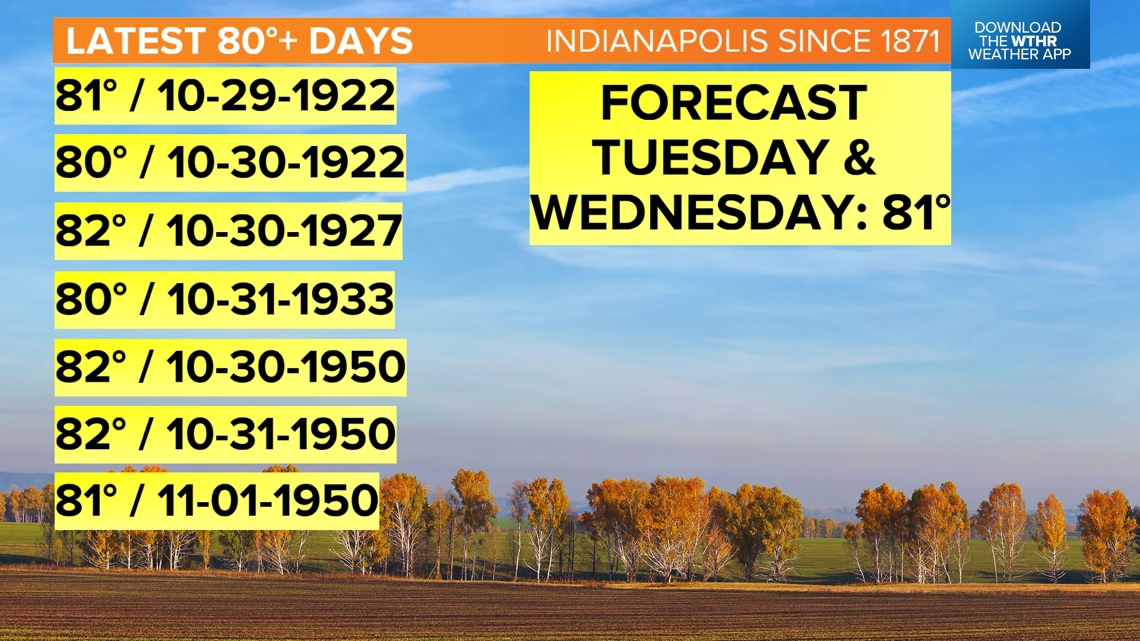

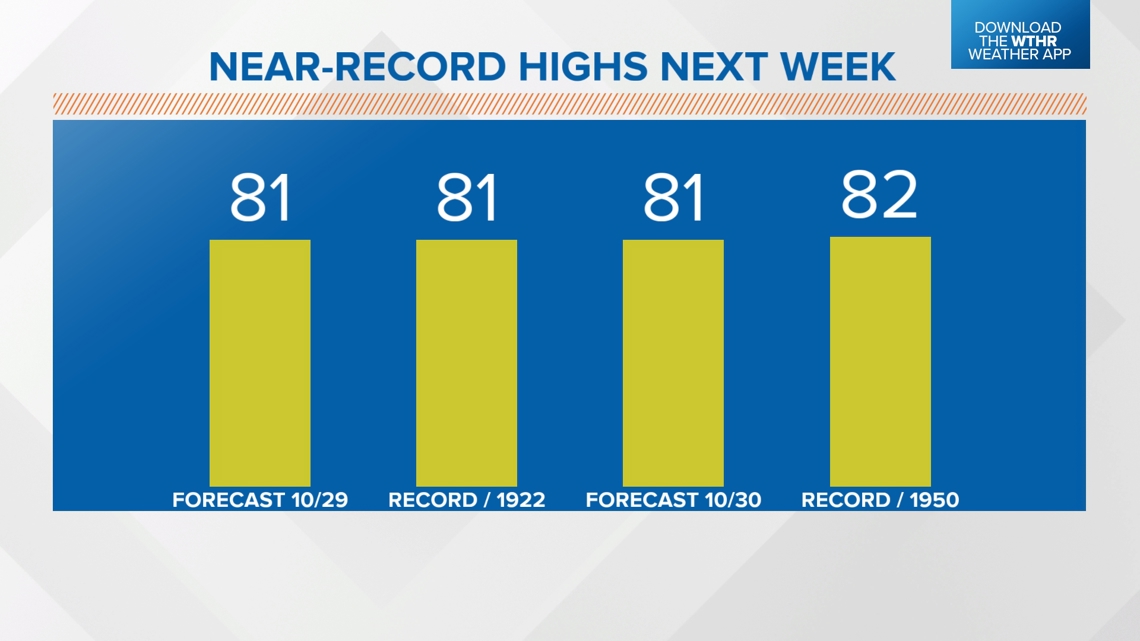
If our current forecast verifies, Tuesday and Wednesday will join this list and approach the daily record highs for Oct. 29 and Oct. 30. With or without records, the airmass advecting into Ohio Valley produces temperature anomalies of 20+ degrees into mid-week.


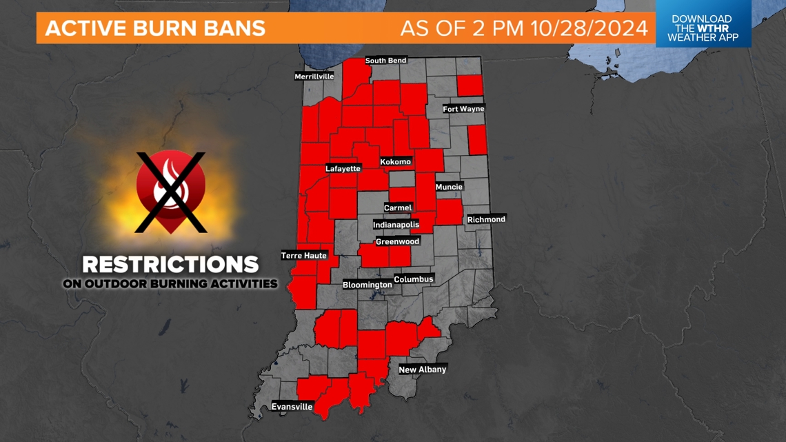
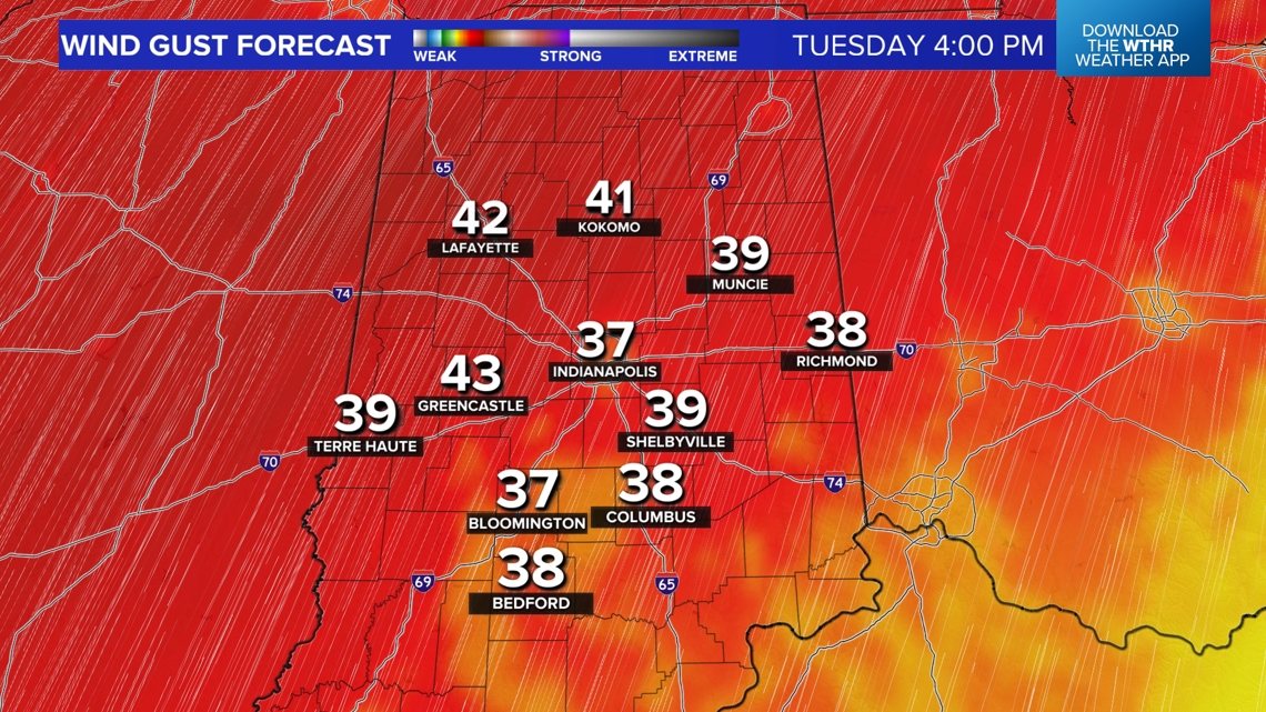
Elevated fire risk Tuesday and Wednesday
With the combination of dry air (humidity 20-30%), near-record highs near 80°, and wind gusts of 35+ mph, there will be an elevated fire risk Tuesday and Wednesday afternoons. This will be exacerbated by a state that is in dry to locally severe drought conditions. There are over 40 counties in Indiana currently with Burn Bans, and we're urging everyone to avoid any burning until further notice. In the atmospheric conditions, fires can spread quickly.


Rainy before sunset Halloween
It's, so far, been a historically dry October in Indiana. Coincidentally, the wettest day of the month may occur on Halloween. That's when the latest cool front arrives and brings organized rainfall into the state Thursday morning. The axis of rain lingers into Thursday afternoon before drifting southeast toward sunset (6:43 p.m.). Showers and embedded thunderstorms are likely along that front. We'll continue to monitor trends, but current timing places the rain/thunderstorm axis in eastern-southeastern Indiana by sunset.

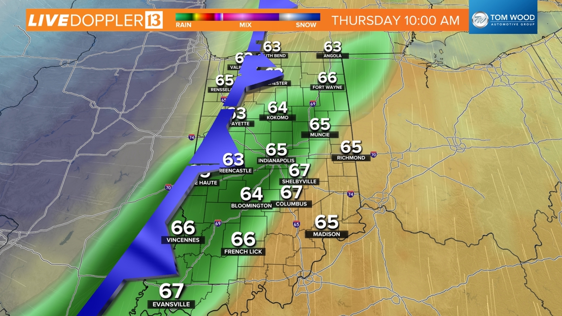

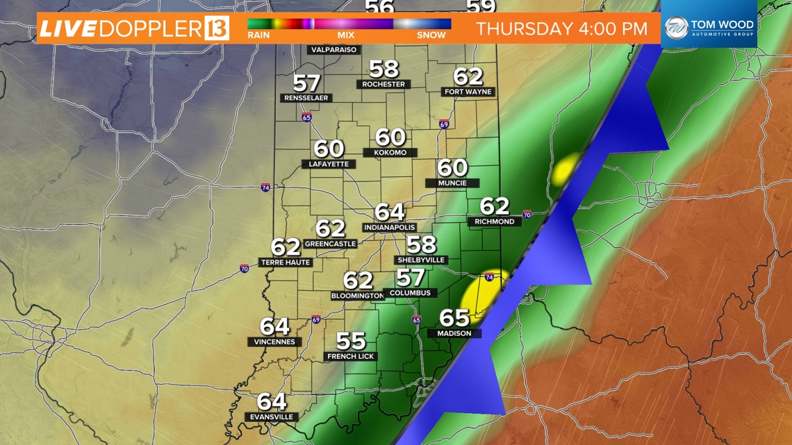
Odds of a dry trick-or-treat are high north and northwest of Indy where the cooler, drier air arrives quicker in the wake of the front. Still a tough call on the Indy metro area possibly still having lingering rain around at the start of trick-or-treating, but we odds go up for rain-free conditions by 7-8 p.m. There's a higher chance of rain lingering east of I-65 and south of I-70 Thursday evening. Please check back for updates on timing, coverage and amounts of rain.
We're back to seasonably cool air Friday into the start of the weekend. That coincides nicely for Operation Football Sectional Semifinals and Taylor Swift concertgoers. We'll fine-tune temperatures, but right now, Friday looks like the coolest and Sunday the mildest, though showers may return by the end of the weekend. Stay tuned.