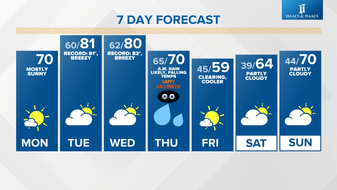
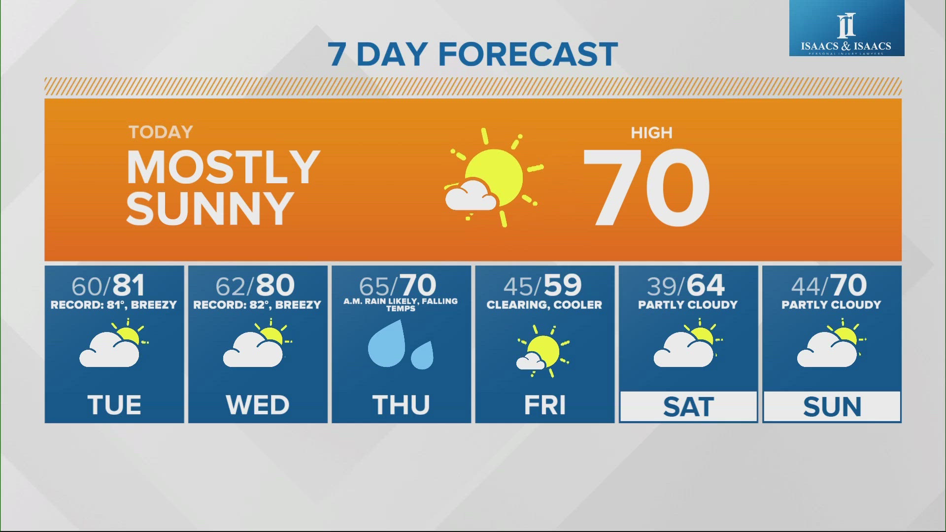
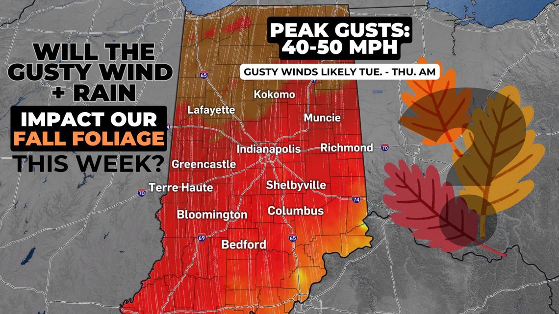
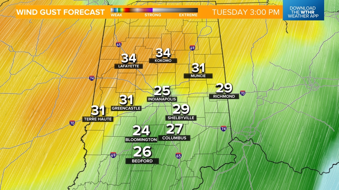
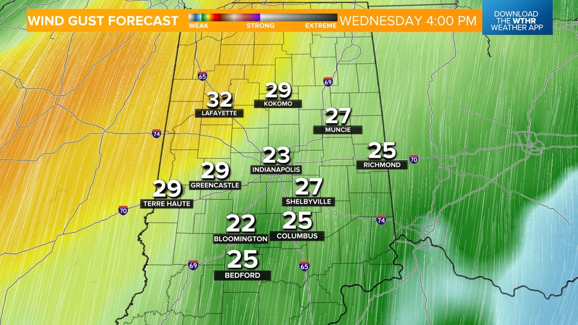
INDIANAPOLIS — We've got a warmer and windy setup moving in with gusts over 30 mph expected Tuesday through Thursday morning with peak gusts in northern Indiana exceeding 40-50 mph Wednesday morning.

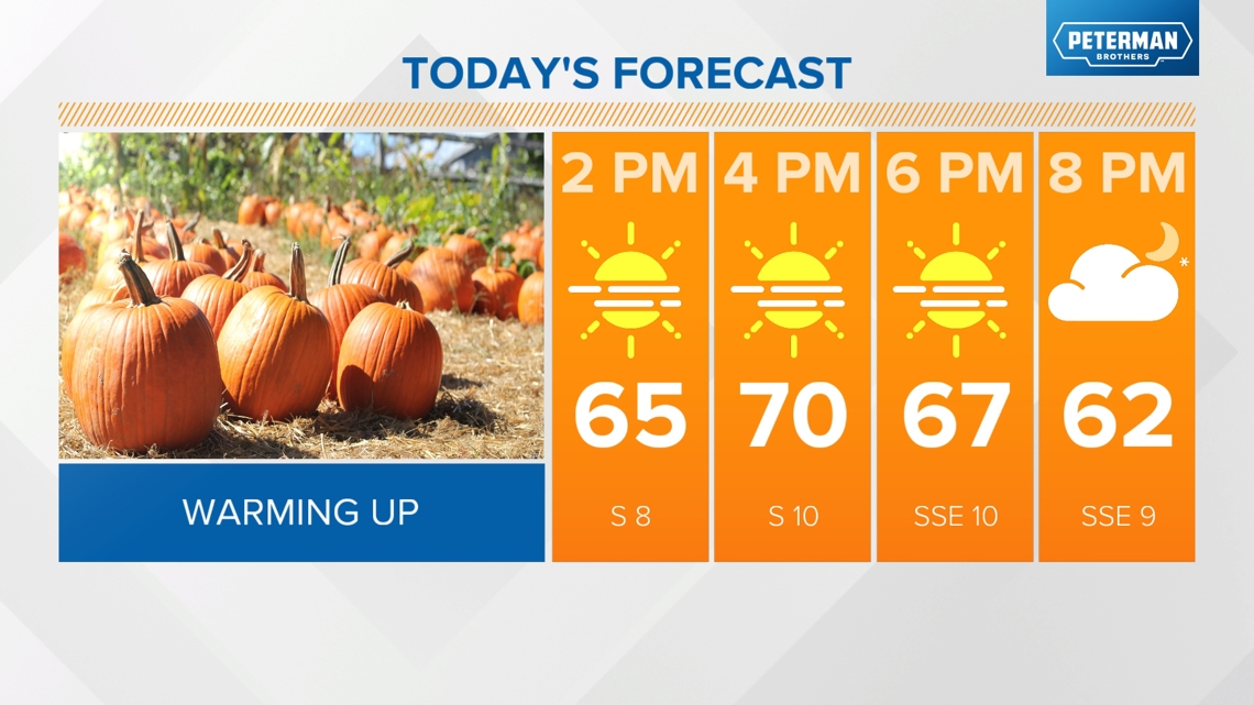
TODAY'S FORECAST:
- Transitioning to warmer weather as winds shift to the south
- Highs near 70 (about 10 degrees above average)
- Becoming partly cloudy

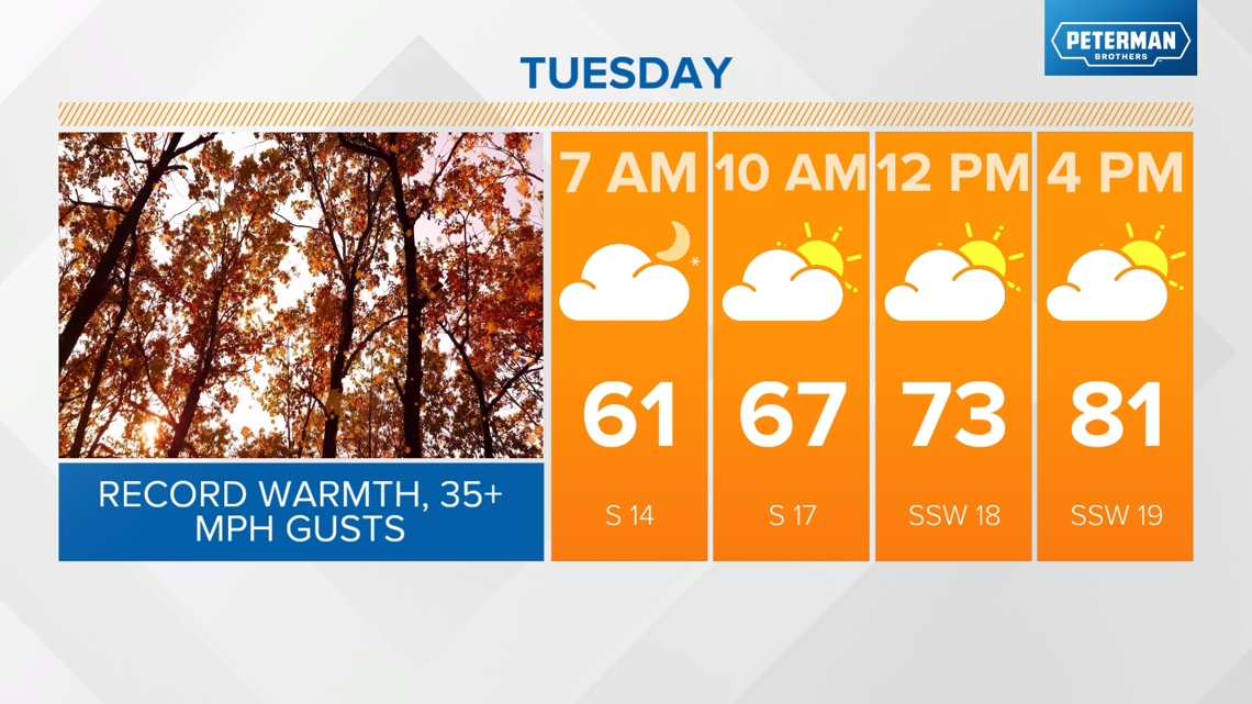
Wind speed increases starting tonight with 35+ mph gusts through Thursday morning
- Postpone outdoor burning under these conditions
- Make sure outdoor items, such as Halloween decorations, are secured
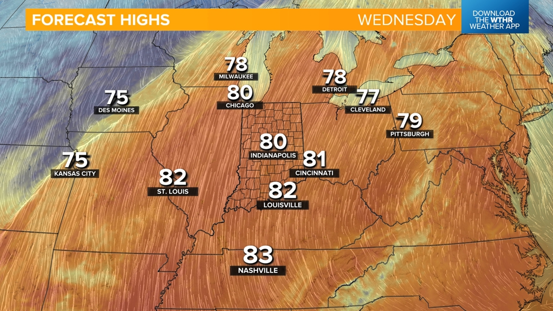
- Southerly wind push in record warmth for late October
10/29 (Tuesday): Record 81 degrees from 1922


10/30 (Wednesday): Record 82 degrees from 1950


What's the latest timeline on the rain and wind Thursday?
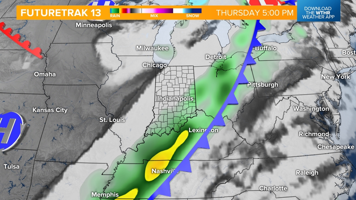
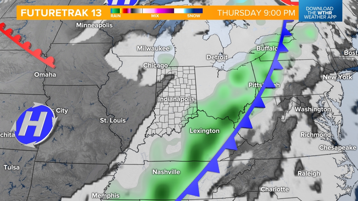
A cold front arrives on Halloween morning (~ 7 a.m.), and rain showers will be likely along this front through Thursday afternoon. The strongest winds will be along the passing front with 30-40 mph gusts possible.

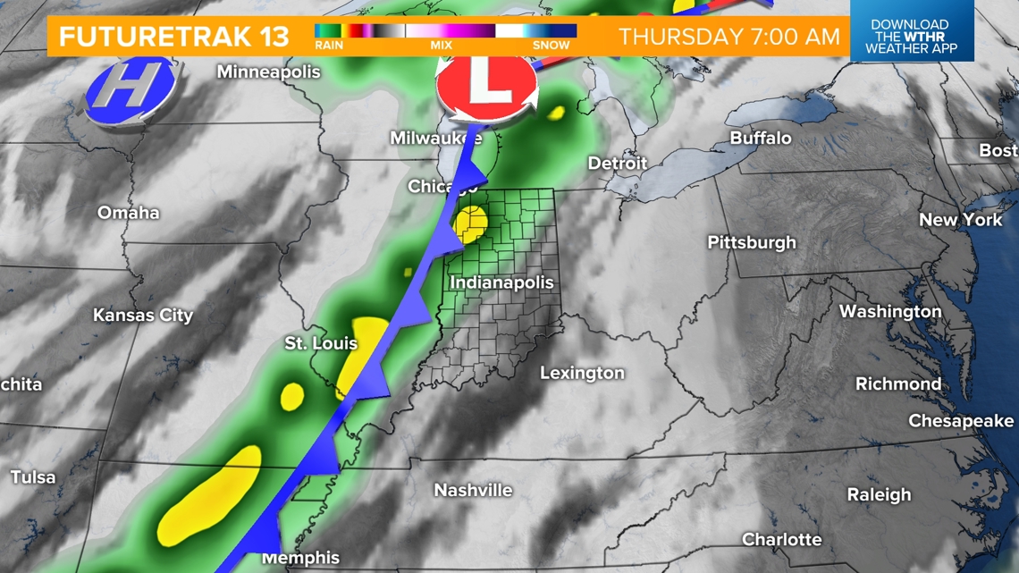

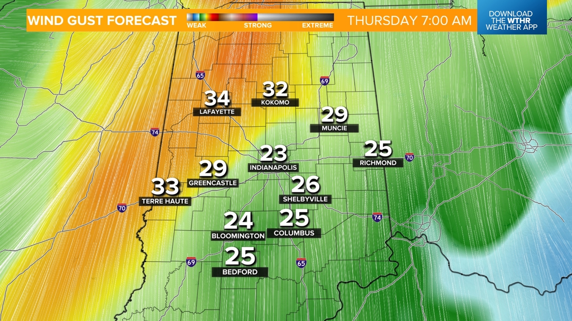

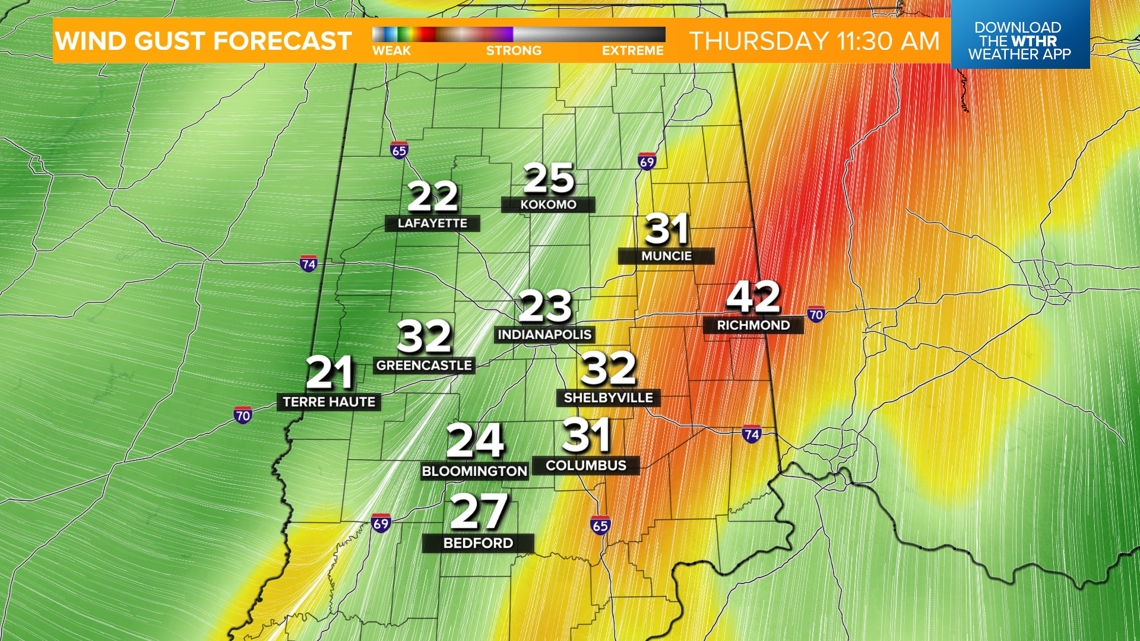
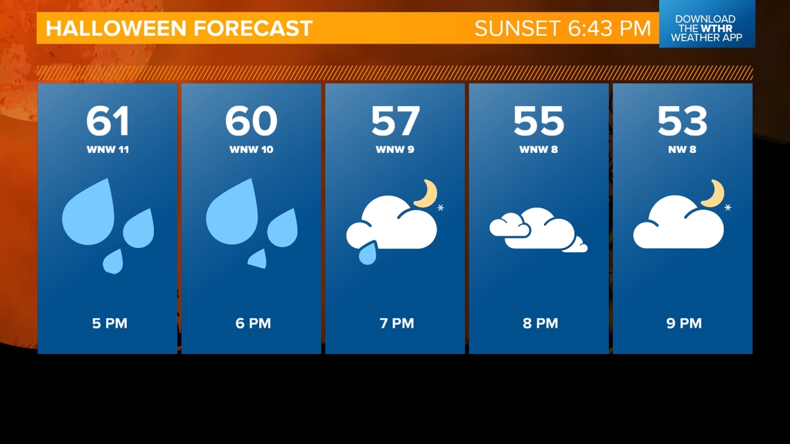
Temperatures will be in the upper 60s in the morning ahead of the front and drop into the upper 50s behind the front Thursday evening for trick-or-treating. The heaviest of the rain will be out of the area by sunset, but a few stray showers could linger Thursday evening.



Will this rain help alleviate drought conditions?
Not completely, but it will help. Most of the area will likely see up to 0.25", with west central Indiana seeing an upwards of 1".
Will this stretch of gusty winds and the rain on Thursday impact our fall foliage?
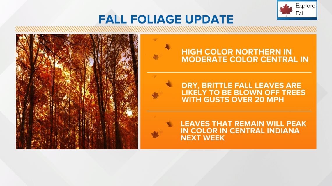
Since it has been so dry this month – and really the entire fall season – the leaves still changing color are likely drier and more brittle than normal. Wind gusts of at least 20 mph will bring many down. Most will fall with the combination of wind and rain Thursday morning.

It will be cooler but clearing on Friday with highs back near 60. Next weekend looks mild with temperatures recovering back into the mid to upper 60s.

