INDIANAPOLIS — We're finally getting a break from the cold and clouds as sunshine returns to kickoff the weekend.
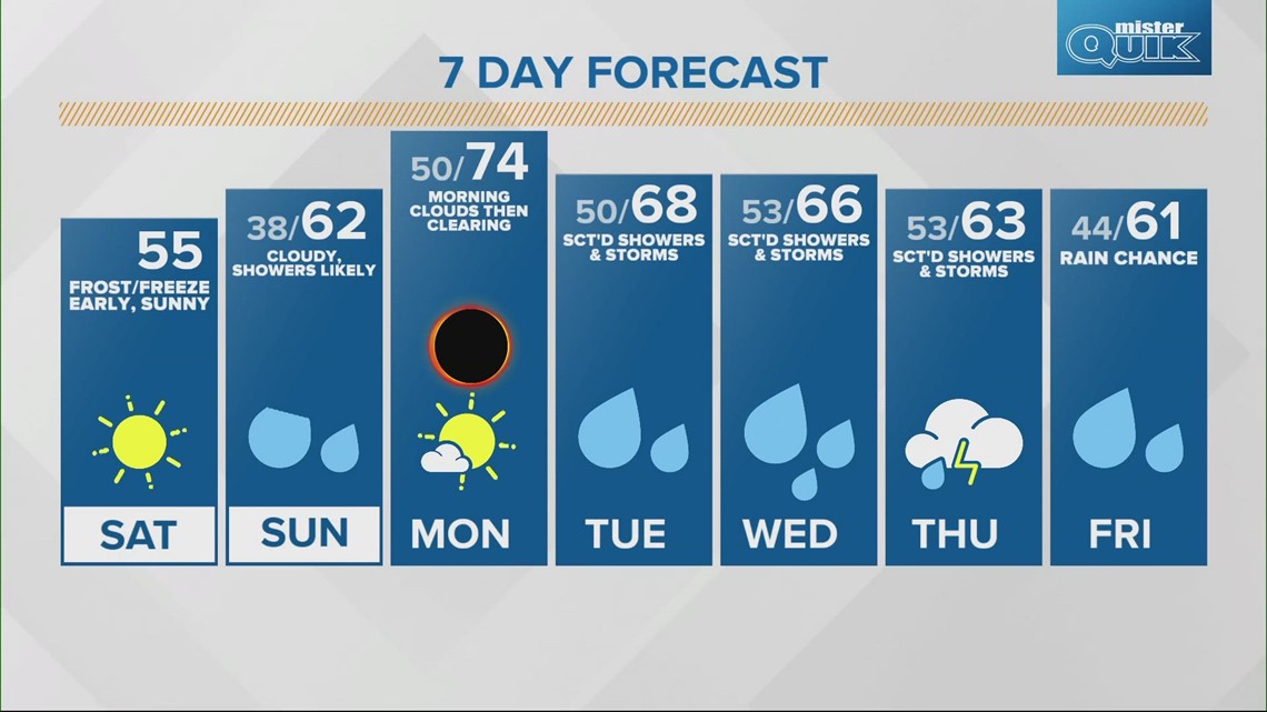
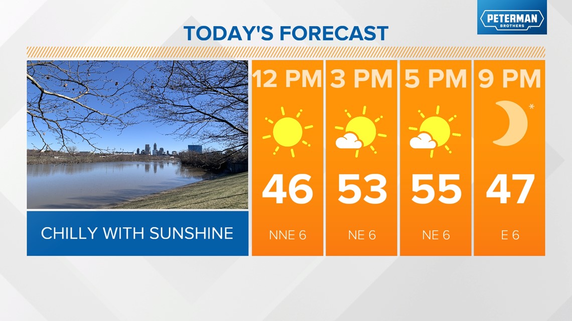
- TODAY: Sunny and more seasonal with highs in the mid 50s.
- TONIGHT: Mainly clear this evening and overnight with lows in the upper 30s.

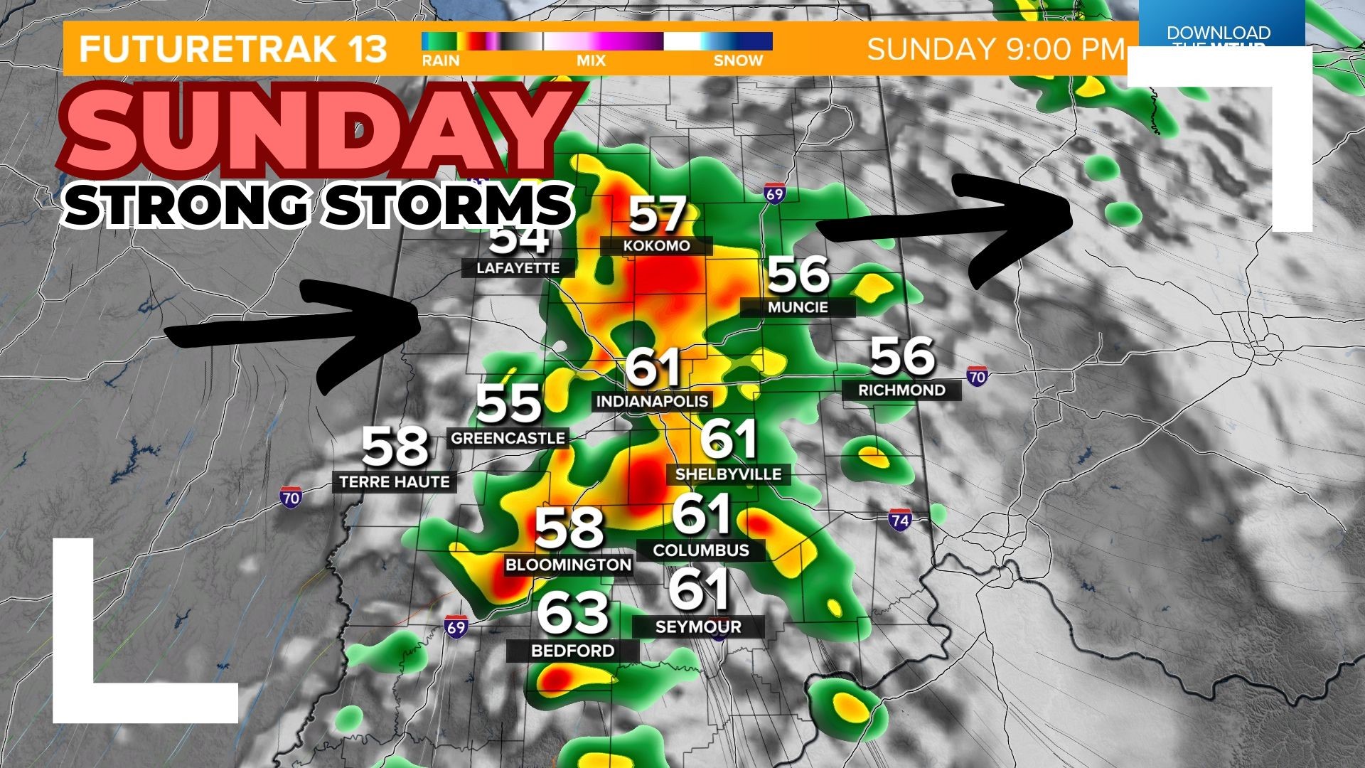
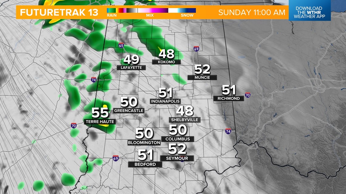
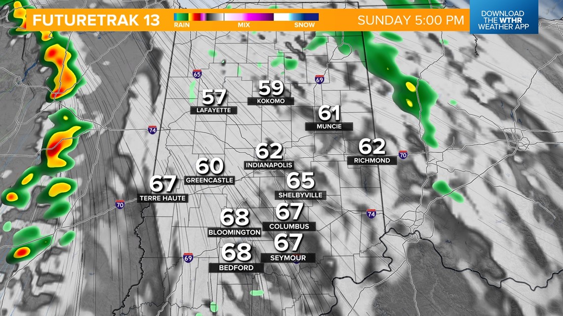
- SUNDAY: Rain chances ramp up in the morning with highs in the low 60s. We'll see several dry hours in the late afternoon with a few thunderstorms possible in the evening.


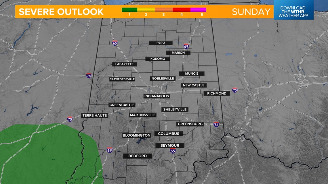
STRONG STORM RISK: The far southwestern tier of the state from Sullivan to Vincennes is under a level 1 of 5 from the Storm Prediction Center for the potential of damaging wind gusts.
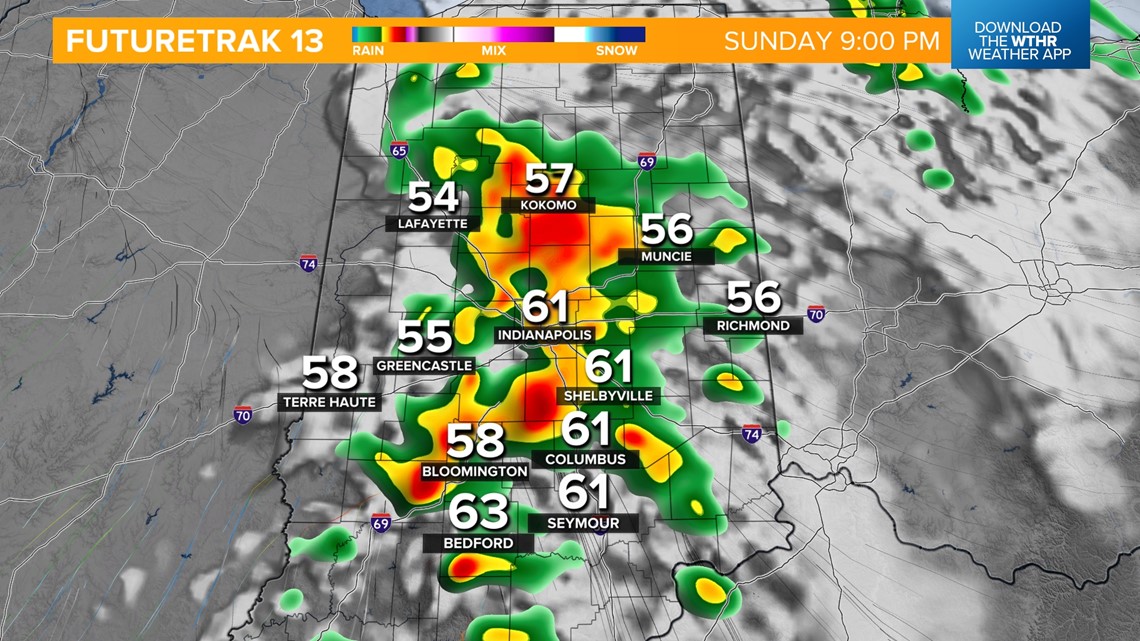
TIMELINE: After 5 p.m. from west to east, storms become more widespread through the late evening and exit the state overnight.


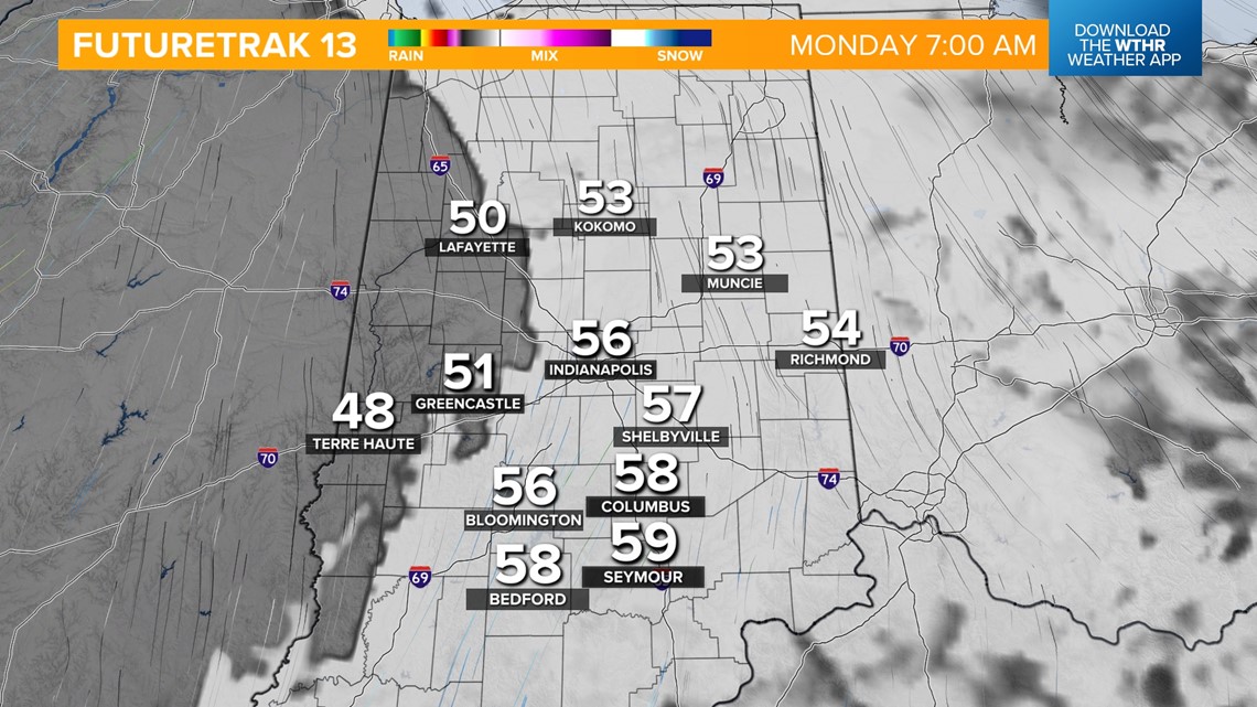
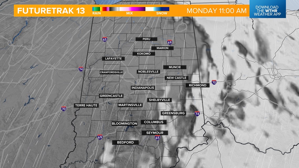
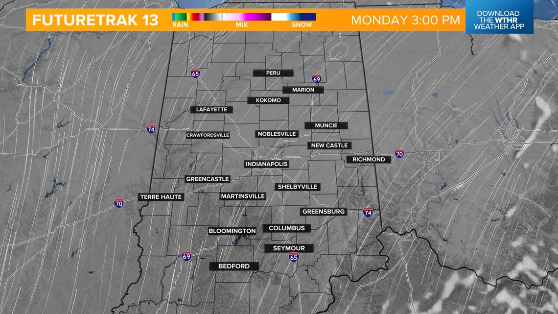
ECLIPSE CLOUD FORECAST: It'll be a mainly cloudy start to Monday, but a good clearing will take place by the late morning.

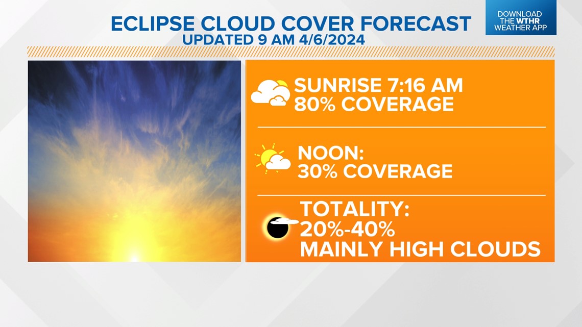
Cloud coverage will be less than 30% when the partial eclipse begins around the Indy metro (~1:40 p.m.) with only a few high, thin clouds during totality (3:06 - 3:09 p.m.). This forecast will set most of central Indiana up for a good view of the eclipse. Temperatures will surge with southwest wind gusts up to 20 mph Monday afternoon with highs in the low to mid 70s.


After the eclipse, the pattern turns more active with daily shower and storm chances starting Tuesday lasting through the work week. Temperatures will be hindered with the additional clouds and rain with highs mainly in the 60s. We're looking at 1-2 inches of rainfall possible from Tuesday through Friday.