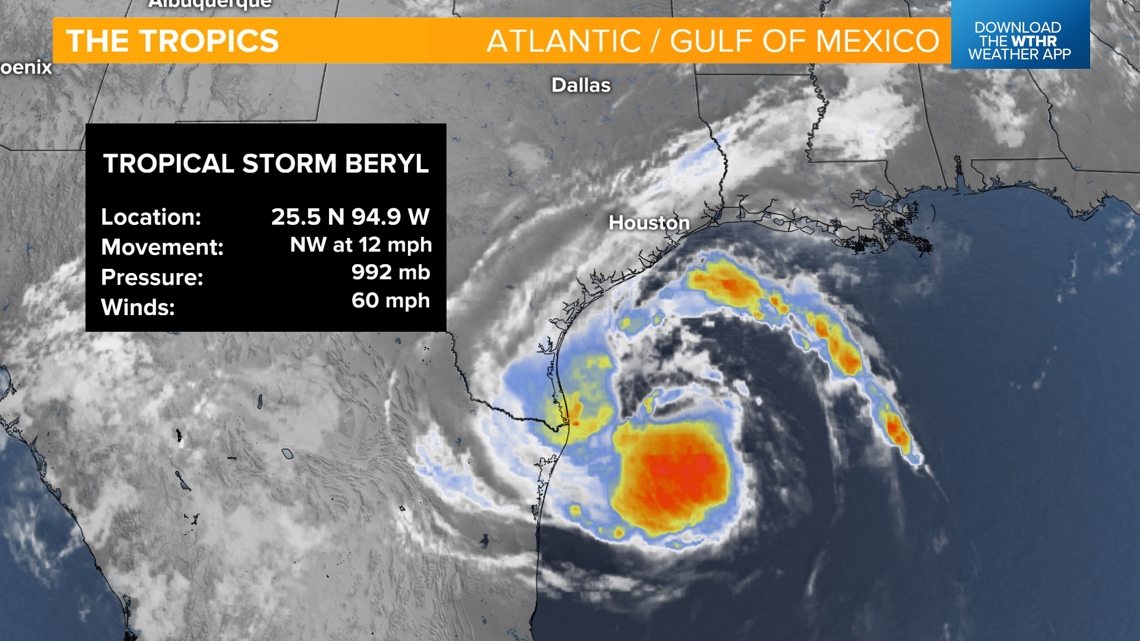
INDIANAPOLIS — We're bracing for the remnants of what is now Tropical Storm Beryl sitting in the Gulf of Mexico. The storm is forecast to strengthen back into a Category 1 hurricane as it approaches south Texas tonight into Monday morning.

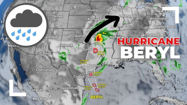
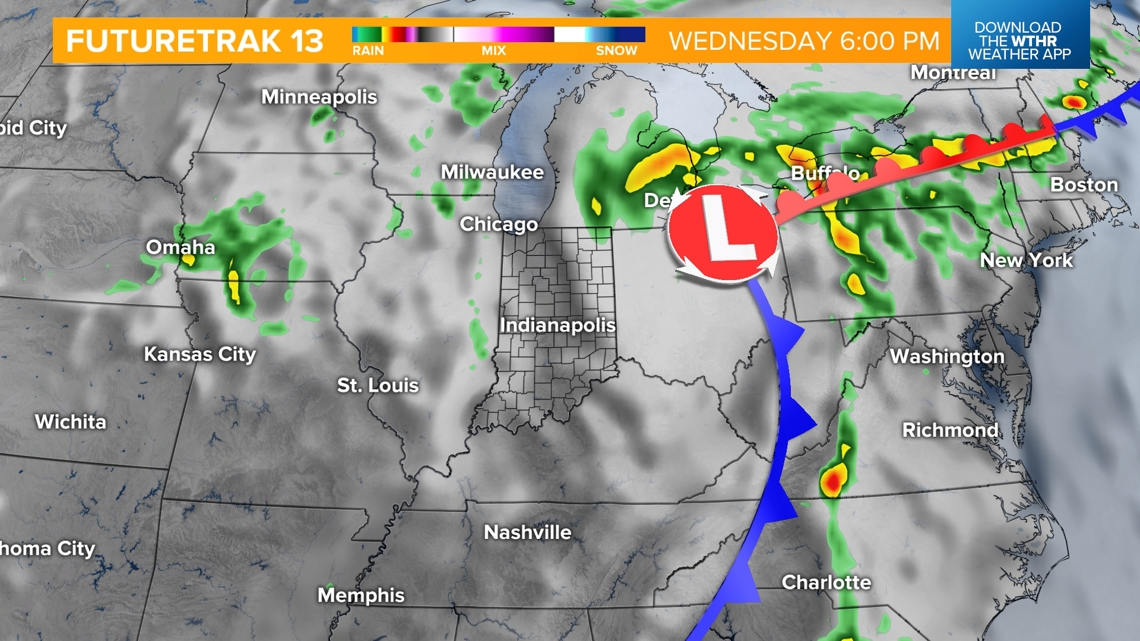
Current weather models are becoming more consistent, taking the track of this system north into the Mid-South on Tuesday and eventually northeast into Indiana.

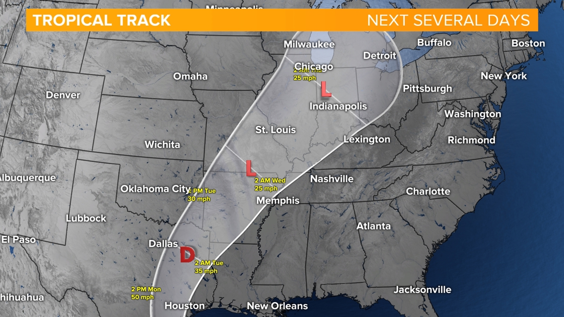
TIMELINE:
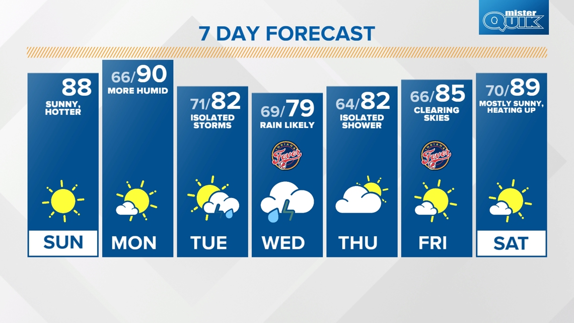
Late Tuesday: Rain, isolated storms move in.

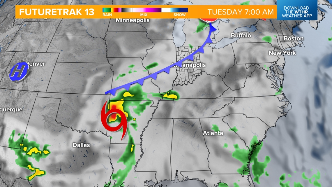

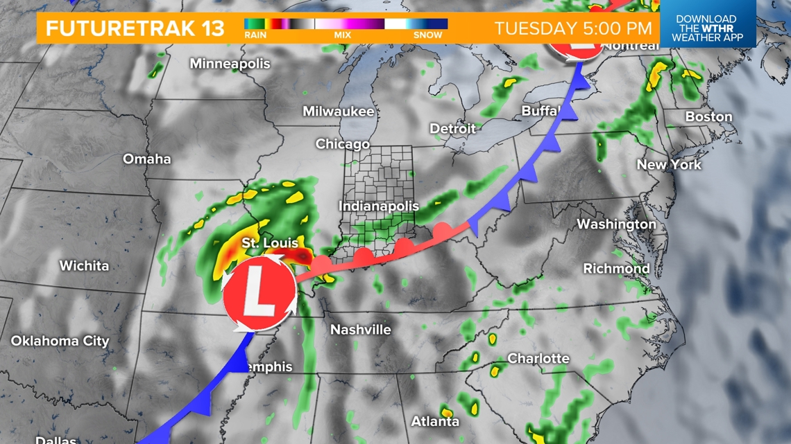
Wednesday: Rain becomes likely in the morning into the afternoon
Thursday morning: Rain tapers off

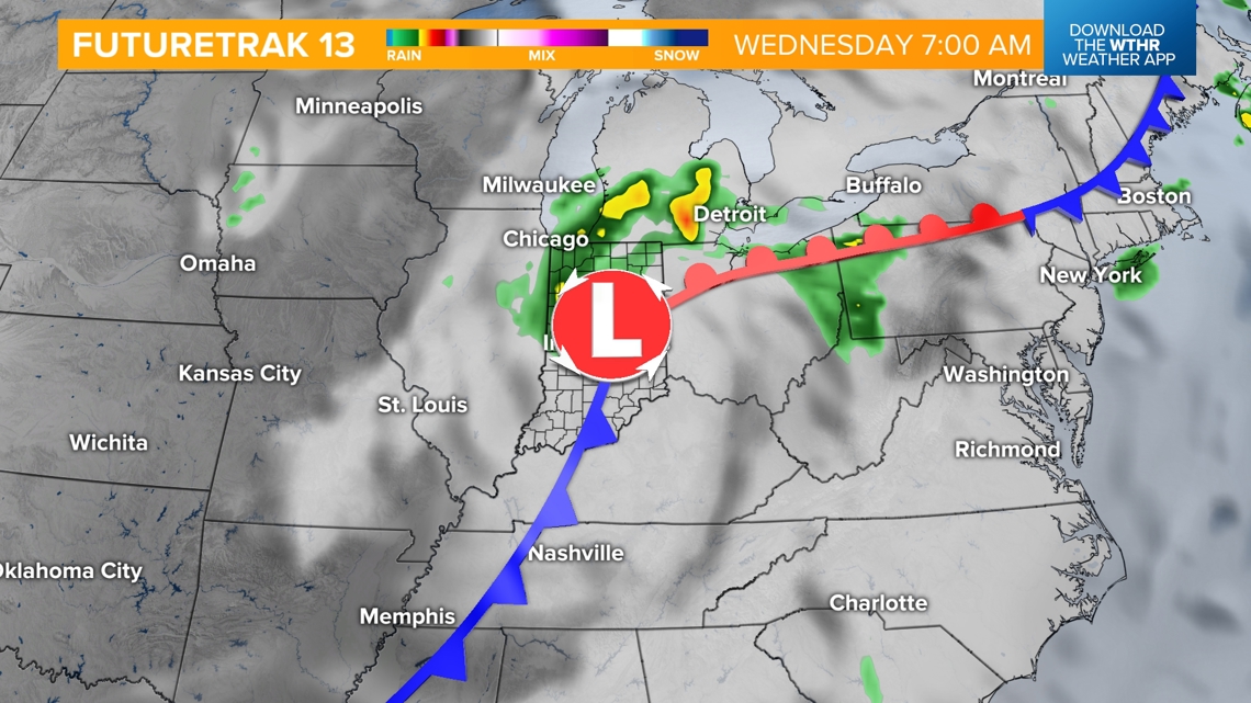

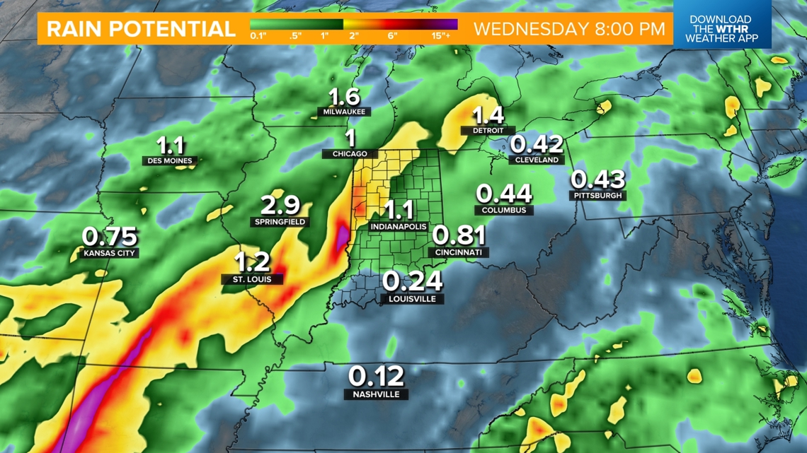
RAIN POTENTIAL:
We'll likely see a few inches of rainfall across central Indiana with northwest Indiana potentially seeing 3 inches more by Thursday morning. This heavy rain could lead to areal flooding in northern Indiana and river flooding elsewhere across the state.

