INDIANAPOLIS — Much Colder Air Arriving Tonight:
The well-advertised cool down the for the weekend is in progress. Temperatures compared to 24 hours ago are some 20° cooler with the coldest air yet to come.
A strengthening northerly-northwesterly wind this evening is gusting to near 30 mph at times. A steady diet of a brisk north-northwesterly wind delivers the much chillier air to open the weekend.

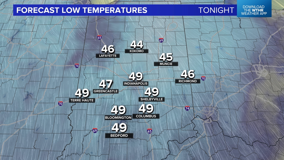

It will be quite a contrast Saturday morning in the 40s compared to near 90° highs we had just Thursday afternoon! That's a 50°+ drop in 36 hours if you're counting and it will be even colder Sunday morning.
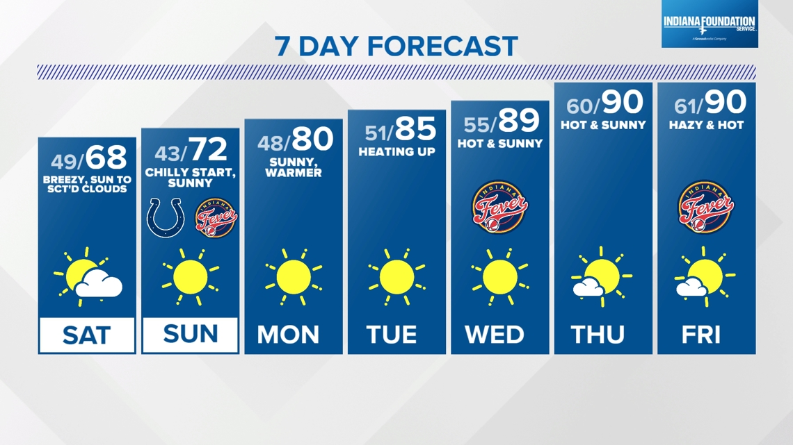
Saturday begins chilly and sunny before low clouds develop due to daytime heating. Areas downwind of the fetch coming off of Lake Michigan likely have greater lake-induced cloud cover at times Saturday afternoon. Highs tomorrow with the brisk flow remain in the 60s and a light jacket is a good idea even in the heart of the afternoon.
College Football Saturday Forecast:


Colts Tailgate Sunday Forecast:
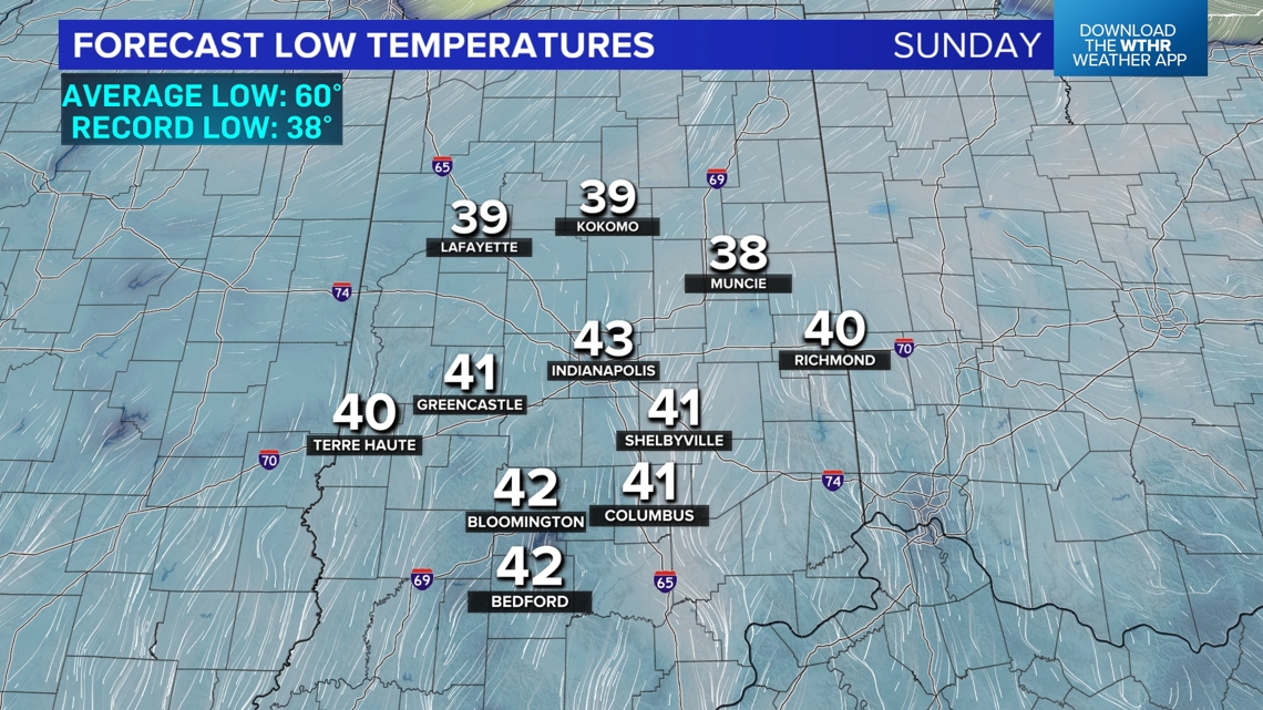
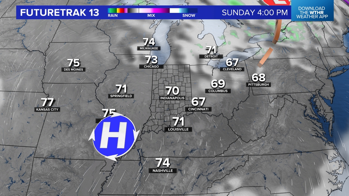
Any cloud cover diminishes after sunset Saturday to set the stage for our coldest temperatures since April come Sunday morning. We're forecasting low to mid 40s for the Indy metro area with rural areas dropping into the 30s. While the daily record low Sunday morning (38° / 1986) looks safe in Indianapolis, the forecast of 43° is nearly 20° below average. There will be plenty of 30s on the map early Sunday and we wouldn't be completely surprised to hear of frost on windshields, roofs, etc.


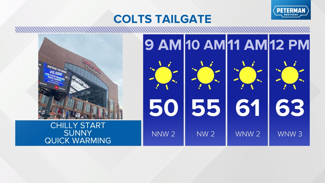

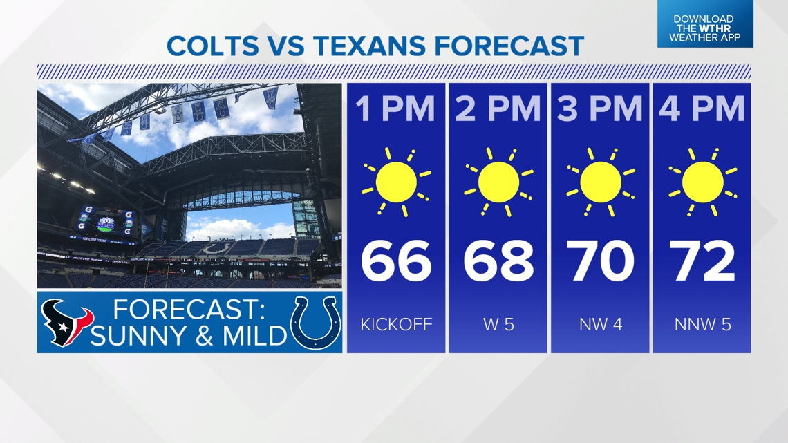
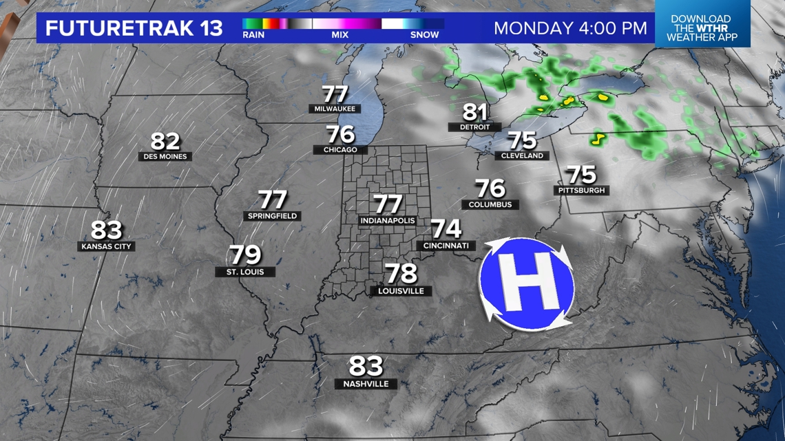
Thankfully for Colts fans, the chilly start Sunday morning warms quickly and we're expecting a beautiful afternoon in the 70s. Sunday afternoon looks absolutely spectacular with abundant sunshine, a light wind, and pleasant air. High pressure that brings the chilly starts this weekend will slide to east Monday and thus begins the warm up for next week.


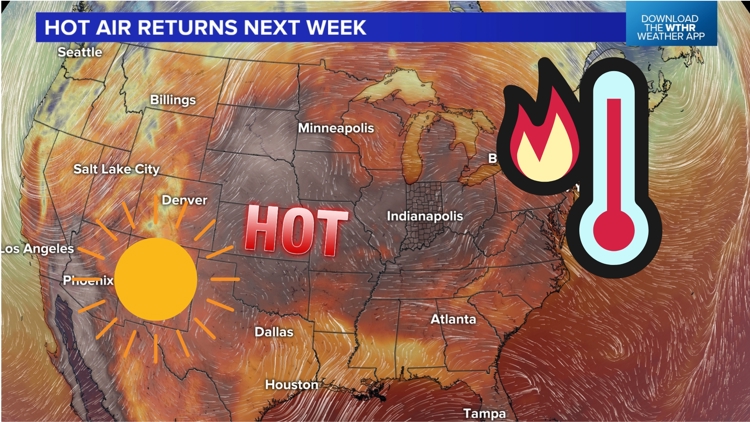
Sunny, Hot Streak Next Week:
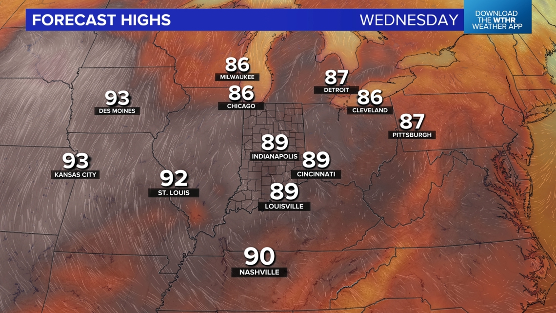
The cooler air this weekend is a quick hitter and the warm-up next week will be rather quick and have some staying power. We're expecting a string of sunny days with highs warming to near 80° Monday, mid-80s Tuesday, and near 90° Wednesday-Thursday. The sunny and unseasonably hot days exacerbate the growing drought conditions in Indiana.
Indianapolis won't be far from record high temperatures in the mid to latter half of the week and a good 10° above average.
Wednesday Record High: 95° / 2013 Forecast High: 89°
Thursday Record High: 96° / 1897 - Forecast High: 90°