INDIANA, USA — February warmth comes at a price in Indiana. It's so nice to thaw out, but the atmosphere usually will throw a cold front at us quickly after a few nice days.
Quick weather rundown this week:
- MONDAY: Near-record warmth across Indiana
- TUESDAY: More clouds, scattered rain, evening strong storms and overnight storm chances
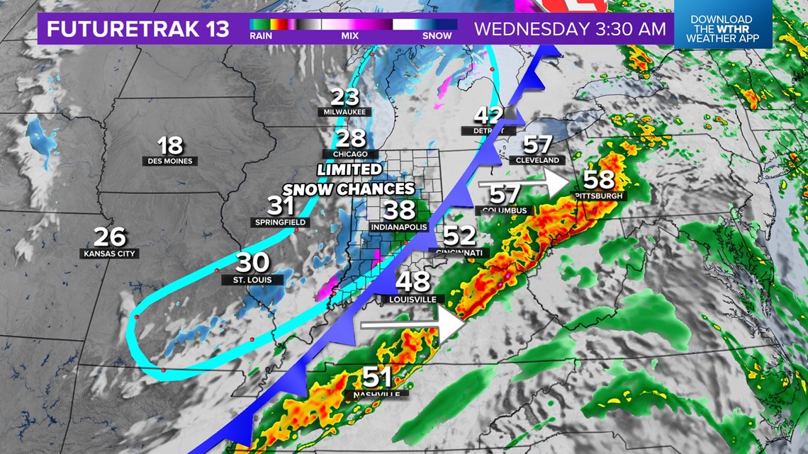
- WEDNESDAY: Morning storms, dropping temperatures, limited snow chances
Tap HERE for our interactive radar to track the storm system as it moves in from the west.
How quickly is this cold front coming into Indiana?
Not only do we track temperatures on the ground, but also higher up. There is a big push of colder air at all levels of the atmosphere heading toward Indiana. This is helping drive a powerful cold front south and east from Canada and into the Great Lakes. The leading edge of the cold air arrives Wednesday morning. Before then, expect the storms while the final hours of the warm air linger Tuesday night.

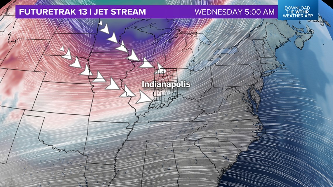
The darker colors on the jet stream map show the coldest air. Indiana will get a better mix of cold air aloft, plus warm air on the ground to help create instability to spark severe storms.
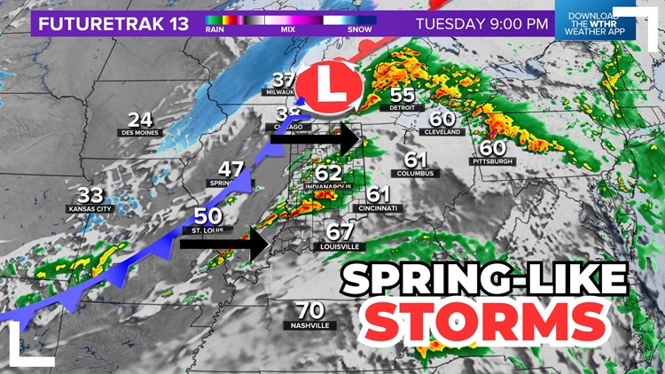
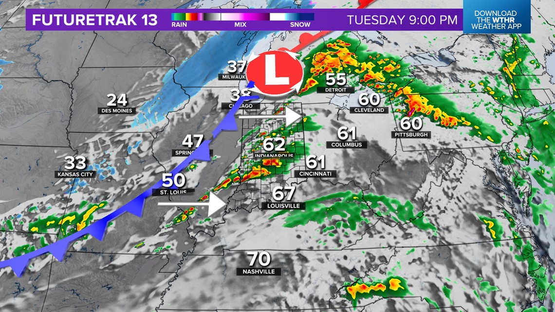
Timing will be adjusted as we get closer to the storm event, but generally, expect the cold front will start approaching the Illinois-Indiana state line after sunset on Tuesday. As that happens, severe storms are likely to spark near the state line and march east into the night and early Wednesday morning.

How bad will the storms be?
The main threats will be wind and hail as these storms push east. There will be some rotation in these cells, so a tornado or two cannot be ruled out. Timing will be a big factor in this storm:
- Faster timing — storms earlier Tuesday evening
- This may bring stronger storms as daytime heating helps bolster stronger storm development.
- Slower timing — storms later into Wednesday morning
- This may give the storms a chance to slowly weaken as they get into Indiana, although one or two cells can still remain very intense.
Generally, expect scattered downpours with lots of thunder at times across Indiana. Some cells will help small-medium hail stones. Some storms may also form into a line, creating gusty winds 60+ mph. There will be some low chances for tornadoes.

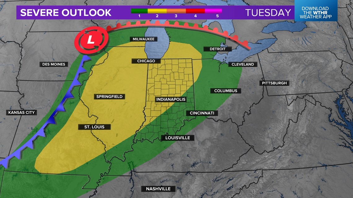
Who will get the worst severe weather?
As the front presses east, we are watching where moisture levels (dew points) can rebound the fastest, plus where the heart of the cold air above will be and its angle of attack.
Generally, the strongest storms will likely be in eastern Illinois and western Indiana. This map below will be updated multiple times for severe zones. Check for updates.