INDIANAPOLIS — You can't ask for much better weather on July 1 than the comfortably mild air and mixed sky we had today in central Indiana. For my money, it was some of the best weather across the country.
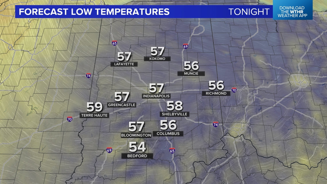
The 55° official low in Indianapolis was the coolest July 1 low since 2008 and one of only 14 July 1 days with a low that cool. Tonight will be equally as cool and comfortable with lows back in the 50s. This offers you the chance to keep the air conditioner off and windows open if you'd like before a surge of miserably humid air hits mid-week.
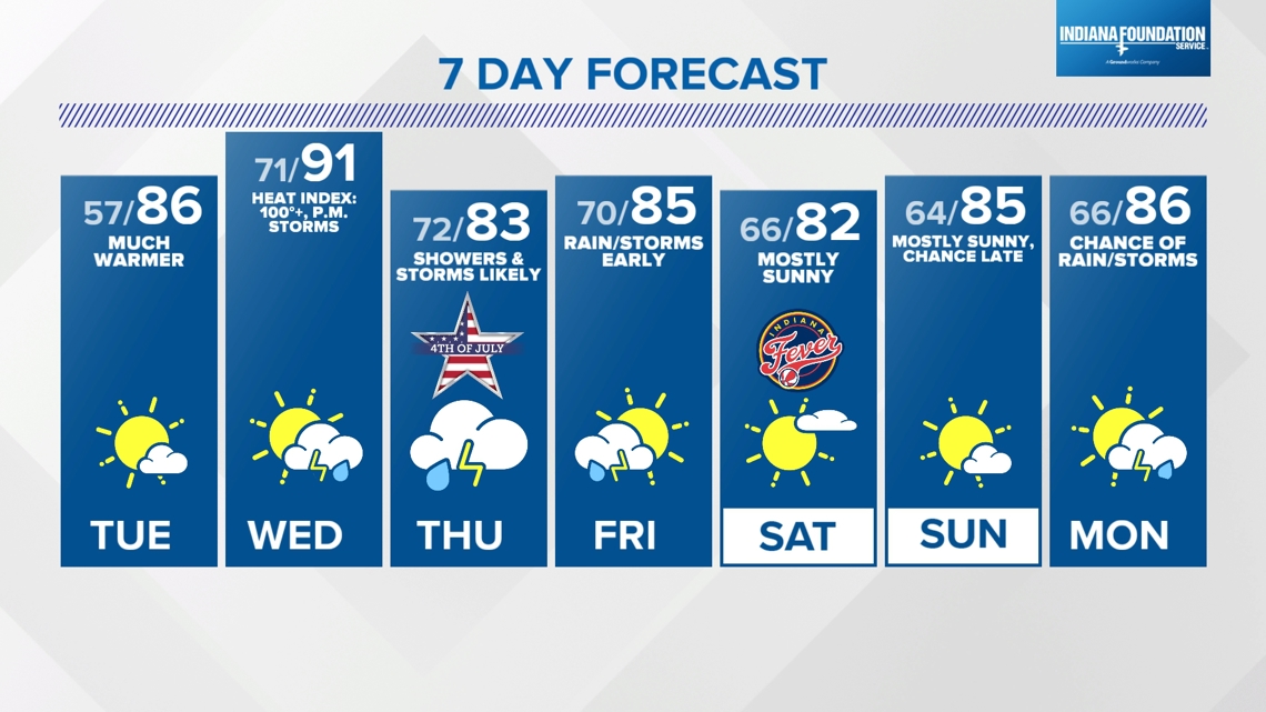
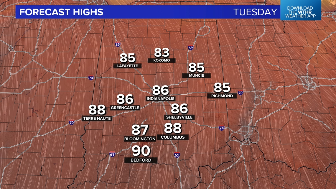
But not before another pleasant day around here on Tuesday. It will be much warmer Tuesday afternoon in the mid/upper 80s, but the Muggy Meter won't be too bad until later in the day.


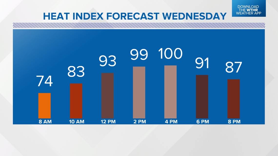
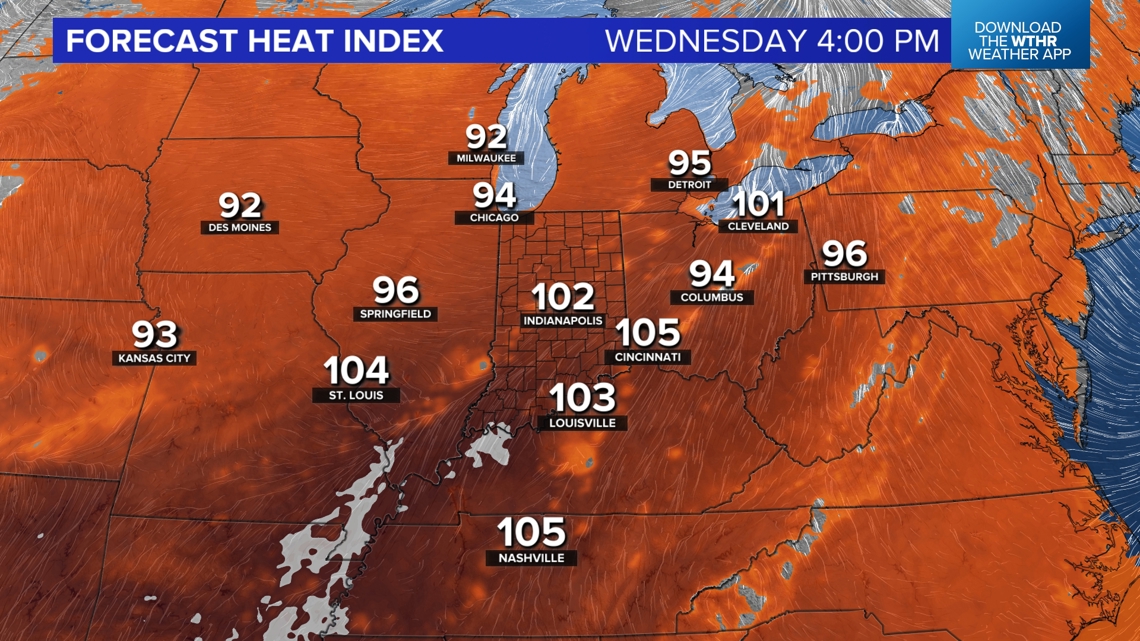
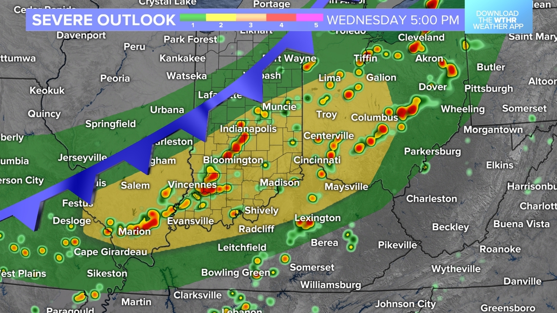
However, Wednesday will be miserably muggy as a quick surge of tropical moisture spreads into the with dewpoints well in the 70s. That's the "air you can wear" and as it teams up with highs in the 90s, heat indices peak in the 100°-105° range Wednesday afternoon.


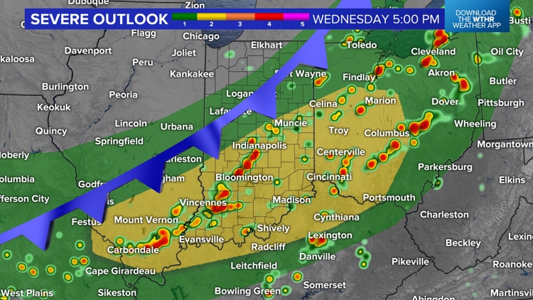
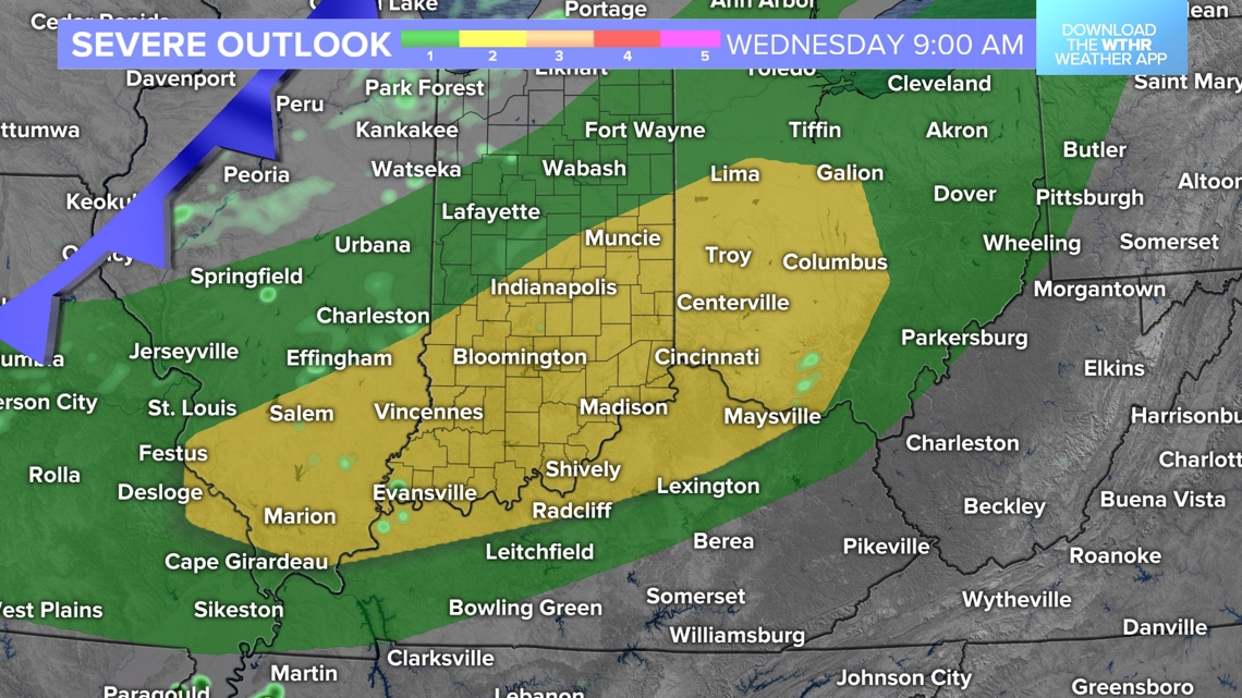
In addition, we'll be on radar watch, too, with the expectation of scattered to numerous storms developing in the afternoon/evening. It's too early to say where the greatest storm coverage and severe potential will be specifically, but clusters of storms pose damaging wind potential where they track.


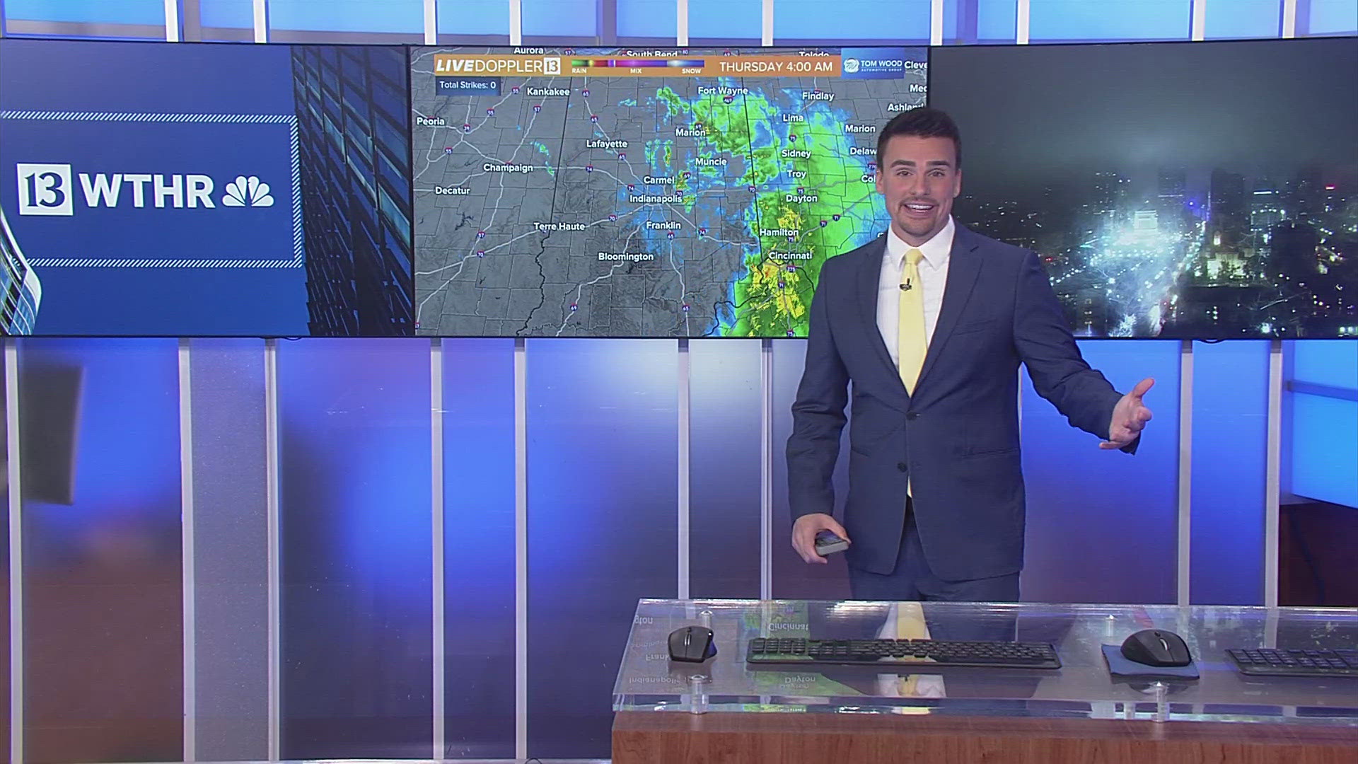
Our weather remains unsettled for the Fourth of July with rounds of showers and thunderstorms. Rain will be heavy at times due to the mugginess of the airmass and this lingers into early Friday before a brightening, less humid weekend.

