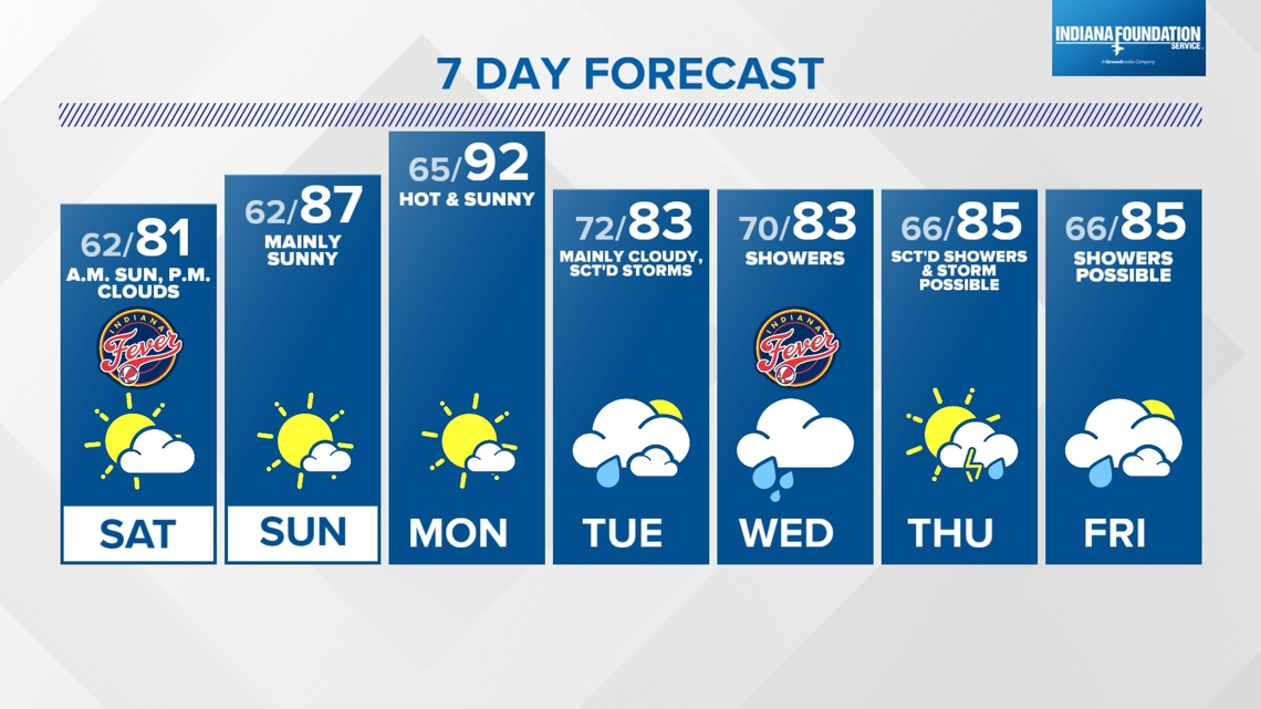
INDIANAPOLIS — Afternoon splash-and-dashers give way to increasing sunshine after their narrow, scattered axis gradually move eastward through central Indiana. In their wake will be a wind-shift to the west-northwest and eventual drop in the Muggy Meter as dewpoints fall into the lower 60s. That will be a much better feeling airmass than the swampy air we've sweated through the past several days.

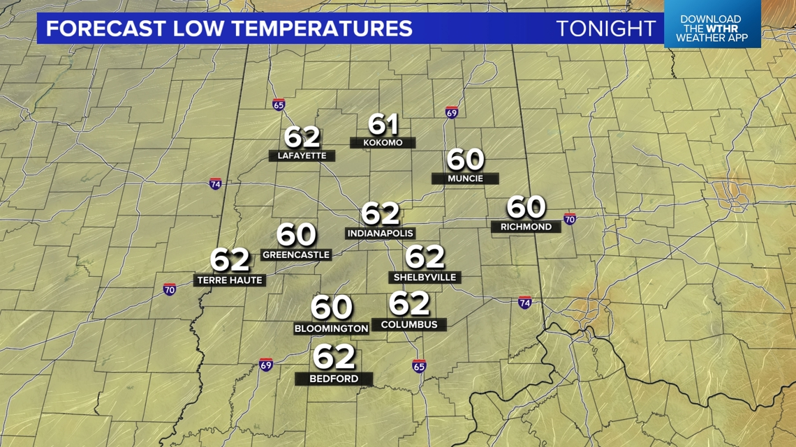


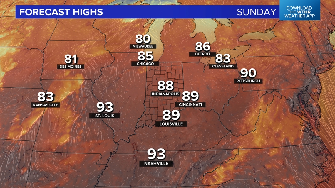
The timing couldn't be better for your weekend plans. Lows in the 60s tonight should feel refreshing Saturday morning. There may be some fog early Saturday but otherwise expect plenty of sun that mixes with scattered cumulus clouds in the afternoon. Comfortable highs in the lower 80s Saturday afternoon give way to upper 80s to finish the weekend on Sunday.


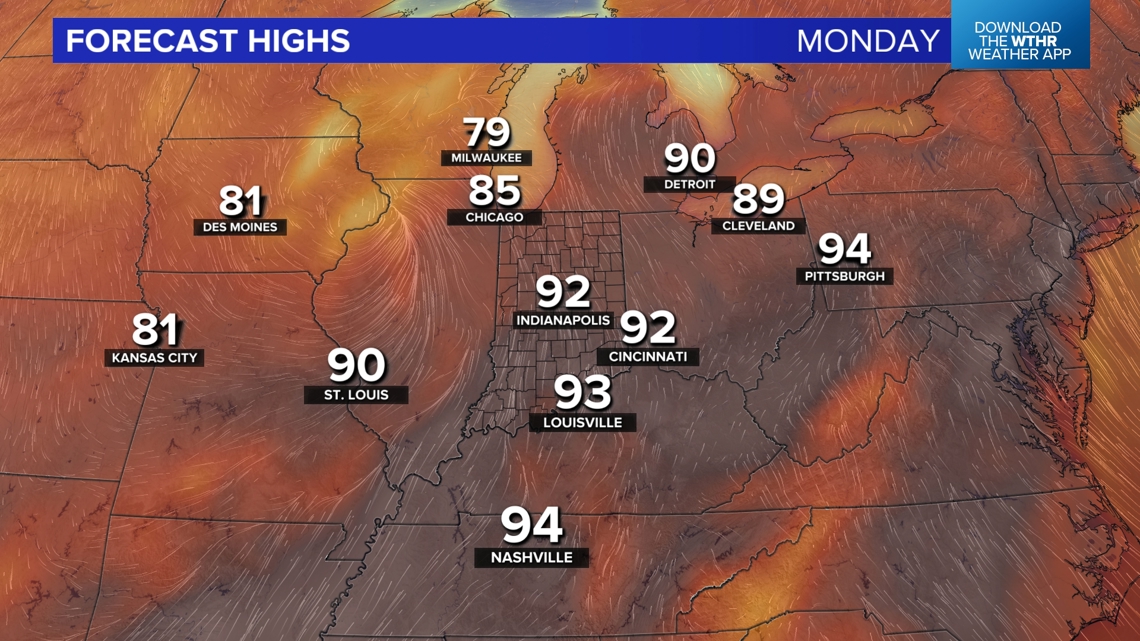
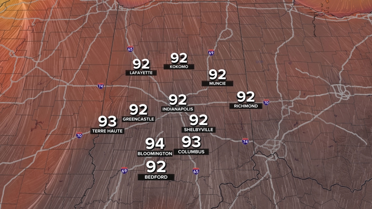
The hottest temperatures look to be Monday afternoon with sunshine and lower 90s. This precedes the potential of remnant moisture from what's left of Beryl creeping into the Ohio Valley sometime next week to maybe bring us some rain. Stay tuned.