INDIANA, USA — What will winter be like this year? More snow?
While summer still rages on with lots of heat and humidity, you may wish for colder days ahead. In some parts of the United States, slightly colder than normal weather is possible this winter. NOAA has issued a La Niña watch for winter 2024-2025. There is an 79% chance La Niña takes hold this fall and winter.
This pattern can enhance snow in places and reduce it in others. Indiana's snow chance will likely be higher this year.
Tap HERE for the latest day-to-day forecast from the 13News weather team.
This is a very early outlook for the upcoming winter. Last winter, we had below-average snowfall. On average, we pick up 25 inches. We haven't had more than 25 inches since winter 2013-2014 (52.2" record for winter).
Precipitation
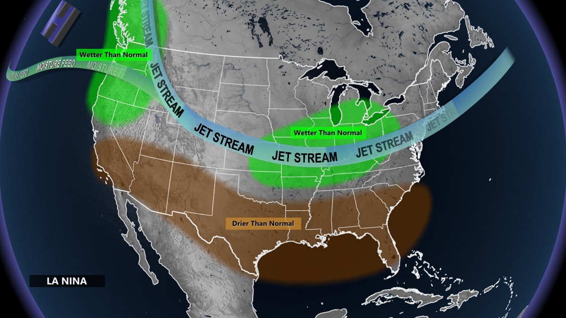
Rain, snow, ice... it's all possible in Indiana during the winter. Which one we get is determined by our temperatures. However, you have to get moisture to Indiana to make the precipitation in the first place. La Niña helps enhance how much water comes overhead to create rain and snow.


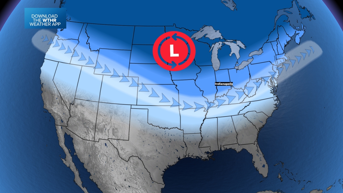
The polar jet is likely to be more active over the southern Great Lakes. While it will not snow or rain all the time, we are expecting more clouds and more chances for some rain and snow.
Temperature
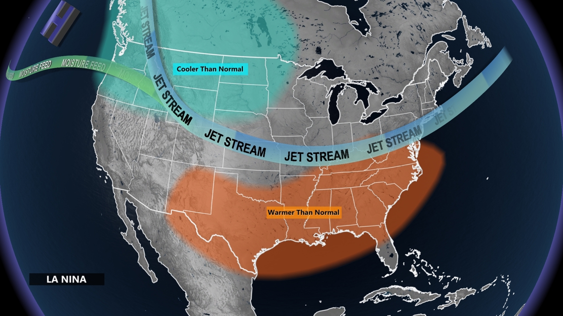
A farther south jet stream will allow for more chances for cold air outbreaks. Expect lots of flips between warm air and cold air this winter.


The western half of the jet stream will likely be more constant over the northwestern United States, keeping conditions consistently colder. However, more swings near Indiana will bring more chances for "weather" and lots of changes between warmer and colder days.
Much of the south will be expecting warmer than normal conditions as the jet stream will have a harder time pushing south of I-40 from Oklahoma to Tennessee.


Snowfall
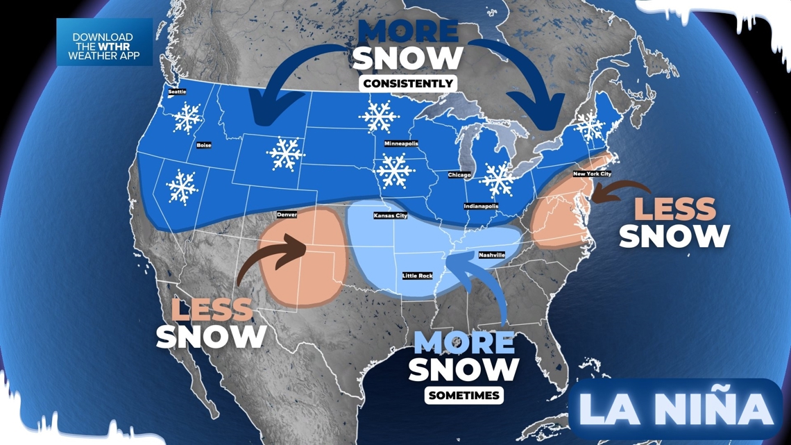
Snow is tough to forecast long-range. You need cold air and moisture to meet at the same time. Many times, you can have one or the other, but not always both at the same time. Generally during La Niña winters, we do see an increase in the combination of both happening at the same time.
If you look closely in the data for La Niña, not all years are the same. In the dark blue areas, we fairly consistently have near or above-average snowfall. In areas of light blue, it goes either way. Sometimes, we get blasted, while other winters are tame. The data is more erratic. In areas of brown, we see less snow more often.


Indiana is in the dark blue zone, highlighting the chance for more snow this winter.
We will have more winter outlooks as we get closer to the colder season. This is a very first early look as NOAA issues that La Niña watch.

