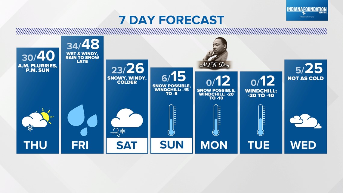
INDIANAPOLIS — We're wrapping up what's been a cloudy, blustery day in central Indiana with overcast keeping temperatures in the lower to mid-30s and wind chills in the lower to mid-20s.
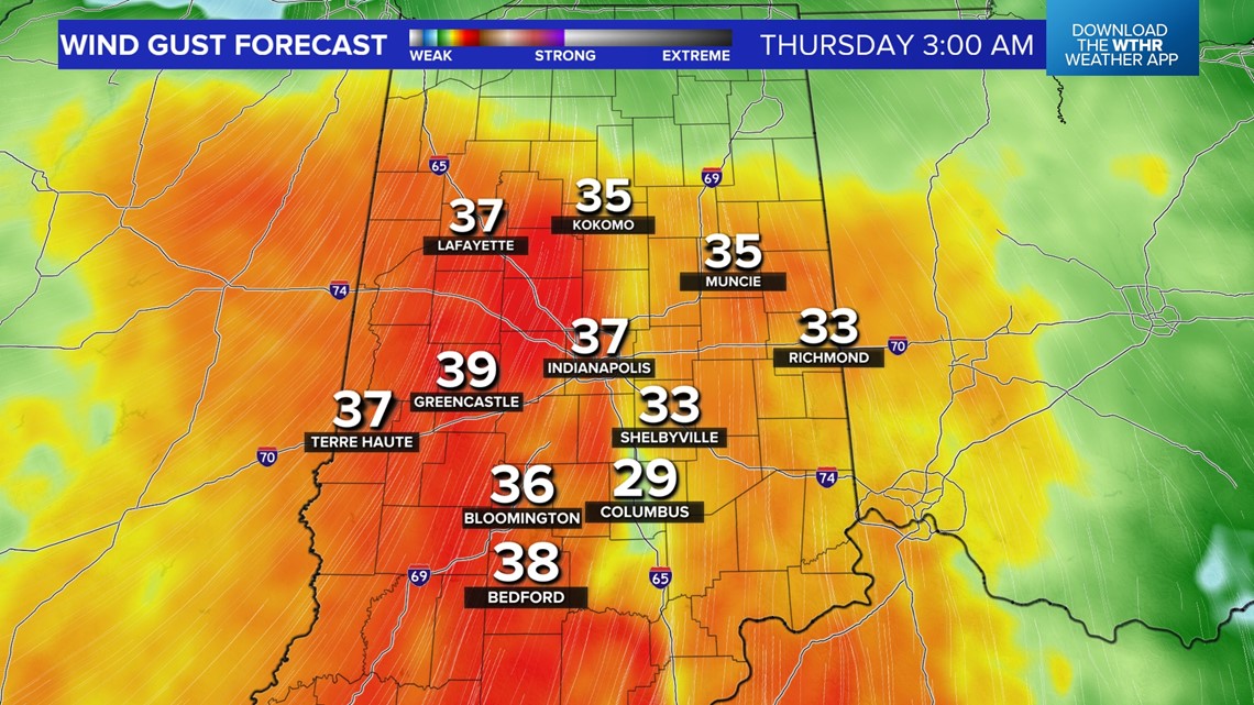
The second of the three weather systems this week arrives overnight. While it will be the "weaker" of the three, it brings another night of wind gusts peaking in the 35-40 mph range between midnight and 7 a.m.


In addition, some wind-whipped flurries/snow showers are possible later tonight into the morning commute. It will be another blustery day tomorrow with limited sunshine until maybe the afternoon.
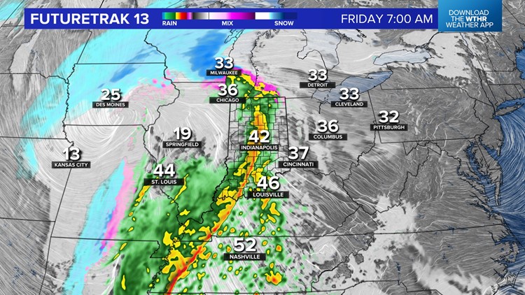
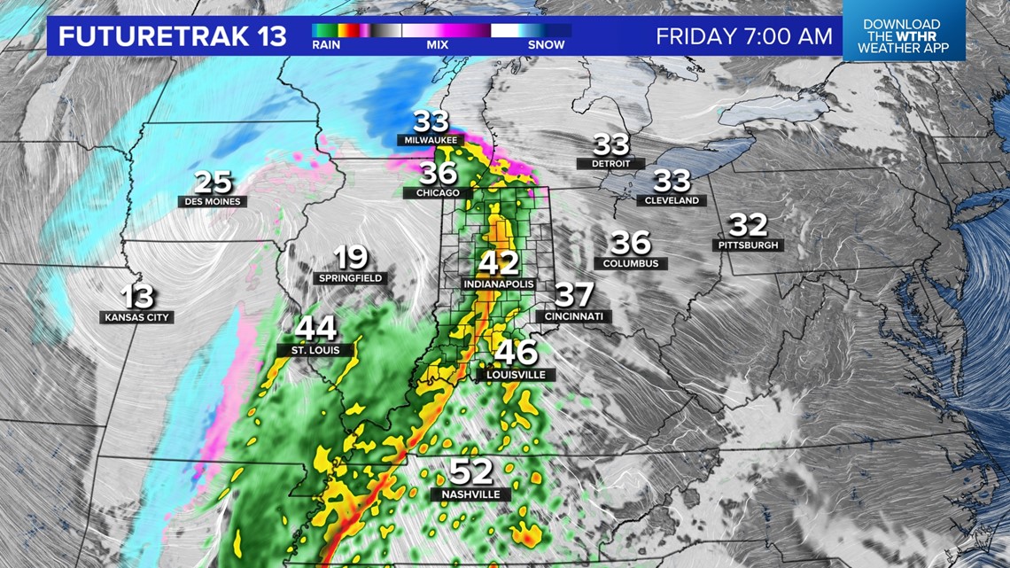
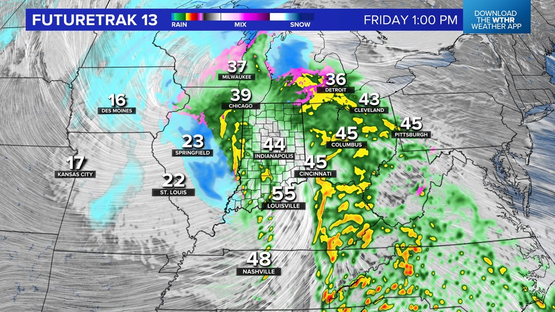
All eyes are on the third, and likely stronger, of the systems this week. We're now within the 48-hour forecast window of this storm. And forecast confidence continues to increase that the Friday storm is more wet than white for us in central Indiana.


Yes, there will be some wraparound snow that could accumulate from a coating to a few inches north. But the main band of heavier snow will be way north-northwest along/north of the Michiana border into the western Great Lakes.
There could still be some wiggle room in the track, but for now, this is a rainmaker — a much-needed rainmaker to an area in moderate to severe drought. It delivers another 1"-2" of liquid that is mainly rain for central Indiana.

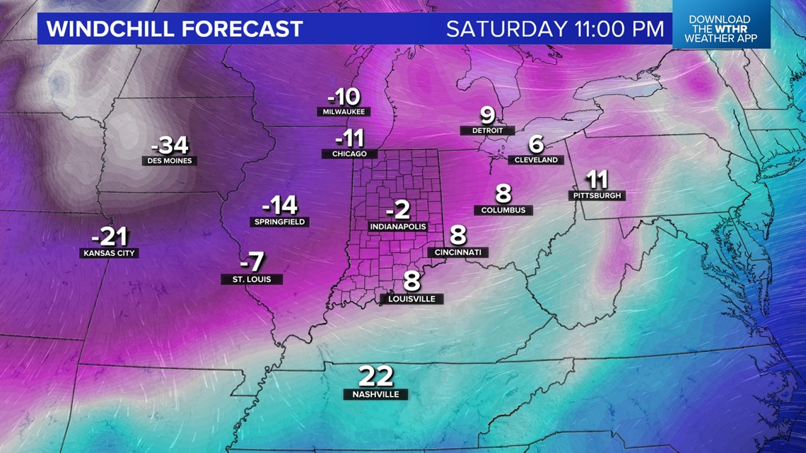
Though we're dodging heaviest snow, we're not dodging strong gusts near 50 mph Friday night and bitter wind chills dropping sub-zero Saturday night. This begins a bitter streak of days of sub-zero wind chills, highs in the teens and lows near/below zero.
Bouts of snow will be possible within the bitterly cold air, but for now, trying to time out disturbances is highly uncertain. Please check back frequently for updates.