

INDIANAPOLIS — We'll recover to the upper 30s for highs this afternoon with increasing clouds. Our next weather system is set to arrive after 5 p.m. as mainly rain across central Indiana.

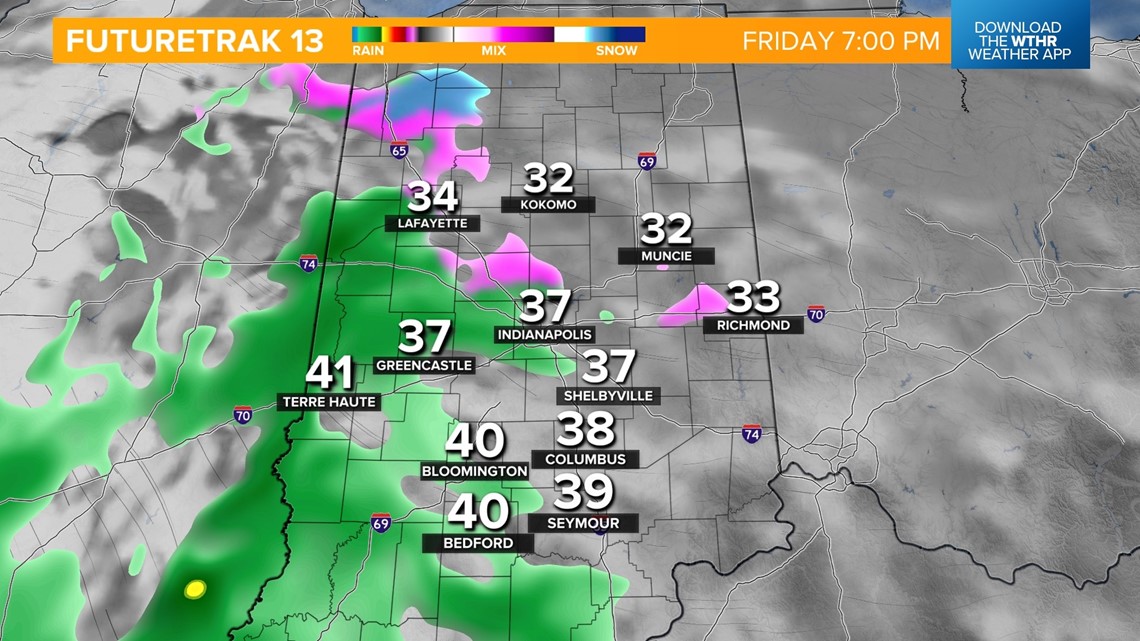
As temperatures drop overnight, we'll see rain mixing with snow, especially across the northern tier of the state.

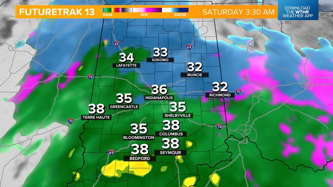
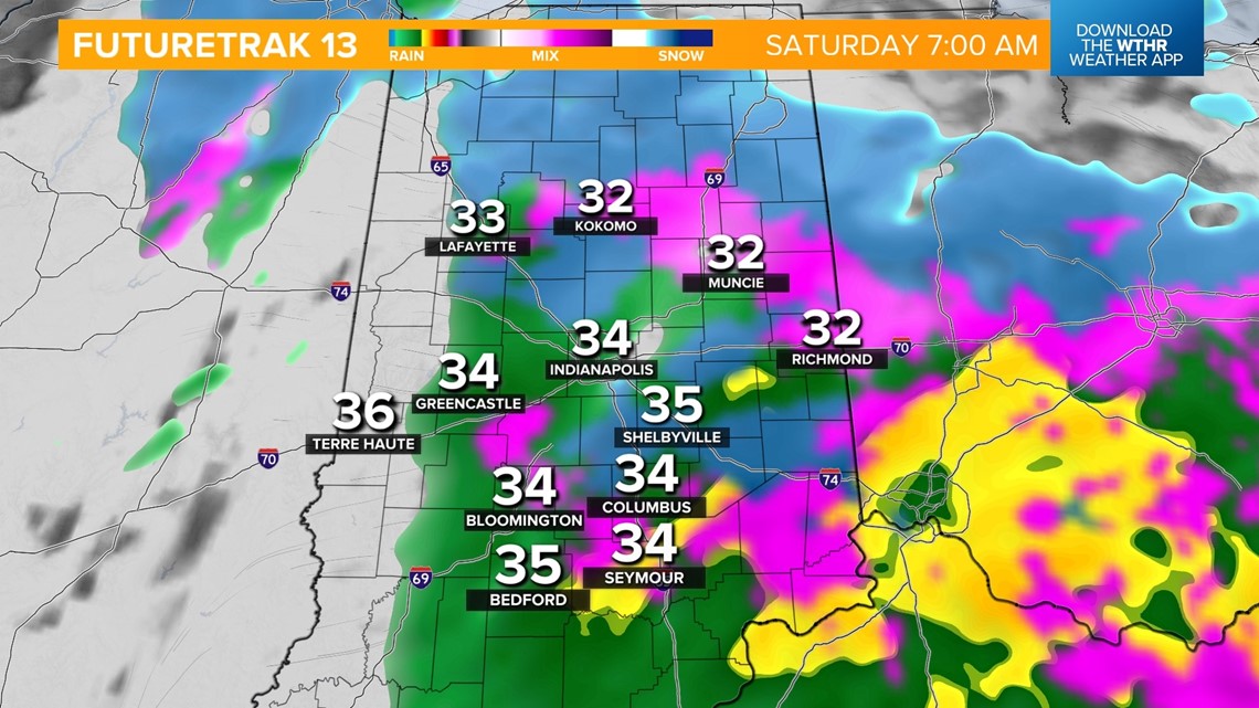
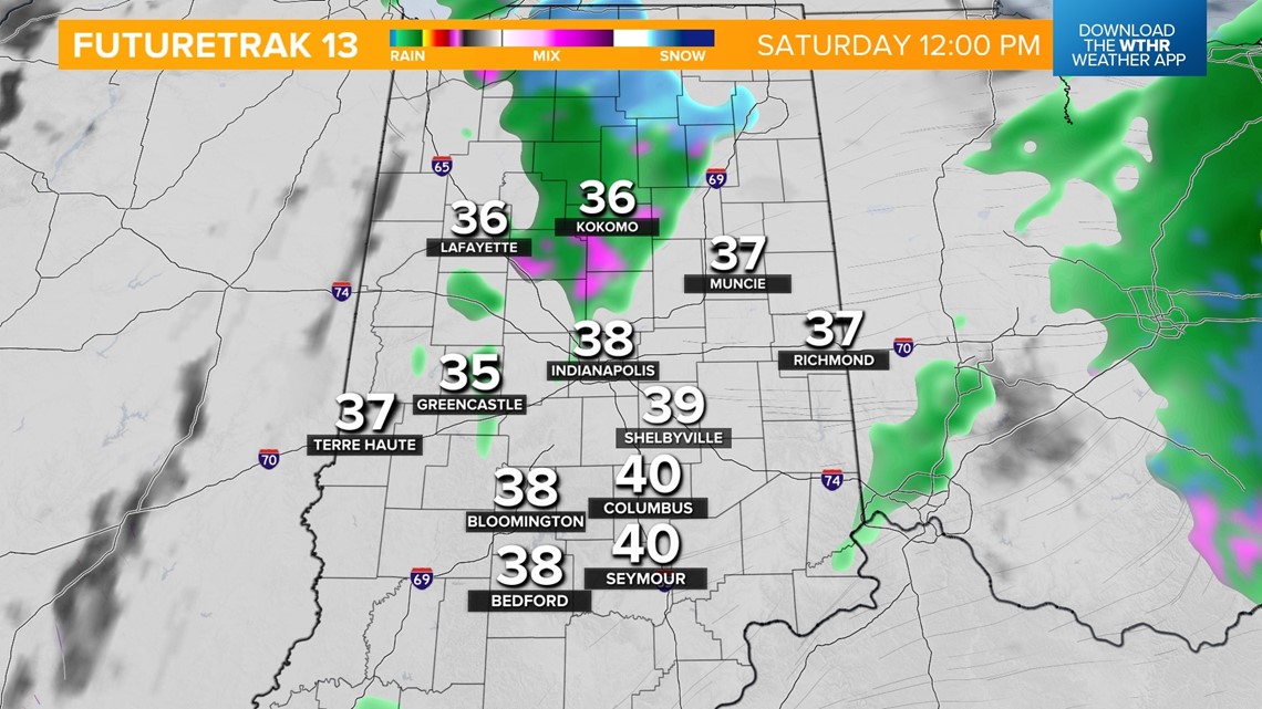
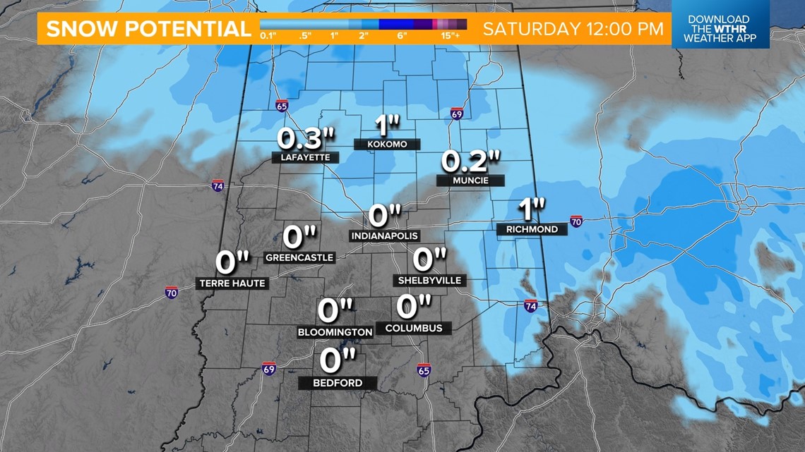
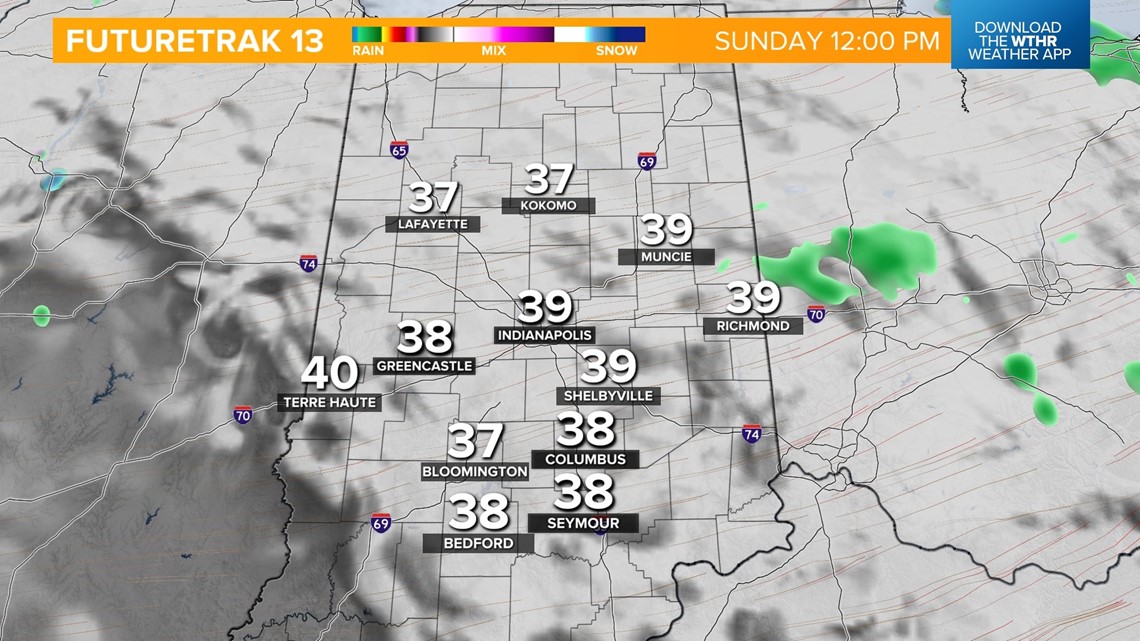
This wintry mix will continue through early Saturday, exiting by the afternoon. Areas north and east could see up to 1" of snow accumulation but will likely compact and melt as highs rebound into the upper 30s.


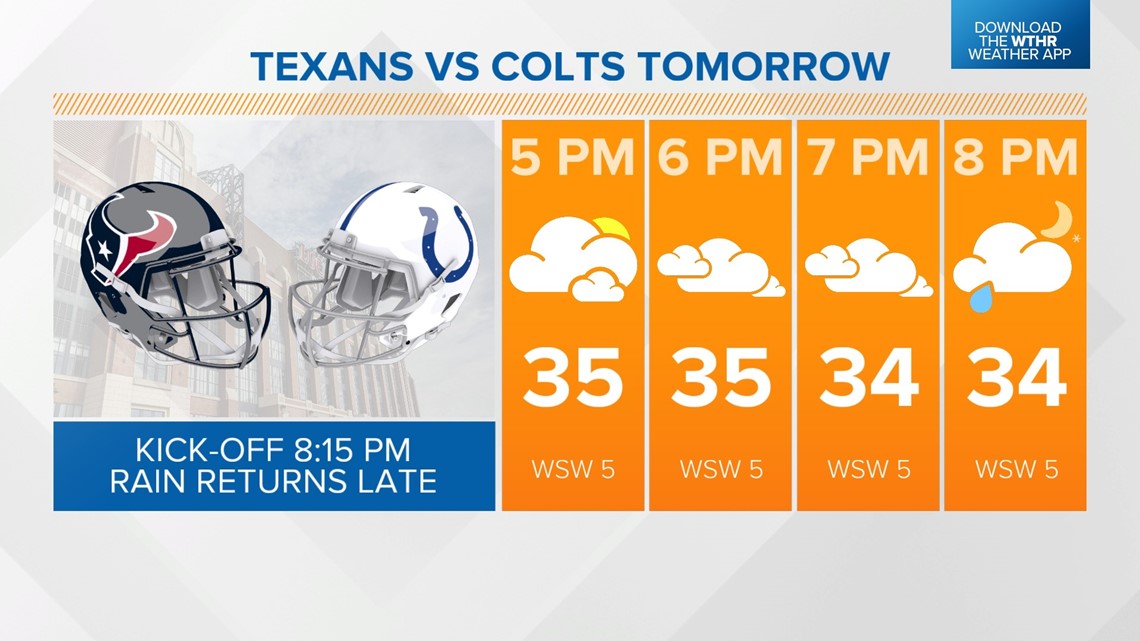
We'll be mainly dry for the remainder of the afternoon with only a stray rain shower possible for Colts tailgaters. Rain chances will again increase with a second wave moving in toward the end of the game Saturday night.

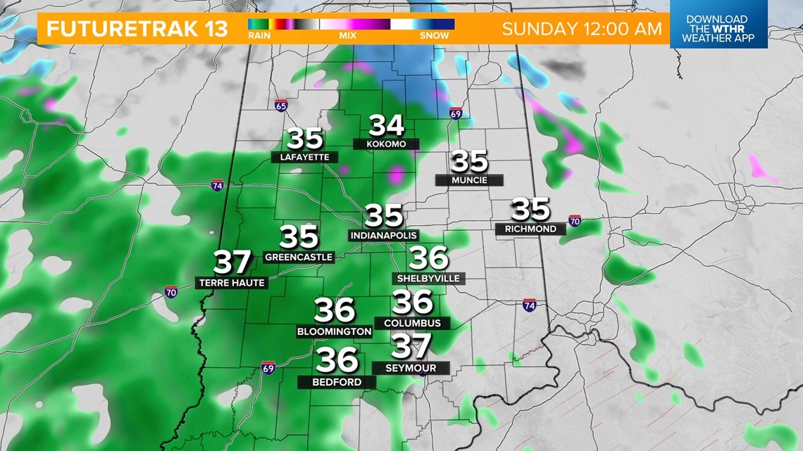
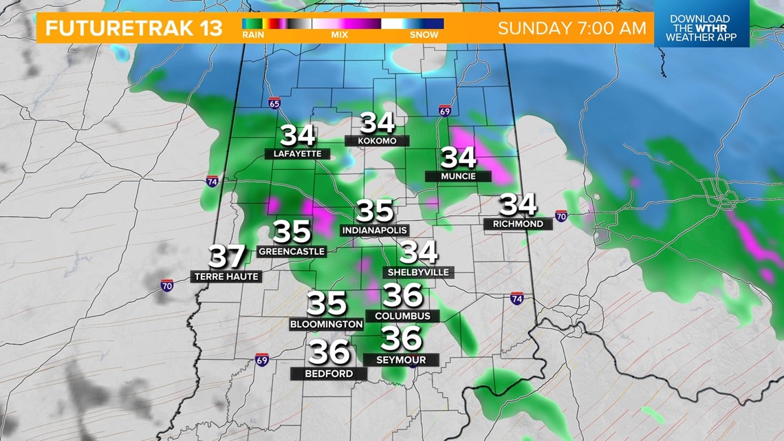
Overnight, snowflakes will again be possible to areas north. Most of the precipitation moves out by the late morning, with mainly cloudy skies through the afternoon. Little to no additional accumulation is expected with this wave. Temperatures recover to the upper 30s.


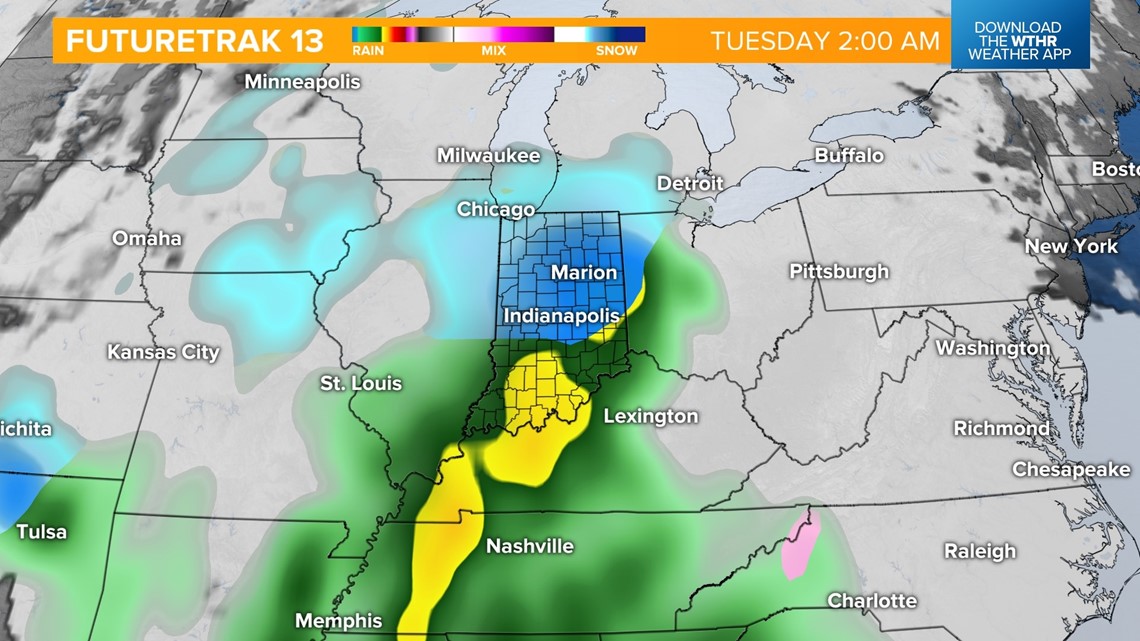
Looking ahead, Monday looks to be a mainly dry day ahead of a more potent storm complex set to return in the early morning hours Tuesday. We're monitoring the storm track closely as this will impact where the freezing line sets up.

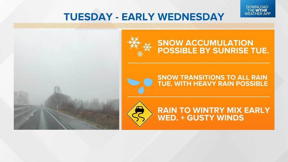
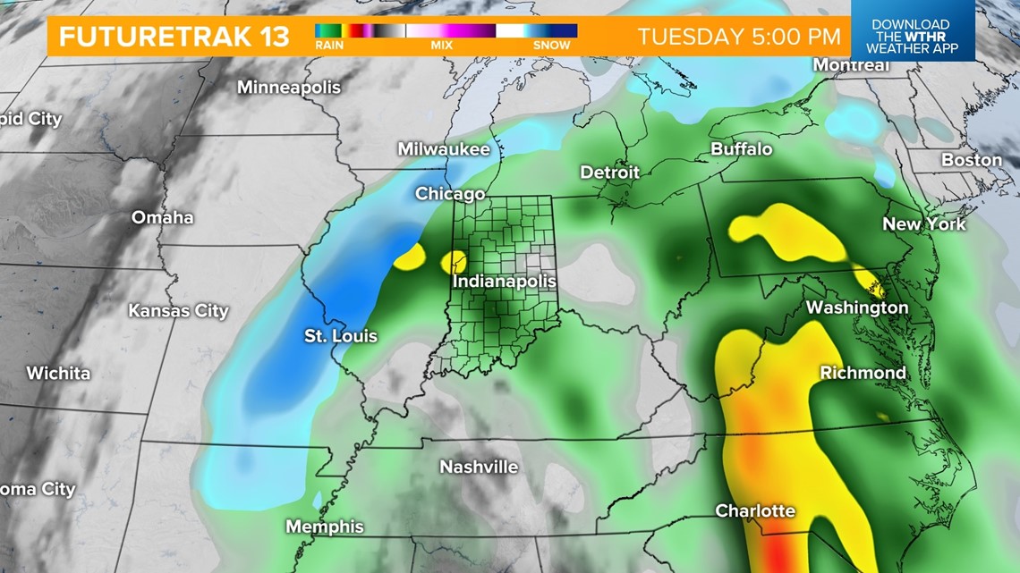
Initially, this appears to start as snow quickly transitioning to rain showers, becoming heavy rain at times Tuesday afternoon and evening as temperatures warm into the 40s in the "warm sector."


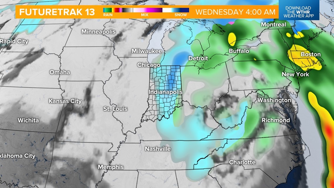
By early Wednesday, the core of the storm system will lift northeast, allowing for colder air to wrap around the backside of this system. Remnant moisture will transition into mainly snow before exiting Wednesday afternoon. Wind gusts will increase to 30+ mph as well Wednesday.

We're still several days out with this storm system, so make sure to check back on the forecast for snowfall potential and timeline updates.
RELATED: Winter driving safety: 5 Fast Facts
