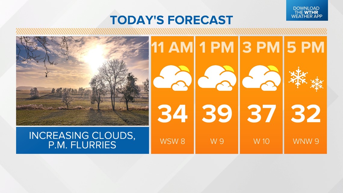
INDIANAPOLIS — A weak wave will push through this afternoon, increasing clouds and prompting a few isolated flurries. Temperatures recover to the upper 30s ahead of winds switching from the southwest to the northwest. We'll see temperatures falling to near freezing by 5 p.m. and eventually into the mid-20s overnight.


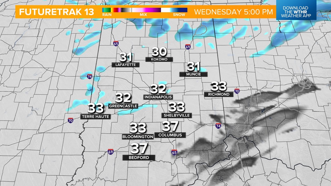
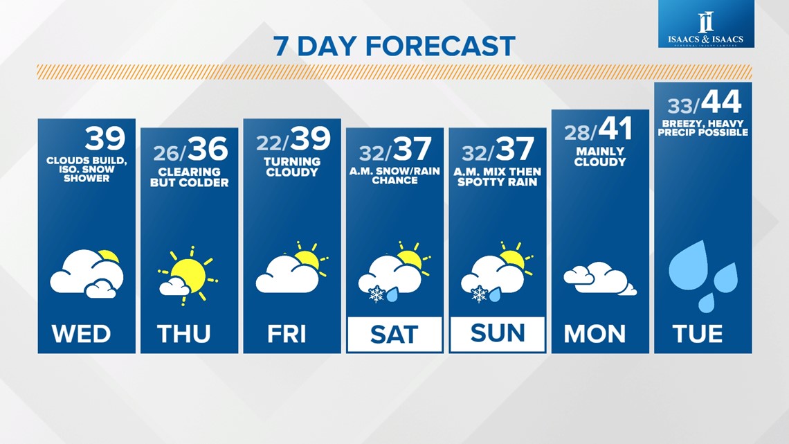
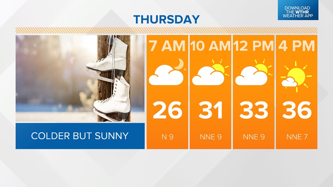
Cooler temperatures will then settle in for the rest of the week. Look for highs only in the mid-30s Thursday but under a mainly sunny sky. We'll recover to the upper 30s for highs Friday with increasing clouds.

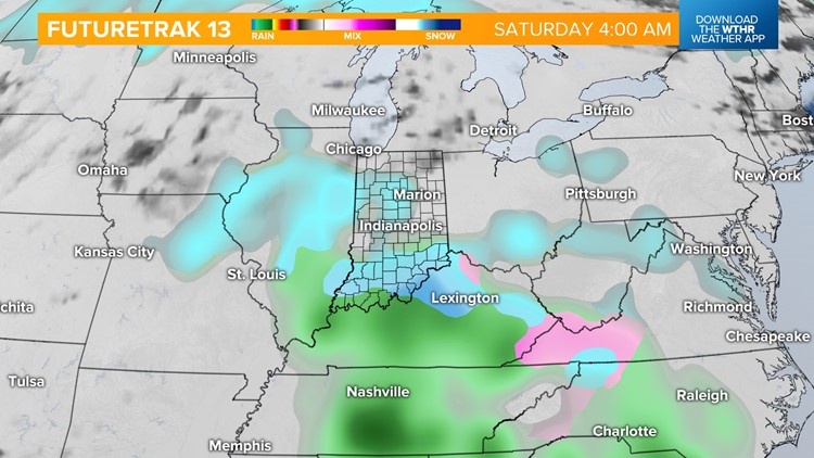
Our next weather system is set to arrive early Saturday, bringing snow initially with a rain/snow mix exiting by the afternoon. Highs reach near 37 degrees, with lots of dry time for Colts tailgaters.


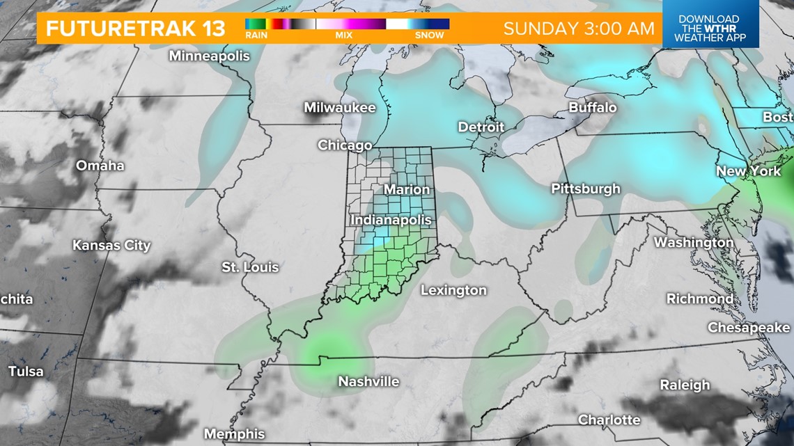
Another quick wave will move through early Sunday morning, bringing a chance of a wintry mix. Most of the precipitation moves out by the late morning, with a few spotty rain showers possible in the afternoon as temperatures recover to the upper 30s.

Looking ahead, Monday looks to be a mainly dry day ahead of a more potent storm complex set to return in the early morning hours Tuesday. We're monitoring the storm track closely as this will impact where the freezing line sets up. Initially, this appears to start as rain showers becoming heavy rain at times Tuesday afternoon and evening as temperatures warm into the 40s in the "warm sector."

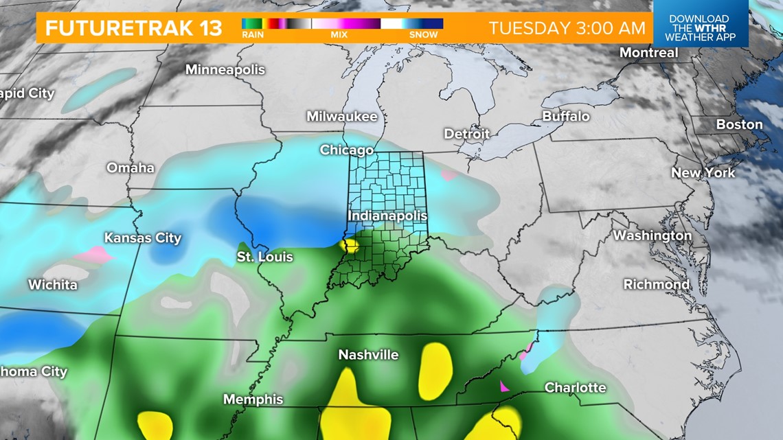

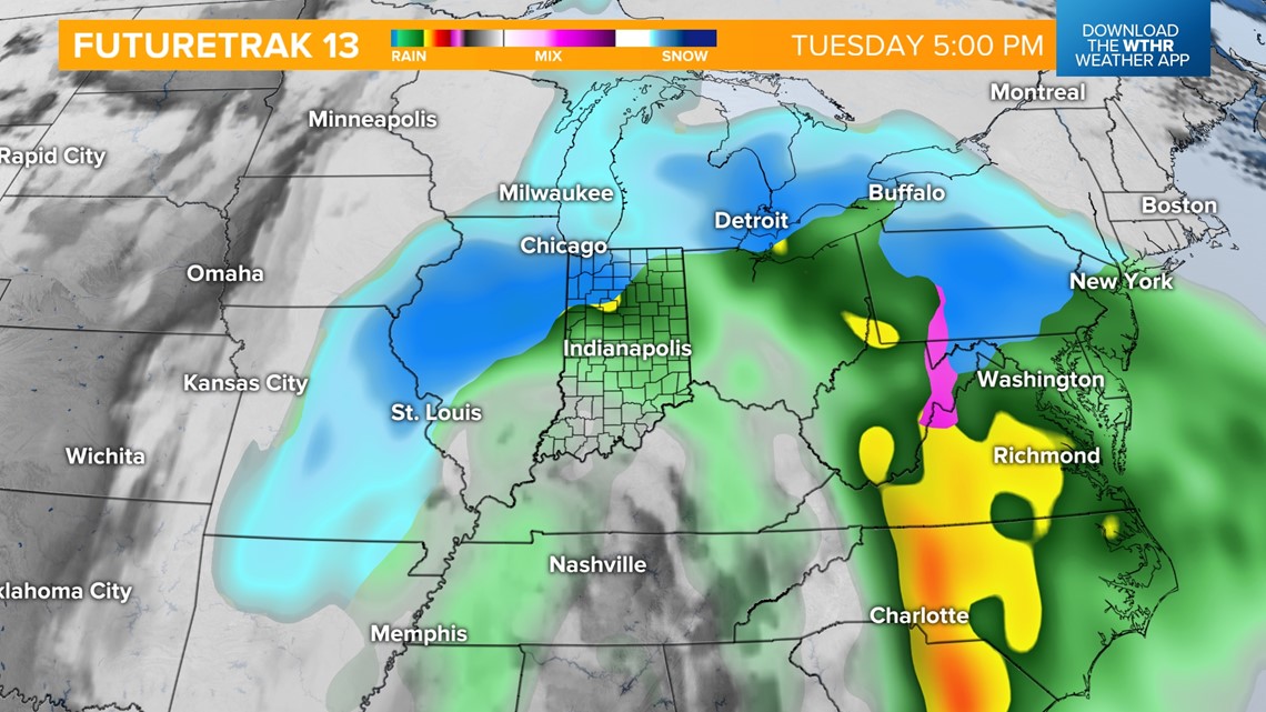
By early Wednesday, the core of the storm system will lift northeast, allowing for colder air to wrap around the backside of this system. Remnant moisture will transition into all snow before exiting Wednesday afternoon.

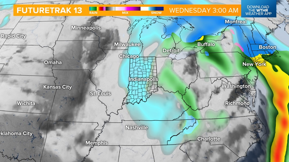
We're still several days out with this storm system, so make sure to check back on the forecast for snowfall potential and timeline updates.

