The weekend is here and there will be some dry time but we are also tracking rain chances and single digit wind chills to end the weekend.
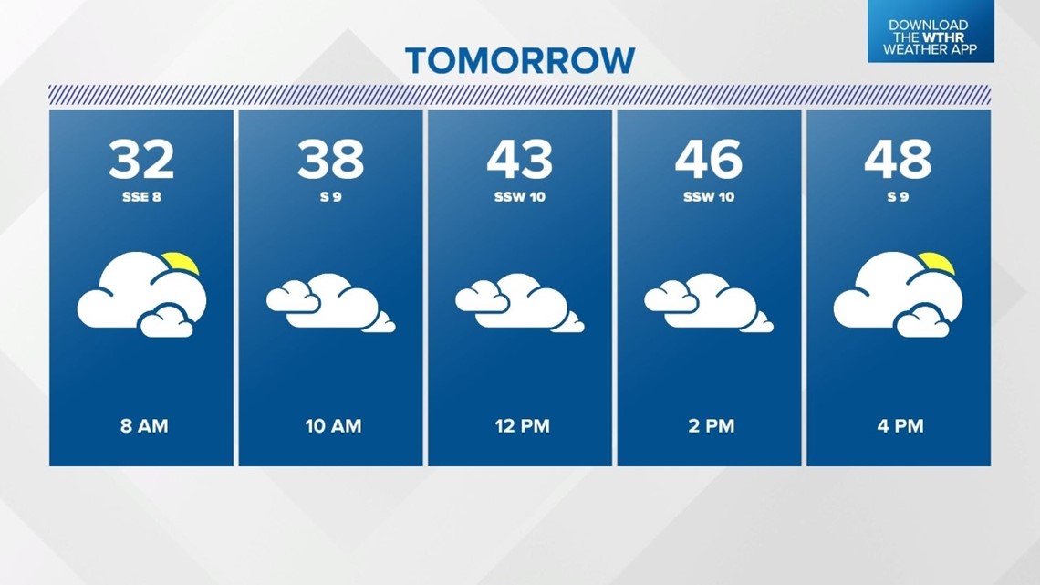
Clouds will increase on Saturday and there is a slight chance for a few sprinkles or flurries. Forecast highs are in the range of 45 to 50 degrees.

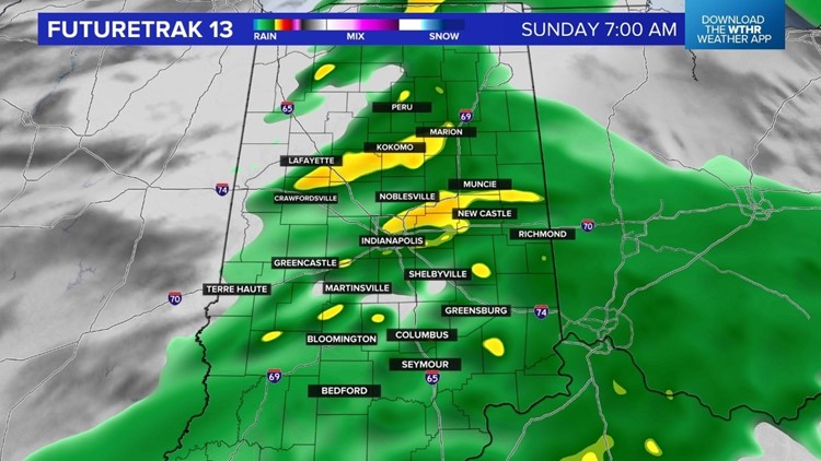
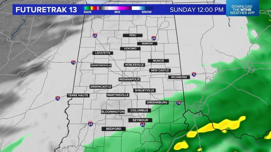
The steadier rain will arrive late Saturday night and linger through about midday Sunday. A few showers are possible south Sunday afternoon but the rest of central Indiana will have some dry time.


Forecast highs are again in the range of 45 to 50 degrees.
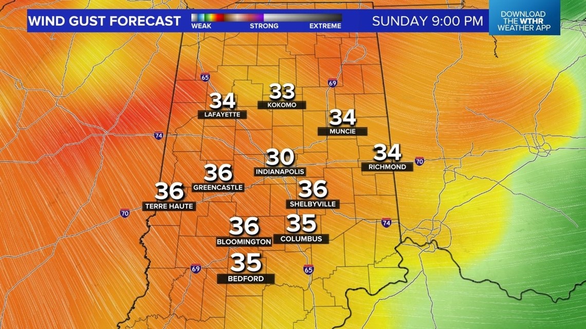
A big change arrives Sunday evening. Winds will increase and temperatures will tumble. Winds will be NW 15-25mph and gusts are forecast 40mph+.

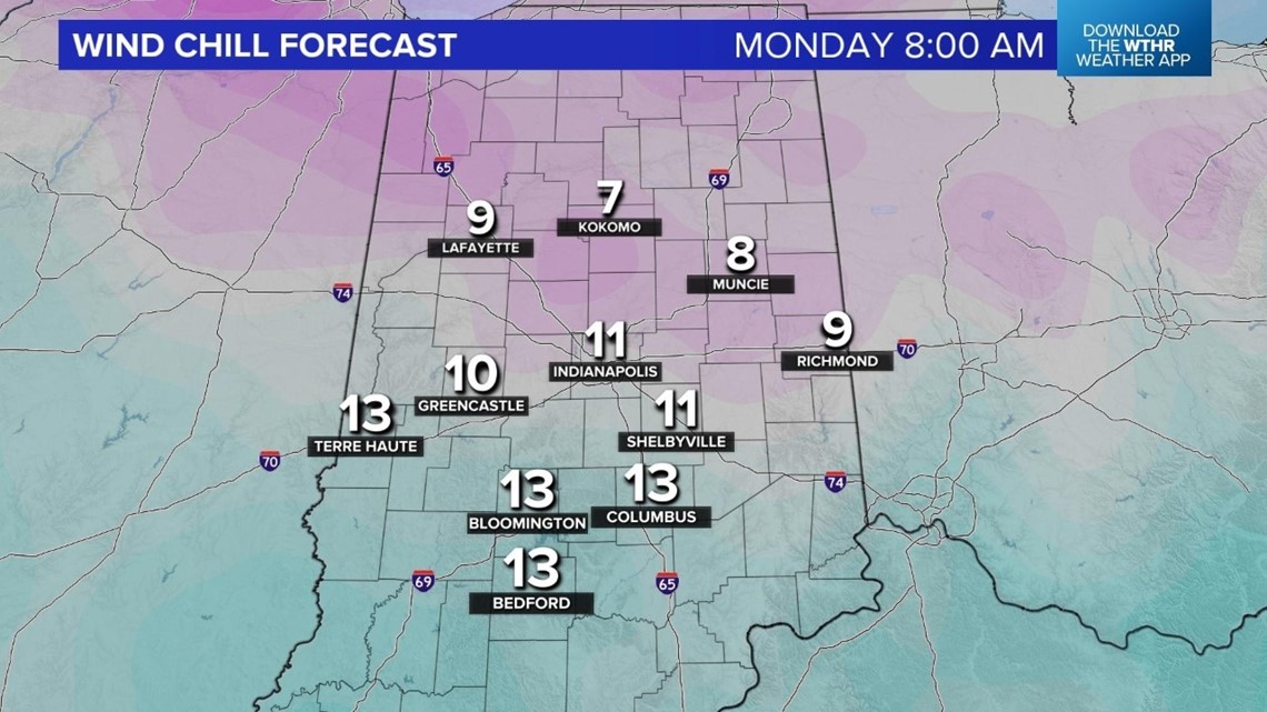
Temperatures will fall to near 20 degrees and wind chills fall into the single digits Sunday night into Monday morning.

It will be cold with a few flurries possible on Monday with highs in the lower 30s. Tuesday will be sunny with highs in the 30s.
Milder air arrives Wednesday into Thanksgiving Day next week. This will mean highs near 50 degrees. There is a storm system to track toward the end of next week. There is still some uncertainty on the timing. If it is slower, Thanksgiving Day will be mild but if the system speeds up it will be colder. Right now it doesn't look like the system has a lot of moisture to work with but we include a few mixed showers on Wednesday and a slight rain chance on Thursday. Stay tuned for updates.