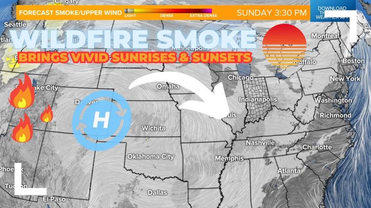
INDIANAPOLIS — A dome of high pressure out west has created a wind profile that will help transport remnant wildfire smoke into the area today.


While the smoke layer will stay lofted well into the atmosphere and not impact air quality in central Indiana, it will bring a hazy look to the sky and cause more vibrant/red-tinted sunrises and sunsets.
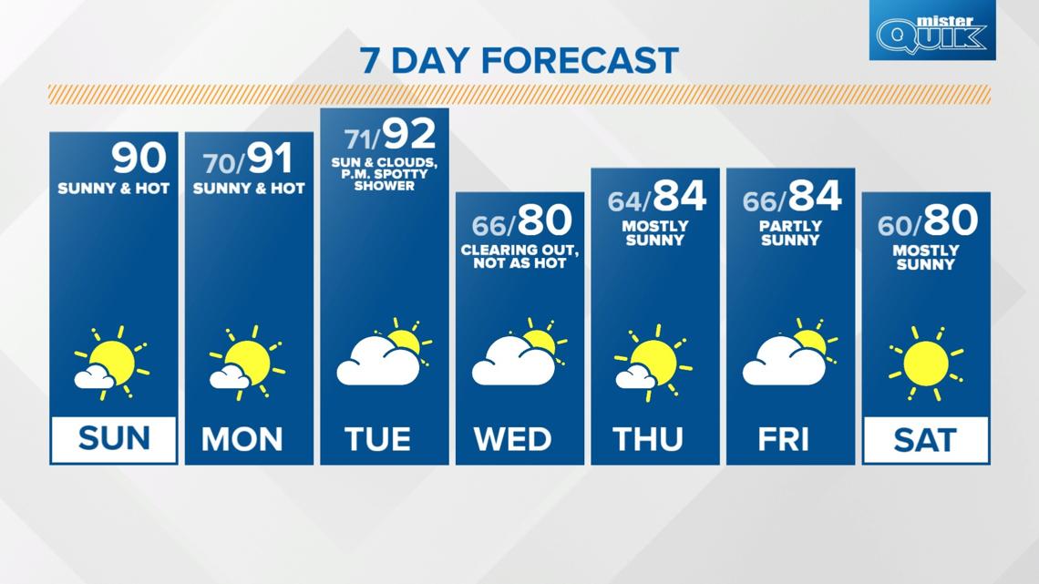
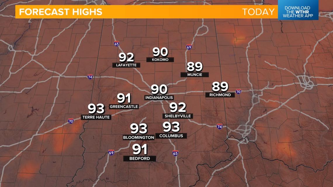
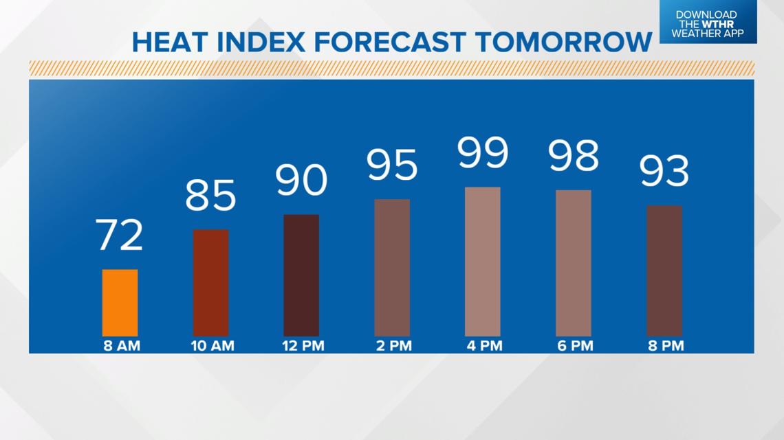
This high pressure zone setup will also aid in pushing in a hotter, more humid air mass. Look for highs near 90 degrees today with heat indices in the mid to upper 90s.


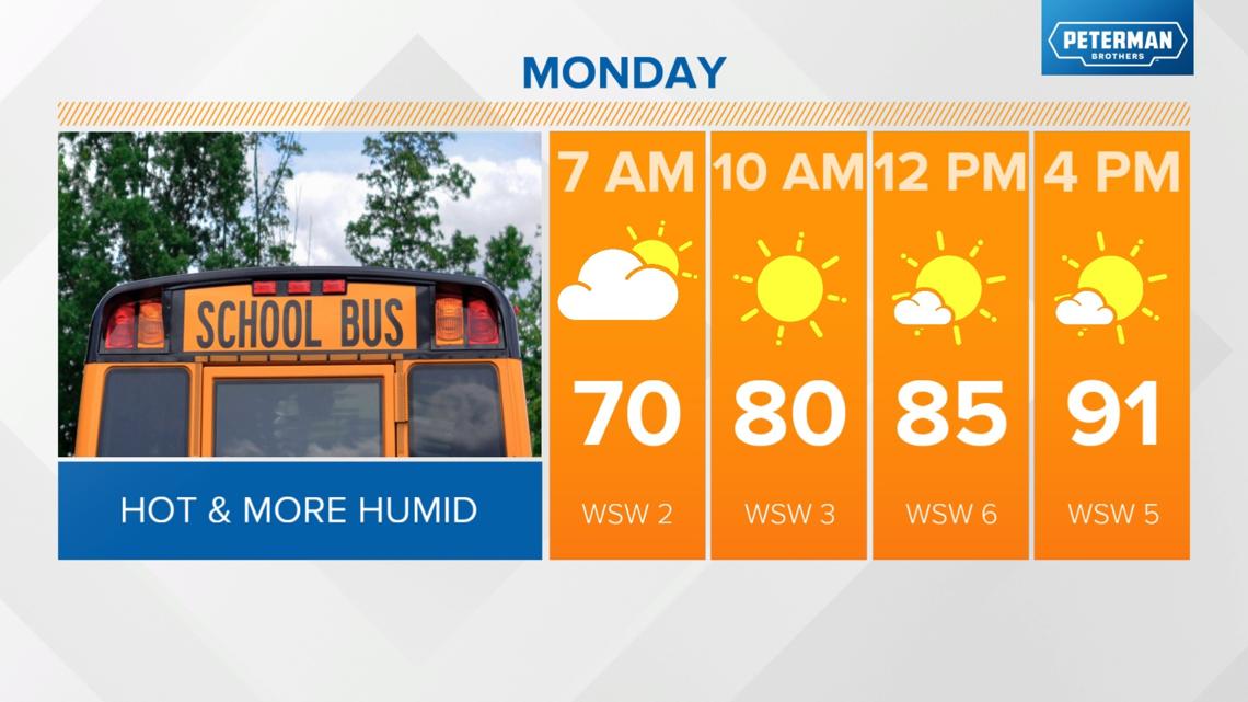
MONDAY: Sunny and hot again with highs in the low 90s and a heat index near 100 degrees.


When will we see some relief from this current stretch of heat?
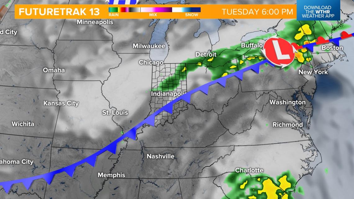
We're watching a cold front set to arrive later in the day on Tuesday, which will serve as a game-changer bringing relief from the well above average temperatures.
Ahead of the front though, we'll still see highs in the low 90s Tuesday afternoon.
This will be a relatively dry front, but a few showers or storms will be possible Tuesday night into Wednesday morning.
Skies will clear during the day Wednesday, and it will be much more comfortable with highs near 80 degrees.

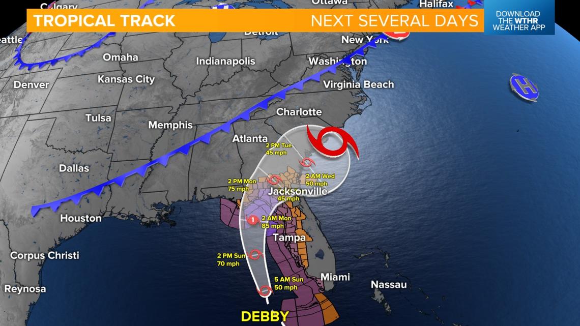
This front will also keep the remnants of what is currently Tropical Storm Debby at bay across the southeastern U.S., therefore limiting any impacts from this system here locally.

The pattern will then stay mainly dry and more seasonal with highs in the low to mid-80s through next weekend.