INDIANA, USA — Round one of snow is wrapping up, mainly in the form of scattered snow showers. Expect a break in the late morning before round two arrives. This second round will be much stronger and will likely drop 1-3 inches of snow across lots of central Indiana.
If round one was an appetizer, round two will be the full meal.
The commute home from work and school may be rough with the heavy burst of snow. Expect lots of slick spots and some roads even becoming snow-covered.
Tap HERE to track the incoming snow burst with our live interactive radar.
Round 1 (ending 9 a.m.)
Let's chat about what the first round did to help us predict how the second round will impact us.
We saw scattered snow showers from 2 a.m. through 9 a.m. across much of central Indiana. Interstates mainly stayed wet, but some bridges and overpasses turned snow-covered.

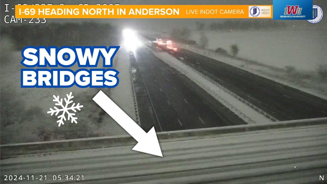
This was what South Rangeline Road on the south side of Anderson looked like around 6 a.m. The bridge crosses over I-69.
Many county roads and neighborhood roads outside of I-465 in the suburbs and rural towns also saw some snow stick.
Parked cars, some rooftops and mailboxes were able to pick up a dusting.
Round 2 (12 p.m. to 7 p.m.)
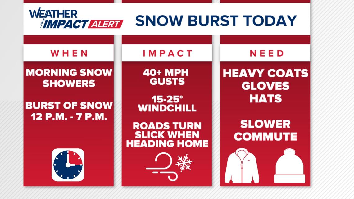
This second round is likely to be three times stronger than the first round. The snowflakes will be large and numerous. Plus, expect northwest winds gusting 20-45 mph across Indiana. The snow will be blowing sideways and the air will sting.
What we are expecting for round two this afternoon and evening:
- 1-3 inches of snow across central Indiana
- Snow-covered county and rural roads, some neighborhoods
- Wet interstates with lots of slick patches
- Wind chills in the 10s and 20s (gusts NW 30-45 mph)
- Whiteout conditions possible at times thanks to big flakes blowing sideways
- Slow commute home from work and school

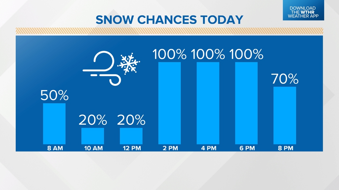
Timing out the snow Thursday afternoon and evening
Right around lunch time, heavy snow will move in from the north. At times there will be whiteout conditions across Indiana when you combine big snowflakes and 30+ mph winds. Visibility will be low.
12 p.m. today

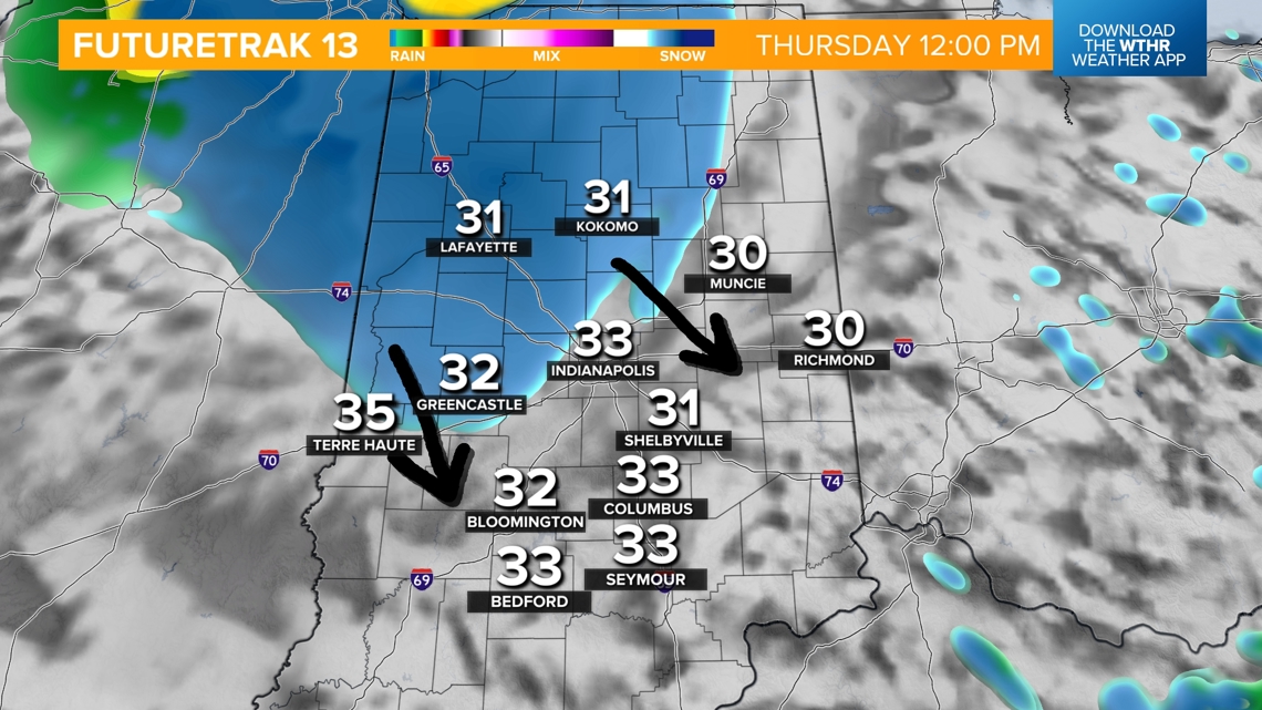
Areas south and east of Indianapolis may wait until 1 or 2 p.m. until this heavy snow arrives.
3 p.m. today
Heavy wet snow will be falling all across Indiana, from north to south. Some rain will mix in for the far western parts of the state.

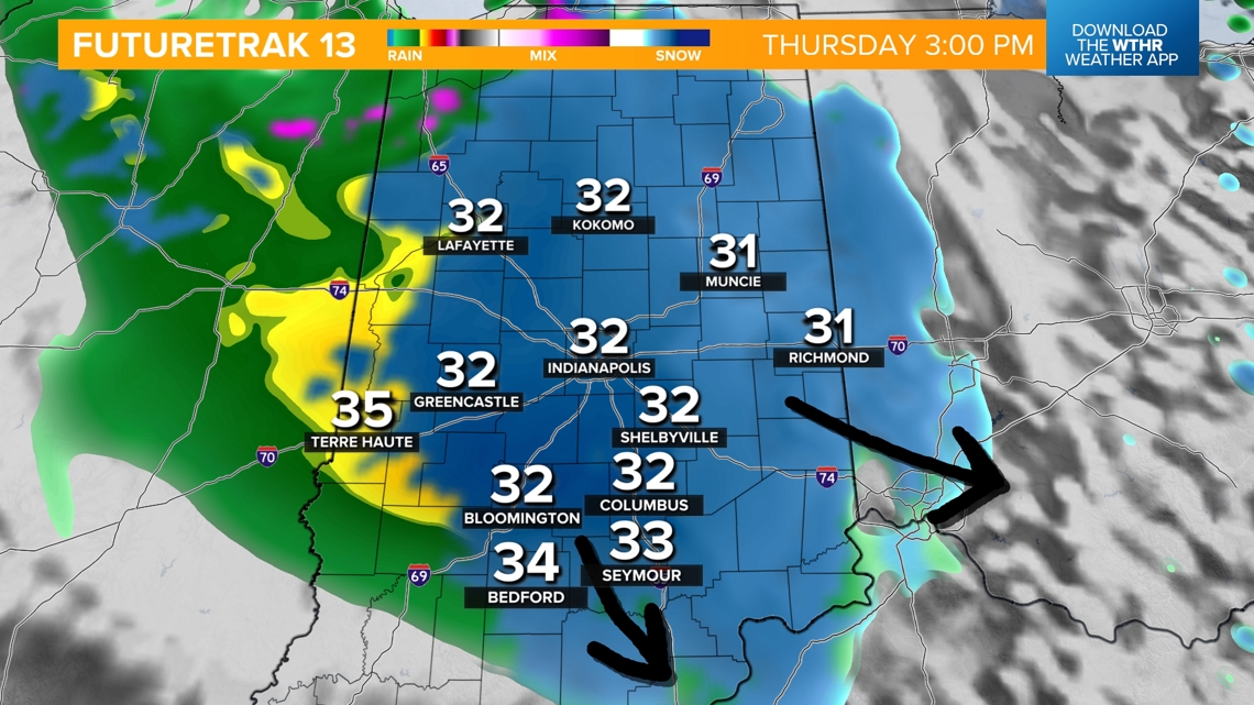
This is what the radar is expected to look like when we are heading home from school. The bus route may take longer today because of the heavy snow and slick roads.
6 p.m. today
By 6 or 7 p.m., expect the snow to gradually lighten up. It will break up to the north first, and then the south.

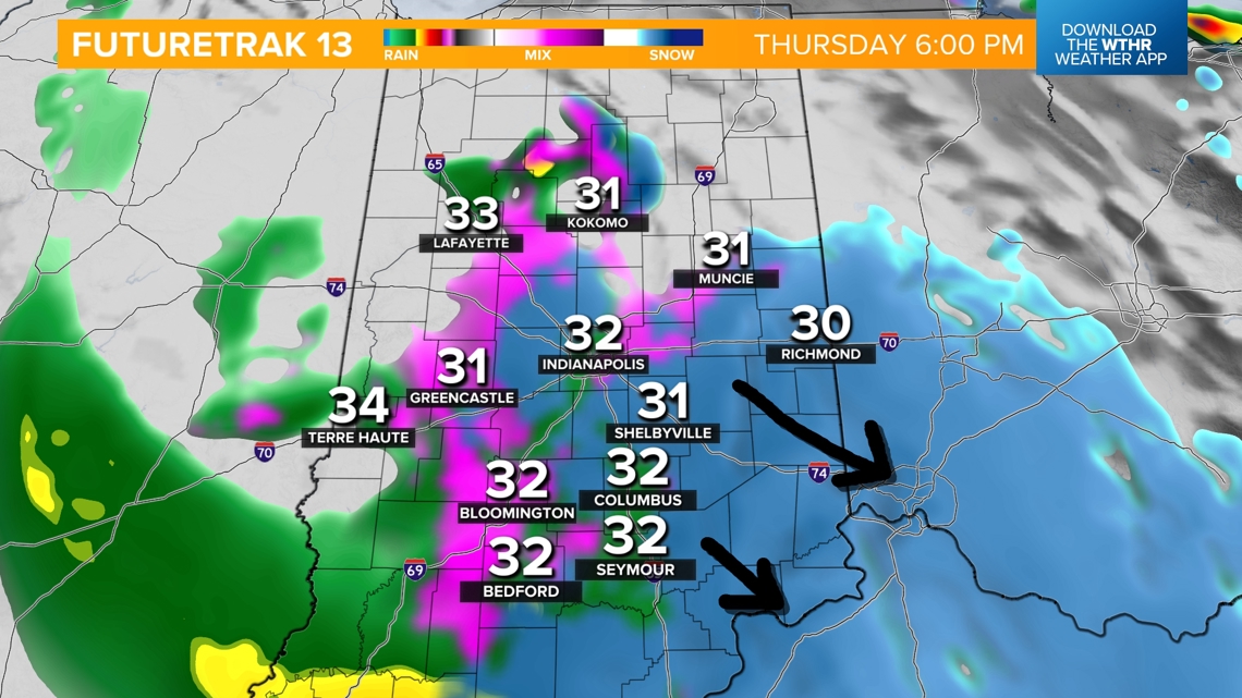
The snow will be heavy through sunset. The evening commute home may be difficult, especially once you get off the interstate. We are expecting numerous traffic incidents across the state.
Many interstates in open areas are likely to become very slick.
Projected snowfall totals
We think most of central Indiana will at least get an inch or two. There may be some places that get 3 inches, especially north of Indianapolis.

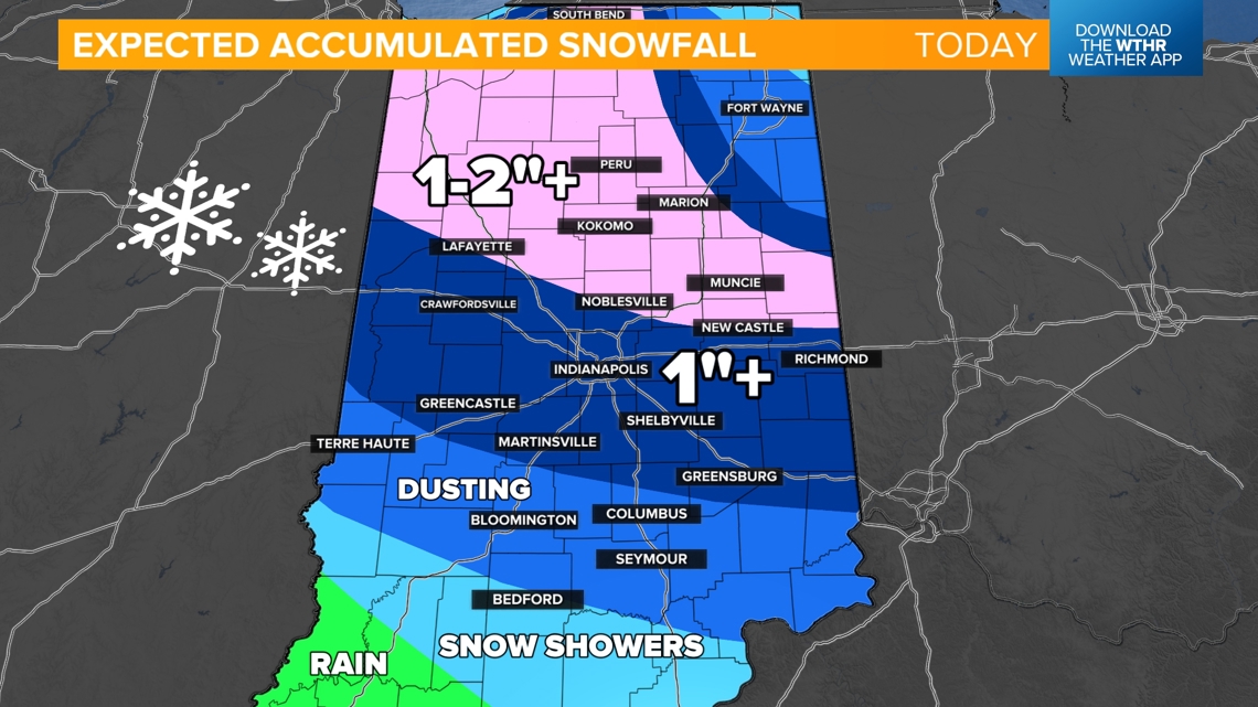
Snowfall forecasting has been tough because the clouds want to throw two to five inches of snow at us, but over half of that will melt upon contact.

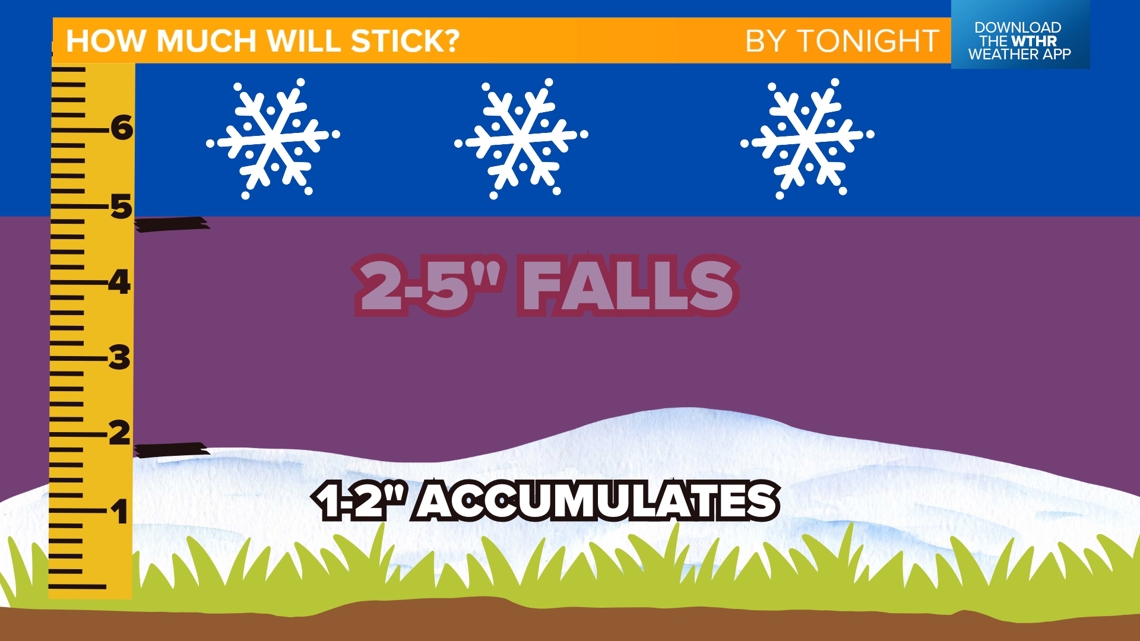
Also, once you build some snowpack, the bottom of it will be melting as it lies on the 50-degree ground temperatures.
Fierce wintry winds today
The wind is the second big story of the day. Gusts are likely to top 30 mph much of the day, but they may top 40 mph later this evening, especially west of Indianapolis.

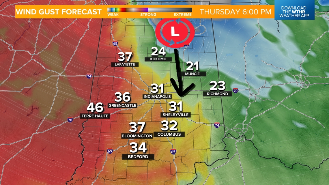
Wind chills will drop to the teens and 20s across the state.
Summary for later today
Expect weather conditions to worsen quickly this afternoon. Plan for messy travel heading home from work and school.
Snow will definitely accumulate on grassy surfaces, mailboxes, trees, rooftops, parked vehicles and bridges/overpasses. Some snow may also develop on big roadways, at least in patches. Expect the shoulder and lane lines to get some snow accumulation.

-13News Meteorologist Matt Standridge

