INDIANA, USA — It's been feeling more like July across Indiana with higher heat and humidity the past few days — not so much like May. If you want some cooler, spring-like air, just wait a couple more days. A cold front is on the way.
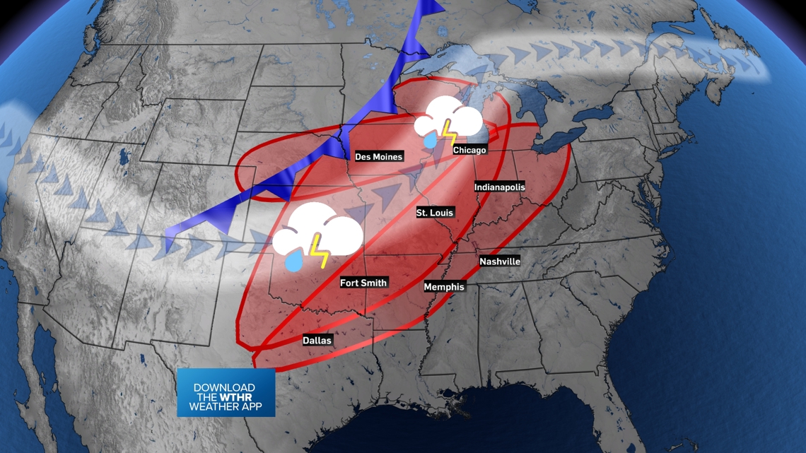
Expect the humidity to last into Wednesday before a cold front brings scattered severe storm chances and cooler air to the Midwest. Some north winds will also help push muggy air back south toward the Gulf coast, at least temporarily.
Tap HERE to track the rain and storms with the front that is on the way to Indiana.
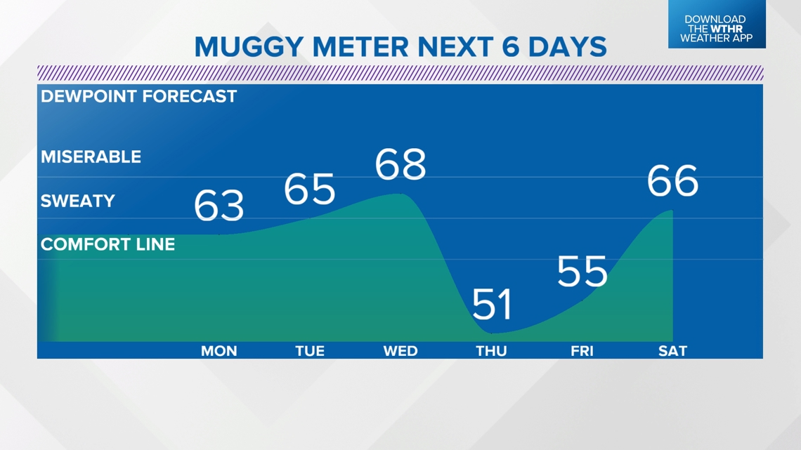
The mugginess will remain high through Wednesday. More refreshing air will move in by Thursday and Friday. However, south winds may come back by the weekend, bringing another wave of humidity.


When will this cold front arrive?
This front is a slow mover. Generally once you get closer to summer, our fronts tend to move slower. It will spark multiple rounds of rain and storms across the central U.S.A. the next few days. The zones for severe weather will gradually push east day-after-day. By Tuesday night, a few showers and storms are possible in extreme western Indiana. More widespread rain and storm chances hit the rest of Indiana on Wednesday.


Some severe storms Wednesday
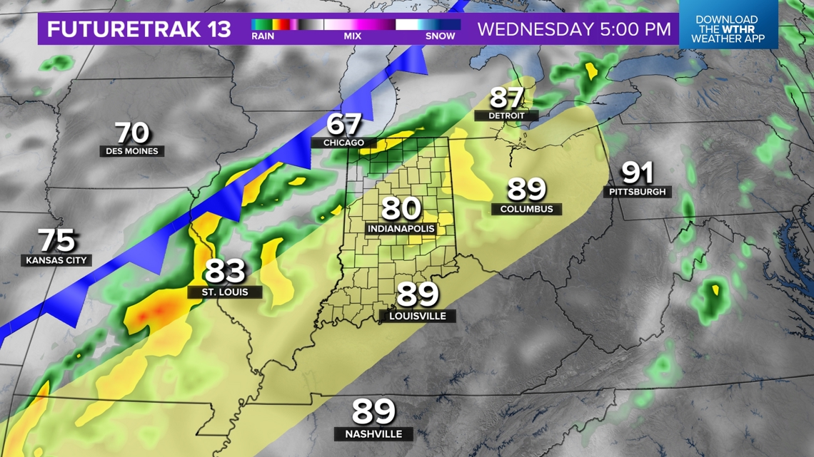
Check for more updated severe zones as we get closer, but the yellow zone generally shows the area where we think thunderstorms with hail, wind and tornado threats will be.
Expect isolated storms Wednesday morning, with more widespread rain and severe storms Wednesday afternoon and evening.


Most of the rain will exit by Thursday, with only isolated showers remaining for southern Indiana the next day or so.
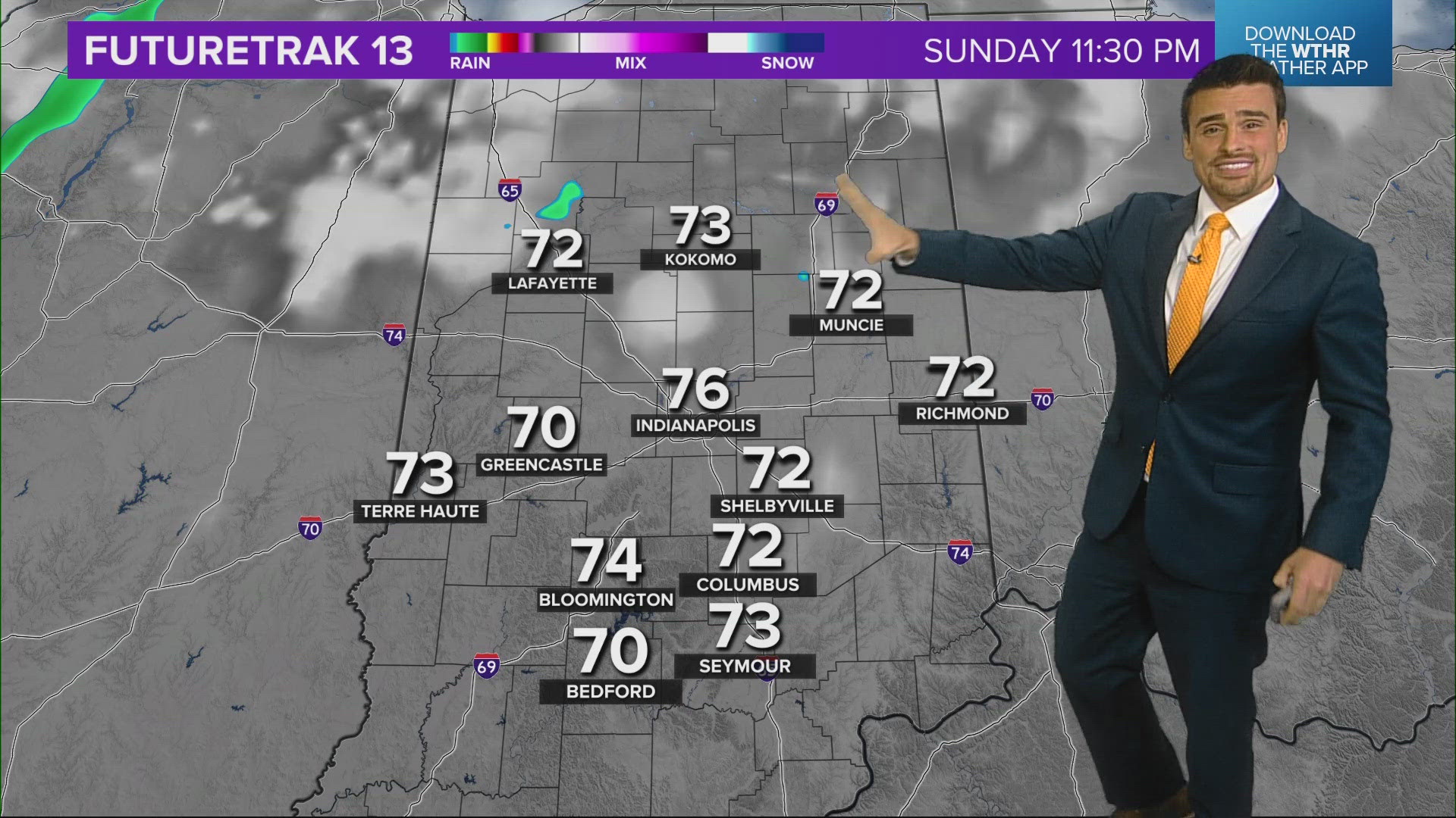
Eventually, a warm front will come back for the weekend with more unsettled weather across Indiana. That includes the Indy 500 and Memorial Day.
— 13News Meteorologist Matt Standridge

