
INDIANA, USA — It was a rain lottery on Sunday across Indiana. Everyone technically got some raindrops, but that ranged from a trace to 1.5" across the state. If you did not get a lot of rain, no worries, we have about three more rounds to go the next two days.
Tap HERE to track scattered showers with our live interactive radar.
Tap HERE for the latest local rain forecast.
Everyone got the clouds and cooler air, but not everyone got enough rain today. We'll take a look across the whole state and then narrow it down to three regions: north, central, and south.
Today was the first day of fall, so the clouds thankfully dropped us by nearly 20 degrees, down to the mid 70s across Indiana.
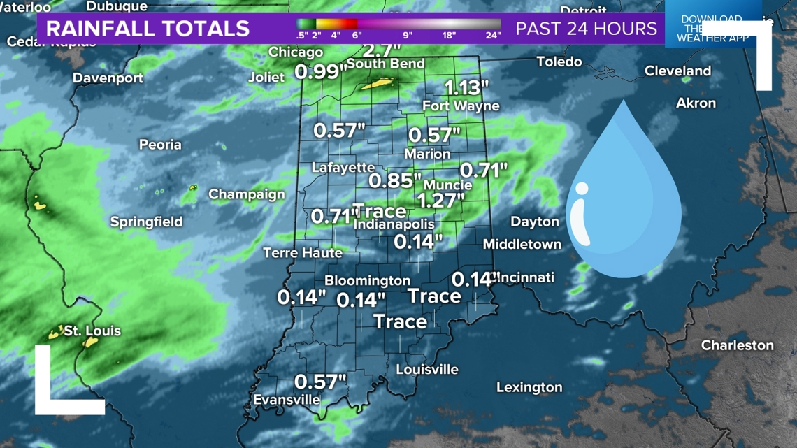
Indiana statewide rainfall
This map shows the radar estimation across the state. Blue areas indicate locations that picked up a trace to 0.25" of rainfall. Greenish areas highlight rainfall totals from 0.25" to 2". The darker the green, the higher the rainfall amount.

Northern Indiana
Overall, northern Indiana faired a bit better than everyone else. Most areas picked up nearly a quarter inch of rainfall, with a bit more in some spots. Michiana and "the region" did the best. Areas within 40 miles of South Bend and Valparaiso picked up the most rain in the state with 0.5" to 2".
- Valparaiso: 1.47"
- South Bend: 1.01"
- Fort Wayne: 0.55"
- Peru: 0.46"
- Warsaw: 0.40"
- Kokomo: 0.33"
- Lafayette: 0.27"
Central Indiana
It was hit-or-miss across central Indiana. While not a perfect delineation, areas north of I-70 faired better than those to the south. Those who live north of Indianapolis picked up a decent quarter to half inch of rainfall in spots. Areas south of Indianapolis mainly picked up a trace, sometimes not even enough to wet the ground. Indianapolis itself was hit or miss. A few isolated downpours hit parts of the city.
There were some decent totals for parts of eastern Indiana around Henry, Wayne, Randolph, Rush, and Fayette counties.
- Cambridge City: 1.50"
- Pendleton: 1.40"
- Fishers: 1.11"
- New Castle: 1.07"
- Brownsburg: 0.59"
- Greenwood: 0.25"
- Indianapolis: 0.13"
Southern Indiana
Southwest Indiana got some of the smallest rainfall totals today. However, they picked up more rain in the days prior.
Good news for southern Indiana: you have the highest chance for some light rain Monday late afternoon and evening.
- Vincennes: 0.29"
- Evansville: 0.21"
- Edinburgh: 0.10"
- Scottsburg: 0.07"
- Bedford: 0.06"
- Bloomington: 0.05"
- Jeffersonville: 0.05"
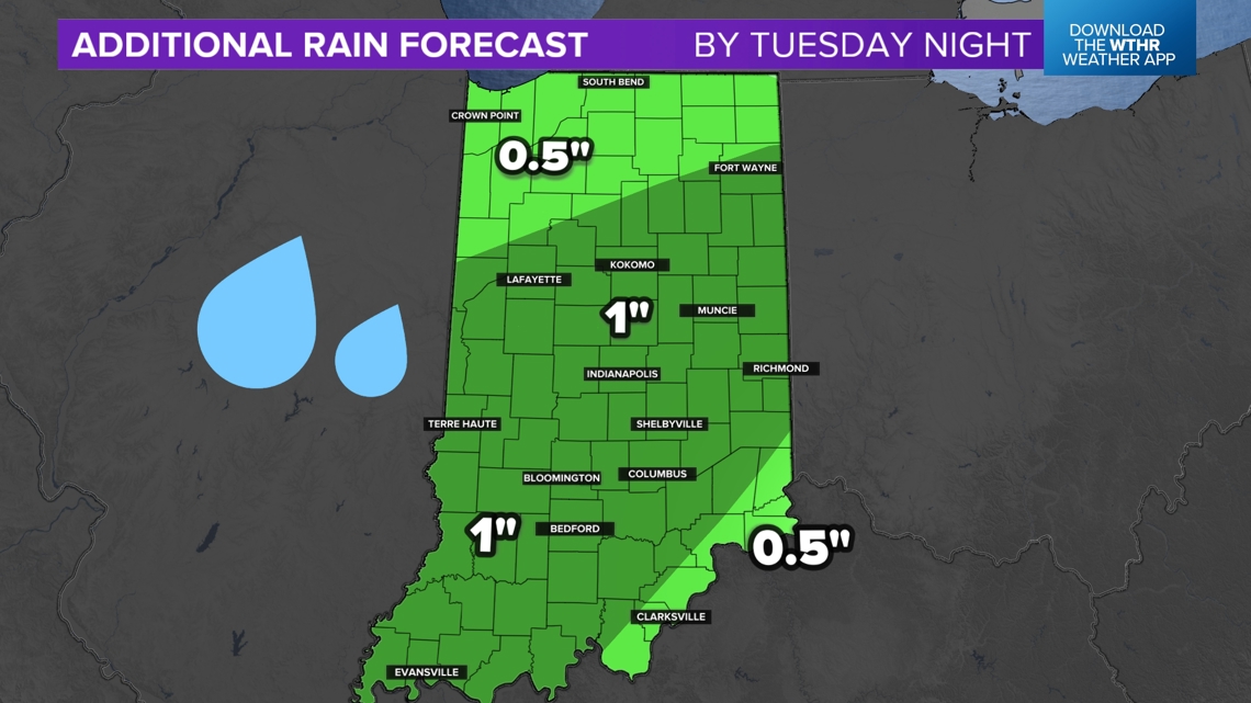
How much more rain could head our way?
If you didn't get enough rainfall, no worries, more is on the way. Monday's showers look pretty light and mainly concentrated around southern Indiana.
Generally we are expecting nearly an additional inch of rainfall across much of Indiana by Tuesday night. There will be some who get more and some who get less. The scattered nature of the rain makes it difficult to exactly pinpoint individual amounts. Across the state expect 0.5" to 1", give or take a little.

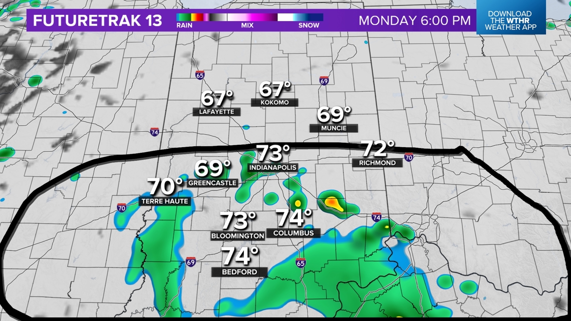
Monday's rain chances
The best chance for some scattered showers will be south of Indianapolis. The rain should not be very heavy.

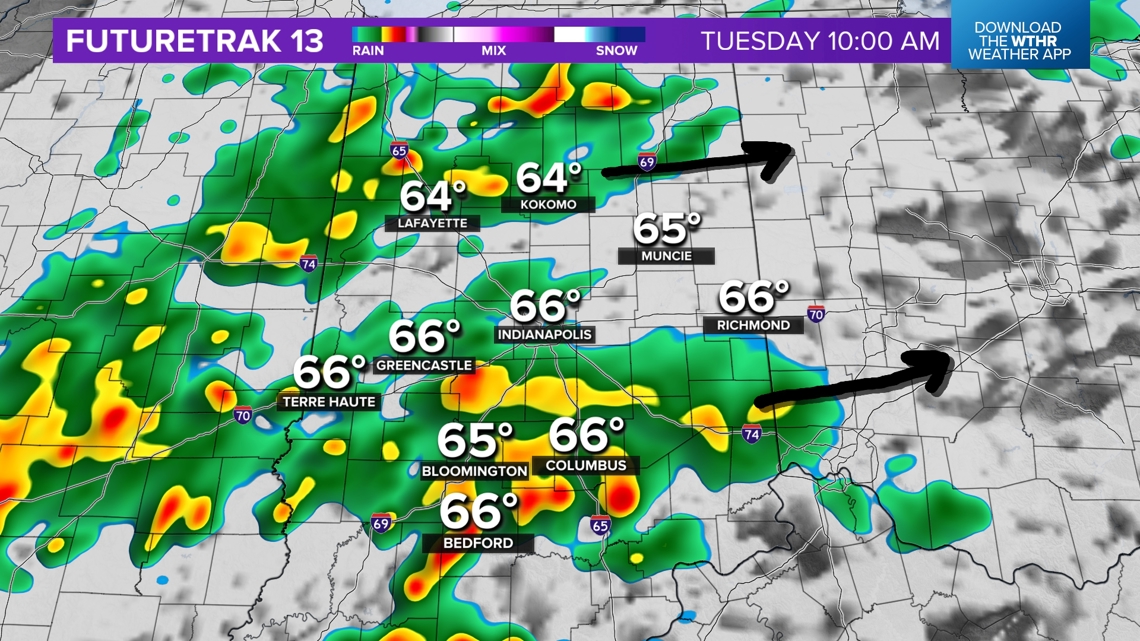
Tuesday rain chances
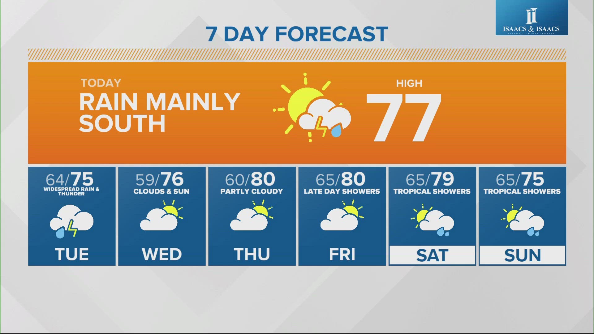
Tuesday looks to be one of the rainiest days. Widespread showers and downpours are likely throughout the day on Tuesday, starting near or just after sunrise.

We are forecasting drier conditions by Wednesday, only about a 10-20% chance for a stray shower.
-13News Meteorologist Matt Standridge